Cope, Colorado | |
|---|---|
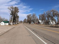 U.S. Route 36 in Cope (2017) | |
 Cope Location of the Cope CDP, Colorado.  Cope Cope (Colorado) | |
| Coordinates: 39°39′50″N102°51′04″W / 39.6639°N 102.8510°W [1] | |
| Country | United States |
| State | Colorado |
| County | Washington [2] |
| Government | |
| • Type | unincorporated community |
| • Body | Washington County [2] |
| Area | |
• Total | 1.827 sq mi (4.731 km2) |
| • Land | 1.796 sq mi (4.651 km2) |
| • Water | 0.031 sq mi (0.080 km2) |
| Elevation | 4,403 ft (1,342 m) |
| Population | |
• Total | 53 |
| • Density | 30/sq mi (11/km2) |
| Time zone | UTC−07:00 (MST) |
| • Summer (DST) | UTC−06:00 (MDT) |
| ZIP code [5] | 80812 |
| Area codes | 970/748 |
| GNIS place ID | 195026 |
| GNIS town ID | 2805926 |
| FIPS code | 08-17100 |
Cope is an unincorporated town, a post office, and a census-designated place (CDP) located in and governed by Washington County, Colorado, United States. The population was 53 at the 2020 census. [4] The Cope post office has the ZIP Code 80812. [5]
