Duncan, Colorado

Last updated

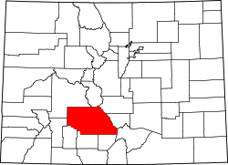
Duncan is an extinct town in Saguache County, Colorado, [1] about 8 miles south of Crestone, Colorado. Only one house remains, John Duncan's cabin. Duncan was on the Luis Maria Baca Grant No. 4 and is now within Rio Grande National Forest.

Contents

History

Duncan, Colorado was first founded in 1874 when John Duncan found gold ore in a nearby river. Other prospectors soon settled around his cabin, and by 1890 a town was established. [2] The town was plotted by John Duncan, lots were sold, gold mines promoted, home were built, businesses established, even a newspaper, The Duncan Eagle. At that point, he sold lots in town for $25 a piece. The Duncan post office operated from November 21, 1892, to September 15, 1900. [3] Mail came six days a week and served 250 residents of the area. A school district formed in 1893 to serve the community and the last classes were held in 1899.

In 1900, George Adams purchased the Luis Maria Baca Grant No. 4, which allowed him to claim property and mineral rights. [2] This caused the settlers to be considered squatters, and after a supreme court battle, settlers were pushed off the land. Settlers were paid $125 for each structure. Some of the residents of Duncan moved to a new townsite, just off the Grant property to the south, Liberty, Colorado. [4]

In 2011, Duncan Cabin was renovated and is now able to be rented out to visitors. [5]

See also

Related Research Articles

<span class="mw-page-title-main">San Luis Valley</span> High-altitude basin in Colorado and New Mexico in the United States

The San Luis Valley is a region in south-central Colorado with a small portion overlapping into New Mexico. The valley is approximately 122 miles (196 km) long and 74 miles (119 km) wide, extending from the Continental Divide on the northwest rim into New Mexico on the south. It contains 6 counties and portions of 3 others. It is an extensive high-elevation depositional basin of approximately 8,000 square miles (21,000 km2) with an average elevation of 7,664 feet (2,336 m) above sea level. The valley is a section of the Rio Grande Rift and is drained to the south by the Rio Grande, which rises in the San Juan Mountains to the west of the valley and flows south into New Mexico. The San Luis Valley has a cold desert climate but has substantial water resources from the Rio Grande and groundwater.

<span class="mw-page-title-main">Crestone, Colorado</span> Town in Saguache County, Colorado, United States

The Town of Crestone is a Statutory Town in Saguache County, Colorado. According to the 2020 United States Census, the town's population was 141. Crestone is located at the foot of the western slope of the Sangre de Cristo Range, in the northern part of the San Luis Valley. Crestone was platted in 1880 by George Adams, owner of the neighboring Luis Maria Baca Grant No. 4. In the 1970s, the Baca Grande land development was established on the lands of the Baca Grant to the south and west. Several hundred homes have been built there.

<span class="mw-page-title-main">Costilla County, Colorado</span> County in Colorado, United States

Costilla County is a county located in the U.S. state of Colorado. As of the 2020 census, the population was 3,499. The county seat is San Luis, the oldest continuously occupied town in Colorado.

<span class="mw-page-title-main">Allenspark, Colorado</span> Census Designated Place in Colorado, United States

Allenspark is an unincorporated town, a post office, and a census-designated place (CDP) located in and governed by Boulder County, Colorado, United States. The CDP is a part of the Boulder, CO Metropolitan Statistical Area. The Allenspark post office has the ZIP code 80510. At the United States Census 2020, the population of the Allenspark CDP was 568.

<span class="mw-page-title-main">Ward, Colorado</span> Town in Colorado, United States

Ward is a home rule municipality in Boulder County, Colorado, United States. The population was 128 at the 2020 census. The town is a former mining settlement founded in 1860 in the wake of the discovery of gold at nearby Gold Hill. Once one of the richest towns in the state during the Colorado Gold Rush, it is located on a mountainside at the top of Left Hand Canyon, near the Peak to Peak Highway northwest of Boulder at an elevation of 9,450 feet (2,880 m) above sea level.

<span class="mw-page-title-main">Red Feather Lakes, Colorado</span> Census Designated Place in Colorado, United States

Red Feather Lakes is an unincorporated town, a post office, and a census-designated place (CDP) located in and governed by Larimer County, Colorado, United States. The CDP is a part of the Fort Collins, CO Metropolitan Statistical Area. The Red Feather Lakes post office has the ZIP Code 80545. At the United States Census 2020, the population of the Red Feather Lakes CDP was 426.

<span class="mw-page-title-main">Colorado Territory</span> Historic region of the US, 1861 to 1876

The Territory of Colorado was an organized incorporated territory of the United States that existed from February 28, 1861, until August 1, 1876, when it was admitted to the Union as the State of Colorado.

<span class="mw-page-title-main">Bellvue, Colorado</span> Unincorporated community in State of Colorado, United States

Bellvue is an unincorporated community and U.S. Post Office in Larimer County, Colorado. It is a small agricultural community located in Pleasant Valley, a narrow valley just northwest of Fort Collins near the mouth of the Poudre Canyon between the Dakota Hogback ridge and the foothills of the Rocky Mountains. The ZIP Code of the Bellvue Post Office is 80512.

<span class="mw-page-title-main">Animas Forks, Colorado</span> Unincorporated in Colorado, United States

Animas Forks is an extinct mining town located 12 miles (19 km) northeast of Silverton in San Juan County, Colorado, United States. The area is managed by the Bureau of Land Management. At an elevation of 11,185 feet (3,409 m), Animas Forks is one of the highest mining camps in North America.

<span class="mw-page-title-main">Caribou, Colorado</span> Ghost town

Caribou is an extinct silver mining town located near Nederland in Boulder County, Colorado, United States. It was named after the Caribou silver mine nearby. The Caribou post office operated from January 31, 1871, until March 31, 1917. The Caribou Ranch recording studio was located several miles away, on the road from Nederland up to Caribou.

Arapahoe was one of the first settlements in what is now the U.S. state of Colorado. Nothing remains of the now deserted ghost town in Jefferson County, except a historical marker on the south side of 44th Avenue, between the towns of Golden and Wheat Ridge.

<span class="mw-page-title-main">Luis Maria Baca Grant No. 4</span>

The Luis Maria Baca Grant No. 4, south of Crestone, Colorado, was a large land grant made in 1860 by the United States to the heirs of the original Vegas Grandes Grant to Baca family of New Mexico at Las Vegas, New Mexico. Title to the grant at Las Vegas was clouded by a second grant of the same land. The Baca heirs were offered alternative lands from the public lands of the United States. The largest of the tracts selected, near what is now Crestone, was 12.5 miles (20.1 km) on a side and was located to the south of what is now Saguache County Road T, about 1-mile (1.6 km) south of the 38th parallel. The Bacas deeded the land to their attorney, John Sebrie Watts, but it soon passed by tax sale to a third party. The ranch headquarters was on Crestone Creek to the southwest of Crestone. The Baca Grant was one of the first large tracts of land to be fenced in the West and in its heyday was the home of prize Hereford cattle.

<span class="mw-page-title-main">Independence, Pitkin County, Colorado</span> Ghost town in Colorado, United States

Independence is an extinct town located in Pitkin County, Colorado, United States. It is located at an elevation of 10,913 feet (3,326 m) 2.2 miles (3.6 km) directly west of Independence Pass. It was the first settlement established in the Roaring Fork Valley, after gold was struck in the vicinity on Independence Day, July 4, 1879, hence its name. Independence was served by three differently named post offices: Farwell from July 14, 1881, until July 3, 1882; Sparkill from February 1, 1882, until October 18, 1887; and Chipeta from April 20, 1899, until October 17, 1899. It has also been known historically as Mammoth City, Mount Hope, and Hunter's Pass.

<span class="mw-page-title-main">El Dorado Canyon (Nevada)</span> Historic site in U.S. Highway near Nelson, Nevada

El Dorado Canyon is a canyon in southern Clark County, Nevada famed for its rich silver and gold mines. The canyon was named in 1857 by steamboat entrepreneur Captain George Alonzo Johnson when gold and silver was discovered here. It drains into the Colorado River at the former site of Nelson's Landing.

Eastdale is an extinct town in Costilla County, in the U.S. state of Colorado.

<span class="mw-page-title-main">Edgerton, Colorado</span> Extinct town in Colorado

Edgerton is an extinct town at the confluence of Monument Creek and West Monument Creek eight miles north of present-day Colorado Springs in El Paso County, Colorado, United States. It was across from Black Forest. The Edgerton post office operated from June 16, 1870, until August 28, 1902.

The Sangre de Cristo Land Grant in the San Luis Valley of southern Colorado and northern New Mexico consists of 1,000,000 acres (4,000 km2) of mostly arid land. It was awarded by the government of New Mexico to the Beaubien family in 1843. The land grant was originally settled by Hispanics from New Mexico. Since the incorporation of the area of the grant into the United States in 1848, legal disputes between the descendants of the Hispanic settlers and Anglo ranchers about ownership of and access to some of the land in the grant area have been frequent and continued into the 21st century.

References

  1. U.S. Geological Survey Geographic Names Information System: Duncan, Colorado
  2. 1 2 "Duncan, Colorado – The Story of a Short-Lived Town on the Edge of the Great Sand Dunes – Colorado Central Magazine". cozine.com. Retrieved June 13, 2017.
  3. Bauer, William H.; Ozment, James L.; Willard, John H. (January 1990). "The Post Offices of Colorado Listed Alphabetically by Office". Colorado Post Offices 1859-1989[A Comprehensive Listing of Post Offices, Stations and Branches]. Golden, Colorado: The Colorado Railroad Museum. p. 47. ISBN   0-918654-42-4. OCLC   21334351.
  4. Harlan, George (1976). Postmarks and Places. Denver: Golden Bell Press. pp. 78–92.
  5. "Duncan Cabin". historicorps.org. Retrieved February 4, 2011.

37°52′27″N105°36′52″W / 37.87417°N 105.61444°W / 37.87417; -105.61444 (Duncan)