
Idaho is a landlocked state in the Pacific Northwest and Mountain West subregions of the Western United States. It borders Montana and Wyoming to the east, Nevada and Utah to the south, and Washington and Oregon to the west; the state shares a small portion of the Canada–United States border to the north with the Canadian province of British Columbia. Idaho's state capital and largest city is Boise. With an area of 83,569 square miles (216,440 km2), Idaho is the 14th-largest state by land area. The state has a population of approximately 2 million people; it ranks as the 13th-least populous and the seventh-least densely populated of the 50 U.S. states.

Multnomah County is one of the 36 counties in the U.S. state of Oregon. As of the 2020 census, the county's population was 815,428. Multnomah County is part of the Portland–Vancouver–Hillsboro, OR–WA metropolitan statistical area. The state's smallest and most populous county, its county seat, Portland, is the state's largest city.

Multnomah Falls is a waterfall located on Multnomah Creek in the Columbia River Gorge, east of Troutdale, between Corbett and Dodson, Oregon, United States. The waterfall is accessible from the Historic Columbia River Highway and Interstate 84. Spanning two tiers on basalt cliffs, it is the tallest waterfall in the state of Oregon at 620 ft (189 m) in height. The Multnomah Creek Bridge, built in 1914, crosses below the falls, and is listed on the National Register of Historic Places.

Latourell Falls is a waterfall along the Columbia River Gorge in the U.S. state of Oregon, within Guy W. Talbot State Park.

Shepperd's Dell is a small canyon in the Columbia River Gorge in Oregon, located at 45.54833°N 122.195°W which is less than one-third mile southeast of Rooster Rock State Park. The Shepperd's Dell Bridge is listed on the National Register of Historic Places.
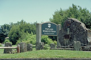
Chanticleer Point is a geographical landmark on the Oregon side of the Columbia River Gorge. It is the first notable overlook encountered traveling east on the Historic Columbia River Highway. It is a typical location from which to take photos of the gorge featuring Crown Point and the Vista House prominently. It overlooks Rooster Rock State Park.

Silver Falls State Park is a state park in the U.S. state of Oregon, located near Silverton, about 20 miles (32 km) east-southeast of Salem. It is the largest state park in Oregon with an area of more than 9,000 acres (36 km2), and it includes more than 24 miles (39 km) of walking trails, 14 miles (23 km) of horse trails, and a 4-mile (6.4 km) bike path. Its 7.2-mile (11.6 km) Canyon Trail/Trail of Ten Falls runs along the banks of Silver Creek and by ten waterfalls, from which the park received its name. Four of the ten falls have an amphitheater-like surrounding that allows the trail to pass behind the flow of the falls. The Silver Falls State Park Concession Building Area and the Silver Creek Youth Camp-Silver Falls State Park are separately listed on the U.S. National Register of Historic Places.

Ainsworth State Park is a state park in eastern Multnomah County, Oregon, near Cascade Locks. It is located in the Columbia River Gorge, adjacent to the Historic Columbia River Highway. The park, administered by the Oregon Parks and Recreation Department, offers a seasonal, full-service campground, access to Gorge hiking trails beyond park boundaries, and a day-use area.

Guy W. Talbot State Park is a state park in the Columbia River Gorge, near Troutdale, Oregon, United States. Although the main feature of the park is Latourell Falls, the parkland stretches west to the Crown Point State Scenic Corridor. Here the Historic Columbia River Highway descends from Crown Point via the Figure-Eight Loops, a series of horseshoe curves that "develop distance" and thus keep the grade to a minimum.
Vinzenz Lausmann Memorial State Natural Area is a state park in northern Hood River County, Oregon, 5.3 miles (8.5 km) west of the city of Hood River, and is administered by the Oregon Parks and Recreation Department. It is located in the Columbia River Gorge, adjacent to an abandoned section of the Historic Columbia River Highway. This park is one of a trio encompassing areas in the vicinity of Mitchell Point, along with Seneca Fouts Memorial State Natural Area and Wygant State Natural Area. The three parks offer scenic hiking and views over the Gorge.

Latourell is an unincorporated community located in Multnomah County, Oregon, United States, on the Historic Columbia River Highway about eight miles (13 km) east of Troutdale and 5.5 miles (9 km) west of Multnomah Falls. Compared to its peak in the 1880s, it is now virtually a ghost town.

George W. P. Joseph was an attorney and Republican politician in the U.S. state of Oregon. A native of California, his family relocated to Oregon when he was young. There he would practice law and serve in the Oregon State Senate.

Collier Memorial State Park is a state park in southern Oregon. The park is operated and maintained by the Oregon Parks and Recreation Department. It is located on U.S. Highway 97, approximately 30 miles (48 km) north of Klamath Falls and 105 miles (169 km) south of Bend. The park covers 146 acres (59 ha) along the Williamson River.

The Wood River is a short river in the southern region of the U.S. state of Oregon, and part of the Klamath Basin drainage. It flows 18 miles (29 km) through the Fremont-Winema National Forests, Bureau of Land Management land, and private property in southern Oregon. Its watershed consists of 220 square miles (570 km2) of conifer forest, rural pasture land, and marsh. The river provides habitat for many species of wildlife including an adfluvial (migratory) and resident populations of native Great Basin redband trout.

Cascadia State Park is a state park in the U.S. state of Oregon near Sweet Home along the South Santiam River at Cascadia. The park includes a day use area, campsites, hiking trails and 150 foot Lower Soda Creek Falls.

Cline Falls State Scenic Viewpoint is a state park near Redmond, Oregon, United States. It is located on the Deschutes River. The park covers 9 acres (36,000 m2). It is administered by the Oregon Parks and Recreation Department.
Coquille Myrtle Grove State Natural Site is a state park administered by the Oregon Parks and Recreation Department in the U.S. state of Oregon. The park, bordering the Powers Highway between Myrtle Point and Powers, in Coos County, features a swimming hole and sandy beach along the South Fork Coquille River. Other amenities include parking, picnic tables, restrooms, and access to fishing but no drinking water.

D River State Recreation Site is a state park in the U.S. state of Oregon, administered by the Oregon Parks and Recreation Department. It is a sandy beach of the Pacific Ocean within central Lincoln City along the length of the 120-foot (37 m) long D River, one of the world's shortest rivers.

Golden and Silver Falls State Natural Area is a state park in Coos County, Oregon, United States, administered by the Oregon Parks and Recreation Department. The nearest settlement is Allegany.

Munson Creek Falls State Natural Site is a state park in the U.S. state of Oregon, administered by the Oregon Parks and Recreation Department. The park contains Munson Creek Falls, which is the tallest waterfall in Oregon's Coast Range. A short hike of 0.5 miles (0.80 km) leads to views of the 319 feet (97 m) waterfall.

