
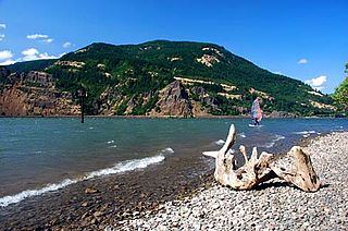
Detroit Lake is a reservoir impounded by the Detroit Dam on the North Santiam River 46 miles (74 km) southeast of Salem, Oregon, United States. The lake is adjacent to Oregon Route 22 near the city of Detroit. This mesotrophic lake stores water for use by the city of Salem and other nearby communities.

The Mount Hood National Forest is a U.S. National Forest in the U.S. state of Oregon, located 62 miles (100 km) east of the city of Portland and the northern Willamette River valley. The Forest extends south from the Columbia River Gorge across more than 60 miles (97 km) of forested mountains, lakes and streams to the Olallie Scenic Area, a high lake basin under the slopes of Mount Jefferson. The Forest includes and is named after Mount Hood, a stratovolcano and the highest mountain in the state.

This is a list of properties and historic districts in Oregon that are listed on the National Register of Historic Places. There are listings in all of Oregon's 36 counties.
Vinzenz Lausmann Memorial State Natural Area is a state park in northern Hood River County, Oregon, 5.3 miles (8.5 km) west of the city of Hood River, and is administered by the Oregon Parks and Recreation Department. It is located in the Columbia River Gorge, adjacent to an abandoned section of the Historic Columbia River Highway. This park is one of a trio encompassing areas in the vicinity of Mitchell Point, along with Seneca Fouts Memorial State Natural Area and Wygant State Natural Area. The three parks offer scenic hiking and views over the Gorge.
Viento State Park is a state park in north central Hood River County, Oregon, near the city of Hood River. The park, named for the former Viento railroad station located there, is administered by the Oregon Parks and Recreation Department. The park is on the south bank of the Columbia River in the Columbia River Gorge. Interstate 84 and the Union Pacific Railroad pass through the park. It offers a seasonal, full-service campground, access to gorge hiking trails beyond park boundaries, a day-use area and river access for windsurfing and kiteboarding.
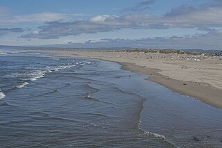
Harris Beach State Park is an Oregon State Park located on US Highway 101, north of Brookings. The day-use area offers a restroom and picnic area with tables, and the campground has RV sites, yurts and tent sites available year-round.

Santiam State Forest is one of six state forests managed by the Oregon Department of Forestry. The forest is located approximately 25 miles (40 km) southeast of Salem, Oregon, and includes 47,871 acres (193.73 km2) on the western slope of the Cascade Mountains in three Oregon counties: Clackamas, Linn, and Marion. It is bounded on the east by the Willamette National Forest and Mount Hood National Forest. Silver Falls State Park is located west of the forest. The rest of the land surrounding the forest belongs to the Bureau of Land Management or is privately owned. The forest is managed as part of the Department of Forestry's North Cascade District.
Bolon Island Tideways State Scenic Corridor is a state park in the U.S. state of Oregon, administered by the Oregon Parks and Recreation Department. The 11.4-acre (4.6 ha) park is on Bolon Island 10 river miles (16 km) from the mouth of the Umpqua River and north of Reedsport. It is along Highway 101 and near the site, where in 1828, most of Jedediah Smith's party were massacred. The land was given to the state in 1934 by William C. and Jennie D. Chamberlain.

Bradley State Scenic Viewpoint is a state park in the U.S. state of Oregon, administered by the Oregon Parks and Recreation Department. It is located directly north of U.S. Route 30 between Astoria and Portland.
Bullards Beach State Park is a state park in the U.S. state of Oregon, administered by the Oregon Parks and Recreation Department.

Cascadia State Park is a state park in the U.S. state of Oregon near Sweet Home along the South Santiam River at Cascadia. The park includes a day use area, campsites, hiking trails and 150 foot Lower Soda Creek Falls.

Fall Creek State Recreation Site is a state park in the U.S. state of Oregon, administered by the Oregon Parks and Recreation Department. The park includes 47 campsites that do not include many luxuries. Each site includes a picnic table and a fire ring. There is also a designated swimming area in the lake that Fall Creek flows into. A dock and boat ramp are on the lake as well.

Hilgard Junction State Recreation Area is a state park in Hilgard, Oregon, United States, administered by the Oregon Parks and Recreation Department. Located along the Grande Ronde River next to Interstate 84 at its intersection with Highway 244, the park has Full RV hook-up sites and tent camp sites with flush toilets and showers nearby.

La Pine State Park is a state park along the Deschutes River in the U.S. state of Oregon, administered by the Oregon Parks and Recreation Department. The closest town is La Pine, 5 miles north-east of the park.

Lake Owyhee State Park is a state park in the U.S. state of Oregon, administered by the Oregon Parks and Recreation Department. The park lies on the north-eastern end of the Owhyee reservoir. Bighorn sheep can be found here.

Minam State Recreation Area is a state park in the U.S. state of Oregon. Administered by the Oregon Parks and Recreation Department, it covers about 600 acres (240 ha) along the Wallowa River north of La Grande in Wallowa County. The park is off Oregon Route 82 about 15 miles (24 km) northeast of Elgin.

Succor Creek State Natural Area is a state park in the U.S. state of Oregon, administered by the Oregon Parks and Recreation Department.

The Little North Santiam River is a 27-mile (43 km) tributary of the North Santiam River in western Oregon in the United States. It drains 113 square miles (290 km2) of the Cascade Range on the eastern side of the Willamette Valley east of Salem.

Elliott Corbett Memorial State Recreation Site is a state park along the south shore of Blue Lake Crater in Jefferson County, Oregon, United States. The park is named in honor of Elliott R. Corbett II, who was killed while serving in the United States Army during World War II. It includes 63 acres (25 ha) of wilderness land with very few park facilities. Corbett State Park is administered by the Oregon Parks and Recreation Department.
Thomas Creek is a stream, about 35 miles (56 km) long, in Linn County in the U.S. state of Oregon. Beginning in Willamette National Forest on the western slopes of the Cascade Range, the creek flows generally west through Santiam State Forest and farmland to meet the South Santiam River west of Scio.

