Coos Bay is a city located in Coos County, Oregon, United States, where the Coos River enters Coos Bay on the Pacific Ocean. The city borders the city of North Bend, and together they are often referred to as one entity called either Coos Bay-North Bend or Oregon's Bay Area. Coos Bay's population as of the 2020 census was 15,985 residents, making it the most populous city on the Oregon Coast. Oregon's Bay Area is estimated to be home to 32,308.

The Oregon Coast is a coastal region of the U.S. state of Oregon. It is bordered by the Pacific Ocean to its west and the Oregon Coast Range to the east, and stretches approximately 362 miles (583 km) from the California state border in the south to the Columbia River in the north. The region is not a specific geological, environmental, or political entity, and includes the Columbia River Estuary.

The Coos River flows for about 5 miles (8.0 km) into Coos Bay along the Pacific coast of southwest Oregon in the United States. Formed by the confluence of its major tributaries, the South Fork Coos River and the Millicoma River, it drains an important timber-producing region of the Southern Oregon Coast Range. The course of the main stem and the major tributaries is generally westward from the coastal forests to the eastern end of Coos Bay near the city of Coos Bay.
Allegany is an unincorporated community in Coos County, Oregon, United States. It lies at the upstream end of the Millicoma River, where the East Fork Millicoma River and West Fork Millicoma River join to form the main stem, a short tributary of the Coos River. Oregon Route 241 passes through Allegany. The community borders the Elliott State Forest.

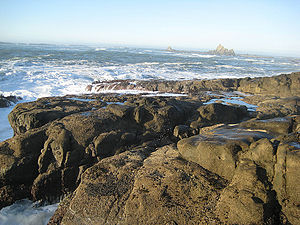
The Cape Arago Lighthouse is a lighthouse located in Charleston, Oregon. It is located 2.6 miles (4.2 km) north of Cape Arago.

Charleston is an unincorporated community in Coos County, Oregon, United States. Charleston is the least populated community in Oregon's Bay Area and is Home to a large commercial fishing fleet, it is adjacent to the ocean entrance to Coos Bay. Charleston is the site of the Oregon Institute of Marine Biology and the United States Coast Guard Charleston Lifeboat Station.

Shore Acres State Park is a state park 13 miles (21 km) south of Coos Bay in the U.S. state of Oregon. It is one of three state parks along the Cape Arago Highway, which runs along the Pacific Ocean west of U.S. Route 101. Sunset Bay State Park is about 1 mile (1.6 km) north of Shore Acres, and Cape Arago State Park is about a mile south.

Oregon Route 540 is an Oregon state highway running from North Bend to Cape Arago State Park. OR 540 is known as the Cape Arago Highway No. 240. It is 14.20 miles (22.85 km) long and runs northeast to southwest, entirely within Coos County.
Arago is an unincorporated community in Coos County, Oregon, on the Coquille River, about 6 miles (10 km) south of Coquille. The area's elevation is 30 feet (9 m). The Coquille Rural Fire District provides firefighting services. The Coos County Sheriff and Myrtle Point police provide law enforcement services.

Cline Falls State Scenic Viewpoint is a state park near Redmond, Oregon, United States. It is located on the Deschutes River. The park covers 9 acres (36,000 m2). It is administered by the Oregon Parks and Recreation Department.
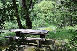
Coquille Myrtle Grove State Natural Site is a state park administered by the Oregon Parks and Recreation Department in the U.S. state of Oregon. The park, bordering the Powers Highway between Myrtle Point and Powers, in Coos County, features a swimming hole and sandy beach along the South Fork Coquille River. Other amenities include parking, picnic tables, restrooms, and access to fishing but no drinking water.

Hat Rock State Park is a state park in the U.S. state of Oregon, administered by the Oregon Parks and Recreation Department. The park is located off the east side of U.S. Highway 730 in Hermiston, on the south shore of Lake Wallula behind McNary Dam on the Columbia River.

Manhattan Beach State Recreation Site is a state park in the U.S. state of Oregon. Administered by the Oregon Parks and Recreation Department, the park is open to the public and is fee-free. Amenities at the park, which is 2 miles (3 km) north of Rockaway Beach along U.S. Route 101, include picnicking, fishing, and a Pacific Ocean beach.

Sunset Bay State Park is a state park in the U.S. state of Oregon. Administered by the Oregon Parks and Recreation Department, it is about 0.4 miles (0.6 km) south of Cape Arago Lighthouse and 2.5 miles (4.0 km) outside the town of Charleston on Coos Bay. The park offers a crescent shaped beach, tide pools, hiking trails and a year-round campground.
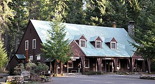
Union Creek is an unincorporated community in Jackson County in the U.S. state of Oregon. It is located along Union Creek and Oregon Route 62, about 15 miles (24 km) from Crater Lake National Park. The community is home to the Union Creek Historic District, which has been listed on the National Register of Historic Places since 1980.

The Millicoma River is a coast stream, about 8.5 miles (13.7 km) long, east of Coos Bay in the U.S. state of Oregon. Formed by the confluence of the East Fork Millicoma River and the West Fork Millicoma River at Allegany, it meanders across relatively flat land to meet the South Fork Coos River, with which it forms the Coos River.

The East Fork Millicoma River is a tributary, about 24 miles (39 km) long, of the Millicoma River in the U.S. state of Oregon. Rising in eastern Coos County, it flows generally west to the community of Allegany, where it joins the West Fork Millicoma River to form the Millicoma. In turn, the Millicoma, which is only about 9 miles (14 km) long, joins the South Fork Coos River to form the Coos River. The Coos River, itself only about 5 miles (8 km) long, empties into the eastern end of Coos Bay, which connects to the Pacific Ocean.

The following works deal with the cultural, political, economic, military, biographical and geologic history of pre-territorial Oregon, Oregon Territory and the State of Oregon.
Camp Castaway was a military encampment at what is now Coos Bay, Oregon, United States. It was established by the survivors of the wreck of the Captain Lincoln, a U.S. transport schooner, on January 3, 1852. The ship began taking on water during a storm while en route from San Francisco to Fort Orford at the town of Port Orford. To avoid sinking, the captain decided to beach the ship north of Cape Arago. All of the roughly 30 troops on board, and the ship's crew, survived the wreck and most of the cargo was salvaged. At the time no U.S. settlement was present at Coos Bay, so commanding officer Lt. Henry Stanton decided to establish the camp to protect the cargo until it could be transported to Fort Orford, some 50 miles south on the Oregon Coast. The troops and crew used spars, booms and sail cloth from the schooner to build tent structures for housing and for protecting the cargo from winter rains and blowing sand. They named the temporary post Camp Castaway. The camp endured for four months in the open dunes with help from Native Americans of the Coos tribe who traded fresh foods to the soldiers for silverware, biscuits and other nonlocal goods.

Floras Lake is a natural 236-acre (96 ha) body of water on the southern Oregon Coast of the United States. Fed by four small tributaries from a basin of about 10 square miles (26 km2) in Curry County, it lies about 10 miles (16 km) north of Port Orford and 2 miles (3 km) west of U.S. Route 101. It was probably named for Fred Flora, a 19th-century settler and miner who lived nearby.