Oregon City is the county seat of Clackamas County, Oregon, United States, located on the Willamette River near the southern limits of the Portland metropolitan area. As of the 2020 census, the city population was 37,572. Established in 1829 by the Hudson's Bay Company, in 1844 it became the first U.S. city west of the Rocky Mountains to be incorporated.

The Willamette River is a major tributary of the Columbia River, accounting for 12 to 15 percent of the Columbia's flow. The Willamette's main stem is 187 miles (301 km) long, lying entirely in northwestern Oregon in the United States. Flowing northward between the Oregon Coast Range and the Cascade Range, the river and its tributaries form the Willamette Valley, a basin that contains two-thirds of Oregon's population, including the state capital, Salem, and the state's largest city, Portland, which surrounds the Willamette's mouth at the Columbia.

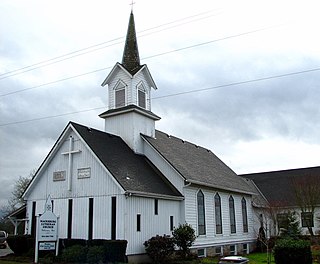
Canby is a city in Clackamas County, Oregon, United States. The population was 15,829 at the 2010 census. It is along Oregon Route 99E, 2 miles (3 km) northeast of Barlow.
Molalla is a city in Clackamas County, Oregon. The population was 8,108 at the time of the 2010 census.

The Pudding River is a 62-mile (100 km) tributary of the Molalla River in the U.S. state of Oregon. Its drainage basin covers 528 square miles (1,368 km2). Among its tributaries are Silver Creek, Butte Creek, Abiqua Creek, and the Little Pudding River.

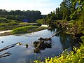
The Molalla River is a 51-mile (82 km) tributary of the Willamette River in the northwestern part of Oregon in the United States. Flowing northwest from the Cascade Range through Table Rock Wilderness, it passes the city of Molalla before entering the larger river near Canby. The Molalla is the largest Willamette tributary unblocked by a dam.
Beavercreek is an unincorporated hamlet and census-designated place in Clackamas County, Oregon, United States, located 6 miles (10 km) southeast of Oregon City. The population was 4,485 at the 2010 census.

The Lewis and Clark National Historical Park, located in the vicinity of the mouth of the Columbia River, commemorates the Lewis and Clark Expedition. Administration of the park, which includes both federal and state lands, is a cooperative effort of the National Park Service and the states of Oregon and Washington. The National Historical Park was dedicated on November 12, 2004.
Abiqua Creek is a tributary of the Pudding River in the U.S. state of Oregon. The creek originates near Lookout Mountain in the foothills of the Cascade Range in the northwestern part of the state. It flows northwest for about 29 miles (47 km) to its confluence with the Pudding, about 2 miles (3.2 km) west of Silverton, in the Willamette Valley. About 20 miles (32 km) north of Silverton, the Pudding River meets the Molalla River, which meets the Willamette River less than 1 mile (1.6 km) later near Canby.

The Table Rock Wilderness is a small pocket wilderness designated in 1984 in the western Cascade Mountains in northwestern Oregon, United States. The wilderness area protects 5,500 acres (2,200 ha) of forest in the historic Molalla River–Pudding River drainage basin, some 19 miles (31 km) southeast of Molalla, Oregon and 50 miles (80 km) southeast of Portland. Somewhat unusual for a wilderness in this area is that it is on BLM land rather the nearby Mount Hood National Forest.

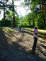
Mary S. Young Park is a city park in the U.S. state of Oregon. It is located within the city of West Linn, alongside the Willamette River, and is heavily wooded. It offers more than five miles of hiking trails, bicycle trails, picnicking, bird watching, fishing, sports fields, and a very popular dog off-leash area.

Santiam State Forest is one of six state forests managed by the Oregon Department of Forestry. The forest is located approximately 25 miles (40 km) southeast of Salem, Oregon, and includes 47,871 acres (193.73 km2) on the western slope of the Cascade Mountains in three Oregon counties: Clackamas, Linn, and Marion. It is bounded on the east by the Willamette National Forest and Mount Hood National Forest. Silver Falls State Park is located west of the forest. The rest of the land surrounding the forest belongs to the Bureau of Land Management or is privately owned. The forest is managed as part of the Department of Forestry's North Cascade District.

Willamette Mission State Park is a state park in the U.S. state of Oregon, located about four miles (6 km) north of Keizer adjacent to the Wheatland Ferry and east of the Willamette River. It includes Willamette Station Site, Methodist Mission in Oregon, which is listed by the National Register of Historic Places.

Erratic Rock State Natural Site is a state park in the Willamette Valley of Oregon, United States. Featuring a 40-short-ton (36 t) glacial erratic from the Missoula Floods, the small park sits atop a foothill of the Northern Oregon Coast Range in Yamhill County between Sheridan and McMinnville off Oregon Route 18. The day use only park is owned and maintained by the Oregon Parks and Recreation Department.

Cascadia State Park is a state park in the U.S. state of Oregon near Sweet Home along the South Santiam River at Cascadia. The park includes a day use area, campsites, hiking trails and 150 foot Lower Soda Creek Falls.

Cline Falls State Scenic Viewpoint is a state park near Redmond, Oregon, United States. It is located on the Deschutes River. The park covers 9 acres (36,000 m2). It is administered by the Oregon Parks and Recreation Department.

Elijah Bristow State Park is a state park in the U.S. state of Oregon, administered by the Oregon Parks and Recreation Department. It has more than 10 miles (16 km) of well-maintained trails along ponds, wetlands, meadows, and the Middle Fork Willamette River, and through forests of broadleaf and evergreen trees. The trails are open to horses, hikers, and mountain bikers, and there is a separate equestrian staging area popular with riding clubs.

The Willamette River Greenway is a cooperative state and local government effort to maintain and enhance the scenic, recreational, historic, natural and agricultural qualities of the Willamette River and its adjacent lands. A number of trails exist along the greenway, but significant gaps still exist.
Macksburg is an unincorporated community in Clackamas County, Oregon, United States four miles southeast of Canby. It is located on Gribble Prairie between the Pudding River and the Molalla River.

Butterfly Park is a city park of about 1 acre (0.4 ha) in south Portland, in the U.S. state of Oregon. Located at 7720 Southwest Macadam Avenue, the park includes a natural area and walking paths near the Willamette River. The natural area provides important habitat for butterflies, including mourning cloaks and orange sulphurs.