
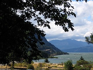
The Columbia River Gorge is a canyon of the Columbia River in the Pacific Northwest of the United States. Up to 4,000 feet (1,200 m) deep, the canyon stretches for over eighty miles (130 km) as the river winds westward through the Cascade Range, forming the boundary between the state of Washington to the north and Oregon to the south. Extending roughly from the confluence of the Columbia with the Deschutes River in the east down to the eastern reaches of the Portland metropolitan area, the water gap furnishes the only navigable route through the Cascades and the only water connection between the Columbia Plateau and the Pacific Ocean. It is thus the route of Interstate 84, U.S. Route 30, Washington State Route 14, and railroad tracks on both sides.

Multnomah Falls is a waterfall located on Multnomah Creek in the Columbia River Gorge, east of Troutdale, between Corbett and Dodson, Oregon, United States. The waterfall is accessible from the Historic Columbia River Highway and Interstate 84. Spanning two tiers on basalt cliffs, it is the tallest waterfall in the state of Oregon at 620 ft (189 m) in height. The Multnomah Creek Bridge, built in 1914, crosses below the falls, and is listed on the National Register of Historic Places.
The Confluence Project is a series of outdoor installations and interpretive artworks located in public parks along the Columbia River and its tributaries in the U.S. states of Washington and Oregon. Each art installation explores the confluence of history, culture and ecology of the Columbia River system. The project draws on the region's history, including Native American traditional stories and entries from the Lewis and Clark Expedition journals, to "evoke a landscape and a way of life submerged in time and memory." The project reaches from the mouth of the Columbia River to Hells Canyon.

The Oregon Coast is a coastal region of the U.S. state of Oregon. It is bordered by the Pacific Ocean to its west and the Oregon Coast Range to the east, and stretches approximately 362 miles (583 km) from the California state border in the south to the Columbia River in the north. The region is not a specific geological, environmental, or political entity, and includes the Columbia River Estuary.

The Sandy River is a 56-mile (90 km) tributary of the Columbia River in northwestern Oregon in the United States. The Sandy joins the Columbia about 14 miles (23 km) upstream of Portland.

The Lewis and Clark National Historical Park, located in the vicinity of the mouth of the Columbia River, commemorates the Lewis and Clark Expedition. Administration of the park, which includes both federal and state lands, is a cooperative effort of the National Park Service and the states of Oregon and Washington. The National Historical Park was dedicated on November 12, 2004.

William Robert Broughton was a British naval officer in the late 18th century. As a lieutenant in the Royal Navy, he commanded HMS Chatham as part of the Vancouver Expedition, a voyage of exploration through the Pacific Ocean led by Captain George Vancouver in the early 1790s.

Beacon Rock State Park is a geologic preserve and public recreation area on Route 14 in the Columbia River Gorge National Scenic Area in Skamania County, Washington, United States. The park takes its name from Beacon Rock, an 848-foot (258 m) basalt volcanic plug on the north shore of the Columbia River 32 miles (51 km) east of Vancouver. On October 31, 1805, the Lewis and Clark Expedition arrived here and first measured tides on the river, indicating that they were nearing the ocean.

Rooster Rock State Park is a state park located east of Corbett, in the U.S. state of Oregon. One of the features of the park is Rooster Rock, a column of basalt forming a natural obelisk, which stands near the south side of the Columbia River Gorge, in the lee of Crown Point. The park is administered by the Oregon Parks and Recreation Department.

The Lewis and Clark National Historic Trail is a route across the United States commemorating the Lewis and Clark Expedition of 1804 to 1806. It is part of the National Trails System of the United States. It extends for some 4,900 miles (7,900 km) from Pittsburgh, Pennsylvania, to the mouth of the Columbia River in Oregon.
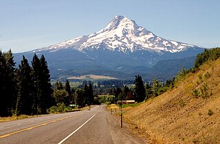
The Mount Hood Highway No. 26 is the Oregon Department of Transportation's designation for a 96.74-mile-long (155.69 km) highway from Portland east around the south side of Mount Hood and north via Bennett Pass to Hood River. It is marked as U.S. Route 26 from Portland to near Mount Hood and Oregon Route 35 the rest of the way to Hood River.

Cape Disappointment State Park is a public recreation area on Cape Disappointment, located southwest of Ilwaco, Washington, on the bottom end of Long Beach Peninsula, the northern headlands where the Columbia River meets the Pacific Ocean. The state park's 2,023 acres (819 ha) encompass a diverse landscape of old-growth forest, freshwater lakes, freshwater and saltwater marshes, and oceanside tidelands. Park sites include Fort Canby, the Lewis and Clark Interpretive Center, North Head Lighthouse, and Cape Disappointment Lighthouse. Cape Disappointment is one of several state parks and sites in Washington and Oregon that are included in Lewis and Clark National Historical Park.

Lewis and Clark Lake is a 31,400 acre (130 km²) reservoir located on the border of the U.S. states of Nebraska and South Dakota on the Missouri River. The lake is approximately 25 miles (40 km) in length with over 90 miles (140 km) of shoreline and a maximum water depth of 45 feet (14 m). The lake is impounded by Gavins Point Dam and is managed by the U.S. Army Corps of Engineers, Omaha District.
Starvation Creek State Park is a state park located west of Hood River, Oregon in the Columbia River Gorge. It was named Starvation Creek because a train was stopped there by snow drifts and passengers had to dig out the train. No one starved there.

Ainsworth State Park is a state park in eastern Multnomah County, Oregon, near Cascade Locks. It is located in the Columbia River Gorge, adjacent to the Historic Columbia River Highway. The park administered by the Oregon Parks and Recreation Department, offers a seasonal, full-service campground, access to Gorge hiking trails beyond park boundaries, and a day-use area.

Seneca Fouts Memorial State Natural Area is a state park in northern Hood River County, Oregon, just west of the city of Hood River, and is administered by the Oregon Parks and Recreation Department. It is located in the Columbia River Gorge, adjacent to an abandoned section of the Historic Columbia River Highway. This park is one of a trio encompassing areas in the vicinity of Mitchell Point, along with Vinzenz Lausmann Memorial State Natural Area and Wygant State Natural Area. The three parks offers scenic hiking and views over the Gorge.

Hat Rock State Park is a state park in the U.S. state of Oregon, administered by the Oregon Parks and Recreation Department. The park is located off the east side of U.S. Highway 730 in Hermiston, on the south shore of Lake Wallula behind McNary Dam on the Columbia River.

John B. Yeon State Scenic Corridor is a state park in the U.S. state of Oregon, administered by the Oregon Parks and Recreation Department. It is located about 35 miles east of Portland in the Columbia Gorge. It is named in honor of John B. Yeon, one of the principal financiers of the Historic Columbia River Highway U.S. Route 30 which was constructed between 1913 and 1922. Located in the Columbia River Gorge National Scenic Area, the park features hiking trails that access some of the nearby waterfalls, including Elowah Falls.

Mississippi Gorge Regional Park is a regional park along the east and west bluffs of the Mississippi River in the cities of Minneapolis and Saint Paul in the U.S. state of Minnesota. The two-city park area is between Mississippi river miles 848 and 852, from just south of Northern Pacific Bridge Number 9 to just north of Minnehaha Regional Park, and lies within the Mississippi National River and Recreation Area. The park area protects scenic and natural areas of the Mississippi River gorge, the only true gorge along the entire length of the 2,320-mile (3,730 km) river.


