
Boardman is a city in Morrow County, Oregon, United States on the Columbia River and Interstate 84. As of the 2010 census the population was 3,220. It is currently the largest town in Morrow County, Oregon.

The Oregon Coast Trail (OCT) is a long-distance hiking route along the Pacific coast of the U.S. state of Oregon in the United States. It follows the coast of Oregon from the mouth of the Columbia River to the California border south of Brookings.

Bald Peak State Scenic Viewpoint is a state park located atop Bald Peak located in Yamhill County, in the United States. The day use only park offers picnic tables and a hiking trail for views of the Willamette Valley and the Cascade Range. The state of Oregon acquired the 26 acres (11 ha) in 1931 after Yamhill and Washington counties requested a park from the state.

Chandler State Wayside is a state park in south-central Oregon in the United States. It is named in honor of Solomon and Hattie Chandler, who donated the land for the park. The park covers 85 acres (34 ha) of pine forest along a creek. The park provides restrooms and other basic facilities to accommodate the traveling public. Chandler State Wayside is administered by the Oregon Parks and Recreation Department.

Samuel H. Boardman State Scenic Corridor is a linear state park in southwestern Oregon, in the United States. It is 12 miles (19 km) long and thickly forested along steep and rugged coastline with a few small sand beaches. It is named in honor of Samuel H. Boardman, the first Oregon Parks superintendent.

H. B. Van Duzer Forest State Scenic Corridor is a 12-mile (19 km) scenic driving route along Route 18 in Lincoln, Tillamook, and Polk counties in the U.S. state of Oregon that passes through a forested corridor. The Van Duzer Corridor stretches from northwestern Polk County to Lincoln City, passing through the Northern Oregon Coast Range.
Battle Mountain Forest State Scenic Corridor is a state park in the U.S. state of Oregon, administered by the Oregon Parks and Recreation Department.
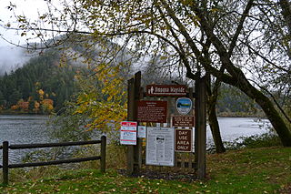
Blue Mountain Forest State Scenic Corridor is a state park in the U.S. state of Oregon, administered by the Oregon Parks and Recreation Department.
Bolon Island Tideways State Scenic Corridor is a state park in the U.S. state of Oregon, administered by the Oregon Parks and Recreation Department. The 11.4-acre (4.6 ha) park is on Bolon Island 10 river miles (16 km) from the mouth of the Umpqua River and north of Reedsport. It is along Highway 101 and near the site, where in 1828, most of Jedediah Smith's party were massacred. The land was given to the state in 1934 by William C. and Jennie D. Chamberlain.

Booth State Scenic Corridor is a state park in the U.S. state of Oregon, administered by the Oregon Parks and Recreation Department.

Cape Sebastian State Scenic Corridor is a state park in the U.S. state of Oregon, administered by the Oregon Parks and Recreation Department.

Face Rock State Scenic Viewpoint is a state park in Bandon, Oregon, United States, administered by the Oregon Parks and Recreation Department. The rocks and tidal flats adjacent to the park form part of the Oregon Islands National Wildlife Refuge. More than 300 species of birds frequent the area.

John B. Yeon State Scenic Corridor is a state park in the U.S. state of Oregon, administered by the Oregon Parks and Recreation Department. It is located about 35 miles east of Portland in the Columbia Gorge. It is named in honor of John B. Yeon, one of the principal financiers of the Historic Columbia River Highway U.S. Route 30 which was constructed between 1913 and 1922. Located in the Columbia River Gorge National Scenic Area, the park features hiking trails that access some of the nearby waterfalls, including Elowah Falls.

Ukiah–Dale Forest State Scenic Corridor is a state park in the U.S. state of Oregon, administered by the Oregon Parks and Recreation Department.
Umpqua State Scenic Corridor is a state park in the U.S. state of Oregon, administered by the Oregon Parks and Recreation Department.
Unity Forest State Scenic Corridor is a state park in the U.S. state of Oregon, administered by the Oregon Parks and Recreation Department.

Wallowa Lake Highway Forest State Scenic Corridor is a state park in the U.S. state of Oregon, administered by the Oregon Parks and Recreation Department.

The High Desert Discovery Scenic Byway is a 127-mile-long (204 km) scenic highway in the southeastern part of the U.S. state of Oregon. It runs through the state's high desert country from the town of Burns to the unincorporated community of Fields. It was designated as an Oregon Scenic Byway in 2003. The highway is maintained by the Oregon Department of Transportation (ODOT). There are a number of points of interest along the route including several that are listed on the National Register of Historic Places.

Redmond–Bend Juniper State Scenic Corridor is a collection of ten unimproved land parcels administered for the Oregon Parks and Recreation Department. The parcels are located along U.S. Route 97 between Bend and Redmond, Oregon, United States. It is named for the large western juniper trees found on the parcels. The scenic corridor is completely undeveloped with no trails or park facilities of any kind.
The High Point Shell Midden is a prehistoric archeological site located in Samuel H. Boardman State Scenic Corridor near Carpenterville, Oregon, United States. The midden is located on a strategic high point overlooking the Pacific coast, and is visible in the eroding cliff face. Radiocarbon dating indicates that the site was occupied c. 1070 CE and again c. 1385 CE, but additional dating may extend this chronology. Although shell deposits are evident without excavation, it is likely that evidence of other activities related to site occupation may be found on the periphery of the midden. The site has potential to produce scientific data related to several topics, including "site formation processes, landscape evolution, and changes in settlement, subsistence, technology, and society among the Native American cultures of the Oregon Coast."


