Oswald West State Park is part of the state park system of the U.S. state of Oregon. It is located about 10 miles (16 km) south of the city of Cannon Beach, adjacent to Arch Cape, on the Pacific Ocean. The park covers 2,448 acres (9.91 km2), with many miles of hiking trails both inside the park grounds and linking to other parks and landmarks beyond.

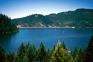
Dexter is an unincorporated community in Lane County, Oregon, United States. It is located near Dexter Reservoir, a.k.a. Dexter Lake, a reservoir of the Middle Fork Willamette River along Oregon Route 58.

Ainsworth State Park is a state park in eastern Multnomah County, Oregon, near Cascade Locks. It is located in the Columbia River Gorge, adjacent to the Historic Columbia River Highway. The park, administered by the Oregon Parks and Recreation Department, offers a seasonal, full-service campground, access to Gorge hiking trails beyond park boundaries, and a day-use area.

Joseph H. Stewart State Recreation Area is a state park located on the Rogue River approximately 40 miles (64 km) from Crater Lake National Park and 35 miles (56 km) northeast of Medford in Jackson County, southern Oregon. It is administered by the Oregon Parks and Recreation Department. Campsites are provided overlooking the Lost Creek Reservoir.

Sheridan State Scenic Corridor is a state park in the Columbia River Gorge, west of Cascade Locks, Oregon. The 11-acre (4.5 ha) property, containing an old-growth forest, is located on the south side of Interstate 84 at approximately milepoint 42.5, and was not accessible by motor vehicle since I-84 was built in 1960. However, with the opening of the Eagle Creek-Cascade Locks segment of the Historic Columbia River Highway State Trail in 1998, it has become easily accessible by foot or bicycle. The park is on a triangular lot, surrounded by I-84 and the Mount Hood National Forest.

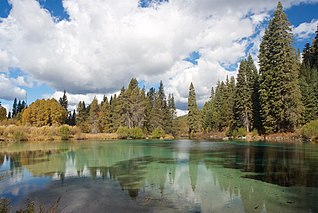
Jackson F. Kimball State Recreation Site is a seasonal state park in southern Oregon. The park is operated and maintained by the Oregon Parks and Recreation Department, and is located approximately 20 miles (32 km) southeast of Crater Lake National Park and 3 miles (4.8 km) north of Fort Klamath. The park was established in 1955, and covers 19 acres (7.7 ha) including the headwaters of the Wood River. It is accessible from May to November, weather dependant.

Samuel H. Boardman State Scenic Corridor is a linear state park in southwestern Oregon, in the United States. It is 12 miles (19 km) long and thickly forested along steep and rugged coastline with a few small sand beaches. It is named in honor of Samuel H. Boardman, the first Oregon Parks superintendent.

Cascadia State Park is a state park in the U.S. state of Oregon near Sweet Home along the South Santiam River at Cascadia. The park includes a day use area, campsites, hiking trails and 150 foot Lower Soda Creek Falls.

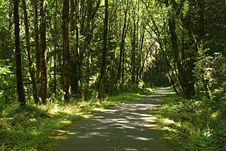
Elijah Bristow State Park is a state park in the U.S. state of Oregon, administered by the Oregon Parks and Recreation Department. It has more than 10 miles (16 km) of well-maintained trails along ponds, wetlands, meadows, and the Middle Fork Willamette River, and through forests of broadleaf and evergreen trees. The trails are open to horses, hikers, and mountain bikers, and there is a separate equestrian staging area popular with riding clubs.

Fall Creek State Recreation Site is a state park in the U.S. state of Oregon, administered by the Oregon Parks and Recreation Department. The park includes 47 campsites that do not include many luxuries. Each site includes a picnic table and a fire ring. There is also a designated swimming area in the lake that Fall Creek flows into. A dock and boat ramp are on the lake as well.

Fogarty Creek State Recreation Area is a state park in the U.S. state of Oregon, administered by the Oregon Parks and Recreation Department.
McVay Rock State Recreation Site is a state park in the U.S. state of Oregon, administered by the Oregon Parks and Recreation Department.

Munson Creek Falls State Natural Site is a state park in the U.S. state of Oregon, administered by the Oregon Parks and Recreation Department. The park contains Munson Creek Falls, which is the tallest waterfall in Oregon's Coast Range. A short hike of 0.5 miles (0.80 km) leads to views of the 319 feet (97 m) waterfall.
Paradise Point State Recreation Site is a state park in the U.S. state of Oregon, administered by the Oregon Parks and Recreation Department.

Roads End State Recreation Site is a state park in the U.S. state of Oregon, administered by the Oregon Parks and Recreation Department.

Rocky Creek State Scenic Viewpoint is a state park in Lincoln County in northwestern Oregon, United States. Administered by the Oregon Parks and Recreation Department, the 59-acre (24 ha) park lies along a bluff between Whale Cove and Rocky Creek. The park extends south along the Otter Crest Loop Road to the Rocky Creek Bridge.

Stonefield Beach State Recreation Site is a state park in the U.S. state of Oregon, administered by the Oregon Parks and Recreation Department.

Wolf Creek Inn State Heritage Site is a state park in the U.S. state of Oregon, administered by the Oregon Parks and Recreation Department.
Arizona Beach State Recreation Site is a 68-acre (28 ha) Oregon state park in Curry County, Oregon, in the United States. The beach is at an average elevation of 7 feet (2 m). Public recreational facilities at Arizona Beach State Recreation Site include a parking lot for beach access, observation areas for viewing marine mammals and birds and tables for picnicking. The park is open year-round.

Brian Booth State Park is a coastal recreational area located near Seal Rock, Lincoln County, Oregon United States, administered by the Oregon Parks and Recreation Department. It consists of two major portions: Ona Beach State Park and Beaver Creek State Natural Area, which were merged in 2013. The park has beach access, kayaking, and hiking trails. The park is 886.32 acres and has an annual attendance of 247,772 people. Ona is known as a Chinook Jargon word for razor clam.


