Saddle Mountain State Natural Area is a state park in northwest Oregon. It is located in the Northern Oregon Coast Range in central Clatsop County, about 20 miles (32 km) by road from Seaside. A 2.5-mile (4.0 km) long hiking trail climbs to the top of Saddle Mountain, which is located in the park. On clear days, the Pacific Ocean, Columbia River mouth and several of the Cascade mountains in Washington and Oregon can be seen from the summit.

Chanticleer Point is a geographical landmark on the Oregon side of the Columbia River Gorge. It is the first notable overlook encountered traveling east on the Historic Columbia River Highway. It is a typical location from which to take photos of the gorge featuring Crown Point and the Vista House prominently. It overlooks Rooster Rock State Park.

The Depoe Bay Whale Watching Center, also known as the Depoe Bay Ocean Wayside, is an Oregon State Parks-staffed visitor center in Depoe Bay, Oregon, U.S. to help visitors observe whale migration and provide information about whales and other marine mammals, including history, economics, and their environmental and ecological influences. The wayside provides a sheltered platform from which to view the ocean. First established as a wayside parking area on the Oregon Coast Highway in 1930, the wayside building was built in 1956 as a restroom facility for the popular spot. It is located just to the north of the Depoe Bay Bridge, also on the National Register.

Bald Peak State Scenic Viewpoint is a state park located atop Bald Peak located in Yamhill County, in the United States. The day use only park offers picnic tables and a hiking trail for views of the Willamette Valley and the Cascade Range. The state of Oregon acquired the 26 acres (11 ha) in 1931 after Yamhill and Washington counties requested a park from the state.

The Peter Skene Ogden State Scenic Viewpoint is a state park on the Crooked River in Oregon, United States. It is on the border of Deschutes and Jefferson counties.

Chandler State Wayside is a state park in south-central Oregon in the United States. It is named in honor of Solomon and Hattie Chandler, who donated the land for the park. The park covers 85 acres (34 ha) of pine forest along a creek. The park provides restrooms and other basic facilities to accommodate the traveling public. Chandler State Wayside is administered by the Oregon Parks and Recreation Department.

Samuel H. Boardman State Scenic Corridor is a linear state park in southwestern Oregon, in the United States. It is 12 miles (19 km) long and thickly forested along steep and rugged coastline with a few small sand beaches. It is named in honor of Samuel H. Boardman, the first Oregon Parks superintendent.

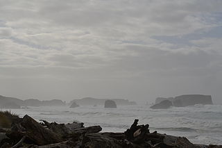
Bandon State Natural Area is a state park in the U.S. state of Oregon. It is administered by the Oregon Parks and Recreation Department. The 879-acre (356 ha) park lies west of U.S. Route 101, off Beach Loop Drive, about 5 miles (8 km) south of Bandon. The Oregon Coast Trail passes through the park.

Booth State Scenic Corridor is a state park in the U.S. state of Oregon, administered by the Oregon Parks and Recreation Department.

Cline Falls State Scenic Viewpoint is a state park near Redmond, Oregon, United States. It is located on the Deschutes River. The park covers 9 acres (36,000 m2). It is administered by the Oregon Parks and Recreation Department.

Ellmaker State Wayside is a state park in the U.S. state of Oregon, administered by the Oregon Parks and Recreation Department. It is located on U.S. Route 20 approximately 1 mile (1.6 km) north of the community of Burnt Woods.

Face Rock State Scenic Viewpoint is a state park in Bandon, Oregon, United States, administered by the Oregon Parks and Recreation Department. The rocks and tidal flats adjacent to the park form part of the Oregon Islands National Wildlife Refuge. More than 300 species of birds frequent the area.

Gleneden Beach State Recreation Site is a state park administered by the Oregon Parks and Recreation Department in the U.S. state of Oregon. Located along the Pacific Ocean 7 miles (11 km) south of Lincoln City, it offers public beach access, picnicking, and fishing in a setting of shore pines, sandstone bluffs, and sand. The park is fee-free.

Hat Rock State Park is a state park in the U.S. state of Oregon, administered by the Oregon Parks and Recreation Department. The park is located off the east side of U.S. Highway 730 in Hermiston, on the south shore of Lake Wallula behind McNary Dam on the Columbia River.
Holman State Wayside is a state park in Polk County, Oregon, United States, on Oregon Route 22 at the foot of the Eola Hills near the community of Eola. The wayside is administered by the Oregon Parks and Recreation Department but was closed to vehicular traffic in 2007 because of ongoing problems with criminal activity.

Rocky Creek State Scenic Viewpoint is a state park in Lincoln County in northwestern Oregon, United States. Administered by the Oregon Parks and Recreation Department, the 59-acre (24 ha) park lies along a bluff between Whale Cove and Rocky Creek. The park extends south along the Otter Crest Loop Road to the Rocky Creek Bridge.

Washburne State Wayside was a state park 4 miles (6 km) northwest of Junction City, in the U.S. state of Oregon. Administered by the Oregon Parks and Recreation Department, the wayside served as a rest stop for travelers on Oregon Route 99W and an interpretive center for the Applegate Trail. The state bought the land for the park in 1926 from William C. and Mae E. Washburne. It was located on the border between Lane and Benton counties.

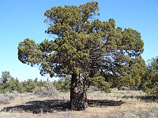
Redmond–Bend Juniper State Scenic Corridor is a collection of ten unimproved land parcels administered for the Oregon Parks and Recreation Department. The parcels are located along U.S. Route 97 between Bend and Redmond, Oregon, United States. It is named for the large western juniper trees found on the parcels. The scenic corridor is completely undeveloped with no trails or park facilities of any kind.

Sisters State Park is a state park located at the southeast side of the town of Sisters in Deschutes County, Oregon, United States. The park property is bisected by U.S. Route 20 and Oregon Route 126, creating three separate parcels. The park covers 28 acres (11 ha) of undeveloped forest land along Whychus Creek. It is adjacent to two developed city parks that were once part of the state park. Sisters State Park is administered by the Oregon Parks and Recreation Department.

Beaver Brook Falls Wayside is a 7.3-acre (3.0 ha) park in Colebrook, New Hampshire, along Route 145. It features a roadside view of the scenic 80-foot (24 m) Beaver Brook Falls. Picnic tables, restroom facilities and a small picnic shelter are available.


