The Umpqua River Bridge is a swing-span bridge that spans the Umpqua River in Reedsport, Oregon. It consists of a central swing span flanked by two reinforced concrete arches on each end. The swing span was necessary to accommodate tall sailing vessels which were common on the Umpqua River. The final cost of the bridge was $510,500.

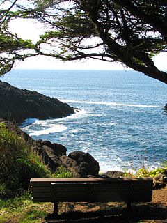
Samuel H. Boardman State Scenic Corridor is a linear state park in southwestern Oregon, in the United States. It is 12 miles (19 km) long and thickly forested along steep and rugged coastline with a few small sand beaches. It is named in honor of Samuel H. Boardman, the first Oregon Parks superintendent.

H. B. Van Duzer Forest State Scenic Corridor is a 12-mile (19 km) scenic driving route along Route 18 in Lincoln, Tillamook, and Polk counties in the U.S. state of Oregon that passes through a forested corridor. The Van Duzer Corridor stretches from northwestern Polk County to Lincoln City, passing through the Northern Oregon Coast Range.
Battle Mountain Forest State Scenic Corridor is a state park in the U.S. state of Oregon, administered by the Oregon Parks and Recreation Department.
Blue Mountain Forest State Scenic Corridor is a state park in the U.S. state of Oregon, administered by the Oregon Parks and Recreation Department.
Bolon Island Tideways State Scenic Corridor is a state park in the U.S. state of Oregon, administered by the Oregon Parks and Recreation Department. The 11.4-acre (4.6 ha) park is on Bolon Island 10 river miles (16 km) from the mouth of the Umpqua River and north of Reedsport. It is along Highway 101 and near the site, where in 1828, most of Jedediah Smith's party were massacred. The land was given to the state in 1934 by William C. and Jennie D. Chamberlain.

Booth State Scenic Corridor is a state park in the U.S. state of Oregon, administered by the Oregon Parks and Recreation Department.

Bradley State Scenic Viewpoint is a state park in the U.S. state of Oregon, administered by the Oregon Parks and Recreation Department. It is located directly north of U.S. Route 30 between Astoria and Portland.

Cape Sebastian State Scenic Corridor is a state park in the U.S. state of Oregon, administered by the Oregon Parks and Recreation Department.

Cline Falls State Scenic Viewpoint is a state park near Redmond, Oregon, United States. It is located on the Deschutes River. The park covers 9 acres (36,000 m2). It is administered by the Oregon Parks and Recreation Department.

John B. Yeon State Scenic Corridor is a state park in the U.S. state of Oregon, administered by the Oregon Parks and Recreation Department. It is located about 35 miles east of Portland in the Columbia Gorge. It is named in honor of John B. Yeon, one of the principal financiers of the Historic Columbia River Highway U.S. Route 30 which was constructed between 1913 and 1922. Located in the Columbia River Gorge National Scenic Area, the park features hiking trails that access some of the nearby waterfalls, including Elowah Falls.

Muriel O. Ponsler Memorial State Scenic Viewpoint is a state park in the U.S. state of Oregon, administered by the Oregon Parks and Recreation Department.

Neptune State Scenic Viewpoint is a state park in the U.S. state of Oregon, administered by the Oregon Parks and Recreation Department.

Pistol River State Scenic Viewpoint is a state park in the U.S. state of Oregon, administered by the Oregon Parks and Recreation Department.

Rocky Creek State Scenic Viewpoint is a state park in Lincoln County in northwestern Oregon, United States. Administered by the Oregon Parks and Recreation Department, the 59-acre (24 ha) park lies along a bluff between Whale Cove and Rocky Creek. The park extends south along the Otter Crest Loop Road to the Rocky Creek Bridge.

Ukiah–Dale Forest State Scenic Corridor is a state park in the U.S. state of Oregon, administered by the Oregon Parks and Recreation Department.
Unity Forest State Scenic Corridor is a state park in the U.S. state of Oregon, administered by the Oregon Parks and Recreation Department.

Wallowa Lake Highway Forest State Scenic Corridor is a state park in the U.S. state of Oregon, administered by the Oregon Parks and Recreation Department.

Lone Ranch Beach is a beach administered by the Oregon Parks and Recreation Department, as it is part of the Samuel H. Boardman State Scenic Corridor.

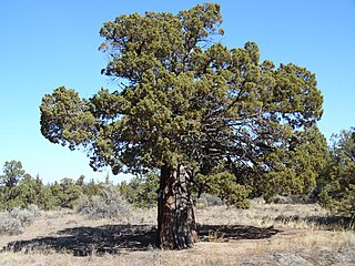
Redmond–Bend Juniper State Scenic Corridor is a collection of ten unimproved land parcels administered for the Oregon Parks and Recreation Department. The parcels are located along U.S. Route 97 between Bend and Redmond, Oregon, United States. It is named for the large western juniper trees found on the parcels. The scenic corridor is completely undeveloped with no trails or park facilities of any kind.


