
Beacon Rock State Park is a geologic preserve and public recreation area on Route 14 in the Columbia River Gorge National Scenic Area in Skamania County, Washington, United States. The park takes its name from Beacon Rock, an 848-foot (258 m) basalt volcanic plug on the north shore of the Columbia River 32 miles (51 km) east of Vancouver. On October 31, 1805, the Lewis and Clark Expedition arrived here and first measured tides on the river, indicating that they were nearing the ocean.

Darlingtonia State Natural Site is a state park and botanical preserve located five miles (8.0 km) north of Florence, Oregon, United States on U.S. Route 101, just west of Mercer Lake and south of Sutton Lake that is dedicated to the preservation of a rare plant.
Wygant State Natural Area is a state park in northern Hood River County, Oregon, just west of the city of Hood River, and is administered by the Oregon Parks and Recreation Department. It is located in the Columbia River Gorge, adjacent to an abandoned section of the Historic Columbia River Highway. This park is one of a trio encompassing areas in the vicinity of Mitchell Point, along with Seneca Fouts Memorial State Natural Area and Vinzenz Lausmann Memorial State Natural Area. The three parks offers scenic hiking and views over the Gorge.

Saddle Mountain is the tallest mountain in Clatsop County in the U.S. state of Oregon. Part of the Oregon Coast Range, Saddle Mountain is in Saddle Mountain State Natural Area in the northwest corner of Oregon. The peak is listed on Oregon's Register of Natural Heritage Resources.

The Tryon Creek State Natural Area is a state park located primarily in Portland, in the U.S. state of Oregon. It is the only Oregon state park within a major metropolitan area. The 645-acre (261 ha) park lies between Boones Ferry Road and Terwilliger Boulevard in southwest Portland in Multnomah County and northern Lake Oswego in Clackamas County and is bisected from north to south by Tryon Creek. To the north, the park abuts the Lewis & Clark Law School campus.
Harris Beach State Park is an Oregon State Park located on US Highway 101, north of Brookings. The day-use area offers a restroom and picnic area with tables, and the campground has RV sites, yurts and tent sites available year-round.

Bald Peak State Scenic Viewpoint is a state park located atop Bald Peak located in Yamhill County, in the United States. The day use only park offers picnic tables and a hiking trail for views of the Willamette Valley and the Cascade Range. The state of Oregon acquired the 26 acres (11 ha) in 1931 after Yamhill and Washington counties requested a park from the state.

The Deschutes River State Recreation Area is a park at the confluence of the Deschutes and Columbia rivers in the U.S. state of Oregon. It is a few miles east of The Dalles. The 35.1-acre (14.2 ha) park offers opportunities for camping, fishing, hiking, mountain biking, and equestrian trail riding.
George W. Joseph State Natural Area is a natural area in the U.S. state of Oregon. It is located near the city of Troutdale between Latourell Falls and Guy W. Talbot State Park, and is accessible from both.
Bandon State Natural Area is a state park in the U.S. state of Oregon. It is administered by the Oregon Parks and Recreation Department. The 879-acre (356 ha) park lies west of U.S. Route 101, off Beach Loop Drive, about 5 miles (8 km) south of Bandon. The Oregon Coast Trail passes through the park.
Bolon Island Tideways State Scenic Corridor is a state park in the U.S. state of Oregon, administered by the Oregon Parks and Recreation Department. The 11.4-acre (4.6 ha) park is on Bolon Island 10 river miles (16 km) from the mouth of the Umpqua River and north of Reedsport. It is along Highway 101 and near the site, where in 1828, most of Jedediah Smith's party were massacred. The land was given to the state in 1934 by William C. and Jennie D. Chamberlain.
Carl G. Washburne Memorial State Park is a state park in the U.S. state of Oregon, administered by the Oregon Parks and Recreation Department. This park is in Lane County near Florence and Yachats. Very scenic wide beach, great for dogs, kids, kites. Some areas nearby are SNOWY PLOVER protected breeding areas, where dogs are banned, so be careful to keep dogs leashed if uncertain, and always in the State Park itself.

Cascadia State Park is a state park in the U.S. state of Oregon near Sweet Home along the South Santiam River at Cascadia. The park includes a day use area, campsites, hiking trails and 150 foot Lower Soda Creek Falls.

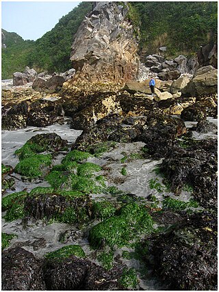
Face Rock State Scenic Viewpoint is a state park in Bandon, Oregon, United States, administered by the Oregon Parks and Recreation Department. The rocks and tidal flats adjacent to the park form part of the Oregon Islands National Wildlife Refuge. More than 300 species of birds frequent the area.

Golden and Silver Falls State Natural Area is a state park in Coos County, Oregon, United States, administered by the Oregon Parks and Recreation Department. The nearest settlement is Allegany.

Munson Creek Falls State Natural Site is a state park in the U.S. state of Oregon, administered by the Oregon Parks and Recreation Department. The park contains Munson Creek Falls, which is the tallest waterfall in Oregon's Coast Range. A short hike of 0.5 miles (0.80 km) leads to views of the 319 feet (97 m) waterfall.

Oceanside Beach State Recreation Site is a state park in the U.S. state of Oregon. Administered by the Oregon Parks and Recreation Department, the park is open to the public and is fee-free. Amenities at the site, in the unincorporated community of Oceanside, include picnicking, wildlife watching, fishing, windsurfing, and kite flying. It is not uncommon to see paraglider pilots land at the beach on Southwest wind days during the fall, winter and spring. Beachcombing is popular in summer, and agate hunting is best in winter, when ocean currents remove sand. Oceanside is about 11 miles (18 km) west of Tillamook off U.S. Route 101.

Marquam Nature Park is a 178.25-acre (72.14 ha) park, located in the gulch northeast of Marquam hill in southwest Portland, Oregon, United States. The park was acquired by Portland Parks & Recreation in 1979. Marquam Nature Park is in Southwest Portland in the Tualatin Mountains, also known as the West Hills, and has several miles of hiking trails.

Brian Booth State Park is a coastal recreational area located near Seal Rock, Lincoln County, Oregon United States, administered by the Oregon Parks and Recreation Department.. It consists of two major portions: Ona Beach State Park and Beaver Creek State Natural Area, which were merged in 2013. The park has beach access, kayaking, and hiking trails. The park is 886.32 acres and has an annual attendance of 247,772 people. Ona is known as a Chinook Jargon word for razor clam.

