Hamblen County, Tennessee

Last updated

Hamblen County, Tennessee
Hamblen-county-courthouse-tn1.jpg
Hamblen County, TN 150 Seal.png
Motto(s): 
Service, Community, Industry
Map of Tennessee highlighting Hamblen County.svg
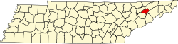
Location within the U.S. state of Tennessee
Coordinates: 36°13′N83°16′W / 36.22°N 83.27°W / 36.22; -83.27
CountryFlag of the United States.svg United States
StateFlag of Tennessee.svg Tennessee
Founded1870
Named after Hezekiah Hamblen [1]
Seat Morristown
Largest cityMorristown
Government
   Mayor Chris Cutshaw [2] (R) [3]
Area
  Total
176 sq mi (460 km2)
  Land161 sq mi (420 km2)
  Water15 sq mi (39 km2)  8.3%
Population
 (2020)
  Total
64,499 Increase2.svg
  Density400.61/sq mi (154.68/km2)
Time zone UTC−5 (Eastern)
  Summer (DST) UTC−4 (EDT)
Congressional district 1st
Website www.hamblencountytn.gov

Hamblen County is a county located in the U.S. state of Tennessee. As of the 2020 census, the population was 64,499. [4] Its county seat and only incorporated city is Morristown. [5] Hamblen County is the core county of the Morristown, Tennessee Metropolitan Statistical Area, which includes Hamblen and Jefferson counties. The county and the Morristown MSA are included in the Knoxville-Morristown-Sevierville, TN Combined Statistical Area. [6]

Contents

History

Hamblen County was created in 1870 from parts of Jefferson, Grainger, and Hawkins counties. The county is named in honor of Hezekiah Hamblen (17751854), [1] [7] an early settler, landowner, attorney, and member of the Hawkins County Court for many years. Governor Dewitt Clinton Senter, a resident of the county, used his influence to assist in its establishment. [8] The Hamblen County Courthouse was completed in 1874.

During World War I, Hamblen County was the only county in the United States to have two Medal of Honor recipients. Edward R. Talley and Calvin Ward both earned them while fighting on the Western Front. [9]

During World War II, the attack transport naval ship USS Hamblen was named after the county.

Historic sites

Geography

According to the U.S. Census Bureau, the county has a total area of 176 square miles (460 km2), of which 161 square miles (420 km2) is land and 15 square miles (39 km2) (8.3%) is water. [10] It is the third-smallest county in Tennessee by land area and fourth-smallest by total area.

Adjacent counties

State protected areas

Major highways

Waterways

The main source of water in Hamblen County is the man-made Cherokee Lake. Cherokee Lake was created during World War II as part of the TVA hydroelectric project. Multiple sources, including a series of natural creeks and runoff waters, feed the lake. The lake originates at its first source in Poor Valley Creek, Hawkins County, and extends through neighboring Grainger County and then Hamblen County. Cherokee Lake then ends with Cherokee Dam, where the water is drained into the Holston River. In total, Cherokee Lake has 28,780 acres of surface area and extends for 400 miles of shoreline, though only a portion of this resides in Hamblen County. [11]

Demographics

Historical population
CensusPop.Note
1880 10,187
1890 11,41812.1%
1900 12,72811.5%
1910 13,6507.2%
1920 15,05610.3%
1930 16,61610.4%
1940 18,61112.0%
1950 23,97628.8%
1960 33,09238.0%
1970 38,69616.9%
1980 49,30027.4%
1990 50,4802.4%
2000 58,12815.2%
2010 62,5447.6%
2020 64,4993.1%
2023 (est.)66,216 [12] 2.7%
U.S. Decennial Census [13]
1790-1960 [14] 1900-1990 [15]
1990-2000 [16] 2010-2014 [4]

2020 census

Hamblen County racial composition [17]
RaceNumberPercentage
White (non-Hispanic)49,19776.28%
Black or African American (non-Hispanic)1,6055.27%
Native American 1300.2%
Asian 7121.1%
Pacific Islander 2680.42%
Other/mixed 2,6034.04%
Hispanic or Latino 9,48314.7%

As of the 2020 census, the county had a population of 64,499. The median age was 40.5 years. 23.2% of residents were under the age of 18 and 18.8% of residents were 65 years of age or older. For every 100 females there were 94.7 males, and for every 100 females age 18 and over there were 92.2 males age 18 and over. [18]

The racial makeup of the county was 79.4% White, 3.4% Black or African American, 0.7% American Indian and Alaska Native, 1.1% Asian, 0.5% Native Hawaiian and Pacific Islander, 7.6% from some other race, and 7.2% from two or more races. Hispanic or Latino residents of any race comprised 14.7% of the population. [19]

77.3% of residents lived in urban areas, while 22.7% lived in rural areas. [20]

There were 25,265 households in the county, of which 31.2% had children under the age of 18 living in them. Of all households, 47.6% were married-couple households, 17.5% were households with a male householder and no spouse or partner present, and 27.8% were households with a female householder and no spouse or partner present. About 27.0% of all households were made up of individuals and 13.1% had someone living alone who was 65 years of age or older. [18]

There were 27,376 housing units, of which 7.7% were vacant. Among occupied housing units, 68.3% were owner-occupied and 31.7% were renter-occupied. The homeowner vacancy rate was 1.8% and the rental vacancy rate was 7.4%. [18]

2010 census

As of the census [21] of 2010, there were 62,544 people, 29,693 households, and 17,161 families residing in the county. The population density was 388 people per square mile (150 people/km2). There were 24,560 housing units at an average density of 153 units per square mile (59/km2). The racial makeup of the county was 91.74% White, 4.22% African American, 0.20% Native American, 0.70% Asian, 0.09% Pacific Islander, and 1.42% from two or more races. Those of Hispanic or Latino origins constituted 10.73% of the population.

There were 24,560 households, out of which 28.4% had children under the age of 18 living with them, 51.3% were married couples living together, 13.1% had a female householder with no husband present, and 30.1% were non-families. 25.70% of all households were made up of individuals living alone, and 11.2% had someone living alone who was 65 years of age or older. The average household size was 2.51 and the average family size was 2.98.

In the county, the population was spread out, with 23.30% under the age of 20, 5.7% from 20 to 24, 25.7% from 25 to 44, 26.7% from 45 to 64, and 15.9% who were 65 years of age or older. The median age was 39.6 years. For every 100 females, there were 94.9 males. For every 100 females age 18 and over, there were 92.30 males.

The median income for a household in the county was $39,807, and the median income for a family was $48,353. Males had a median income of $36,166 versus $27,094 for females. The per capita income for the county was $21,162. 17.7% of the population and 13.2% of families were below the poverty line. Out of the total people living in poverty, 15.7% are under the age of 65 and 19.3% are 65 or older.

Economy

Several large industrial parks on the eastern, western, and southern parts of the county are home to manufacturing facilities for regionally, nationally, and internationally based corporations. [22]

Government

The Hamblen County government consists of 26 elected officials, twelve appointed officials, and the staffing and offices therein. In addition to these offices, the county also houses a liaison office with the University of Tennessee for its Agricultural Extension office. [23] [24]

Communities

City

Town

Census-designated place

Unincorporated communities

Public Education

The Hamblen County Department of Education has two high schools, four middle schools, eleven elementary/intermediate schools, and one alternative-placement school. The Tennessee Board of Regents also has a community college located in Morristown, as well as a technical college for vocational training. Hamblen County's department of education's current mission statement, as of the 2019–2020 school year, is, "The mission of Hamblen County Department of Education is to educate students so they can be challenged to successfully compete in their chosen fields." [25] The current superintendent of Hamblen County Schools is Arnold Bunch [26] As of the 2019–2020 school year, Hamblen County Department of Education has 10,424 students enrolled. [27]

Elementary schools

Middle schools

High schools

Community college

Technical college

Alternative school

Private education

All Saints' Episcopal School

All Saints' Episcopal School was founded in 1967 as a preschool. In 1985, the school was expanded to include first grade. Since then, the school has further expanded (completion in 1992) to enroll students from PreK to 8th grade. [28]

Cornerstone Christian Academy

Cornerstone Christian Academy enrolls students from grades PreK through 5. [29]

Faith Christian Academy

Faith Christian Academy enrolls students from grades 1 through 12. [30]

Morristown Covenant Academy

Morristown Covenant Academy was founded in 1985 and enrolls students in grades Kindergarten through 12. In their high school educational program, students can choose an educational path for general education, college/university readiness, or vocational readiness. [31] The Morristown Covenant Academy also houses a day care and PreK program. [32]

Politics

Like almost all of East Tennessee, Hamblen County has long voted overwhelmingly Republican, starting with its powerful Unionist sentiment during the Civil War. The last Democratic candidate to carry the county was Jimmy Carter in 1976.

United States presidential election results for Hamblen County, Tennessee [33]
Year Republican Democratic Third party(ies)
%%%
1912 42728.62%72248.39%34322.99%
1916 79550.73%74147.29%311.98%
1920 1,57153.86%1,30144.60%451.54%
1924 1,34249.48%1,31748.56%531.95%
1928 1,90260.09%1,26339.91%00.00%
1932 1,45841.40%2,03257.69%320.91%
1936 2,26148.12%2,43851.88%00.00%
1940 1,79446.27%2,05553.00%280.72%
1944 2,00153.73%1,72346.27%00.00%
1948 2,11653.80%1,55239.46%2656.74%
1952 5,03167.19%2,39531.98%620.83%
1956 5,60867.77%2,59231.32%750.91%
1960 7,09369.23%3,12230.47%300.29%
1964 5,19653.00%4,60747.00%00.00%
1968 6,38257.86%2,39021.67%2,25920.48%
1972 8,87976.39%2,56322.05%1821.57%
1976 6,98947.78%7,50451.30%1350.92%
1980 9,74160.60%5,89036.65%4422.75%
1984 11,14468.97%4,92230.46%920.57%
1988 10,41866.93%5,06132.52%860.55%
1992 8,89849.84%7,11439.85%1,84210.32%
1996 9,79754.13%7,00638.71%1,2967.16%
2000 11,82460.02%7,56438.40%3111.58%
2004 14,74266.05%7,43333.30%1430.64%
2008 15,50868.41%6,80730.03%3541.56%
2012 14,52272.49%5,23426.13%2761.38%
2016 15,85776.63%4,07519.69%7603.67%
2020 18,81176.37%5,50022.33%3201.30%
2024 20,15479.03%5,13220.12%2150.84%

See also

References

  1. 1 2 Mrs. Burwin Haun, "Hamblen County," Tennessee Encyclopedia of History and Culture. Retrieved: October 16, 2013.
  2. "Hamblen". County Technical Assistance Service. University of Tennessee . Retrieved September 11, 2020.
  3. "Re-elect Bill Brittain". Bill Brittain for County Mayor.
  4. 1 2 "State & County QuickFacts". United States Census Bureau. Archived from the original on June 7, 2011. Retrieved December 2, 2013.
  5. "Find a County". National Association of Counties. Retrieved June 7, 2011.
  6. "Revised Delineations of Metropolitan Statistical Areas, Micropolitan Statistical Areas, and Combined Statistical Areas, and Guidance on Uses of the Delineations of These Areas" (PDF). Office of Management and Budget . Archived (PDF) from the original on October 9, 2022. Retrieved April 27, 2014 via National Archives.
  7. Gannett, Henry (1905). The Origin of Certain Place Names in the United States. Govt. Print. Off. pp.  147.
  8. "Hamblen's History," Morristown Citizen Tribune, September 12, 2012. Retrieved: October 16, 2013.
  9. Claborn, Jim (March 25, 2017). "Back When". CitizenTribune.com. Retrieved November 19, 2018.
  10. "2010 Census Gazetteer Files". United States Census Bureau. August 22, 2012. Retrieved April 5, 2015.
  11. "Cherokee Lake".
  12. "Annual Estimates of the Resident Population for Counties: April 1, 2020 to July 1, 2023". United States Census Bureau. Retrieved March 14, 2024.
  13. "U.S. Decennial Census". United States Census Bureau. Retrieved April 5, 2015.
  14. "Historical Census Browser". University of Virginia Library. Retrieved April 5, 2015.
  15. Forstall, Richard L., ed. (March 27, 1995). "Population of Counties by Decennial Census: 1900 to 1990". United States Census Bureau. Retrieved April 5, 2015.
  16. "Census 2000 PHC-T-4. Ranking Tables for Counties: 1990 and 2000" (PDF). United States Census Bureau. April 2, 2001. Archived (PDF) from the original on October 9, 2022. Retrieved April 5, 2015.
  17. "Explore Census Data". data.census.gov. Retrieved December 26, 2021.
  18. 1 2 3 "2020 Decennial Census Demographic Profile (DP1)". United States Census Bureau. 2021. Retrieved December 31, 2025.
  19. "2020 Decennial Census Redistricting Data (Public Law 94-171)". United States Census Bureau. 2021. Retrieved December 31, 2025.
  20. "2020 Decennial Census Demographic and Housing Characteristics (DHC)". United States Census Bureau. 2023. Retrieved December 31, 2025.
  21. "U.S. Census website". United States Census Bureau . Retrieved May 14, 2011.
  22. "Hamblen County".
  23. hostmethod (June 15, 2014). "Elected Officials/Department Heads Directory". Hamblen County Government. Retrieved February 9, 2020.
  24. hostmethod (June 15, 2014). "County Commission". Hamblen County Government. Retrieved February 9, 2020.
  25. "About". www.hcboe.net. Retrieved February 8, 2020.
  26. "Welcome to the Hamblen County Board of Education Website". hamblencounty.schoolinsites.com. Retrieved February 8, 2020.
  27. "Explore Hamblen County School District". Niche. Retrieved February 8, 2020.
  28. "History". All Saints' School. Retrieved February 8, 2020.
  29. "About - Cornerstone and Lakeway Academy". www.lcstn.org. Retrieved February 8, 2020.
  30. "Academy Info". FAITH CHURCH AND ACADEMY. Retrieved February 8, 2020.
  31. "About – Morristown Covenant Academy". August 5, 2018. Retrieved February 8, 2020.
  32. "ELC – Morristown Covenant Academy". August 4, 2018. Retrieved February 8, 2020.
  33. Leip, David. "Dave Leip's Atlas of U.S. Presidential Elections". uselectionatlas.org. Retrieved March 10, 2018.

36°13′N83°16′W / 36.22°N 83.27°W / 36.22; -83.27