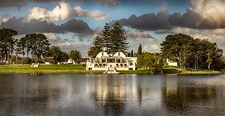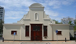
Bellville is a town and former independent city that is now incorporated into the City of Cape Town in the Western Cape province of South Africa. The residential suburb of Bellville lies approximately 23 km north-east of Cape Town and 38 km south-west of Paarl set amongst the Tygerberg hills, with breathtaking views over the Durbanville winelands and the Cape Fold Mountains.

Mooroopna is a rural town located 181 kilometres (112 mi) north of Melbourne, Victoria, Australia. It is on the banks of the Goulburn River opposite the larger town of Shepparton. The Midland Highway crosses the river between the two towns. At the 2016 census, Mooroopna had a population of 7,942.

Bergvliet is a suburb of Cape Town, South Africa. Bergvliet, which means "Mountain Streamlet" in Afrikaans, is bordered by Retreat, Meadowridge, Tokai, and Heathfield.

Somerset West is a town in the Western Cape, South Africa. Organisationally and administratively it is included in the City of Cape Town metropolitan municipality as a suburb of the Helderberg region . The vehicle registration code for Somerset West is CFM and the post code is 7130 for street addresses, and 7129 for post office boxes.

Khayelitsha is a township in Western Cape, South Africa, on the Cape Flats in the City of Cape Town Metropolitan Municipality. The name is Xhosa for New Home. It is reputed to be one of the largest and fastest-growing townships in South Africa.

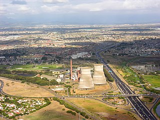
Athlone is a suburb of Cape Town located to the east of the city centre on the Cape Flats, south of the N2 highway. Two of the suburb's main landmarks are Athlone Stadium and the decommissioned coal-burning Athlone Power Station. Athlone is mainly residential and is served by a railway station of the same name. It however includes industrial and commercial zones. There are many "sub-areas" within Athlone, including Gatesville, Rylands, Belgravia Estate, Bridgetown and Hazendal. Colloquially other areas around Athlone are also often included in the greater Athlone area even though the City of Cape Town might classify them as separate neighborhoods such as Rondebosch East, Crawford, and Manenberg.

Tamboerskloof is a neighbourhood and suburb of Cape Town, South Africa. It lies on the slopes of Lion's Head and Signal Hill, adjacent to the neighbourhoods of Gardens and Bo-Kaap. Tamboerskloof is one of the contiguous group of neighbourhoods referred to as the City Bowl.

Mitchells Plain is a large township located within the City of Cape Town, Western Cape, South Africa and situated about 28 km (17 mi) from the Cape Town city centre. It is one of South Africa's largest residential areas and contains multiple smaller suburbs. It is located on the Cape Flats on the False Bay coast between Muizenberg and Khayelitsha. Conceived of as a "model suburb" by the apartheid government, it was built during the 1970s to provide housing for Coloured victims of forced removal due to the implementation of the Group Areas Act.

Brackenfell is a railway town in the Western Cape province of South Africa at the gateway to the Cape Winelands. Formerly an independent municipality, Brackenfell is now a part of the City of Cape Town Metropolitan Municipality and is about 30 kilometres (19 mi) east of Cape Town City Bowl. In Brackenfell a variety of property situated on the slopes of the Bottelary Hills can be found.

Durbanville is a town in the Western Cape province of South Africa, part of the greater Cape Town metropolitan area. Durbanville is a semi-rural residential suburb on the north-eastern outskirts of the metropolis and is surrounded by farms producing wine and wheat.

The Southern Suburbs are a group of Anglophone suburbs in Cape Town, Western Cape, South Africa. This group includes, among others, Observatory, Mowbray, Pinelands, Rosebank, Rondebosch, Rondebosch East, Newlands, Claremont, Hanover Park,Lansdowne, Kenilworth, Bishopscourt, Constantia, Wynberg, Ottery, Plumstead, Diep River, Bergvliet and Tokai. The area is also commonly referred to as the Cape Peninsula, often including the towns further South such as Fish Hoek.

The Faculty of Dentistry at the University of the Western Cape (UWC) is the largest dental school in Africa. Located in Belville, near Cape Town the UWC Faculty of Dentistry offers the BChD (DDS) Degree, degree in dental hygiene, and post-graduate MChD, MSc(Dent) degrees.

Philippi is a large urban and semi-urban area in Cape Town's Cape Flats region, in the Western Cape, South Africa. It comprises the Philippi Horticultural Area to the west, and the neighbourhoods of Brown's Farm, Philippi East and Samora Machel located within its eastern half. The neighbourhoods of Gugulethu and Nyanga are located to its north. The horticultural area is sparsely populated compared to the surrounding city and contains many farms.
Portland is a neighborhood located within the Mitchells Plain urban area of the City of Cape Town in the Western Cape province of South Africa. It is located within the central area of Mitchells Plain with Mitchells Plain Town Centre located to its immediate east.

Westgate is a neighbourhood located within the Mitchells Plain urban area of the City of Cape Town in the Western Cape province of South Africa. It is located in the central western part of Mitchells Plain. Westgate Mall is located to the neighbourhood's immediate north on the other side of Morgenster Road.
Tafelsig is a neighbourhood located within the Mitchells Plain urban area of the City of Cape Town in the Western Cape province of South Africa. It is located in the south eastern corner of the Mitchells Plain area.
Mandalay is a neighbourhood located within the Mitchells Plain urban area of the City of Cape Town in the Western Cape province of South Africa. It is located in the north eastern most corner of the Mitchells Plain area.
Colorado is a neighbourhood located within the Mitchells Plain urban area of the City of Cape Town in the Western Cape province of South Africa. It is located in the north western part of the Mitchells Plain area.

Westridge is a neighbourhood located within the Mitchells Plain urban area of the City of Cape Town in the Western Cape province of South Africa. It is located in the western part of the Mitchells Plain area. The Westridge Gardens, which hosts several indigenous Cape Flats fynbos species, is an important large public park in the area located in the north of Westridge.
Beacon Valley is a neighborhood located within the Mitchells Plain urban area of the City of Cape Town in the Western Cape province of South Africa. It is located in the central eastern part of Mitchells Plain just north and north east of Micheals Plain Town Centre.


