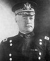
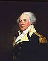
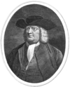
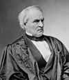
Marker title Image Date dedicated Location Marker type Topics Anthony Sadowski September 18, 1966 U.S. 422 eastbound near graveyard, Douglassville 40°15′28″N 75°43′44″W / 40.25775°N 75.72897°W / 40.25775; -75.72897 (Anthony Sadowski ) Roadside Early Settlement, Ethnic & Immigration, Government & Politics, Government & Politics 18th Century, Native American Baird House September 15, 1950 5th & Washington Sts., SW corner, Reading (Missing) City Environment, Professions & Vocations Ben Austrian June 17, 1995 New Bethel Union Church Cemetery, RD 2, Kempton 40°37′58″N 75°53′32″W / 40.63282°N 75.89217°W / 40.63282; -75.89217 (Ben Austrian ) Roadside Artists Berks County May 12, 1982 Courthouse, N. 6th & Court Sts., Reading 40°20′11″N 75°55′33″W / 40.33648°N 75.92587°W / 40.33648; -75.92587 (Berks County ) City Government & Politics, Government & Politics 18th Century, Iron Bethel A.M.E. Church May 11, 1996 119 N. 10th St., Reading 40°20′33″N 75°55′32″W / 40.34255°N 75.9256°W / 40.34255; -75.9256 (Bethel A.M.E. Church ) City African American, Buildings, Religion, Underground Railroad Carl A. Spaatz June 27, 1991 Pa. 562 (S. Reading Ave.) at W. 2nd St., Boyertown 40°19′54″N 75°38′30″W / 40.33177°N 75.64163°W / 40.33177; -75.64163 (Carl A. Spaatz ) Roadside Military, Military Post-Civil War Charming Forge April 30, 1947 U.S. 422, Womelsdorf 40°21′57″N 76°10′48″W / 40.36577°N 76.17993°W / 40.36577; -76.17993 (Charming Forge ) Roadside American Revolution, Buildings, Business & Industry, Iron, Professions & Vocations Christ Little Tulpehocken Church June 12, 1963 SR 4010 W of Bernville 40°25′20″N 76°07′56″W / 40.42213°N 76.13218°W / 40.42213; -76.13218 (Christ Little Tulpehocken Church ) Roadside Buildings, Religion Colebrookdale Furnace n/a Pa. 562 near SR 2040 SW of Boyertown 40°19′24″N 75°39′14″W / 40.32323°N 75.65392°W / 40.32323; -75.65392 (Colebrookdale Furnace ) Roadside Business & Industry, Furnaces, Iron Conrad Weiser April 29, 1947 U.S. 422, Weiser Homestead, E of Womelsdorf 40°21′36″N 76°10′20″W / 40.36013°N 76.17213°W / 40.36013; -76.17213 (Conrad Weiser ) Roadside Early Settlement, Government & Politics, Native American Conrad Weiser Trading Post February 16, 1951 505 Penn St., Penn Sq., Reading 40°20′08″N 75°55′40″W / 40.33555°N 75.92775°W / 40.33555; -75.92775 (Conrad Weiser Trading Post ) City Buildings, Early Settlement, Government & Politics, Native American, Professions & Vocations Daniel Boone n/a U.S. 422, 2 miles SE of Baumstown 40°16′04″N 75°45′40″W / 40.26767°N 75.76107°W / 40.26767; -75.76107 (Daniel Boone ) Roadside Education, Houses & Homesteads, Professions & Vocations Daniel Boone April 1, 1947 U.S. 422 westbound at SR 2041 just E of Baumstown; U.S. 422 eastbound at Baumstown Union Sunday School 40°16′46″N 75°48′07″W / 40.27938°N 75.80183°W / 40.27938; -75.80183 (Daniel Boone ) Roadside Education, Houses & Homesteads, Professions & Vocations Daniel Boone (1734-1820) - PLAQUE n/a US 422 between Baumstown and Douglassville 40°16′03″N 75°45′40″W / 40.26756°N 75.76106°W / 40.26756; -75.76106 (Daniel Boone - PLAQUE ) Plaque Exploration Daniel Boone Homestead n/a SR 2041 N of Baumstown 40°17′27″N 75°47′40″W / 40.29073°N 75.79435°W / 40.29073; -75.79435 (Daniel Boone Homestead ) Roadside Buildings, Early Settlement, Houses & Homesteads De Benneville House December 4, 1948 Pa. 622, 1.5 miles N of Yellow House 40°20′36″N 75°45′42″W / 40.34335°N 75.7618°W / 40.34335; -75.7618 (De Benneville House ) Roadside Houses & Homesteads, Religion De Turk House December 4, 1948 Junction PA 73 & Memorial Hwy. (PA 662), near DeTurk Rd., just S of Oley 40°23′01″N 75°47′12″W / 40.38373°N 75.78669°W / 40.38373; -75.78669 (De Turk House ) Roadside Early Settlement, Ethnic & Immigration, Religion Doctor Jonathan Potts February 16, 1951 545 Penn St., Penn Sq., Reading 40°20′08″N 75°55′35″W / 40.33543°N 75.92632°W / 40.33543; -75.92632 (Doctor Jonathan Potts ) City American Revolution, Military Dr. Bodo Otto February 16, 1951 525 Penn St., Penn Sq., Reading 40°20′08″N 75°55′40″W / 40.33555°N 75.92775°W / 40.33555; -75.92775 (Dr. Bodo Otto ) City American Revolution, Medicine & Science, Military, Professions & Vocations Duryea Drive May 17, 1951 Intersection of Clymer & 13th Sts. at Park Dr., Reading 40°20′05″N 75°54′40″W / 40.33473°N 75.91112°W / 40.33473; -75.91112 (Duryea Drive ) Roadside Business & Industry, Invention, Oil & Gas, Professions & Vocations, Transportation Duryea Drive May 17, 1951 In Reading at 1st curve on road to Pagoda, about 65' from curve Roadside Business & Industry, Invention, Oil & Gas, Professions & Vocations, Transportation Duryea Drive May 17, 1951 In Reading, on Mount Penn at Pagoda 40°20′10″N 75°54′20″W / 40.33607°N 75.90565°W / 40.33607; -75.90565 (Duryea Drive ) Roadside Business & Industry, Invention, Oil & Gas, Professions & Vocations, Transportation Eight-Cornered School June 10, 1948 U.S. 422 in Sinking Spring (Missing) City Education, Religion Exeter Friends Meeting May 7, 1979 Meetinghouse Road, .5 mile S of Pa. 562 & 2 mile W of Yellow House 40°18′46″N 75°47′04″W / 40.3129°N 75.78443°W / 40.3129; -75.78443 (Exeter Friends Meeting ) Roadside Abraham Lincoln, Buildings, Religion Federal Inn February 16, 1951 445 Penn St., Penn Sq., Reading 40°20′08″N 75°55′42″W / 40.33543°N 75.92822°W / 40.33543; -75.92822 (Federal Inn ) City Buildings, Business & Industry, George Washington, Military, Inns & Taverns, Whiskey Rebellion Fisher House August 28, 1948 Pa. 622, 1.4 miles N of Yellow House 40°20′28″N 75°45′39″W / 40.34113°N 75.76095°W / 40.34113; -75.76095 (Fisher House ) Roadside Buildings, Houses & Homesteads Fort Henry June 18, 1959 Pa. 501, 2 miles N of Bethel 40°29′30″N 76°18′59″W / 40.49178°N 76.31645°W / 40.49178; -76.31645 (Fort Henry ) Roadside Forts, French & Indian War, Military Goshenhoppen April 30, 1947 Pa. 100 (7th & Main Sts.), Bally 40°24′10″N 75°35′09″W / 40.40268°N 75.58588°W / 40.40268; -75.58588 (Goshenhoppen ) Roadside Early Settlement, Education, Religion Hawk Mountain Sanctuary September 14, 2019 Hawk Mountain Road, at path to North Lookout 40°38′06″N 75°59′13″W / 40.63494°N 75.98698°W / 40.63494; -75.98698 (Hawk Mountain Sanctuary ) Roadside Education, Environment, Science & Medicine, Sports & Recreation, Women Henry A. Muhlenberg February 16, 1951 400 Penn St., Reading 40°20′07″N 75°55′47″W / 40.33523°N 75.9297°W / 40.33523; -75.9297 (Henry A. Muhlenberg ) City Government & Politics, Religion Hereford Furnace May 5, 1967 Pa. 29 & 100 at junction SR 1010, Hereford 40°26′59″N 75°33′08″W / 40.4497°N 75.55232°W / 40.4497; -75.55232 (Hereford Furnace ) Roadside Business & Industry, Furnaces, Iron Hessian Camp October 1, 1949 Mineral Spring Rd. (Business U.S. 422 westbound) at 18th St., Reading 40°19′54″N 75°54′06″W / 40.33168°N 75.90163°W / 40.33168; -75.90163 (Hessian Camp ) Roadside American Revolution, Ethnic & Immigration Hessian Camp October 1, 1949 Pa. 73 & U.S. 422, Mineral Spring Park (Missing) Roadside Ethnic & Immigration Hiester Home February 16, 1951 439 Penn St., Penn Sq., Reading 40°20′08″N 75°55′43″W / 40.33542°N 75.92862°W / 40.33542; -75.92862 (Hiester Home ) City American Revolution, Government & Politics, Governors, Houses & Homesteads, Military Hopewell Village August 28, 1948 Pa. 10, S of Plowville Roadside Business & Industry, Furnaces, Iron Hopewell Village March 29, 1947 U.S. 422 east & westbound at Pa. 82, Baumstown 40°16′51″N 75°48′21″W / 40.28077°N 75.8057°W / 40.28077; -75.8057 (Hopewell Village ) Roadside Business & Industry, Furnaces, Iron Hunter Liggett December 30, 1984 145 S. 6th St. at Chestnut, Reading 40°19′56″N 75°55′33″W / 40.33232°N 75.92593°W / 40.33232; -75.92593 (Hunter Liggett ) City Military, Military Post-Civil War James Maurer (1864-1944) September 8, 2006 Heritage Park near Workers' Memorial, 8th & Canal Sts., Reading 40°19′30″N 75°55′34″W / 40.32493°N 75.92622°W / 40.32493; -75.92622 (James Maurer ) Roadside Government & Politics 20th Century, Labor Jeremiah Sweinhart and Successors April 17, 1994 3rd. & Walnut Sts., Boyertown 40°19′59″N 75°38′24″W / 40.33315°N 75.64012°W / 40.33315; -75.64012 (Jeremiah Sweinhart and Successors ) Roadside Agriculture, Business & Industry, Entrepreneurs, Military, Transportation John A. Shulze September 6, 1951 Conrad Weiser Pkwy. (US 422) at Main St. & Longs Church Ln., outside Stouchsburg 40°23′02″N 76°14′49″W / 40.38383°N 76.24686°W / 40.38383; -76.24686 (John A. Shulze ) Roadside Government & Politics, Government & Politics 19th Century, Governors Joseph Hiester March 27, 1947 Pa. 183 at SR 3051 & 3053 near Leinbachs 40°23′18″N 75°59′34″W / 40.38827°N 75.99267°W / 40.38827; -75.99267 (Joseph Hiester ) Roadside American Revolution, Government & Politics, Governors, Mansions & Manors, Military Lincoln Homestead March 29, 1947 5700 Perkiomen Ave. (US 422), near Lincoln Rd., Reading / Exeter Twp. Roadside Abraham Lincoln, Early Settlement, Government & Politics 18th Century, Houses & Homesteads Northkill Amish June 26, 1959 Old U.S. 22, 1 mile W of Shartlesville 40°30′43″N 76°07′11″W / 40.51207°N 76.11982°W / 40.51207; -76.11982 (Northkill Amish ) Roadside Early Settlement, Native American, Religion Oley Moravians August 28, 1948 Memorial Hwy. (PA 622), near Mine Ln., 1 mile S of Oley 40°22′25″N 75°46′38″W / 40.37348°N 75.77713°W / 40.37348; -75.77713 (Oley Moravians ) Roadside Early Settlement, Education, Religion Penn's Common February 16, 1951 Perkiomen Ave. (Business U.S. 422 westbound) at 11th & Penn Sts., Reading 40°20′06″N 75°54′57″W / 40.33505°N 75.91585°W / 40.33505; -75.91585 (Penn's Common ) City Government & Politics, Government & Politics 18th Century, William Penn Pilger Ruh April 22, 1950 Bethel Rd. (PA 501) at Pilger Ruh Rd., N of Bethel near Schuylkill Co. line 40°30′48″N 76°20′14″W / 40.51327°N 76.33735°W / 40.51327; -76.33735 (Pilger Ruh ) Roadside Environment, Native American, Paths & Trails, Religion Reading n/a Lancaster Ave. (Bus. 222) at Summit Ave., S end of city 40°22′08″N 75°55′37″W / 40.36895°N 75.92688°W / 40.36895; -75.92688 (Reading ) Roadside Business & Industry, Cities & Towns, Early Settlement, Ethnic & Immigration, Government & Politics Reading 1948 U.S. 122 S Roadside Business & Industry, Cities & Towns, Early Settlement, Ethnic & Immigration, Government & Politics Reading 1948 U.S. 122 N Roadside Business & Industry, Cities & Towns, Early Settlement, Ethnic & Immigration, Government & Politics Reading n/a N 5th St. Hwy. / Allentown Pike (US 222) at N city line, just S of Warren St. Bypass (PA 12) Roadside Business & Industry, Cities & Towns, Early Settlement, Ethnic & Immigration, Government & Politics Reading n/a Penn Ave. (Bus. Rt. 422) just W of Ben Franklin Hwy. / Conrad Weiser Pkwy. cloverleaf 40°20′05″N 75°56′27″W / 40.33472°N 75.94073°W / 40.33472; -75.94073 (Reading ) Roadside Business & Industry, Cities & Towns, Ethnic & Immigration Reading Railroad Massacre October 16, 1993 7th & Penn Sts., Reading 40°20′07″N 75°55′27″W / 40.33522°N 75.9242°W / 40.33522; -75.9242 (Reading Railroad Massacre ) City Labor, Railroads, Transportation Rhoads Opera House Fire June 29, 2008 Fairview Cemetery, north side of W Philadelphia Ave., Boyertown Roadside Buildings, Government & Politics 20th Century Robesonia Furnace n/a U.S. 422 (Penn Ave.) at Freeman St., Robesonia 40°20′59″N 76°07′44″W / 40.34977°N 76.1289°W / 40.34977; -76.1289 (Robesonia Furnace ) Roadside Buildings, Business & Industry, Furnaces, Iron, Professions & Vocations Skew Bridge March 1, 1951 N. 6th St. at railroad bridge, near Woodward St., Reading 40°20′34″N 75°55′33″W / 40.34265°N 75.92572°W / 40.34265; -75.92572 (Skew Bridge ) City Bridges, Railroads, Transportation Solomon Boscov August 3, 1999 1400 Block N. 9th St., Reading 40°21′23″N 75°55′10″W / 40.35635°N 75.91933°W / 40.35635; -75.91933 (Solomon Boscov ) City Business & Industry, Ethnic & Immigration Swedish Pioneers February 20, 1949 E Main St. / W Schuylkill Rd. (PA 724) just NW of River Bridge Rd., 5 miles SE of Birdsboro 40°15′10″N 75°43′46″W / 40.25273°N 75.72957°W / 40.25273; -75.72957 (Swedish Pioneers ) Roadside Early Settlement, Ethnic & Immigration, Houses & Homesteads, William Penn Thomas Mifflin March 27, 1947 U.S. 222 (E. Lancaster Ave.) at Mifflin Blvd., Shillington 40°18′25″N 75°57′34″W / 40.307°N 75.95936°W / 40.307; -75.95936 (Thomas Mifflin ) Roadside American Revolution, Government & Politics, Government & Politics 18th Century, Governors, Military Thomas Rutter October 4, 1982 Pine Forge Academy off Pine Forge Rd. (SR 2063), Pine Forge 40°16′52″N 75°42′14″W / 40.281°N 75.70375°W / 40.281; -75.70375 (Thomas Rutter ) City African American, Business & Industry, Education, Iron, Mansions & Manors, Professions & Vocations, Underground Railroad Thompson's Rifle Battalion: Capt. George Nagel's Company November 4, 1989 940 Centre Ave. (Pa. 61), Greenfield Manor section of Reading Roadside American Revolution, Military Tulpehocken Path March 19, 1952 Lancaster Ave. (PA 501) at Schubert Rd., just N of I-78/US22, 1 mile N of Bethel 40°28′42″N 76°17′44″W / 40.47822°N 76.2955°W / 40.47822; -76.2955 (Tulpehocken Path ) Roadside Forts, French & Indian War, Military, Native American, Paths & Trails Tulpehocken Path July 16, 1951 Conrad Weiser Pkwy. / W Penn Ave. (US 422), at Conrad Weiser Homestead E of Womelsdorf 40°21′36″N 76°10′20″W / 40.36013°N 76.17213°W / 40.36013; -76.17213 (Tulpehocken Path ) Roadside Government & Politics, Native American, Paths & Trails, Transportation, William Penn Tulpehocken Path July 16, 1951 PA 419 N of Host (Missing) Roadside Government & Politics, Native American, Paths & Trails, Transportation, William Penn Union Canal April 22, 1950 Morgantown Rd. (PA 10) & Philadelphia Ave. (PA 724), 2 miles S of Reading 40°17′52″N 75°55′34″W / 40.29778°N 75.92598°W / 40.29778; -75.92598 (Union Canal ) Roadside Business & Industry, Canals, Mills, Navigation, Transportation Union Canal May 12, 1950 Pa. 183, .9 mile SE of Bernville Roadside Business & Industry, Canals, Mills, Navigation, Transportation Union Canal October 1950 Upper Van Reed Rd. near Tulpehocken Creek, .1 mile S of Leinbachs, Bernville Roadside Business & Industry, Canals, Mills, Navigation, Transportation Wallace Stevens (1879-1955) October 1, 2007 323 N 5th St., Reading 40°20′27″N 75°55′40″W / 40.3407°N 75.9277°W / 40.3407; -75.9277 (Wallace Stevens ) City Writers William Penn - First Visit to America - PLAQUE October 1, 1945 US 422, .8 mile SE of Baumstown (264 E Ben Franklin Hwy., Birdsboro) 40°16′26″N 75°46′50″W / 40.27375°N 75.78053°W / 40.27375; -75.78053 (William Penn - First Visit to America - PLAQUE ) Plaque Exploration, William Penn William Strong February 16, 1951 NW corner, 5th & Court Sts., Reading 40°20′10″N 75°55′40″W / 40.33622°N 75.92788°W / 40.33622; -75.92788 (William Strong ) City Government & Politics, Government & Politics 19th Century, Professions & Vocations