List of ecclesiastical parishes in the Diocese of Bath and Wells

Last updated

Diocese of Bath and Wells
Dio Bath Wells arms.png
Location
Ecclesiastical province Canterbury
Archdeaconries Bath, Wells, Taunton
Statistics
Parishes477
Churches569
Information
Cathedral Cathedral Church of Saint Andrew
Current leadership
Bishop Michael Beasley, Bishop of Bath and Wells
Suffragan Ruth Worsley, Bishop of Taunton [1]
Archdeacons Simon Hill, Archdeacon of Taunton
Anne Gell, Archdeacon of Wells
Adrian Youings, Archdeacon of Bath
Website
bathandwells.org.uk

The ecclesiastical parishes within the Diocese of Bath and Wells cover the majority of the English county of Somerset and small areas of Devon, Dorset, Gloucestershire and Wiltshire. The episcopal seat of the Bishop of Bath and Wells is in the Cathedral Church of Saint Andrew in the city of Wells in Somerset.

Contents

The diocesan offices, the bishops' offices and residences and the cathedral are all located around the Bishop's Palace in Wells. The diocese is not referred to as "Bath diocese" or "Wells diocese", but as "Bath and Wells diocese". [2] The ordinary of the diocese is the diocesan Bishop of Bath and Wells, Michael Beasley; he is assisted throughout the diocese by the Bishop suffragan of Taunton, Ruth Worsley. Her See was created in 1911.

Alternative episcopal oversight (for parishes in the diocese that reject the ministry of women priests) is provided by the provincial episcopal visitor (PEV), the Bishop suffragan of Ebbsfleet, Jonathan Goodall. He is licensed as an honorary assistant bishop of the diocese in order to facilitate his work there. [3]

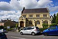
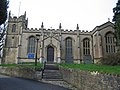
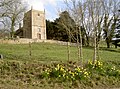
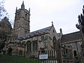
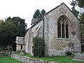
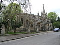
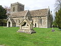
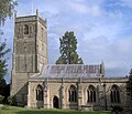
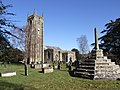
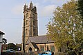
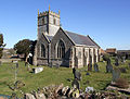
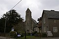
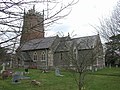
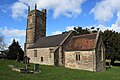
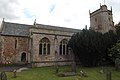
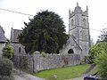
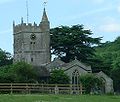
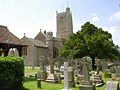
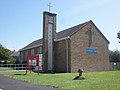
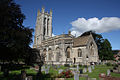
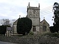
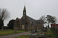
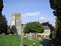
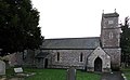
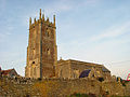
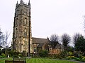
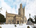
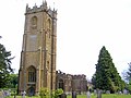
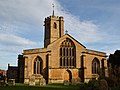
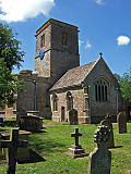
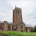
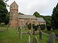
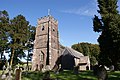
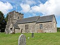
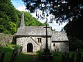
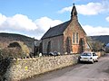
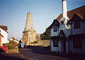
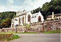
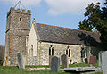
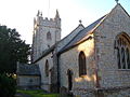
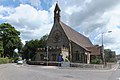
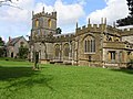
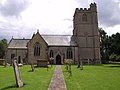
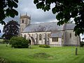
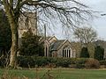
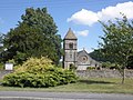
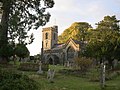
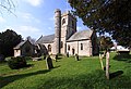
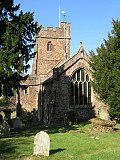
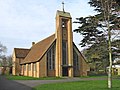
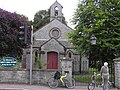
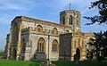
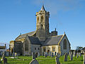
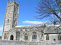
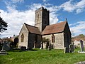
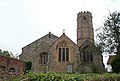
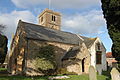
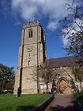
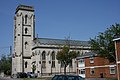
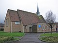
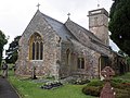
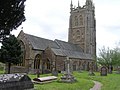
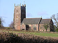
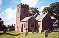
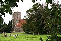
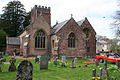
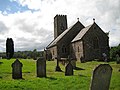
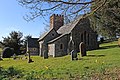
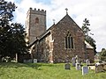
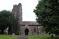
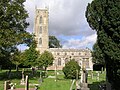
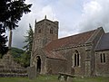
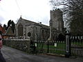
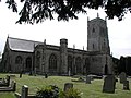
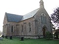
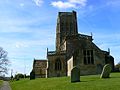
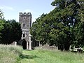
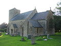
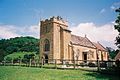
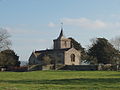
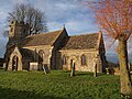
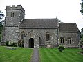
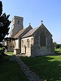
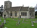
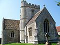
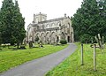
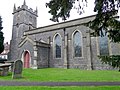
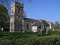
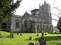
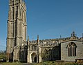
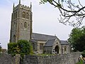
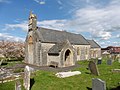
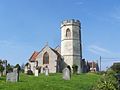
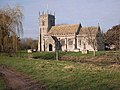
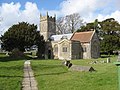
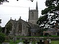
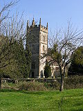
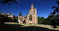
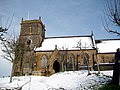
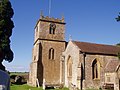
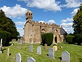
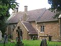
The parish with its local parish church is the basic unit of the Church of England. The parish within the Church of England structure has its roots in the Roman Catholic Church and survived the Reformation largely untouched. Church of England parishes are currently each within one of 44 dioceses divided between the provinces of Canterbury, with 30 dioceses, and York with 14. In 2017 there were approximately 12,600 Church of England parishes in all, with 477 being within this diocese. [4]

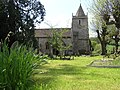
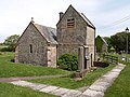
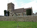
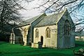
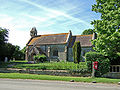
Each parish is administered by a parish priest who may be assisted in his pastoral duties by a curate or curates, who are also ordained but not parish priests. There are wide variations in the size of parishes and church-going populations. A parish priest may have responsibility for one parish or for two or more, and some are part of a team ministry. By extension, the term parish refers not only to the territorial unit but to the people of its community or congregation. A benefice or "living" in the Church of England describes any ecclesiastical parish or group of ecclesiastical parishes under a single stipendiary minister. [5] The holder of a benefice owns the "freehold" of the post (the church and the parsonage house) for life.

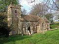
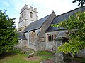
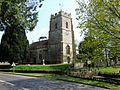
Until the late 19th century, the parishes were the smallest area for local government and administrative functions. Following the Local Government Act 1894, the civil duties of the church were abolished and separate civil parishes were established. [6] As a result of the different needs of the civil community and the church, in many cases the boundaries of the ecclesiastical parishes and their equivalent civil parish have diverged with time.

Archdeaconry of Bath

The archdeaconry covers most of the two unitary authorities of North Somerset and Bath and North East Somerset, and also includes sections of neighbouring districts in Somerset and Wiltshire. The Archdeacon of Bath is Adrian Youings. [7]

Deanery of Bath

The deanery is mostly within Bath and North East Somerset, but includes one civil parish in Wiltshire and a small section in South Gloucestershire. As well as covering the city of Bath, it also includes the surrounding suburbs of the city and neighbouring villages. [8]

Ecclesiastical parish Benefice Parish churchLocationImage Civil parish(es) District(s)
Bath Abbey with St JamesBath Abbey with St James Bath Abbey [9] 51°22′53″N2°21′31″W / 51.3815°N 2.3587°W / 51.3815; -2.3587 (Bath Abbey)
Abadia de Bath, Bath, Inglaterra, 2014-08-12, DD 07.JPG
Bath Abbey
Bath (unparished) Bath and North East Somerset
Bath, Bathwick: St JohnBath Bathwick St John [10] 51°23′18″N2°21′19″W / 51.3883°N 2.3554°W / 51.3883; -2.3554 (Church of St John the Baptist, Bathwick)
St John the Baptist church, Bath (geograph 2037798).jpg
St John: Bathwick
Bath (unparished) Bath and North East Somerset
Bath, Bathwick: St MaryBath Bathwick St Mary [11] 51°23′05″N2°21′04″W / 51.3847°N 2.3511°W / 51.3847; -2.3511 (St Mary the Virgin's Church, Bathwick)
St Mary's Church, Bathwick, 2015.jpg
St Mary, Bathwick
Bath (unparished) Bath and North East Somerset
Bath: The AscensionBath Marlbrook Team The Ascension [12] 51°22′26″N2°22′57″W / 51.3738°N 2.3824°W / 51.3738; -2.3824 (Church of the Ascension, Bath)
-
Bath (unparished) Bath and North East Somerset
Bath: Twerton-on-AvonBath Marlbrook Team St Michael [13] 51°22′51″N2°23′54″W / 51.3809°N 2.3982°W / 51.3809; -2.3982 (Church of St Michael, Twerton)
Geograph 3202950 St Michael's church, Twerton, Bath.jpg
St Michael: Twerton
Bath (unparished) Bath and North East Somerset
Bath Combe HayBath Odd Down with Combe Hay Combe Hay [14] 51°20′15″N2°22′53″W / 51.3374°N 2.3815°W / 51.3374; -2.3815 (Combe Hay Church)
Combe Hay parish church - geograph.org.uk - 358440.jpg
Combe Hay Church
All of Combe Hay [lower-alpha 1] Bath and North East Somerset
Bath, Odd DownBath Odd Down with Combe Hay St Philip & St James [15] 51°21′41″N2°22′51″W / 51.3613°N 2.3809°W / 51.3613; -2.3809 (Church of St Philip & St James, Odd Down)
St. Philip and St. James, Odd Down - geograph.org.uk - 144828.jpg
St Philip & St James, Odd Down
Bath (unparished) Bath and North East Somerset
Bath St Michael WithoutBath St Michael Without St Michael [16] 51°23′03″N2°21′36″W / 51.3842°N 2.3601°W / 51.3842; -2.3601 (St Michael's Church, Bath)
Iglesia en Bath.JPG
St Michael: Bath
Bath (unparished) Bath and North East Somerset
Bath: St BarnabasBath St Barnabas with Englishcombe St Barnabas [17] 51°22′10″N2°23′41″W / 51.3695°N 2.3946°W / 51.3695; -2.3946 (Church of St Barnabas, Bath)
In between the hills (geograph 3920699).jpg
St Barnabas: Bath
Bath (unparished) Bath and North East Somerset
EnglishcombeBath St Barnabas with Englishcombe St Peter [18] 51°21′52″N2°24′32″W / 51.3644°N 2.4089°W / 51.3644; -2.4089 (Church of St Peter, Englishcombe)
Church englishcombe.jpg
St Peter: Englishcombe
All of Englishcombe.
Small part of Bath (unparished)
Bath and North East Somerset
Bath St BartholomewBath St Bartholomew St Bartholomew [19] 51°22′30″N2°22′28″W / 51.3751°N 2.3745°W / 51.3751; -2.3745 (Church of St Bartholomew, Bath)
St Barts Church, Bath (geograph 5283933).jpg
St Bartholomew, Bath
Bath (unparished) Bath and North East Somerset
Bath St LukeBath St Luke St Luke [20] 51°22′07″N2°22′00″W / 51.3687°N 2.3667°W / 51.3687; -2.3667 (Church of St Luke, Bath)
St Lukes church, Bloomfield, Bath (geograph 3205567).jpg
St Luke: Bath
Bath (unparished) Bath and North East Somerset
Bath St SaviourBath St Saviour with Swainswick and Woolley St Saviour [21] 51°23′45″N2°20′47″W / 51.3958°N 2.3465°W / 51.3958; -2.3465 (Church of St Saviour, Bath)
St. Saviour's church, Larkhall, Bath - geograph.org.uk - 1601115.jpg
St Saviour: Bath
Bath (unparished) Bath and North East Somerset
Swainswick with WoolleyBath St Saviour with Swainswick and Woolley St Mary [22]
All Saints [23]
51°24′51″N2°21′06″W / 51.4143°N 2.3516°W / 51.4143; -2.3516 (St Mary, Swainswick)
Swainswick (Somerset) St Mary's Church - geograph.org.uk - 67846.jpg
St Mary: Swainswick
All of Swainswick
Charlcombe
Bath (unparished)
Bath and North East Somerset
Bath, WalcotBath Walcot St Swithin [24]
St Andrew [25]
Christ Church [26]
51°23′19″N2°21′33″W / 51.3886°N 2.3593°W / 51.3886; -2.3593 (Church of St Swithin, Bath)
Geograph 2807697 Church of St Swithin, Bath.jpg
St Swithin: Bath
Bath (unparished) Bath and North East Somerset
Bath, Weston: All SaintsBath Weston All Saints with North Stoke and Langridge All Saints [27] 51°23′44″N2°23′18″W / 51.3956°N 2.3883°W / 51.3956; -2.3883 (All Saints' Church, Weston)
Allsaintsweston.jpg
All Saints: Bath
Bath (unparished)
Charlcombe
Kelston
Bath and North East Somerset
LangridgeBath Weston All Saints with North Stoke and Langridge St Mary [28] 51°25′26″N2°22′05″W / 51.4239°N 2.3681°W / 51.4239; -2.3681 (St Mary Magdalene's Church, Langridge)
Langridge church.jpg
St Mary: Langridge
Charlcombe Bath and North East Somerset
North StokeBath Weston All Saints with North Stoke and Langridge St Martin [29] 51°25′13″N2°25′39″W / 51.4203°N 2.4274°W / 51.4203; -2.4274 (Church of St Martin, North Stoke)
St Martins, North Stoke, Somerset, in the Spring (geograph 4873960).jpg
St Martin: North Stoke
All of North Stoke
Small part of Bitton
Bath and North East Somerset, South Gloucestershire
Bath, Weston: St JohnBath Weston St John with Kelston St John [30]
Emmanuel [31]
51°23′07″N2°22′54″W / 51.3852°N 2.3817°W / 51.3852; -2.3817 (Church of St John, Weston, Bath)
Lower Weston, St. John the Evangelist (geograph 4377203).jpg
St John, Weston, Bath
Bath (unparished)
Small part of Kelston
Bath and North East Somerset
KelstonBath Weston St John with Kelston St Nicholas [32] 51°24′01″N2°26′03″W / 51.4004°N 2.4342°W / 51.4004; -2.4342 (Church of St Nicholas, Kelston)
St Nicholas, Kelston, from south-west.jpg
St Nicholas: Kelston
Most of Kelston Bath and North East Somerset
Bath, WidcombeBath Widcombe St Thomas à Becket [33]
St Matthew [34]
51°22′24″N2°20′47″W / 51.3734°N 2.3465°W / 51.3734; -2.3465 (St Thomas à Becket Church, Widcombe)
St Thomas a Becket Church, Widcombe (geograph 978274).jpg
St Thomas à Becket: Widcombe
Bath (unparished) Bath and North East Somerset
BathamptonBathampton with Claverton St Nicholas [35] 51°23′51″N2°19′18″W / 51.3975°N 2.3217°W / 51.3975; -2.3217 (Church of St Nicholas, Bathampton)
St.nicholas.church.at.bathampton.arp.jpg
St Nicholas: Bathampton
All of Bathampton [lower-alpha 1] Bath and North East Somerset
ClavertonBathampton with Claverton St Mary [36] 51°22′33″N2°18′22″W / 51.3759°N 2.3061°W / 51.3759; -2.3061 (Church of St Mary the Virgin, Claverton)
Claverton Church (geograph 2664042).jpg
St Mary: Claverton
All of Claverton
Bath (unparished)
Bath and North East Somerset
Batheaston (LEP)Batheaston with St Catherine St John: Batheaston [37]
St Catherine: St Catherine [38]
51°24′35″N2°19′17″W / 51.4097°N 2.3214°W / 51.4097; -2.3214 (Church of St John The Baptist, Batheaston)
Geograph 2795738 St. John the Baptist, Batheaston.jpg
St John: Batheaston
All of Batheaston
All of St Catherine
Bath (unparished)
Bath and North East Somerset
BathfordBathford St Swithin [39] 51°23′54″N2°18′22″W / 51.3983°N 2.3062°W / 51.3983; -2.3062 (Church of St Swithun, Bathford)
Bathford St Swithun's.JPG
St Swithin: Bathford
All of Bathford [lower-alpha 1] Bath and North East Somerset
Bath: St StephenCharlcombe with Bath St Stephen St Stephen [40] 51°23′34″N2°21′49″W / 51.3928°N 2.3636°W / 51.3928; -2.3636 (Church of St Stephen, Bath)
St Stephens Church, Bath (geograph 3205135).jpg
St Stephen: Bath
2 sections -
1 in Bath (unparished).
1 in Bath (unparished)
Charlcombe
Bath and North East Somerset
CharlcombeCharlcombe with Bath St Stephen St Mary [41] 51°24′16″N2°21′46″W / 51.4044°N 2.3628°W / 51.4044; -2.3628 (Church of St Mary, Charlcombe)
Geograph 2695087 St. Mary's Church, Charlcombe.jpg
St Mary: Charlecombe
Charlcombe, Bath (unparished) Bath and North East Somerset
Combe DownCombe Down with Monkton Combe and South Stoke Holy Trinity [42]
St Andrew [43]
51°21′33″N2°20′45″W / 51.3592°N 2.3457°W / 51.3592; -2.3457 (Church of the Holy Trinity, Combe Down)
Holy Trinity Church Bath.jpg
Holy Trinity: Combe Down
Bath (unparished)
Monkton Combe
Bath and North East Somerset
Monkton CombeCombe Down with Monkton Combe and South Stoke St Michael [44] 51°21′22″N2°19′43″W / 51.3561°N 2.3286°W / 51.3561; -2.3286 (St Michael's Church, Monkton Combe)
Monkton combe church arp.jpg
St Michael: Monkton Combe
Most of Monkton Combe
Bath (unparished)
Bath and North East Somerset
South StokeCombe Down with Monkton Combe and South Stoke St James [45] 51°20′59″N2°21′55″W / 51.3497°N 2.3653°W / 51.3497; -2.3653 (Church of St James, Southstoke)
The Church of St James, Southstoke - geograph.org.uk - 1561731.jpg
St James: South Stoke
All of Southstoke [lower-alpha 1] Bath and North East Somerset
Freshford with Limpley Stoke and Hinton CharterhouseFreshford, Limpley Stoke and Hinton Charterhouse St Peter: Freshford [46]
St John: Hinton Charterhouse [47]
St Mary [48]
51°20′24″N2°18′12″W / 51.34°N 2.3033°W / 51.34; -2.3033 (Church of St Peter, Freshford)
Hinton Charterhouse church.jpg
St John: Hinton Charterhouse
All of Freshford
All of Hinton Charterhouse
All of Limpley Stoke
Bath and North East Somerset, Wiltshire

Deanery of Chew Magna

The area covered includes the Chew Valley, and surrounding areas. The deanery is mostly within Bath and North East Somerset, and also includes a portion of North Somerset, Mendip and Sedgemoor. Part of the area falls within the Mendip Hills Area of Outstanding Natural Beauty. Most of the rural area is within the Bristol and Bath Green Belt.

Ecclesiastical parish Benefice Parish churchLocationImage Civil parish(es) District(s)
BlagdonBlagdon with Compton Martin and Ubley St Andrew [49] [50]
St Hugh [51]
51°19′40″N2°42′47″W / 51.3277°N 2.7131°W / 51.3277; -2.7131 (Church of St Andrew, Blagdon)
St Andrew's Church, Blagdon, Somerset (4735091376).jpg
St Andrew: Blagdon
All of Blagdon
Priddy
Cheddar
Butcombe
Bath and North East Somerset, Mendip, North Somerset
Compton MartinBlagdon with Compton Martin and Ubley [52] St Michael [53] 51°18′37″N2°39′15″W / 51.3103°N 2.6542°W / 51.3103; -2.6542 (Church of St Michael the Archangel, Compton Martin)
Compton martin church.jpg
St Michael: Compton Martin
Compton Martin
Priddy
Bath and North East Somerset, Mendip
UbleyBlagdon with Compton Martin and Ubley [52] St Bartholomew [54] 51°19′17″N2°40′36″W / 51.3214°N 2.6767°W / 51.3214; -2.6767 (Church of St Bartholomew, Ubley)
Ubleychurch.JPG
St Batholomew: Ubley
All of Ubley
Priddy
Bath and North East Somerset, Mendip
Chew MagnaChew Magna with Dundry, Norton Malreward and Stanton Drew St Andrew [55] [56] 51°22′00″N2°36′35″W / 51.3667°N 2.6097°W / 51.3667; -2.6097 (St Andrew's Church, Chew Magna)
St Andrew's Church, Chew Magna, Somerset (4417620245).jpg
St Andrew: Chew Magna
Chew Magna
Norton Malreward
Bath and North East Somerset
DundryChew Magna with Dundry, Norton Malreward and Stanton Drew St Michael [57] 51°23′56″N2°38′14″W / 51.399°N 2.6373°W / 51.399; -2.6373 (Church of St Michael, Dundry)
St Michael's church, Dundry 10.JPG
St Michael: Dundry
Dundry
Winford
Bath and North East Somerset, North Somerset
Norton MalrewardChew Magna with Dundry, Norton Malreward and Stanton Drew Holy Trinity [58] 51°22′59″N2°34′16″W / 51.3831°N 2.5711°W / 51.3831; -2.5711 (Holy Trinity Church, Norton Malreward)
Norton Malreward church.jpg
Holy Trinity: Norton Malreward
Norton Malreward
Stanton Drew
Bath and North East Somerset
Stanton DrewChew Magna with Dundry, Norton Malreward and Stanton Drew St Mary [58] 51°21′57″N2°34′45″W / 51.3658°N 2.5791°W / 51.3658; -2.5791 (Church of St Mary the Virgin, Stanton Drew)
St Mary the Virgin Church, Stanton Drew, Somerset (4418382338).jpg
St Mary: Stanton Drew
Stanton Drew
Publow
Bath and North East Somerset
Chew StokeChew Stoke with Nempnett Thrubwell [59] St Andrew [60] 51°21′03″N2°38′18″W / 51.3507°N 2.6383°W / 51.3507; -2.6383 (St Andrew's Church, Chew Stoke)
St Andrew's Church, Chew Stoke, Somerset (4417621611).jpg
St Andrew: Chew Stoke
Chew Stoke
Chew Magna
Bath and North East Somerset
Nempnett ThrubwellChew Stoke with Nempnett Thrubwell [59] St Mary [61] 51°20′27″N2°40′20″W / 51.3408°N 2.6722°W / 51.3408; -2.6722 (Church of St Mary, Nempnett Thrubwell)
Nempnett Thrubwell - geograph.org.uk - 1926.jpg
St Mary: Nempnett Thrubwell
Nempnett Thrubwell
Chew Stoke
Bath and North East Somerset
Bishop SuttonBishop Sutton and Stowey Holy Trinity [62] 51°20′03″N2°35′46″W / 51.3341°N 2.5960°W / 51.3341; -2.5960 (Holy Trinity Church, Bishop Sutton)
Bishopsuttonchurch.jpg
Holy Trinity: Bishop Sutton
Stowey-Sutton
Chew Magna
Bath and North East Somerset
Clutton with CameleyFarmborough with Marksbury and Stanton Prior, Clutton with Cameley St Augustine: Clutton [63]
& St James: Cameley
51°19′41″N2°32′35″W / 51.3281°N 2.5431°W / 51.3281; -2.5431 (Church of St Augustine, Clutton)
Clutton (Somerset) St Augustine of Hippo - geograph.org.uk - 67717.jpg
St Augustine of Hippo: Clutton
Clutton
Cameley
Hinton Blewett
Bath and North East Somerset
StoweyBishop Sutton and Stowey St Nicholas and St Mary [64] 51°19′57″N2°34′36″W / 51.3325°N 2.5767°W / 51.3325; -2.5767 (Church of St Nicholas and the Blessed Virgin Mary, Stowey)
Church of St Nicholas and St Mary, Stowey from south.JPG
St Nicholas and St Mary: Stowey
Stowey-Sutton
Chew Magna
Bath and North East Somerset
East Harptree with West Harptree and Hinton BlewettEast with West Harptree and Hinton Blewett [65] St Laurence: East Harptree, [66]
St Mary: West Harptree [67]
& St Margaret: Hinton Blewett [68]
51°18′04″N2°37′29″W / 51.3011°N 2.6247°W / 51.3011; -2.6247 (Church of St Laurence, East Harptree)
Church of St Laurence, East Harptree side.JPG
St Laurence:East Harptree
All of East Harptree,
all of West Harptree,
Hinton Blewett
Priddy
Bath and North East Somerset
FarmboroughFarmborough with Marksbury and Stanton Prior, Clutton with Cameley All Saints [69] 51°20′35″N2°29′16″W / 51.3431°N 2.4878°W / 51.3431; -2.4878 (Church of All Saints, Farmborough)
Farmborougchurch.jpg
All Saints: Farmborough
All of Farmborough [lower-alpha 1] Bath and North East Somerset
MarksburyFarmborough with Marksbury and Stanton Prior, Clutton with Cameley St Peter [70] 51°21′33″N2°28′49″W / 51.3592°N 2.4803°W / 51.3592; -2.4803 (Church of St Peter, Marksbury)
Church of St Peter, Marksbury.JPG
St Peter: Marksbury
Marksbury Bath and North East Somerset
Stanton PriorFarmborough with Marksbury and Stanton Prior, Clutton with Cameley St Lawrence [71] 51°21′46″N2°27′50″W / 51.3628°N 2.4639°W / 51.3628; -2.4639 (Church of St Lawrence, Stanton Prior)
Stanton Prior (Somerset) St Lawrence Church - geograph.org.uk - 67844.jpg
St Lawrence: Stanton Prior
Marksbury Bath and North East Somerset
KeynshamKeynsham St John [72]
Chewton Keynsham Mission Church [73]
St Francis [74]
St Michael [75]
St Margaret [76]
51°25′03″N2°29′55″W / 51.4175°N 2.4986°W / 51.4175; -2.4986 (Church of St John the Baptist, Keynsham)
Church of St John the Baptist, Keynsham 02.JPG
St John: Keynsham
Keynsham
Compton Dando
Whitchurch
Bath and North East Somerset
Compton Dando and ChelwoodPublow with Pensford, Compton Dando and Chelwood [77] St Mary: Compton Dando [78]
& St Leonard: Chelwood [79]
51°22′47″N2°30′38″W / 51.3797°N 2.5106°W / 51.3797; -2.5106 (Church of St Mary, Compton Dando)
Compton Dando church.JPG
St Mary: Compton Dando
Compton Dando
& all of Chelwood
Bath and North East Somerset
Publow with PensfordPublow with Pensford, Compton Dando and Chelwood [77] All Saints: Publow [80] 51°22′34″N2°32′32″W / 51.3761°N 2.5422°W / 51.3761; -2.5422 (Church of All Saints, Publow)
Publow church 1.JPG
All Saints: Publow
Publow
Stanton Drew
Bath and North East Somerset
CorstonSaltford with Corston and Newton St Loe [81] All Saints [82] 51°23′09″N2°26′23″W / 51.3858°N 2.4398°W / 51.3858; -2.4398 (All Saints' Church, Corston)
Corston (Somerset) All Saints Church - geograph.org.uk - 67722.jpg
All Saints: Corston
All of Corston [lower-alpha 1] Bath and North East Somerset
Newton St LoeSaltford with Corston and Newton St Loe [81] Holy Trinity [83] 51°22′56″N2°25′51″W / 51.3822°N 2.4308°W / 51.3822; -2.4308 (Church of the Holy Trinity, Newton St Loe)
Newtonstloechurch.jpg
Holy Trinity: Newton St Loe
All of Newton St Loe [lower-alpha 1] Bath and North East Somerset
SaltfordSaltford with Corston and Newton St Loe [81] St Mary [84] 51°24′20″N2°27′15″W / 51.4056°N 2.4542°W / 51.4056; -2.4542 (St Mary's Church, Saltford)
Saltford St Marys church.jpg
St Mary: Saltford
Saltford
Keynsham
Bath and North East Somerset
Felton Common HillWinford with Felton Common Hill St Katherine [85] 51°23′16″N2°41′52″W / 51.3878°N 2.6977°W / 51.3878; -2.6977 (Church of St Katharine and the Noble Army of Martyrs, Felton)
Felton (Somerset) St Katherine's Church - geograph.org.uk - 67571.jpg
St Katherine: Felton
Backwell
Winford
Wrington
North Somerset
WinfordWinford with Felton Common Hill St Mary and St Peter [86]
St James [87]
51°22′57″N2°39′29″W / 51.3825°N 2.6581°W / 51.3825; -2.6581 (Church of St Mary and St Peter, Winford)
Ss Mary and Peter's Church, Winford, Somerset.jpg
St Mary and St Peter: Winford
Winford
Nempnett Thrubwell
Dundry
North Somerset, Bath and North East Somerset

Deanery of Locking

The Deanery of Locking covers Weston-super-Mare and the surrounding villages. It is mostly within North Somerset, but includes sections of Mendip and Sedgemoor.

Ecclesiastical parish Benefice Parish churchLocationImage Civil parish(es) District(s)
BanwellBanwell St Andrew [88] 51°19′40″N2°51′48″W / 51.3279°N 2.8633°W / 51.3279; -2.8633 (St Andrew's Church, Banwell)
Banwellchurch.jpg
St Andrew: Banwell
Banwell
Hutton, Somerset
Locking
Weston-super-Mare
North Somerset
Bournville (LEP)Bleadon and Bournville St Andrew [89] [90] 51°19′55″N2°57′57″W / 51.3319°N 2.9657°W / 51.3319; -2.9657 (Church of St Andrew, Bourneville)
-
Weston-super-Mare North Somerset
St Peter and St Paul, BleadonBleadon and Bournville St Peter & St Paul [91] 51°18′27″N2°56′46″W / 51.3075°N 2.9462°W / 51.3075; -2.9462 (Church of St Peter & St Paul, Bleadon)
Bleadonchurch.jpg
St Andrew: Bleadon
All of Bleadon
Weston-super-Mare
Lympsham
North Somerset, Sedgemoor
Churchill and LangfordChurchill and Langford St John: Churchill [92]
St Mary: Lower Langford [93]
51°20′19″N2°48′32″W / 51.3385°N 2.8088°W / 51.3385; -2.8088 (Church of St John the Baptist, Churchill)
Church of St. John the Baptist, Churchill.jpg
St John: Churchill
All of Churchill North Somerset
CongresburyCongresbury with Puxton and Hewish St Ann St Andrew [94] 51°22′11″N2°48′33″W / 51.3697°N 2.8091°W / 51.3697; -2.8091 (St Andrew's Church, Congresbury)
CongresburyChurch.jpg
St Andrew: Congresbury
All of Congresbury
All of Puxton
Banwell
Weston-super-Mare
North Somerset
HuttonHutton and Locking St Mary [95] 51°19′22″N2°55′51″W / 51.3228°N 2.9307°W / 51.3228; -2.9307 (Church of Saint Mary The Virgin, Hutton)
Geograph 1793773 Church of St Mary the Virgin, Hutton.jpg
St Mary: Hutton
Hutton
Weston-super-Mare
North Somerset
LockingHutton and Locking St Augustine [96] 51°19′56″N2°54′55″W / 51.3322°N 2.9152°W / 51.3322; -2.9152 (Church of St Augustine, Locking)
Geograph 3131806 Locking village church.jpg
St Augustine: Locking
Locking
Weston-super-Mare
North Somerset
KewstokeMilton and Kewstoke St Paul [97] 51°21′56″N2°57′25″W / 51.3655°N 2.957°W / 51.3655; -2.957 (Church of St Paul, Kewstoke)
Church of St Paul Kewstoke.jpg
St Paul: Kewstoke
Kewstoke
Weston-super-Mare
North Somerset
Milton St Peter with St JudeMilton and Kewstoke St Peter and St Jude [98] 51°21′11″N2°56′25″W / 51.3530°N 2.9402°W / 51.3530; -2.9402 (Church of St Peter and St Jude, Milton)
The Church of St Peter, Weston-super-Mare - geograph.org.uk - 1651016.jpg
St Peter and St Jude: Milton
Weston-super-Mare North Somerset
Weston-super-Mare: Saint Nicholas with Saint BarnabasSaint Nicholas with Saint Barnabas, Weston-super-Mare St Nicholas [99]
St Barnabas [100]
51°19′28″N2°58′41″W / 51.3244°N 2.9781°W / 51.3244; -2.9781 (Church of St Nicholas, Weston-super-Mare)
St Barnabas Church (geograph 4587931).jpg
St Barnabas: Weston-super-Mare
Weston-super-Mare North Somerset|
Weston-super-Mare: All Saints with St SaviourWeston-super-Mare All SS and St Saviour All Saints [101] 51°21′11″N2°58′35″W / 51.3531°N 2.9765°W / 51.3531; -2.9765 (All Saints Church, Weston-super-Mare)
-
Weston-super-Mare North Somerset
Weston-super-Mare: Christ ChurchWeston-super-Mare Christ Church and Emmanuel Christ Church [102] 51°21′02″N2°58′10″W / 51.3505°N 2.9695°W / 51.3505; -2.9695 (Christ Church, Weston-super-Mare)
Christchurch, Weston-super-Mare - geograph.org.uk - 1656044.jpg
Christ Church, Weston-super-Mare
Weston-super-Mare North Somerset
Weston-super-Mare: EmmanuelWeston-super-Mare Christ Church and Emmanuel Emmanuel Church [103] 51°20′45″N2°58′38″W / 51.3458°N 2.9771°W / 51.3458; -2.9771 (Emmanuel Church, Weston-super-Mare)
Emmanuel Parish Church (geograph 2861459).jpg
St Emmanuel: Weston-super-Mare
Weston-super-Mare North Somerset
Weston-super-Mare: St JohnWeston-super-Mare St John St John [104] 51°21′09″N2°58′51″W / 51.3525°N 2.9809°W / 51.3525; -2.9809 (Church of St John the Baptist, Weston-super-Mare)
St Johns Church, from Lovers Walk (geograph 2205836).jpg
St John: Weston-super-Mare
Weston-super-Mare North Somerset
Weston-super-Mare: St PaulWeston-super-Mare St Paul St Paul [105] 51°20′16″N2°58′41″W / 51.3377°N 2.9781°W / 51.3377; -2.9781 (Church of St Paul, Weston-super-Mare)
St Pauls Church, Walliscote Road (geograph 3782223).jpg
St Paul: Weston-super-Mare
Weston-super-Mare North Somerset
Winscombe and SandfordWinscombe and Sandford St James [106]
All Saints [107]
51°18′42″N2°50′03″W / 51.3116°N 2.8342°W / 51.3116; -2.8342 (Church of St James, Winscombe)
Winscombechurch.jpg
St James: Winscombe
Winscombe and Sandford
Shipham
North Somerset, Sedgemoor
Worle (LEP)Worle St Martin [108]
St Lawrence Chapel [109]
St Lawrence Church [110]
Chapel [111]
St Mark's Church Centre [112]
Locking Castle [113]
51°21′41″N2°55′50″W / 51.3614°N 2.9306°W / 51.3614; -2.9306 (Church of St Martin, Worle)
St Martin's Church Worle exterior.JPG
St Martin: Worle
All of Wick St Lawrence
Weston-super-Mare
Kewstoke
St Georges
Locking
North Somerset
BurringtonWrington with Butcombe and Burrington Holy Trinity [114] 51°19′51″N2°44′59″W / 51.3307°N 2.7497°W / 51.3307; -2.7497 (Church of Holy Trinity, Burrington)
Burrignton church.jpg
Holy Trinity: Burrington
All of Burrington, Somerset [lower-alpha 1] North Somerset
ButcombeWrington with Butcombe and Burrington St Michael and All Angels [115] 51°21′14″N2°41′50″W / 51.3539°N 2.6973°W / 51.3539; -2.6973 (Church of St Michael and All Angels, Butcombe)
Butcombe Church, Somerset - Sept 2005 - geograph.org.uk - 434696.jpg
St Michael: Butcombe
Butcombe North Somerset
WringtonWrington with Butcombe and Burrington All Saints [116]
Christ Church [117]
51°21′40″N2°45′57″W / 51.361°N 2.7658°W / 51.361; -2.7658 (Church of All Saints, Wrington)
All Saints Church, Wrington, Somerset.jpg
All Saints: Wrington
Wrington North Somerset

Deanery of Midsomer Norton

The deanery covers Midsomer Norton, Radstock and the surrounding villages which made up the part of the Somerset Coalfield. The area is split between the local government areas of Bath and North East Somerset and Mendip.

Ecclesiastical parish Benefice Parish churchLocationImage Civil parish(es) District(s)
Chilcompton with DownsideChilcompton with Downside and Stratton on the Fosse St John [118] 51°16′11″N2°30′27″W / 51.2697°N 2.5075°W / 51.2697; -2.5075 (Church of St John The Baptist, Chilcompton)
Chilcompton St John the Baptist's Church - geograph.org.uk - 137564.jpg
St John: Chilcompton
Chilcompton
Ston Easton
Mendip
Stratton-on-the-FosseChilcompton with Downside and Stratton on the Fosse St Vigor [119] 51°15′19″N2°29′23″W / 51.2552°N 2.4896°W / 51.2552; -2.4896 (Church of St Vigor, Stratton-on-the-Fosse)
St Vigors church, Stratton-on-the-Fosse.jpg
St Vigor: Stratton-on-the-Fosse
Stratton-on-the-Fosse Mendip
ColefordColeford with Holcombe [120] Holy Trinity [121] 51°14′21″N2°27′00″W / 51.2393°N 2.4500°W / 51.2393; -2.4500 (Holy Trinity Church, Coleford)
Colefordchurch.jpg
Holy Trinity: Coleford
Coleford
Holcombe
Mendip
HolcombeColeford with Holcombe [120] St Andrew [122] 51°15′17″N2°28′33″W / 51.2547°N 2.4758°W / 51.2547; -2.4758 (Church of St Andrew, Holcombe)
Holcombe Old St Andrews church.jpg
St Andrew:Holcombe
Holcombe
Coleford
Kilmersdon
Stratton-on-the-Fosse
Mendip
Kilmersdon with BabingtonKilmersdon with Babington St Peter and St Paul [123] 51°16′13″N2°26′13″W / 51.2702°N 2.437°W / 51.2702; -2.437 (Church of St Peter and St Paul, Kilmersdon)
Church of St Peter and. and St Paul, Kilmersdon from the south.JPG
St Peter and St Paul: Kilmersdon
Kilmersdon
Coleford, Somerset
Radstock
Mendip, Bath and North East Somerset
Midsomer Norton with ClandownMidsomer Norton with Clandown St John [124] 51°17′09″N2°29′07″W / 51.2858°N 2.4853°W / 51.2858; -2.4853 (Church of St John the Baptist, Midsomer Norton)
Midsomer Norton parish church.jpg
St John: Midsomer Norton
Midsomer Norton
Paulton
Radstock
Ston Easton
Mendip, Bath and North East Somerset
Farrington GurneyPaulton with Farrington Gurney & High Littleton [125] St John [126] 51°17′58″N2°31′29″W / 51.2995°N 2.5248°W / 51.2995; -2.5248 (Church of St John the Baptist, Farrington Gurney)
Farringtongurneychurch.jpg
St John: Farrington Gurney
All of Farrington Gurney [lower-alpha 1] Bath and North East Somerset
High LittletonPaulton with Farrington Gurney & High Littleton [125] Holy Trinity [127] 51°19′11″N2°30′36″W / 51.3198°N 2.5099°W / 51.3198; -2.5099 (Holy Trinity Church, High Littleton)
High Littleton (Somerset) Holy Trinity Church - geograph.org.uk - 67726.jpg
Holy Trinity: High Littleton
High Littleton
Clutton
Bath and North East Somerset
PaultonPaulton with Farrington Gurney & High Littleton [125] Holy Trinity [128] 51°18′27″N2°30′15″W / 51.3075°N 2.5042°W / 51.3075; -2.5042 (Church of the Holy Trinity, Paulton)
Holy Trinity church, Paulton (geograph 3203541).jpg
Holy Trinity: Paulton
Paulton
Midsomer Norton
Bath and North East Somerset
Foxcote with ShoscombePeasedown Saint John with Wellow and Foxcote with Shoscombe [129] St James: Foxcote [130] 51°17′55″N2°24′32″W / 51.2986°N 2.4090°W / 51.2986; -2.4090 (Church of St James the Less, Foxcote)
The tower of St. James the Less, Foxcote - geograph.org.uk - 359365.jpg
Hemington
Peasedown St John
Shoscombe
Bath and North East Somerset
Peasedown: St JohnPeasedown Saint John with Wellow and Foxcote with Shoscombe [129] St John [131] 51°18′59″N2°25′59″W / 51.3164°N 2.4331°W / 51.3164; -2.4331 (St John's Church, Peasedown St John)
St John's Church, Peasdown St John.jpg
St John: Peasedown St John
Peasedown St John Bath and North East Somerset
WellowPeasedown Saint John with Wellow and Foxcote with Shoscombe [129] St Julian [132] 51°19′28″N2°22′21″W / 51.3244°N 2.3725°W / 51.3244; -2.3725 (Church of St Julian, Wellow)
Church of St Julian, Wellow.JPG
St Julian: Wellow
Wellow
Shoscombe
Norton St Philip
Bath and North East Somerset, Mendip
Radstock with WrithlingtonRadstock with Writhlington [133] St Nicholas [134] 51°17′24″N2°26′54″W / 51.2899°N 2.4483°W / 51.2899; -2.4483 (Church of St Nicholas, Radstock)
St Nicholas Church Radstock.jpg
St Nicholas: Radstock
Radstock
Kilmersdon
Westfield
Bath and North East Somerset
CamertonTimsbury with Priston, Camerton and Dunkerton St Peter [135] 51°18′54″N2°27′02″W / 51.3151°N 2.4505°W / 51.3151; -2.4505 (Church of St Peter, Camerton Park)
Camerton (Somerset) St Peter's Church - geograph.org.uk - 67585.jpg
St Peter: Camerton
Camerton
Peasedown St John
Bath and North East Somerset
DunkertonTimsbury with Priston, Camerton and Dunkerton All Saints [136] 51°19′55″N2°24′57″W / 51.3319°N 2.4158°W / 51.3319; -2.4158 (Church of All Saints, Dunkerton)
Geograph 3202937 All Saints church, Dunkerton.jpg
All Saints: Dunkerton
Dunkerton and Tunley Bath and North East Somerset
PristonTimsbury with Priston, Camerton and Dunkerton St Luke and St Andrew [137] 51°20′36″N2°26′19″W / 51.3433°N 2.4386°W / 51.3433; -2.4386 (Church of St Luke and St Andrew, Priston)
St Luke and St Andrew's Church, Priston, Somerset.jpg
St Luke & St Andrew: Priston
All of Priston
Dunkerton and Tunley
Bath and North East Somerset
TimsburyTimsbury with Priston, Camerton and Dunkerton St Mary [138] 51°19′32″N2°28′44″W / 51.3256°N 2.4789°W / 51.3256; -2.4789 (Church of St Mary The Virgin, Timsbury)
Timsbury (Somerset) St Mary's Church - geograph.org.uk - 67849.jpg
St Mary: Timsbury
Timsbury Bath and North East Somerset
WestfieldWestfield St Peter [139] 51°16′54″N2°28′15″W / 51.2818°N 2.4709°W / 51.2818; -2.4709 (St Peter's Church, Westfield)
A367 passing St Peters Church (geograph 5532192).jpg
St Peter: Westfield
Westfield
Kilmersdon
Midsomer Norton
Bath and North East Somerset, Mendip

Deanery of Portishead

The deanery covers the coastal towns of Portishead and Clevedon and the surrounding area. It is wholly within North Somerset.

Ecclesiastical parish Benefice Parish churchLocationImage Civil parish(es) District(s)
BackwellBackwell with Chelvey and Brockley [140] St Andrew [141] 51°24′41″N2°43′50″W / 51.4114°N 2.7306°W / 51.4114; -2.7306 (St Andrew's Church, Backwell)
Backwell st andrews church.jpg
St Andrew: Backwell
Backwell North Somerset
Chelvey and BrockleyBackwell with Chelvey and Brockley [140] St Bridget: Chelvey [142] 51°24′43″N2°46′04″W / 51.4119°N 2.7678°W / 51.4119; -2.7678 (Church of St Bridget, Chelvey)
Church of St Bridget, Chelvey, from south-west.jpg
St Bridget: Chelvey
All of Brockley North Somerset
Clevedon: Christ Church (LEP)Clevedon St Andrew and Christ Church [143] Christ Church [144] 51°26′20″N2°51′07″W / 51.439°N 2.8519°W / 51.439; -2.8519 (Christ Church, Clevedon)
Christ Church Clevedon.jpg
Christ Church: Clevedon
Clevedon North Somerset
Clevedon: St AndrewClevedon St Andrew and Christ Church [143] St Andrew [145] 51°25′58″N2°52′21″W / 51.4329°N 2.8725°W / 51.4329; -2.8725 (St Andrew's Church, Clevedon)
St Andrews church - geograph.org.uk - 288601.jpg
St Andrew: Clevedon
Clevedon North Somerset
Clevedon: St PeterClevedon St Andrew and Christ Church [143] St Peter [146] 51°26′31″N2°51′35″W / 51.442°N 2.8596°W / 51.442; -2.8596 (Church of St Peter, Clevedon)
St Peters Church, Clevedon (geograph 4891144).jpg
St Peter: Clevedon
Clevedon North Somerset
Clevedon: St John the EvangelistClevedon St John St John [147] 51°26′12″N2°51′18″W / 51.4367°N 2.8549°W / 51.4367; -2.8549 (Church of St John, Clevedon)
St John the Evangelist's Church, Clevedon, Somerset (4837480300).jpg
St John: Clevedon
Clevedon
Kenn
North Somerset
East Clevedon with Clapton-in-GordanoEast Clevedon with Clapton in Gordano, Walton in Clevedano [148] All Saints: Clevedon [149] 51°26′33″N2°50′26″W / 51.4426°N 2.8406°W / 51.4426; -2.8406 (All Saints Church, Clevedon)
Clapton-in-Gordano (Somerset) St Michael's Church - geograph.org.uk - 67569.jpg
St Michael: Clapton in Gordano
Clevedon
Clapton in Gordano
North Somerset
Walton-in-GordanoEast Clevedon with Clapton in Gordano, Walton in Clevedano [148] St Paul [150] 51°27′14″N2°49′41″W / 51.454°N 2.828°W / 51.454; -2.828 (Church of St Paul, Walton in Gordano)
Church of St Paul, Walton in Gordano.jpg
St Paul: Walton in Gordano
All of Walton in Gordano
Clevedon
North Somerset
Walton-in-Gordano: St. MaryEast Clevedon with Clapton in Gordano, Walton in Gordano [148] St Mary [151] 51°26′51″N2°50′46″W / 51.4474°N 2.8462°W / 51.4474; -2.8462 (Church of St Mary, Walton Clevedon)
St Mary's Church, Walton, Somerset (4759186559).jpg
St Mary: Walton St Mary
Clevedon North Somerset
Weston-in-GordanoEast Clevedon with Clapton in Gordano, Walton in Clevedano [148] St Peter and St Paul [152] 51°27′51″N2°48′07″W / 51.4642°N 2.802°W / 51.4642; -2.802 (Church of St Peter and St Paul, Weston in Gordano)
Weston in Gordano church.jpg
St Peter and St Paul: Weston-in-Gordano
Weston in Gordano
Portishead
North Somerset
Barrow GurneyLong Ashton with Barrow Guerney and Flax Bourton St Mary and St Edward [153] 51°24′47″N2°50′29″W / 51.4131°N 2.8414°W / 51.4131; -2.8414 (Church of St Mary and St Edward, Barrow Gurney)
Church Of St Mary And St Edward.JPG
St Mary and St Edward: Barrow Gurney
Barrow Gurney
Long Ashton
Wraxall and Failand
North Somerset
Flax-BourtonLong Ashton with Barrow Guerney and Flax Bourton St Michael and All Angels [154] 51°25′16″N2°42′40″W / 51.4212°N 2.711°W / 51.4212; -2.711 (Church of St Michael and All Angels, Flax Bourton)
Parish Church, Flax Bourton - geograph.org.uk - 1051743.jpg
St Michael and All Angels: Flax Bourton
Flax Bourton North Somerset
Long AshtonLong Ashton with Barrow Guerney and Flax Bourton All Saints [155]
Ascension [156]
51°26′09″N2°38′38″W / 51.4358°N 2.6438°W / 51.4358; -2.6438 (Church of All Saints, Long Ashton)
All Saints Church, Long Ashton (geograph 4825391).jpg
All Saints: Long Ashton
Long Ashton
Barrow Gurney
North Somerset
Nailsea: Christ ChurchNailsea Christ Church with Tickenham [157] Christ Church [158] 51°26′00″N2°45′42″W / 51.4332°N 2.7618°W / 51.4332; -2.7618 (Christ Church, Nailsea)
-
Nailsea North Somerset
TickenhamNailsea Christ Church with Tickenham [157] SS Quiricus & Julietta [159] 51°26′22″N2°46′53″W / 51.4394°N 2.7814°W / 51.4394; -2.7814 (Church of SS Quiricus & Julietta, Tickenham)
Church of St Quiricus and St Juliet Tickenham.jpg
St Quiricus & St Julietta: Tickenham
All of Tickenham [lower-alpha 1] North Somerset
Nailsea: Holy TrinityNailsea Holy Trinity Holy Trinity [160] 51°25′33″N2°46′09″W / 51.4258°N 2.7693°W / 51.4258; -2.7693 (Holy Trinity Church, Nailsea)
HolytrinitychurchnailseaUK.jpg
Holy Trinity: Nailsea
Nailsea North Somerset
Easton-in-GordanoPill, Portbury & Easton in Gordano [161] St George [162] 51°28′43″N2°42′03″W / 51.4786°N 2.7008°W / 51.4786; -2.7008 (Church of St George, Easton in Gordano)
EIG-church.JPG
St George: Easton in Gordano
Pill and Easton-in-Gordano North Somerset
Pill (LEP)Pill, Portbury & Easton in Gordano [161] Christ Church [163] 51°28′47″N2°41′10″W / 51.4796°N 2.6862°W / 51.4796; -2.6862 (Christ Church, Pill)
Christ Church, Pill (geograph 3027757).jpg
Christ Church: Pill
Pill and Easton-in-Gordano North Somerset
PortburyPill, Portbury & Easton in Gordano [161] St Mary [164] 51°28′32″N2°43′02″W / 51.4756°N 2.7173°W / 51.4756; -2.7173 (St Mary's Church, Portbury)
Portbury church.jpg
St Mary: Portbury
Portbury North Somerset
PortisheadPortishead St Peter [165]
St Peter [166]
51°28′50″N2°46′13″W / 51.4806°N 2.7702°W / 51.4806; -2.7702 (Church of St Peter, Portishead)
Church of St Peter Portishead.jpg
St Peter: Portishead
Portishead
Portbury
Weston in Gordano
North Somerset
WraxallWraxall with Failand All Saints [167]
St Bartholomew [168]
51°26′40″N2°44′05″W / 51.4444°N 2.7348°W / 51.4444; -2.7348 (All Saints Church, Wraxall)
WraxallAllSaintsChurch.jpg
All Saints: Wraxall
Wraxall and Failand
Clapton in Gordano
Nailsea
North Somerset
Cleeve with ClaverhamYatton Moor [169] Holy Trinity: Cleeve [170]
St Barnabas: Claverham [171]
51°23′28″N2°46′39″W / 51.391°N 2.7774°W / 51.391; -2.7774 (Church Of Holy Trinity, Cleeve)
Holy Trinity Church Cleeve.jpg
Holy Trinity: Cleeve
All of Cleeve
Yatton
Nailsea
North Somerset
Yatton MoorYatton Moor [169] St Mary [172]
All Saints [173]
St John [174]
51°23′06″N2°49′07″W / 51.385°N 2.8185°W / 51.385; -2.8185 (Church of St Mary, Yatton)
St Marys Yatton winter panorama.jpg
St Mary: Yatton
Yatton
Kenn, Somerset
All of Kingston Seymour
North Somerset

Archdeaconry of Taunton

The archdeaconry is centred on Taunton and covers the west of Somerset. It also includes small sections of Devon and Dorset. The Archdeacon of Taunton is Simon Hill. [7]

Deanery of Crewkerne

The deanery covers areas of South Somerset including Crewkerne and North Perrott, with many of the surrounding villages. Some of the parishes are just over the county border in West Dorset.

Ecclesiastical parish Benefice Parish churchLocationImage Civil parish(es) District(s)
Hinton St George with DinningtonMerriott with Hinton Dinnington and Lopen St George: Hinton St George [175]
& St Nicholas: Dinnington [176]
50°54′39″N2°49′38″W / 50.9108°N 2.8272°W / 50.9108; -2.8272 (Church of St George, Hinton St George)
Hintonstgchurch.jpg
St George: Hinton St George
All of Hinton St George
& Dinnington, Lopen
South Somerset
LopenMerriott with Hinton Dinnington and Lopen All Saints [177] 50°55′38″N2°48′59″W / 50.9271°N 2.8165°W / 50.9271; -2.8165 (Church of All Saints, Lopen)
Lopen church.jpg
All Saints: Lopen
Lopen South Somerset
MerriottMerriott with Hinton Dinnington and Lopen All Saints [178] 50°54′45″N2°47′39″W / 50.9124°N 2.7941°W / 50.9124; -2.7941 (Church of All Saints, Merriott)
All Saints Merriot.jpg
AllSaints: Merriot
Merriott South Somerset
South Petherton with the Seavingtons and the LambrooksSouth Petherton with the Seavingtons and the Lambrooks St Peter and St Paul: South Petherton [179]
& St Michael: Seavington St Michael [180]
St James's [181]
50°56′54″N2°48′34″W / 50.9483°N 2.8094°W / 50.9483; -2.8094 (Church of St Peter and St Paul, South Petherton)
South Petherton church.jpg
St Peter & St Paul: South Petherton
All of South Petherton
All of Seavington St Mary
All of Seavington St Michael
& Kingsbury Episcopi
South Somerset
CrewkerneThe Wulfric Benefice [182] St Bartholomew [183]
Church of the Good Shepherd [184]
50°52′53″N2°47′33″W / 50.8814°N 2.7925°W / 50.8814; -2.7925 (Church of St Bartholomew, Crewkerne)
St Bartholomew Crewkerne.jpg
St Batholomew: Crekerne
All of Crewkerne
All of West Crewkerne
Merriott
Broadwindsor
South Somerset, West Dorset
Haselbury PlucknettThe Wulfric Benefice [182] St Michael and All Angels [185] 50°53′43″N2°45′11″W / 50.8954°N 2.753°W / 50.8954; -2.753 (Church of St Michael and All Angels, Haselbury Plucknett)
St Michael's Church - Haselbury Plucknett - geograph.org.uk - 457453.jpg
St Michael: Haselbury Plucknett
All of Haselbury Plucknett [lower-alpha 1] South Somerset
MistertonThe Wulfric Benefice [182] St Leonard: Misterton [186] 50°52′12″N2°46′47″W / 50.8700°N 2.7796°W / 50.8700; -2.7796 (Church of St Leonard, Misterton)
Seaborough, parish church of St. John - geograph.org.uk - 445179.jpg
St John: Seaborough
All of Misterton
Seaborough
South Somerset, West Dorset
North PerrottThe Wulfric Benefice [182] St Martin [187] 50°52′57″N2°45′00″W / 50.8825°N 2.75°W / 50.8825; -2.75 (Church of St Martin, North Perrott)
North Perrott church.jpg
St Martin: North Perrott
All of North Perrott [lower-alpha 1] South Somerset
WayfordThe Wulfric Benefice [182] St Michael and All Angels [188] 50°51′23″N2°50′49″W / 50.8563°N 2.847°W / 50.8563; -2.847 (Church of St Michael and All Angels, Wayford)
-
All of Wayford
Broadwindsor
South Somerset, West Dorset
BarringtonWinsmoor St Mary [189] 50°57′34″N2°52′16″W / 50.9594°N 2.8711°W / 50.9594; -2.8711 (Church of St Mary the Virgin, Barrington)
St Mary church Barrington.jpg
St Mary: Barrington
Barrington South Somerset
ChillingtonWinsmoor St James [190] 50°53′46″N2°52′09″W / 50.8961°N 2.8692°W / 50.8961; -2.8692 (Church of St James, Chillington)
St. James Church, Chillington - geograph.org.uk - 508076.jpg
St James: Chillington
All of Chillington [lower-alpha 1] South Somerset
CudworthWinsmoor St Michael [191] 50°53′38″N2°53′34″W / 50.8939°N 2.8927°W / 50.8939; -2.8927 (Church of St Michael, Cudworth)
Cudworth church.jpg
St James: Cudworth
All of Cudworth [lower-alpha 1] South Somerset
Dowlish WakeWinsmoor St Andrew [192] 50°54′37″N2°53′19″W / 50.9103°N 2.8886°W / 50.9103; -2.8886 (Church of St Andrew, Dowlish Wake)
St Andrews Church (geograph 5025464).jpg
St Andrew: Dowlish Wake
All of Dowlish Wake [lower-alpha 1] South Somerset
KingstoneWinsmoor St John and All Saints [193] 50°55′08″N2°53′06″W / 50.9188°N 2.8851°W / 50.9188; -2.8851 (Church of St John the Evangelist and All Saints, Kingstone)
Church of St John the Evangelist and All Saints, Kingstone.jpg
St John: Kingstone
All of Kingstone [lower-alpha 1] South Somerset
PuckingtonWinsmoor St Andrew [194] 50°57′38″N2°53′18″W / 50.9606°N 2.8884°W / 50.9606; -2.8884 (Church of St Andrew, Puckington)
St Andrews Church Puckington - geograph.org.uk - 419764.jpg
St Andrew: Puckington
All of Puckington [lower-alpha 1] South Somerset
Shepton BeauchampWinsmoor St Michael [195] 50°57′01″N2°50′57″W / 50.9503°N 2.8492°W / 50.9503; -2.8492 (Church of St Michael, Shepton Beauchamp)
Shepton Beauchamp church.jpg
St Michael: Shepton Beauchamp
All of Shepton Beauchamp [lower-alpha 1] South Somerset
StocklinchWinsmoor St Mary [196] 50°56′57″N2°52′24″W / 50.9492°N 2.8733°W / 50.9492; -2.8733 (Church of St Mary Magdalene, Stocklinch)
Stocklinch Church - geograph.org.uk - 734531.jpg
St Mary: Stocklinch
All of Stocklinch [lower-alpha 1] South Somerset

Deanery of Exmoor

The deanery covers large areas of Exmoor in West Somerset. The population is sparse and clustered around small towns and villages.

Ecclesiastical parish Benefice Parish churchLocationImage Civil parish(es) District(s)
AlcombeAlcombe St Michael [197] 51°11′46″N3°27′59″W / 51.196°N 3.4663°W / 51.196; -3.4663 (Church of St Michael the Archangel, Alcombe)
Minehead - St Michael the Archangel Church (geograph 5026799).jpg
St Michael: Alcombe
Minehead West Somerset
Brompton Regis with Withiel FloreyDulverton with Brushford, Brompton Regis, Upton, Withiel Florey and Skilgate [198] St Mary: Brompton Regis [199]
St Mary: Withiel Florey [200]
51°04′23″N3°29′53″W / 51.0731°N 3.4981°W / 51.0731; -3.4981 (Church of St Mary, Brompton Regis)
St Mary, Brompton Regis, Somerset (2865723841).jpg
St Mary: Brompton Regis
Brompton Regis West Somerset
BrushfordDulverton with Brushford, Brompton Regis, Upton, Withiel Florey and Skilgate [198] St Nicholas [201] 51°01′15″N3°32′31″W / 51.0208°N 3.5419°W / 51.0208; -3.5419 (Church of St Nicholas, Brushford)
BRUSHFORD, Somerset - geograph.org.uk - 66241.jpg
St Nicholas: Brushford
All of Brushford
Dulverton
Brompton Regis
West Somerset
DulvertonDulverton with Brushford, Brompton Regis, Upton, Withiel Florey and Skilgate [198] All Saints [202] 51°02′28″N3°32′59″W / 51.0411°N 3.5496°W / 51.0411; -3.5496 (Church of All Saints, Dulverton)
All Saints, Dulverton, Somerset (2866554658).jpg
All Saints: Dulverton
Dulverton West Somerset
SkilgateDulverton with Brushford, Brompton Regis, Upton, Withiel Florey and Skilgate [198] St John [203] 51°02′08″N3°26′47″W / 51.0355°N 3.4463°W / 51.0355; -3.4463 (Church of St John, Skilgate)
St John the Baptist, Skilgate - geograph.org.uk - 693728.jpg
St John: Skilgate
All of Skilgate [lower-alpha 1] West Somerset
UptonDulverton with Brushford, Brompton Regis, Upton, Withiel Florey and Skilgate [198] St James [204] 51°03′04″N3°25′45″W / 51.0512°N 3.4292°W / 51.0512; -3.4292 (Church of St James, Upton)
St James's Church, Upton, Somerset.jpg
St James: Upton
Upton West Somerset
CarhamptonDunster, Carhampton, Withycombe with Roduish, Timberscombe and Wootton Courtenay St John [205] 51°10′29″N3°25′07″W / 51.1746°N 3.4186°W / 51.1746; -3.4186 (Church of St John the Baptist, Carhampton)
Carhampton, Somerset - geograph.org.uk - 66205.jpg
St John: Carhampton
Carhampton West Somerset
DunsterDunster, Carhampton, Withycombe with Roduish, Timberscombe and Wootton Courtenay St George [206] 51°11′00″N3°26′45″W / 51.1832°N 3.4459°W / 51.1832; -3.4459 (Priory Church of St George, Dunster)
Dunster st georges ext.jpg
St George: Dunster
All of Dunster
Carhampton
Minehead
West Somerset
TimberscombeDunster, Carhampton, Withycombe with Roduish, Timberscombe and Wootton Courtenay St Petrock [207] 51°08′17″N3°32′20″W / 51.1381°N 3.5389°W / 51.1381; -3.5389 (Church of St Petrock, Timberscombe)
St. Petrock's church, Timberscombe - geograph.org.uk - 679109.jpg
St Petrock: Timberscombe
All of Timberscombe
Selworthy
Cutcombe
West Somerset
Withycombe with RodhuishDunster, Carhampton, Withycombe with Roduish, Timberscombe and Wootton Courtenay St Nicholas: Withycombe [208]
St Bartholomew [209]
51°09′51″N3°24′36″W / 51.1642°N 3.41°W / 51.1642; -3.41 (Church of St Nicholas, Withycombe)
Withycombe church.jpg
St Nicholas: Withcombe
All of Withycombe
Carhampton
West Somerset
Wootton CourtenayDunster, Carhampton, Withycombe with Roduish, Timberscombe and Wootton Courtenay All Saints [210] 51°10′49″N3°31′13″W / 51.1802°N 3.5204°W / 51.1802; -3.5204 (Church of All Saints, Wootton Courtenay)
Wootton Courtenay church.jpg
All Saints: Wootton Courtenay
Wootton Courtenay
Minehead
West Somerset
CutcombeExmoor St John [211] 51°08′33″N3°31′46″W / 51.1424°N 3.5295°W / 51.1424; -3.5295 (Church of St John, Cutcombe)
Cutcombe church.jpg
St John: Cutcombe
Cutcombe West Somerset
ExfordExmoor St Mary [212] 51°08′04″N3°38′03″W / 51.1344°N 3.6341°W / 51.1344; -3.6341 (Church of St Mary Magdelene, Exford)
St. Mary Magdalene Church, Exford (8386712523).jpg
St Mary: Exford
All of Exford [lower-alpha 1] West Somerset
ExmoorExmoor St Luke [213] 51°08′28″N3°45′06″W / 51.141°N 3.75156°W / 51.141; -3.75156 (Church of St Luke, Simonsbath)
SimonsbathChurchExmoor.jpg
St Luke: Simonsbath
All of Exmoor (civil parish) [lower-alpha 1] West Somerset
ExtonExmoor St Peter [214] 51°05′33″N3°32′07″W / 51.0925°N 3.5353°W / 51.0925; -3.5353 (St Peter's Church, Exton)
EXTON, Somerset - geograph.org.uk - 66312.jpg
St Peter: Exton
Exton
Winsford
West Somerset
HawkridgeExmoor St Giles [215] 51°03′50″N3°37′36″W / 51.0638°N 3.6266°W / 51.0638; -3.6266 (Church of St Giles, Hawkridge)
St Giles Church, Hawkridge (geograph 3875535).jpg
St Giles: Hawkridge
Withypool and Hawkridge West Somerset
LuxboroughExmoor St Mary [216] 51°07′56″N3°28′05″W / 51.1322°N 3.4680°W / 51.1322; -3.4680 (St Mary's Church, Luxborough)
LUXBOROUGH, St Mary's Church, Somerset - geograph.org.uk - 66229.jpg
St Mary: Luxborough
All of Luxborough [lower-alpha 1] West Somerset
WinsfordExmoor St Mary [217] 51°06′13″N3°33′57″W / 51.1037°N 3.5659°W / 51.1037; -3.5659 (Church of St Mary Magdalene, Winsford)
Winsfordchurch.jpg
St Mary: Winsford
Winsford
Exton
Withypool and Hawkridge
West Somerset
WithypoolExmoor St Andrew [218] 51°06′29″N3°38′58″W / 51.108°N 3.6494°W / 51.108; -3.6494 (Church of St Andrew, Withypool)
Withypool, St Andrew (geograph 5497866).jpg
St Andrew: Withypool
Withypool and Hawkridge West Somerset
MineheadMinehead St Michael [219]
St Andrew [220]
St Peter [221]
51°12′39″N3°28′50″W / 51.2109°N 3.4805°W / 51.2109; -3.4805 (Church of St Michael, Minehead)
St Michael's Church, Minehead, Somerset (2875292436).jpg
St Michael: Minehead
Minehead
All of Minehead Without
Wootton Courtenay
West Somerset
OareOare with Culbone St Mary: Oare [222]
St Beuno: Culbone [223]
51°13′17″N3°39′32″W / 51.2213°N 3.659°W / 51.2213; -3.659 (Culbone Church)
Culbonechurch.jpg
St Beuno: Culbone
Oare [lower-alpha 1] West Somerset
LeighlandOld Cleeve Leighland and Treborough [224] St Giles [225] [226] 51°08′09″N3°23′06″W / 51.1357°N 3.3850°W / 51.1357; -3.3850 (Church of St Giles, Leighland)
St Giles Church, Leighland Chapel (geograph 2264293).jpg
St Giles: Leighland
Old Cleeve West Somerset
Old CleeveOld Cleeve Leighland and Treborough [224] St Andrew [227]
St Luke [228]
St Mary [229]
51°10′06″N3°22′31″W / 51.1683°N 3.3753°W / 51.1683; -3.3753 (St Andrew's Church, Old Cleeve)
Old Cleeve church.jpg
St Andrew: Old Cleeve
Old Cleeve
Watchet
West Somerset
TreboroughOld Cleeve Leighland and Treborough [224] St Peter [230] 51°07′05″N3°24′53″W / 51.1181°N 3.4147°W / 51.1181; -3.4147 (St Peter's Church, Treborough)
TREBOROUGH, Somerset - geograph.org.uk - 66473.jpg
St peter: Treborough
All of Treborough [lower-alpha 1] West Somerset
LuccombePorlock and Porlock Weir with Stoke Pero, Selworthy and Luccombe St Mary [231] 51°11′22″N3°33′33″W / 51.1894°N 3.5593°W / 51.1894; -3.5593 (Church of St Mary, Luccombe)
Luccombe church.jpg
St Mary: Luccombe
Luccombe West Somerset
Porlock and Porlock Weir with Stoke PeroPorlock and Porlock Weir with Stoke Pero, Selworthy and Luccombe St Dubricius: Porlock [232]
St Nicholas [233]
Stoke Pero Church [234]
51°12′31″N3°35′44″W / 51.2087°N 3.5955°W / 51.2087; -3.5955 (Church of St Dubricius, Porlock)
Porlock church.jpg
St Dubricius
All of Porlock
Selworthy
Luccombe
West Somerset
SelworthyPorlock and Porlock Weir with Stoke Pero, Selworthy and Luccombe All Saints [235]
Lynch Chapel [236]
St Leonard [237]
51°12′37″N3°32′51″W / 51.2102°N 3.5476°W / 51.2102; -3.5476 (Church of All Saints, Selworthy)
Selworthy Church.jpg
All Saints: Selworthy
Selworthy West Somerset

Deanery of Ilminster

The deanery covers villages in South Somerset and Taunton Deane, as well as a single parish in West Dorset and a small section of East Devon.

Ecclesiastical parish Benefice Parish churchLocationImage Civil parish(es) District(s)
BeercrocombeBeercrocombe with Curry Mallet, Hatch Beauchamp, Orchard Portman [238] St James [239] 50°58′44″N2°57′39″W / 50.9789°N 2.9608°W / 50.9789; -2.9608 (Church of St James, Beercrocombe)
Beercrocombe church.jpg
St James: Beercrocombe
All of Beercrocombe [lower-alpha 1] South Somerset
Curry MalletBeercrocombe with Curry Mallet, Hatch Beauchamp, Orchard Portman [238] St James [239] 50°59′01″N2°56′59″W / 50.9836°N 2.9497°W / 50.9836; -2.9497 (Church of St James, Curry Mallet)
Curry Mallet church.jpg
St James: Curry Mallet
All of Curry Mallet
Fivehead
South Somerset
Hatch BeauchampBeercrocombe with Curry Mallet, Hatch Beauchamp, Orchard Portman [238] St John [240] 50°59′08″N2°59′25″W / 50.9856°N 2.9902°W / 50.9856; -2.9902 (Church of St John the Baptist, Hatch Beauchamp)
Hatchbchurch.jpg
St John: Hatch Beauchamp
Hatch Beauchamp Taunton Deane
Orchard PortmanBeercrocombe with Curry Mallet, Hatch Beauchamp, Orchard Portman [238] St Michael [241] 50°59′21″N3°04′44″W / 50.9893°N 3.0789°W / 50.9893; -3.0789 (Church of St Michael, Orchard Portman)
Orchard Portman church. - geograph.org.uk - 1209496.jpg
St Michael: Orchard Portman
Orchard Portman Taunton Deane
Staple FitzpaineBeercrocombe with Curry Mallet, Hatch Beauchamp, Orchard Portman [238] St Peter [242] 50°57′32″N3°02′59″W / 50.9588°N 3.0496°W / 50.9588; -3.0496 (Church of St Peter, Staple Fitzpaine)
Staplefitzpainechurch.jpg
St Peter: Staple Fitzpaine
All of Staple Fitzpaine
All of Curland
All of Bickenhall
Hatch Beauchamp
Taunton Deane
Stoke Saint Mary with ThurlbearBeercrocombe with Curry Mallet, Hatch Beauchamp, Orchard Portman [238] St Mary [243] 50°59′45″N3°02′51″W / 50.9957°N 3.0476°W / 50.9957; -3.0476 (Church of St Mary, Stoke St Mary)
Stoke St Mary church.jpg
St Mary: Stoke Saint Mary
Stoke St Mary
Orchard Portman
Taunton Deane
West HatchBeercrocombe with Curry Mallet, Hatch Beauchamp, Orchard Portman [238] St Andrew [244] 50°59′03″N3°01′10″W / 50.9842°N 3.0194°W / 50.9842; -3.0194 (Church of St Andrew, West Hatch)
West hatch church.jpg
St Andrew: West Hatch
All of West Hatch [lower-alpha 1] Taunton Deane
Chard the Good Shepherd FurnhamChard, the Good Shepherd Furnham Good Shepherd [245] 50°52′26″N2°57′34″W / 50.8739°N 2.9595°W / 50.8739; -2.9595 (Church of the Good Shepherd, Chard)
Good Shepherd parish church, Chard (geograph 4021613).jpg
Good Shepherd: Chard
Chard
Chaffcombe
Combe St Nicholas
Knowle St Giles
Tatworth and Forton
South Somerset
Chard: St MaryChard, St. Mary with Combe St Nicholas, Wambrook and Whitestaunton St Mary [246] 50°52′09″N2°57′48″W / 50.8692°N 2.9633°W / 50.8692; -2.9633 (Church of St Mary the Virgin, Chard)
Chardchurch.jpg
St Mary: Chard
Chard
Combe St Nicholas
Tatworth and Forton
South Somerset
Combe St NicholasChard, St. Mary with Combe St Nicholas, Wambrook and Whitestaunton St Nicholas [247]
St Barnabas [248]
50°53′45″N2°59′36″W / 50.8958°N 2.9933°W / 50.8958; -2.9933 (Church of St Nicholas, Combe St Nicholas)
Combe St Nicholas - St Nicholass church - geograph.org.uk - 223381.jpg
St Nicholas: Combe St Nicholas
Combe St Nicholas
Knowle St Giles
Wambrook
Whitestaunton
South Somerset
WambrookChard, St. Mary with Combe St Nicholas, Wambrook and Whitestaunton St Mary [249] 50°51′52″N3°00′17″W / 50.8645°N 3.0047°W / 50.8645; -3.0047 (Church of St Mary, Wambrook)
Church of St Mary, Wambrook (geograph 3467756).jpg
St Mary: Wambrook
Wambrook South Somerset
WhitestauntonChard, St. Mary with Combe St Nicholas, Wambrook and Whitestaunton St Andrew [250] 50°53′20″N3°01′21″W / 50.8889°N 3.0225°W / 50.8889; -3.0225 (St Andrew's Church, Whitestaunton)
Whitestaunton - St Andrews church - geograph.org.uk - 223373.jpg
St Andrew: Whitestaunton
Whitestaunton South Somerset
Cricket St ThomasCricket Saint Thomas St Thomas [251] 50°52′24″N2°53′33″W / 50.8733°N 2.8926°W / 50.8733; -2.8926 (Church of St Thomas, Cricket St Thomas)
Church of St Thomas, Cricket St Thomas (geograph 5413173).jpg
St Thomas: Cricket St Thomas
All of Cricket St Thomas [lower-alpha 1] South Somerset
IlminsterIlminster and Whitelackington St Mary [252] 50°55′38″N2°54′41″W / 50.9272°N 2.9114°W / 50.9272; -2.9114 (Church of St Mary, Ilminster)
St Mary's church, Ilminster.jpg
St Mary: Ilminster
All of Ilminster [lower-alpha 1] South Somerset
WhitelackingtonIlminster and Whitelackington St Mary [253] 50°56′01″N2°53′03″W / 50.9335°N 2.8843°W / 50.9335; -2.8843 (Church of St Mary the Virgin, Whitelackington)
Whitelackington church.jpg
St Mary: Whitelackington
All of Whitelackington [lower-alpha 1] South Somerset
AshillIsle Valley St Mary [254] 50°57′03″N2°58′04″W / 50.9508°N 2.9678°W / 50.9508; -2.9678 (Church of the Virgin Mary, Ashill)
Ashill church.jpg
St Mary: Ashill
All of Ashill [lower-alpha 1] South Somerset
BroadwayIsle Valley St Aldhelm and St Eadburgha [255] 50°56′19″N2°57′16″W / 50.9386°N 2.9544°W / 50.9386; -2.9544 (Church of St Aldhelm and St Eadburgha, Broadway)
St Adhelm and St Eadburga church Broadway.jpg
St Aldhelm and St Eadburgha: Broadway
All of Broadway [lower-alpha 1] South Somerset
DonyattIsle Valley St Mary [256] 50°55′20″N2°56′30″W / 50.9222°N 2.9416°W / 50.9222; -2.9416 (Church of St Mary, Donyatt)
The church of The Blessed Virgin Mary, Donyatt - geograph.org.uk - 1279064.jpg
St Mary: Donyatt
All of Donyatt [lower-alpha 1] South Somerset
Hambridge with EarnshillIsle Valley St James [257] 50°59′06″N2°52′00″W / 50.985°N 2.8668°W / 50.985; -2.8668 (Church of St James the Less, Hambridge)
Hambridge Church - geograph.org.uk - 476088.jpg
St James: Hambridge
Hambridge and Westport
Drayton
South Somerset
Horton (LEP)Isle Valley St Peter [258] 50°55′47″N2°57′49″W / 50.9297°N 2.9635°W / 50.9297; -2.9635 (Church of St Peter, Horton)
St Peters Church, Horton (geograph 4745633).jpg
St Peter: Horton
All of Horton [lower-alpha 1] South Somerset
IltonIsle Valley St Peter [259] 50°57′09″N2°55′26″W / 50.9526°N 2.924°W / 50.9526; -2.924 (Church of St Peter, Ilton)
St Peter'sChurch IltonSomerset.JPG
St Peter: Ilton
All of Ilton [lower-alpha 1] South Somerset
Isle AbbottsIsle Valley St Mary [260] 50°59′02″N2°55′21″W / 50.9839°N 2.9225°W / 50.9839; -2.9225 (Church of St Mary the Virgin, Isle Abbotts)
St Mary the Virgin's Church, Isle Abbotts, Somerset 01.jpg
St Mary: Isle Abbotts
All of Isle Abbotts [lower-alpha 1] South Somerset
Isle BrewersIsle Valley All Saints [261] 50°59′06″N2°54′01″W / 50.985°N 2.9003°W / 50.985; -2.9003 (All Saints church, Isle Brewers)
Isle Brewers, parish church of All Saints - geograph.org.uk - 499161.jpg
All Saints: Isle Brewers
All of Isle Brewers [lower-alpha 1] South Somerset
Buckland St MaryThe Blackdown Benefice [262] St Mary [263]
Mission Church [264]
50°54′56″N3°02′19″W / 50.9155°N 3.0386°W / 50.9155; -3.0386 (Church of St Mary, Buckland St Mary)
Buckland St. Mary Church (geograph 2810740).jpg
St Mary: Buckland St Mary
Buckland St Mary
Combe St Nicholas
South Somerset
ChurchstantonThe Blackdown Benefice [262] St Peter & St Paul [265] 50°55′27″N3°08′48″W / 50.9242°N 3.1467°W / 50.9242; -3.1467 (Church of St Peter & St Paul, Churchstanton)
Churchstanton church.jpg
St Peter & St Paul: Churchstanton
Churchstanton
Upottery
Taunton Deane, East Devon
CorfeThe Blackdown Benefice [262] St Nicholas [266] 50°58′17″N3°05′40″W / 50.9715°N 3.0945°W / 50.9715; -3.0945 (Church of St Nicholas, Corfe)
St Nicholas Church, Corfe (geograph 3584998).jpg
St Nicholas: Corfe
All of Corfe [lower-alpha 1] Taunton Deane
OtterfordThe Blackdown Benefice [262] St Leonard [267] 50°55′23″N3°06′28″W / 50.9231°N 3.1077°W / 50.9231; -3.1077 (Church of St Leonard, Otterford)
St Leonards Church, Otterford (geograph 2592888).jpg
St Leonard: Otterford
All of Otterford [lower-alpha 1] Taunton Deane
PitminsterThe Blackdown Benefice [262] St Andrew & St Mary: Pitminster [268] 50°57′58″N3°06′40″W / 50.9661°N 3.111°W / 50.9661; -3.111 (Church of St Andrew & St Mary, Pitminster)
Pitminster church - geograph.org.uk - 126380.jpg
St Andrew & St Mary: Pitminster
Pitminster
Trull
Taunton Deane
ChaffcombeTwo Shires St Michael and All Angels [269] 50°53′15″N2°55′11″W / 50.8875°N 2.9198°W / 50.8875; -2.9198 (Church of St Michael and All Angels, Chaffcombe)
Church of St Michael and All Angels, Chaffcombe - geograph.org.uk - 245016.jpg
St Michael: Chaffcombe
Chaffcombe South Somerset
Cricket Malherbie with Knowle St GilesTwo Shires St Mary [270] 50°53′59″N2°54′35″W / 50.8998°N 2.9096°W / 50.8998; -2.9096 (Church of St Mary Magdalene, Cricket Malherbie)
St Mary Magdalene, Cricket Malherbie (geograph 1981613).jpg
St Mary: Cricket Malherbie
Knowle St Giles South Somerset
Tatworth: St John the EvangelistTwo Shires St John [271] 50°50′52″N2°57′27″W / 50.8477°N 2.9575°W / 50.8477; -2.9575 (Church of St John, Tatworth)
Tatworthchurch.jpg
St John: Tatworth
Tatworth and Forton South Somerset
ThorncombeTwo Shires St Mary [272] 50°49′35″N2°53′14″W / 50.8263°N 2.8873°W / 50.8263; -2.8873 (Church of St Mary, Thorncombe)
St Mary's Church Thorncombe - geograph.org.uk - 410088.jpg
St Mary: Thorncombe
Thorncombe
Tatworth and Forton
West Dorset
South Somerset
WinshamTwo Shires St Stephen [273] 50°51′09″N2°53′23″W / 50.8526°N 2.8898°W / 50.8526; -2.8898 (Church of St Stephen, Winsham)
Winsham - Church of St Stephen - geograph.org.uk - 1224297.jpg
St Stephen: Winsham
All of Winsham
Tatworth and Forton
South Somerset

Deanery of Quantock

The deanery covers parishes in Sedgemoor and West Somerset.

Ecclesiastical parish Benefice Parish churchLocationImage Civil parish(es) District(s)
AisholtAisholt, Enmore, Goathurst, Nether Stowey, Over Stowey and Spaxton with Charlynch [274] All Saints [275] 51°06′47″N3°09′05″W / 51.1131°N 3.1514°W / 51.1131; -3.1514 (Church of All Saints, Aisholt)
Aisholt Church - geograph.org.uk - 103334.jpg
All Saints: Aisholt
Spaxton Sedgemoor
EnmoreAisholt, Enmore, Goathurst, Nether Stowey, Over Stowey and Spaxton with Charlynch [274] St Michael [276] 51°06′40″N3°05′14″W / 51.1111°N 3.0872°W / 51.1111; -3.0872 (Church of St Michael, Enmore)
Enmore church.jpg
St Michael: Enmore
Enmore Sedgemoor
GoathurstAisholt, Enmore, Goathurst, Nether Stowey, Over Stowey and Spaxton with Charlynch [274] St Edward King and Martyr [277] 51°06′11″N3°03′43″W / 51.103°N 3.062°W / 51.103; -3.062 (Church of St Edward King and Martyr, Goathurst)
Church of St. Edward King and Martyr, Goathurst.jpg
St Edward: Goathurst
Goathurst
Durleigh
Enmore
Spaxton
Sedgemoor
Nether StoweyAisholt, Enmore, Goathurst, Nether Stowey, Over Stowey and Spaxton with Charlynch [274] St Mary [278] 51°09′01″N3°08′59″W / 51.1503°N 3.1498°W / 51.1503; -3.1498 (Church of St Mary the Virgin, Nether Stowey)
Netherstoweychurch.jpg
St Mary: Nether Stowey
All of Nether Stowey
Fiddington
Spaxton
Sedgemoor
Over StoweyAisholt, Enmore, Goathurst, Nether Stowey, Over Stowey and Spaxton with Charlynch [274] St Peter and St Paul [279] 51°09′07″N3°09′14″W / 51.152°N 3.154°W / 51.152; -3.154 (Church of St Peter and St Paul, Over Stowey)
St Peter and St Paul Church, Over Stowey - geograph.org.uk - 1766871.jpg
St Peter and St Paul: Over Stowey
All of Over Stowey [lower-alpha 1] Sedgemoor
Spaxton with CharlynchAisholt, Enmore, Goathurst, Nether Stowey, Over Stowey and Spaxton with Charlynch [274] St Margaret [280] 51°07′37″N3°06′25″W / 51.1269°N 3.1069°W / 51.1269; -3.1069 (Church of St Margaret, Spaxton)
St Margaret's Church, Spaxton - geograph.org.uk - 1236801.jpg
St Margaret: Spaxton
Spaxton
Broomfield
Enmore
Sedgemoor
CanningtonCannington Otterhampton Combwich and Stockland [281] St Mary [282] 51°09′01″N3°03′45″W / 51.1502°N 3.0624°W / 51.1502; -3.0624 (Church of St Mary, Cannington)
Cannington church.jpg
St Mary: Cannington
Cannington
Durleigh
Wembdon
Sedgemoor
Otterhampton with CombwichCannington Otterhampton Combwich and Stockland [281] St Peter: Combwich [283] 51°10′30″N3°03′44″W / 51.175°N 3.0622°W / 51.175; -3.0622 (Church of St Peter, Combwich)
St Peter's, Combwich, Somerset (2865722097).jpg
St Peter: Combwich
Otterhampton
Stockland Bristol
Sedgemoor
Stockland with Steart BayCannington Otterhampton Combwich and Stockland [281] St Mary [284]
St Andrew [285]
51°11′13″N3°05′18″W / 51.1869°N 3.0884°W / 51.1869; -3.0884 (Church of St Mary Magdalene, Stockland Bristol)
St. Mary Magdalene, Stockland Bristol - geograph.org.uk - 878183.jpg
St Mary: Stockland Bristol
Stockland Bristol
Otterhampton
Sedgemoor
BicknollerQuantock Towers [286] St George [287] 51°08′50″N3°16′22″W / 51.1471°N 3.2727°W / 51.1471; -3.2727 (Church of St George, Bicknoller)
Bicknoller church.jpg
St George: Bicknoller
Bicknoller West Somerset
CrowcombeQuantock Towers [286] Holy Ghost [288] 51°07′24″N3°13′46″W / 51.1233°N 3.2294°W / 51.1233; -3.2294 (Church of the Holy Ghost, Crowcombe)
Crowcombe church and cross.jpg
Holy Ghost: Crowcombe
All of Crowcombe [lower-alpha 1] West Somerset
MonksilverQuantock Towers [286] All Saints [289] 51°07′43″N3°19′35″W / 51.1286°N 3.3263°W / 51.1286; -3.3263 (Church of All Saints, Monksilver)
Monksilverchurch.jpg
All Saints: Monksilver
All of Monksilver
Elworthy
Stogumber
West Somerset
NettlecombeQuantock Towers [286] St Mary [290] 51°07′44″N3°21′06″W / 51.1289°N 3.3518°W / 51.1289; -3.3518 (Church of St Mary the Virgin, Nettlecombe)
NETTLECOMBE, Somerset - geograph.org.uk - 66189.jpg
St Mary: Nettlecombe
Nettlecombe
Old Cleeve
West Somerset
Sampford BrettQuantock Towers [286] St George [291] 51°09′14″N3°18′12″W / 51.1538°N 3.3033°W / 51.1538; -3.3033 (Church of St George, Sampford Brett)
St George's Church, Sampford Brett, Somerset (3766372925).jpg
St George: Sampford Brett
Sampford Brett
Stogumber
Williton
West Somerset
StogumberQuantock Towers [286] St Mary [292] 51°07′40″N3°17′25″W / 51.1278°N 3.2903°W / 51.1278; -3.2903 (Church of St Mary, Stogumber)
Stogumber church.jpg
St Mary: Stogumber
Stogumber
Bicknoller
Elworthy
West Somerset
East QuantoxheadThe Quantock Coast Benefice [293] St Mary [294] 51°11′08″N3°14′13″W / 51.1856°N 3.237°W / 51.1856; -3.237 (Church of St Mary, East Quantoxhead)
The Church of St Mary the Virgin, East Quantoxhead, Somerset (4449802431).jpg
St Mary: East Quantoxhead
All of East Quantoxhead [lower-alpha 1] West Somerset
FiddingtonThe Quantock Coast Benefice [293] St Martin [295] 51°09′33″N3°07′22″W / 51.1592°N 3.1229°W / 51.1592; -3.1229 (Church of St Martin, Fiddington)
Fiddington Church - geograph.org.uk - 1175231.jpg
St Martin: Fiddington
Fiddington
Spaxton
Sedgemoor
Holford with DoddingtonThe Quantock Coast Benefice [293] St Mary: Holford [296] 51°09′46″N3°12′27″W / 51.1628°N 3.2076°W / 51.1628; -3.2076 (Church of St Mary the Virgin, Holford)
The Church of St Mary the Virgin, Holford, West Somerset (4447968795).jpg
St Mary: Holford
Holford
Kilve
West Somerset
Kilve with Kilton & LilstockThe Quantock Coast Benefice [293] St Mary [297] 51°11′17″N3°13′21″W / 51.188°N 3.2224°W / 51.188; -3.2224 (Church of Saint Mary, Kilve)
St Mary's Church, Kilve - geograph.org.uk - 2455395.jpg
St Mary: Kilve
Kilve
Holford
Stringston
West Somerset
StogurseyThe Quantock Coast Benefice [293] St Andrew [298]
St Peter [299]
51°10′46″N3°08′20″W / 51.1795°N 3.1389°W / 51.1795; -3.1389 (St Andrew's Church, Stogursey)
Stogurseychurch.jpg
St Andrew: Stogursey
All of Stogursey [lower-alpha 1] West Somerset
StringstonThe Quantock Coast Benefice [293] St Mary [300] 51°10′32″N3°10′40″W / 51.1756°N 3.1778°W / 51.1756; -3.1778 (St Mary's Church, Stringston)
St Mary the Virgin's Church, Stringston, Somerset.jpg
St Mary: Stringston
Stringston West Somerset
West QuantoxheadThe Quantock Coast Benefice [293] St Audries (now St Ethel Dreda) [301] 51°10′14″N3°16′11″W / 51.1705°N 3.2696°W / 51.1705; -3.2696 (St Audries Church, West Quantoxhead)
St Audries church.JPG
St Audries: West Quantoxhead
West Quantoxhead West Somerset
WatchetWatchet and Williton [302] St Decuman [303]
Holy Cross [304]
51°10′47″N3°19′49″W / 51.1796°N 3.3302°W / 51.1796; -3.3302 (Church of St Decuman, Watchet)
St Decuman church, Watchet.jpg
St Decuman: Watchet
Watchet West Somerset
WillitonWatchet and Williton [302] St Peter [305] 51°07′05″N3°24′54″W / 51.118°N 3.415°W / 51.118; -3.415 (Church of St Peter, Williton)
St Peters Church, Williton (geograph 3623362).jpg
St Peter: Williton
Williton
Watchet
West Quantoxhead
West Somerset

Deanery of Sedgemoor

The deanery covers areas of Sedgemoor around Bridgwater, and the easternmost part of Taunton Deane.

Ecclesiastical parish Benefice Parish churchLocationImage Civil parish(es) District(s)
DurstonAlfred Jewel [306] St John [307] 51°02′52″N3°00′45″W / 51.0479°N 3.0126°W / 51.0479; -3.0126 (3.0125)
Durston church.jpg
St John: Durston
Durston
North Petherton
Taunton Deane, Sedgemoor
North NewtonAlfred Jewel [306] St Peter [308] 51°04′31″N2°59′56″W / 51.0753°N 2.999°W / 51.0753; -2.999 (Church of St Peter, North Newton)
St Peter's Church. North Newton - geograph.org.uk - 1371051.jpg
St Peter: North Newton
North Petherton Sedgemoor
North PethertonAlfred Jewel [306] St Mary [309] 51°05′32″N3°00′53″W / 51.0922°N 3.0148°W / 51.0922; -3.0148 (Church of St Mary, North Petherton)
North Petherton church.jpg
St Mary: North Petherton
North Petherton Sedgemoor
Northmoor GreenAlfred Jewel [306] St Peter and St John [310]
St Michaelchurch [311]
51°05′03″N2°56′57″W / 51.0843°N 2.9491°W / 51.0843; -2.9491 (Church of St Peter and St John, Northmoor Green)
Moorland Church - geograph.org.uk - 1628117.jpg
St Peter & St John: Northmoor Green
North Petherton
Bridgwater Without
Westonzoyland
Sedgemoor
ThurloxtonAlfred Jewel [306] Church of St Giles [312] 51°04′07″N3°02′12″W / 51.0685°N 3.0367°W / 51.0685; -3.0367 (Church of St Giles, Thurloxton)
St. Giles church, Thurloxton - geograph.org.uk - 159639.jpg
St Giles: Thurloxton
Thurloxton
North Petherton
Creech St Michael
Sedgemoor, Taunton Deane
Bridgwater: Holy TrinityBridgwater Holy Trinity and Durleigh Saint Hugh [313] Holy Trinity [314] 51°07′09″N3°00′11″W / 51.1191°N 3.0030°W / 51.1191; -3.0030 (Church of the Holy Trinity, Bridgwater)
Parish Church of Holy Trinity, Hamp - geograph.org.uk - 1193187.jpg
Holy Trinity: Hamp
Bridgwater
Durleigh
North Petherton
Sedgemoor
DurleighBridgwater Holy Trinity and Durleigh Saint Hugh [313] St Hugh [315] 51°07′12″N3°02′15″W / 51.1199°N 3.0375°W / 51.1199; -3.0375 (Church of St Hugh, Durleigh)
Durleigh Church.jpg
St Hugh: Durleigh
Durleigh
Chilton Trinity
Sedgemoor
Bridgwater: St FrancisBridgwater St Francis [313] St Francis [316] 51°07′39″N2°58′53″W / 51.1276°N 2.9814°W / 51.1276; -2.9814 (Church of St Francis, Bridgwater)
-
Bridgwater
Bridgwater Without
Sedgemoor
Bridgwater: St JohnBridgwater St John [313] St John [317] 51°07′52″N2°59′50″W / 51.1311°N 2.9972°W / 51.1311; -2.9972 (Church of St John, Bridgwater)
Geograph-5335811-by-Jaggery St John Bridgwater.jpg
St John, Bridgwater
Bridgwater
Bridgwater Without
Sedgemoor
Bridgwater: St MaryBridgwater St Mary and Chilton Trinity [313] St Mary [318] 51°07′40″N3°00′17″W / 51.1279°N 3.0048°W / 51.1279; -3.0048 (Church of St Mary, Bridgwater)
Bridgwater church.JPG
St Mary: Bridgwater
Bridgwater Sedgemoor
Chilton TrinityBridgwater St Mary and Chilton Trinity [313] Holy Trinity [319] 51°08′51″N3°00′26″W / 51.1474°N 3.0072°W / 51.1474; -3.0072 (Church of the Holy Trinity, Chilton Trinity)
Chilton Trinity Church - geograph.org.uk - 1001082.jpg
Holy Trinity: Chilton Trinity
Chilton Trinity
Wembdon
Sedgemoor
PawlettPuriton and Pawlett [313] St John [320] 51°10′44″N3°00′05″W / 51.1788°N 3.0014°W / 51.1788; -3.0014 (Church of St John the Baptist, Pawlett)
Pawlettstjohn.jpg
St John: Pawlett
All of Pawlett [lower-alpha 1] Sedgemoor
PuritonPuriton and Pawlett [313] St Michael and All Angels [321] 51°10′44″N2°58′25″W / 51.1788°N 2.9735°W / 51.1788; -2.9735 (Church of St Michael and All Angels, Puriton)
Puriton-Church.jpg
St Michael: Puriton
Puriton
Bridgwater Without
Sedgemoor
BurrowbridgeThe Athelney Benefice [313] St Michael [322] 51°04′11″N2°55′03″W / 51.0697°N 2.9176°W / 51.0697; -2.9176 (Church of St Michael, Burrowbridge)
St Michael's Church, Burrowbridge, Somerset.jpg
St Michael: Burrowbridge
Burrowbridge
North Petherton
Westonzoyland
Taunton Deane, Sedgemoor
LyngThe Athelney Benefice [313] St Bartholomew [323] 51°03′19″N2°57′13″W / 51.0553°N 2.9537°W / 51.0553; -2.9537 (Church of St Bartholomew, Lyng)
East Lyng church.jpg
St Bartholomew
All of Lyng [lower-alpha 1] Sedgemoor
North CurryThe Athelney Benefice [313] St Peter & St Paul [324] 51°01′32″N2°58′19″W / 51.0255°N 2.9719°W / 51.0255; -2.9719 (Church of St Peter & St Paul, North Curry)
Northcurrychurch.jpg
St Peter & St Paul: North Curry
All of North Curry [lower-alpha 1] Taunton Deane
Stoke St GregoryThe Athelney Benefice [313] St Gregory [325] 51°02′24″N2°55′52″W / 51.04°N 2.9311°W / 51.04; -2.9311 (Church of St Gregory, Stoke St Gregory)
Parish Church, Stoke St Gregory - geograph.org.uk - 1082878.jpg
St Gregory: Stoke St Gregory
Stoke St Gregory
Burrowbridge
Taunton Deane
WembdonWembdon [313] St George [326] 51°08′11″N3°01′02″W / 51.1364°N 3.0172°W / 51.1364; -3.0172 (St George's Church, Wembdon)
Wembdon church.jpg
St George: Wembdon
Wembdon
Bridgwater
Sedgemoor
ChedzoyWeston Zoyland with Chedzoy [313] St Mary [327] 51°08′04″N2°56′34″W / 51.1345°N 2.9429°W / 51.1345; -2.9429 (Church of St Mary, Chedzoy)
Chedzoy Church - geograph.org.uk - 153750.jpg
St Mary: Chedzoy
Chedzoy
Bridgwater Without
Sedgemoor
Weston ZoylandWeston Zoyland with Chedzoy [313] St Mary [328] 51°06′31″N2°55′35″W / 51.1087°N 2.9264°W / 51.1087; -2.9264 (Church of St Mary the Virgin, Westonzoyland)
Westonzoylandchurch.JPG
St Mary: Westonzoyland
Westonzoyland
Bridgwater Without
Stawell
Sedgemoor
BawdripWoolavington with Cossington and Bawdrip [313] St Michael and All Angels [329] 51°09′06″N2°56′34″W / 51.1517°N 2.9429°W / 51.1517; -2.9429 (Church of St Michael and All Angels, Bawdrip)
St Michael and All Angels Church, Bawdrip (geograph 4906439).jpg
St Michael: Bawdrip
All of Bawdrip
Bridgwater Without
Woolavington
Sedgemoor
CossingtonWoolavington with Cossington and Bawdrip [313] St Mary [330] 51°09′29″N2°55′17″W / 51.1581°N 2.9215°W / 51.1581; -2.9215 (Church of St Mary, Cossington)
Cossington church.jpg
St Mary: Cossington
All of Cossington [lower-alpha 1] Sedgemoor
WoolavingtonWoolavington with Cossington and Bawdrip [313] St Mary [331] 51°10′13″N2°56′03″W / 51.1704°N 2.9341°W / 51.1704; -2.9341 (Church of St Mary, Woolavington)
Woolavington church.jpg
St Mary: Woolavington
Woolavington Sedgemoor

Deanery of Taunton

The deanery covers the area around Taunton. It is mostly within Taunton Deane and includes a small section of Sedgemoor.

Ecclesiastical parish Benefice Parish churchLocationImage Civil parish(es) District(s)
Bishop's HullBishops Hull St Peter and St Paul [332] 51°01′00″N3°08′06″W / 51.0166°N 3.135°W / 51.0166; -3.135 (Church of St Peter and St Paul, Bishop's Hull)
Bishops Hull Church - geograph.org.uk - 165493.jpg
St Peter and St Paul: Bishop's Hull
Bishop's Hull
Comeytrowe
Taunton (unparished)
Taunton Deane
Creech St MichaelCreech Saint Michael and Ruishton with Thornfalcon [333] St Michael [334] 51°01′21″N3°02′07″W / 51.0224°N 3.0354°W / 51.0224; -3.0354 (Church of St Michael, Creech St Michael)
Church of St Michael, Creech St Michael.JPG
St Michael: Creech St Michael
Creech St Michael Taunton Deane
RuishtonCreech Saint Michael and Ruishton with Thornfalcon [333] St George [335] 51°01′14″N3°03′04″W / 51.0206°N 3.0512°W / 51.0206; -3.0512 (Church of St George, Ruishton)
Ruishton church.jpg
St George: Ruishton
Ruishton
West Monkton
Taunton Deane
ThornfalconCreech Saint Michael and Ruishton with Thornfalcon [333] Holy Cross [336] 51°00′36″N3°01′22″W / 51.0101°N 3.0229°W / 51.0101; -3.0229 (Church of the Holy Cross, Thornfalcon)
Thornfalcon church.jpg
Holy Cross: Thornfalcon
Thornfalcon [lower-alpha 1] Taunton Deane
GalmingtonGalmington St Michael [337] 51°00′20″N3°07′18″W / 51.0056°N 3.1218°W / 51.0056; -3.1218 (Church of St Michael, Galmington)
St. Michael's Church - Galmington - geograph.org.uk - 1249164.jpg
St Michael: Galmington
Comeytrowe
Bishops Hull
Taunton (unparished)
Taunton Deane
St John the Evangelist, Taunton Saint Mary Magdalene and Saint John the Evangelist St John [338] 51°00′49″N3°06′30″W / 51.0135°N 3.1083°W / 51.0135; -3.1083 (Church of St John the Evangelist, Taunton)
St John Taunton.JPG
St John: Taunton
Taunton (unparished) Taunton Deane
Taunton: St Mary MagdaleneSaint Mary Magdalene and Saint John the Evangelist St Mary [339] 51°00′59″N3°06′00″W / 51.0163°N 3.1001°W / 51.0163; -3.1001 (St Mary Magdalene, Taunton)
St Mary Magdalene Taunton.jpg
St Mary: Taunton
Taunton (unparished)
Stoke St Mary
Taunton Deane
Norton FitzwarrenStaplegrove with Norton Fitzwarren All Saints [340] 51°01′42″N3°08′45″W / 51.0282°N 3.1457°W / 51.0282; -3.1457 (Church of All Saints, Norton Fitzwarren)
Norton Fitzwarren church.jpg
All Saints: Norton Fitzwarren
Norton Fitzwarren Taunton Deane
StaplegroveStaplegrove with Norton Fitzwarren St John [341] 51°01′55″N3°07′29″W / 51.0320°N 3.1248°W / 51.0320; -3.1248 (Church of St John, Staplegrove)
St John's Church, Staplegrove, Taunton (6187944517).jpg
St John: Staplegrove
Staplegrove
Taunton (unparished)
Taunton Deane
Taunton: All SaintsTaunton All Saints All Saints [342] 51°01′13″N3°04′40″W / 51.0204°N 3.0779°W / 51.0204; -3.0779 (Church of All Saints, Taunton)
-
Taunton (unparished)
Cheddon Fitzpaine
West Monkton
Taunton Deane
Taunton: Holy TrinityTaunton Holy Trinity Holy Trinity [343] 51°00′51″N3°05′28″W / 51.0143°N 3.0910°W / 51.0143; -3.0910 (Holy Trinity Church, Taunton)
Trinity Church - Taunton - geograph.org.uk - 1301506.jpg
Holy Trinity: Taunton
Taunton (unparished) Taunton Deane
Taunton: St Peter, LyngfordTaunton Lyngford: St Peter St Peter [344] 51°01′56″N3°05′32″W / 51.0322°N 3.0923°W / 51.0322; -3.0923 (Church of St Peter, Lyngford)
St Peters Church, Lyngford (geograph 3837842).jpg
St Peter: Lyngford
Taunton (unparished)
Cheddon Fitzpaine
Taunton Deane
Taunton: St AndrewTaunton St Andrew St Andrew [345] 51°01′32″N3°06′17″W / 51.0255°N 3.1046°W / 51.0255; -3.1046 (Church of St Andrew, Taunton)
St. Andrew's Church - geograph.org.uk - 1249411.jpg
St Andrew: Taunton
Taunton (unparished)
Cheddon Fitzpaine
Staplegrove
Taunton Deane
Taunton: St JamesTaunton St James St. James [346] 51°01′05″N3°06′04″W / 51.018°N 3.101°W / 51.018; -3.101 (Church of St. James, Taunton)
St James Church - Taunton - geograph.org.uk - 1250535.jpg
St James: Taunton
Taunton (unparished) Taunton Deane
AngersleighTrull with Angersleigh St Michael and All Angels [347] 50°57′44″N3°08′31″W / 50.9621°N 3.1419°W / 50.9621; -3.1419 (Church of St Michael, Angersleigh)
Angersleigh Church - geograph.org.uk - 1238388.jpg
St Michael: Angersleigh
Pitminster Taunton Deane
TrullTrull with Angersleigh All Saints [348] 50°59′38″N3°07′05″W / 50.9938°N 3.1181°W / 50.9938; -3.1181 (Church of All Saints, Trull)
Trull church.jpg
All Saints: Trull
Trull
Comeytrowe
West Buckland
Taunton (unparished)
Taunton Deane
BroomfieldWest Monkton with Kingston Saint Mary, Broomfield [349] St Mary & All Saints [350] 51°04′57″N3°06′32″W / 51.0824°N 3.1088°W / 51.0824; -3.1088 (Church of St Mary & All Saints, Broomfield)
Broomfield church.jpg
St Mary & All Saints: Broomfield
All of Broomfield
Enmore
Spaxton
Sedgemoor
Cheddon FitzpaineWest Monkton with Kingston Saint Mary, Broomfield [349] St Mary [351] 51°02′34″N3°04′53″W / 51.0427°N 3.0813°W / 51.0427; -3.0813 (Church of St Mary, Cheddon Fitzpaine)
St Marys Church, Cheddon Fitzpaine (geograph 3516814).jpg
St Mary: Cheddon Fitzpaine
Cheddon Fitzpaine
Kingston St Mary
Taunton Deane
Kingston St MaryWest Monkton with Kingston Saint Mary, Broomfield [349] St Mary [352] 51°03′41″N3°06′37″W / 51.0615°N 3.1103°W / 51.0615; -3.1103 (Church of St Mary, Kingston St Mary)
Kingstmarychurch.jpg
St Mary: Kingston St Mary
Kingston St Mary
Cheddon Fitzpaine
Cothelstone
Taunton Deane
West MonktonWest Monkton with Kingston Saint Mary, Broomfield [349] St Augustine [353] 51°03′03″N3°03′10″W / 51.0507°N 3.0528°W / 51.0507; -3.0528 (Church of St Augustine, West Monkton)
StAugustineWMonkton.jpg
St Augustine: West Monkton
West Monkton Taunton Deane
WiltonWilton St George [354] 51°00′32″N3°06′26″W / 51.009°N 3.1072°W / 51.009; -3.1072 (Church of St George, Wilton)
St George's Church, Fons George, Taunton from South.jpg
St George: Wilton
Taunton (unparished)
Comeytrowe
Taunton Deane

Deanery of Tone

The deanery covers parishes in the western half of Taunton Deane and part of West Somerset.

Ecclesiastical parish Benefice Parish churchLocationImage Civil parish(es) District(s)
BagboroughBishop's Lydeard with Lydeard Saint Lawrence, Combe Florey and Cothelstone [355] St Pancras [356] 51°05′48″N3°11′20″W / 51.0966°N 3.1888°W / 51.0966; -3.1888 (Church of St Pancras, West Bagborough)
St. Pancras, West Bagborough - geograph.org.uk - 1440425.jpg
St Pancras: West Bagborough
West Bagborough Taunton Deane
Bishop's LydeardBishop's Lydeard with Lydeard Saint Lawrence, Combe Florey and Cothelstone [355] St Mary [357] 51°03′41″N3°11′14″W / 51.0614°N 3.1872°W / 51.0614; -3.1872 (Church of St Mary, Bishops Lydeard)
Bishopslydeardchurch.jpg
St Mary: Bishops Lydeard
Bishops Lydeard
Kingston St Mary
West Bagborough
Taunton Deane
Combe FloreyBishop's Lydeard with Lydeard Saint Lawrence, Combe Florey and Cothelstone [355] St Peter & St Paul [358] 51°04′25″N3°12′50″W / 51.0736°N 3.2139°W / 51.0736; -3.2139 (Church of St Peter & St Paul, Combe Florey)
Church of StPeter and StPaul.jpg
St Peter & St Paul: Combe Florey
All of Combe Florey [lower-alpha 1] Taunton Deane
CothelstoneBishop's Lydeard with Lydeard Saint Lawrence, Combe Florey and Cothelstone [355] St Thomas [359] 51°04′48″N3°10′12″W / 51.0801°N 3.17°W / 51.0801; -3.17 (Church of St Thomas of Canterbury, Cothelstone)
Church of St Thomas of Canterbury, Cothelstone.jpg
St Thomas: Cothelstone
Cothelstone Taunton Deane
Lydeard St LawrenceBishop's Lydeard with Lydeard Saint Lawrence, Combe Florey and Cothelstone [355] St Lawrence [360] 51°04′55″N3°14′46″W / 51.082°N 3.2461°W / 51.082; -3.2461 (Church of St Lawrence, Lydeard St Lawrence)
Lydeard St Lawrence church.jpg
St Lawrence: Lydeard St Lawrence
Lydeard St Lawrence Taunton Deane
Ash PriorsMilverton with Halse, Fitzhead and Ash Priors Holy Trinity [361] 51°03′30″N3°12′42″W / 51.0584°N 3.2117°W / 51.0584; -3.2117 (Church of the Holy Trinity, Ash Priors)
Church of Holy Trinity, Ash Priors - geograph.org.uk - 1708591.jpg
Holy Trinity: Ash Priors
Ash Priors
Bishops Lydeard
Lydeard St Lawrence
Taunton Deane
FitzheadMilverton with Halse, Fitzhead and Ash Priors St James [362] 51°02′53″N3°15′26″W / 51.0481°N 3.2571°W / 51.0481; -3.2571 (Church of St James the Great, Fitzhead)
Fitzgead church.jpg
St James: Fitzhead
All of Fitzhead [lower-alpha 1] Taunton Deane
HalseMilverton with Halse, Fitzhead and Ash Priors St James [363] 51°02′33″N3°13′42″W / 51.0425°N 3.2283°W / 51.0425; -3.2283 (Church of St James, Halse)
Halse - St James Church - geograph.org.uk - 50055.jpg
St James: Halse
Halse
Ash Priors
Taunton Deane
MilvertonMilverton with Halse, Fitzhead and Ash Priors St Michael [364] 51°01′32″N3°15′13″W / 51.0256°N 3.2537°W / 51.0256; -3.2537 (Church of St Michael, Milverton)
Milverton church.jpg
St Michael: Milverton
All of Milverton
Oake
Ashbrittle
Taunton Deane
Heathfield with Cotford St. LukeThe Deane Vale Benefice St John [365] 51°01′53″N3°11′57″W / 51.0313°N 3.1992°W / 51.0313; -3.1992 (Church of St John the Baptist, Heathfield)
St John the Baptist's Church and medieval cross at Heathfield, Somerset.jpg
St John: Heathfield
Oake
All of Cotford St Luke
Norton Fitzwarren
Taunton Deane
HillfarranceThe Deane Vale Benefice Holy Cross [366] 51°00′54″N3°11′18″W / 51.0151°N 3.1882°W / 51.0151; -3.1882 (Church of the Holy Cross, Hillfarrance)
Holy Cross church, Hillfarrance - geograph.org.uk - 1708710.jpg
Holy Cross: Hillfarrance
Oake
Norton Fitzwarren
Taunton Deane
OakeThe Deane Vale Benefice St Bartholomew [367] 51°01′11″N3°12′35″W / 51.0197°N 3.2096°W / 51.0197; -3.2096 (Church of St Bartholomew, Oake)
St Bartholomew's Church, Oake, Somerset.jpg
St Bartholomew: Oake
Oake
Norton Fitzwarren
Taunton Deane
AshbrittleWellington and District [368] St John [369]
St Peter [370]
50°59′02″N3°21′07″W / 50.9838°N 3.3519°W / 50.9838; -3.3519 (Church of St John the Baptist, Ashbrittle)
Ashbrittle church and ancient yew tree (geograph 3616349).jpg
St John: Ashbrittle
Ashbrittle
Stawley
Taunton Deane
BathealtonWellington and District [368] St Bartholomew [371] 51°00′31″N3°18′47″W / 51.0086°N 3.3131°W / 51.0086; -3.3131 (Church of St Bartholomew, Bathealton)
Bathealton - St Bartholomew Church (geograph 4030158).jpg
St Bartholomew: Bathealton
All of Bathealton [lower-alpha 1] Taunton Deane
Bradford-on-ToneWellington and District [368] St Giles [372] 51°00′01″N3°10′47″W / 51.0003°N 3.1797°W / 51.0003; -3.1797 (Church of St Giles, Bradford on Tone)
Bradford on Tone St Giles.JPG
St Giles: Bradford on Tone
All of Bradford on Tone
Norton Fitzwarren
West Buckland
Taunton Deane
KittisfordWellington and District [368] St Nicholas [373] 50°59′34″N3°18′53″W / 50.9929°N 3.3148°W / 50.9929; -3.3148 (Church of St Nicholas, Kittisford)
Kittisford - St Nicholas Church (geograph 4031392).jpg
St Nicholas: Kittisford
Stawley Taunton Deane
Langford BudvilleWellington and District [368] St Peter [374] 50°59′56″N3°16′01″W / 50.9988°N 3.2669°W / 50.9988; -3.2669 (Church of St. Peter, Langford Budville)
Langford Budville church (geograph 4870224).jpg
St Peter: Langford Budville
Langford Budville Taunton Deane
NyneheadWellington and District [368] All Saints [375] 50°59′51″N3°13′48″W / 50.9974°N 3.23°W / 50.9974; -3.23 (Church of All Saints, Nynehead)
Nyneheadchurch.jpg
All Saints: Nynehead
Nynehead Taunton Deane
Rockwell Green: All SaintsWellington and District [368] All Saints [376] 50°58′21″N3°14′45″W / 50.9725°N 3.2459°W / 50.9725; -3.2459 (Church of All Saints, Rockwell Green)
All Saints' parish church and two water towers, Rockwell Green, Somerset, seen from the east.jpg
All Saints, Rockwell Green
Wellington
Wellington Without
Taunton Deane
RunningtonWellington and District [368] St Peter and St Paul [377] 50°59′22″N3°15′24″W / 50.9895°N 3.2566°W / 50.9895; -3.2566 (Church of St Peter and St Paul, Runnington)
Runnington Church - geograph.org.uk - 2955734.jpg
St Peter and St Paul: Runnington
Langford Budville Taunton Deane
Sampford ArundelWellington and District [368] Holy Cross [378] 50°57′46″N3°16′19″W / 50.9627°N 3.2719°W / 50.9627; -3.2719 (Church of the Holy Cross, Sampford Arundel)
The Church, Sampford Arundel - geograph.org.uk - 873419.jpg
Holy Cross: Sampford Arunde
All of Sampford Arundel [lower-alpha 1] Taunton Deane
StawleyWellington and District [368] St Michael [379] 50°59′44″N3°20′25″W / 50.9955°N 3.3404°W / 50.9955; -3.3404 (Church of St Michael, Stawley)
Stawley church.jpg
St Michael: Stawley
Stawley Taunton Deane
Thorne St MargaretWellington and District [368] St Margaret [380] 50°58′56″N3°17′07″W / 50.9822°N 3.2854°W / 50.9822; -3.2854 (Church of St Margaret, Thorne St Margaret)
Church at Thorne St. Margaret (geograph 4375849).jpg
St Margaret: Thorne St Margaret
Wellington Without Taunton Deane
Wellington: St John the BaptistWellington and District [368] St John [381] 50°58′44″N3°13′44″W / 50.9788°N 3.2288°W / 50.9788; -3.2288 (Church of St John the Baptist, Wellington)
St John the Baptist, Wellington.jpg
St John: Wellington
Wellington
Wellington Without
Nynehead
Taunton Deane
West BucklandWellington and District [368] St Mary [382] 50°58′40″N3°10′44″W / 50.9778°N 3.1789°W / 50.9778; -3.1789 (Church of St Mary, West Buckland)
West Buckland church.jpg
St Mary: West Buckland
West Buckland
Nynehead
Wellington
Taunton Deane
Brompton RalphWiveliscombe and the Hills [383] St Mary [384] 51°04′59″N3°18′27″W / 51.0831°N 3.3076°W / 51.0831; -3.3076 (Church of St Mary, Brompton Ralph)
St Marys Church, Brompton Ralph (geograph 3393105).jpg
St Mary: Brompton Ralph
All of Brompton Ralph [lower-alpha 1] West Somerset
ChipstableWiveliscombe and the Hills [383] All Saints [385]
St Michael [386]
51°02′08″N3°22′00″W / 51.0356°N 3.3667°W / 51.0356; -3.3667 (Church of All Saints, Chipstable)
All Saints Church, Chipstable.jpg
All Saints: Chipstable
All of Chipstable
Huish Champflower
Taunton Deane, West Somerset
ClatworthyWiveliscombe and the Hills [383] St Mary [387] 51°04′12″N3°21′13″W / 51.0699°N 3.3535°W / 51.0699; -3.3535 (Church of St Mary Magdalene, Clatworthy)
Clatworthychurch.JPG
St Mary: Clatworthy
Clatworthy West Somerset
Huish ChampflowerWiveliscombe and the Hills [383] St Peter [388] 51°03′15″N3°21′29″W / 51.0543°N 3.358°W / 51.0543; -3.358 (Church of St Peter, Huish Champflower)
Huishchampflowerchurch.jpg
St Peter: Huish Champflower
Huish Champflower West Somerset
TollandWiveliscombe and the Hills [383] St John [389] 51°04′58″N3°17′09″W / 51.0828°N 3.2857°W / 51.0828; -3.2857 (Church of St John the Baptist, Tolland)
St John the Baptist's Church, Tolland, Somerset.jpg
St John: Tolland
All of Tolland [lower-alpha 1] Taunton Deane
WiveliscombeWiveliscombe and the Hills [383] St Andrew [390]
St Luke [391]
51°02′28″N3°18′35″W / 51.0411°N 3.3097°W / 51.0411; -3.3097 (Church of St Andrew, Wiveliscombe)
St Andrews Church, Wiveliscombe (geograph 1904479).jpg
St Andrew: Wiveliscombe
All of Wiveliscombe [lower-alpha 1] Taunton Deane

Archdeaconry of Wells

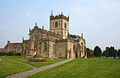
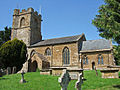
The archdeaconry covers the majority of Mendip, the eastern halves of Sedgemoor and South Somerset, as well as small sections in neighbouring districts in Somerset, Dorset and Wiltshire. Wells Cathedral is within the geographic extent of the archdeaconry, but is excluded from it. The Archdeacon of Wells is Anne Gell. [7]

Deanery of Axbridge

The deanery is split between Sedgemoor and Mendip, and also includes one civil parish in North Somerset.

Ecclesiastical parish Benefice Parish churchLocationImage Civil parish(es) District(s)
AxbridgeAxbridge with Shipham and Rowberrow St John [392] 51°17′16″N2°49′00″W / 51.2877°N 2.8166°W / 51.2877; -2.8166 (Church of St John the Baptist, Axbridge)
Axbridgechurch.jpg
St John: Axbridge
Most of Axbridge Sedgemoor
RowberrowAxbridge with Shipham and Rowberrow St Michael and All Angels [393] 51°19′26″N2°47′29″W / 51.324°N 2.7915°W / 51.324; -2.7915 (Church of St Michael and All Angels, Rowberrow)
Rowbarrowchurch.jpg
St Michael and All Angels: Rowberrow
Shipham
Isolated section of Priddy (dubious)
Sedgemoor, Mendip
ShiphamAxbridge with Shipham and Rowberrow St Leonard [394] 51°18′48″N2°48′01″W / 51.3133°N 2.8004°W / 51.3133; -2.8004 (Church of St Leonard, Shipham)
St Leonard's church Shipham.JPG
St Leonard: Shipham
Shipham
Winscombe and Sandford
Sedgemoor, North Somerset
BerrowBerrow and Brean [395] St Mary [396] 51°16′01″N3°00′49″W / 51.267°N 3.0135°W / 51.267; -3.0135 (Church of St Mary, Berrow)
Berrow church.jpg
St Bridget: Brean
All of Berrow
Brean
Burnham-on-Sea and Highbridge
Sedgemoor
Brean (LEP)Berrow and Brean [395] St Bridget [397] 51°17′54″N3°00′36″W / 51.2983°N 3.0099°W / 51.2983; -3.0099 (St Bridget's Church, Brean)
St Bridget's church, Brean - geograph.org.uk - 1298032.jpg
St Bridget: Brean
Brean Sedgemoor
Three SaintsBrent Knoll, East Brent and Lympsham [398] St Michael: Brent Knoll [399]
St Mary: East Brent [400]
& St Christopher: Lympsham [401]
51°15′07″N2°57′14″W / 51.252°N 2.9539°W / 51.252; -2.9539 (Church of St Michael, Brent Knoll)
Brent Knoll church.jpg
St Michael: Brent Knoll
Brent Knoll
East Brent
Lympsham
Burnham-on-Sea and Highbridge
Mark
Sedgemoor
Burnham on SeaBurnham on Sea St Andrew [402] 51°14′23″N2°59′53″W / 51.2396°N 2.9981°W / 51.2396; -2.9981 (St Andrew's Church, Burnham-on-Sea)
Burnham on Sea - panoramio (11).jpg
St Andrew: Burnham-on-Sea
Burnham-on-Sea and Highbridge
Burnham Without
Sedgemoor
CheddarCheddar, Draycott and Rodney Stoke [403] St Andrew [404] 51°16′25″N2°46′34″W / 51.2737°N 2.7761°W / 51.2737; -2.7761 (St Andrew's Church, Cheddar)
Cheddarchurch.jpg
St Andrew: Cheddar
Cheddar, small part of Axbridge Sedgemoor
DraycottCheddar, Draycott and Rodney Stoke [403] St Peter [405] 51°15′29″N2°45′08″W / 51.2581°N 2.7521°W / 51.2581; -2.7521 (Church of St Peter, Draycott)
-
Cheddar, Rodney Stoke Mendip
Rodney StokeCheddar, Draycott and Rodney Stoke [403] St Leonard [406] 51°14′42″N2°44′29″W / 51.2449°N 2.7414°W / 51.2449; -2.7414 (Church of St Leonard, Rodney Stoke)
Rodney Stoke church.jpg
St Leonard: Rodney Stoke
Rodney Stoke Mendip
Crook PeakCrook Peak St Andrew: Compton Bishop [407]
St Andrew: Loxton [408]
St Mary: Christon [409]
St John: Biddisham [410]
St Congar: Badgworth [411]
St Gregory: Weare [412]
51°17′40″N2°52′03″W / 51.2945°N 2.8676°W / 51.2945; -2.8676 (St Andrew's Church, Compton Bishop)
Comptonbishopchurch.jpg
St Andrew: Compton Bishop
All of Badgworth
All of Compton Bishop
All of Loxton
Weare
East Brent
Mark
Sedgemoor, North Somerset
HighbridgeHighbridge St John [413] 51°12′06″N2°56′24″W / 51.2016°N 2.9401°W / 51.2016; -2.9401 (Church of St John, Highbridge)
Highbridge St Johns.jpg
St John: Highbridge
Burnham-on-Sea and Highbridge
Burnham Without
Sedgemoor
East HuntspillHuntspill and East Huntspill All Saints [414] 51°12′06″N2°56′25″W / 51.2016°N 2.9402°W / 51.2016; -2.9402 (Church of All Saints, East Huntspill)
Church at East Huntspill - geograph.org.uk - 109473.jpg
All Saints: East Huntspill
East Huntspill Sedgemoor
HuntspillHuntspill and East Huntspill St Peter [415] 51°12′15″N2°59′44″W / 51.2043°N 2.9956°W / 51.2043; -2.9956 (Church of St Peter, West Huntspill)
West Huntspill church.jpg
St Peter: West Huntspill
All of West Huntspill
East Huntspill
Otterhampton
Burnham-on-Sea and Highbridge
Sedgemoor
AllertonMark with Allerton Allerton Church [416] 51°14′52″N2°50′54″W / 51.2478°N 2.8484°W / 51.2478; -2.8484 (Allerton Church, Chapel Allerton)
Parish church, Chapel Allerton (geograph 2381455).jpg
Allerton Church: Chapel Allerton
All of Chapel Allerton
Mark
Weare, Somerset
Sedgemoor
MarkMark with Allerton St Mark (Holy Cross) [417] 51°13′34″N2°53′18″W / 51.2262°N 2.8883°W / 51.2262; -2.8883 (Church of St Mark, Mark)
MARK, Somerset - geograph.org.uk - 66003.jpg
St Mark: Mark
Mark
East Brent
Burtle
Sedgemoor
PriddyPriddy St Lawrence [418] 51°15′35″N2°40′33″W / 51.2597°N 2.6758°W / 51.2597; -2.6758 (Church of St Lawrence, Priddy)
St Laurence, Priddy (geograph 4906815).jpg
Priddy
St Lawrence: Priddy Chewton Mendip
St Cuthbert Out
Mendip
BlackfordWedmore with Theale and Blackford Holy Trinity [419] 51°13′32″N2°50′51″W / 51.2256°N 2.8476°W / 51.2256; -2.8476 (Church of the Holy Trinity, Blackford)
BLACKFORD, Somerset - geograph.org.uk - 65788.jpg
Holy Trinity: Blackford
Wedmore Sedgemoor
ThealeWedmore with Theale and Blackford Christ Church [420] 51°12′41″N2°45′48″W / 51.2114°N 2.7632°W / 51.2114; -2.7632 (Christ Church, Theale)
THEALE, Somerset - geograph.org.uk - 66472.jpg
Christ Church: Theale
Wedmore Sedgemoor
WedmoreWedmore with Theale and Blackford St Mary [421] 51°13′40″N2°48′40″W / 51.2277°N 2.811°W / 51.2277; -2.811 (Church of St Mary, Wedmore)
Wedmore church.jpg
St Mary: Wedmore
Wedmore
Isolated parts of Mark
Sedgemoor
EastonWestbury sub Mendip with Easton St Paul [422] 51°13′34″N2°41′54″W / 51.2261°N 2.6983°W / 51.2261; -2.6983 (Church of St Paul, Easton)
St Pauls Church,Easton - geograph.org.uk - 1003324.jpg
St Paul: Easton
St Cuthbert Out Mendip
Westbury sub MendipWestbury sub Mendip with Easton St Lawrence [423] 51°14′07″N2°43′06″W / 51.2353°N 2.7182°W / 51.2353; -2.7182 (Church of St Lawrence, Westbury-sub-Mendip)
Westbury-Sub Mendip Church (geograph 3670043).jpg
St Lawrence: Westbury sub Mendip
All of Westbury-sub-Mendip
Rodney Stoke
Mendip

Deanery of Bruton and Cary

The deanery is mostly in South Somerset, but includes some civil parishes in Mendip and a small part of West Dorset.

Ecclesiastical parish Benefice Parish churchLocationImage Civil parish(es) District(s)
Abbas & TemplecombeAbbas and Templecombe, Henstridge and Horsington St Mary [424] 51°00′10″N2°25′00″W / 51.0028°N 2.4167°W / 51.0028; -2.4167 (Church of St Mary, Abbas and Templecombe)
St Marys Church, Abbas Combe.jpg
St Mary: Abbas Combe
All of Abbas and Templecombe [lower-alpha 1] South Somerset
HenstridgeAbbas and Templecombe, Henstridge and Horsington St Nicholas [425] 50°58′36″N2°23′46″W / 50.9766°N 2.3962°W / 50.9766; -2.3962 (Church of St Nicholas, Henstridge)
Henstridge church.jpg
St Nicholas: Henstridge
All of Henstridge
Milborne Port
South Somerset
HorsingtonAbbas and Templecombe, Henstridge and Horsington St John [426] 51°00′48″N2°25′29″W / 51.0134°N 2.4248°W / 51.0134; -2.4248 (Church of St John the Baptist, Horsington)
Horsington church.jpg
St John: Horsington
All of Horsington
Stoke Trister
Wincanton
South Somerset
BatcombeBruton and District Team Ministry St Mary [427] 51°08′57″N2°26′38″W / 51.1493°N 2.4439°W / 51.1493; -2.4439 (Church of St Mary the Virgin, Batcombe)
Batcombe church.jpg
St Mary: Batcombe
All of Batcombe [lower-alpha 1] Mendip
BrewhamBruton and District Team Ministry St John [428] 51°07′26″N2°24′07″W / 51.1239°N 2.4019°W / 51.1239; -2.4019 (Church of Saint John the Baptist, South Brewham)
SOUTH BREWHAM, Somerset - geograph.org.uk - 66465.jpg
St John: South Brewham
All of Brewham [lower-alpha 1] South Somerset
BrutonBruton and District Team Ministry St Mary [429]
Holy Trinity [430]
St Peter [431]
51°06′42″N2°27′07″W / 51.1117°N 2.4519°W / 51.1117; -2.4519 (Church of St Mary, Bruton)
St Mary's Church, Bruton - geograph.org.uk - 666069.jpg
St Mary: Bruton
Bruton South Somerset
LamyattBruton and District Team Ministry St Mary and St John [432] 51°07′26″N2°29′07″W / 51.1239°N 2.4853°W / 51.1239; -2.4853 (Church of St Mary and St John, Lamyat)
Lamyatt church.jpg
St Mary and St John: Lamyat
All of Lamyatt [lower-alpha 1] Mendip
PitcombeBruton and District Team Ministry St Leonard [433] 51°05′34″N2°28′07″W / 51.0928°N 2.4685°W / 51.0928; -2.4685 (St Leonards Church, Pitcombe)
Church of St Leonard - Pitcombe - geograph.org.uk - 424253.jpg
St Leonard: Pitcombe
All of Pitcombe
Bruton
South Somerset
Shepton MontagueBruton and District Team Ministry St Peter [434] 51°05′03″N2°27′19″W / 51.0841°N 2.4553°W / 51.0841; -2.4553 (Church of St Peter, Shepton Montague)
St. Peters, Lower Shepton - geograph.org.uk - 132840.jpg
St Peter: Shepton Montague
All of Shepton Montague
Charlton Musgrove
South Somerset
Upton NobleBruton and District Team Ministry St Mary Magdalene [435] 51°09′26″N2°24′43″W / 51.1572°N 2.4119°W / 51.1572; -2.4119 (Church of St Mary Magdalene, Upton Noble)
Upton Noble church.jpg
St Mary: Upton Noble
All of Upton Noble [lower-alpha 1] Mendip
Corton DenhamCam Vale [436] St Andrew [437] 51°00′06″N2°31′13″W / 51.0016°N 2.5202°W / 51.0016; -2.5202 (Church of St Andrew, Corton Denham)
Corton Denham Church - geograph.org.uk - 1635458.jpg
St Andrew: Corton Denham
Corton Denham
Sandford Orcas
South Somerset, West Dorset
Queen CamelCam Vale [436] St Barnabas [438] 51°01′19″N2°34′26″W / 51.0219°N 2.5739°W / 51.0219; -2.5739 (Church of St Barnabas, Queen Camel)
Qcamelchurch.jpg
St Barnabas: Queen Camel
Queen Camel
Marston Magna
South Somerset
SparkfordCam Vale [436] St Mary [439] 51°01′44″N2°33′32″W / 51.029°N 2.5589°W / 51.029; -2.5589 (Church of St Mary Magdalene, Sparkford)
Church of St Mary Magdalene - Sparkford - geograph.org.uk - 424442.jpg
St Mary: Sparkford
Sparkford
Queen Camel
South Somerset
Sutton MontisCam Vale [436] Holy Trinity [440] 51°01′15″N2°32′13″W / 51.0208°N 2.5369°W / 51.0208; -2.5369 (Church of the Holy Trinity, Sutton Montis)
Sutton Montis church.jpg
Holy Trinity: Sutton Montis
South Cadbury and Sutton Montis (CP recently renamed) South Somerset
West CamelCam Vale [436] All Saints [441] 51°01′06″N2°35′53″W / 51.0183°N 2.5981°W / 51.0183; -2.5981 (Church of All Saints, West Camel)
West Camel church.jpg
All Saints: West Camel
All of West Camel [lower-alpha 1] South Somerset
Weston BampfyldeCam Vale [436] Holy Cross [442] 51°01′21″N2°33′24″W / 51.0225°N 2.5566°W / 51.0225; -2.5566 (Church of the Holy Cross, Weston Bampfylde)
Holy Cross Church, Weston Bampfylde, Somerset.jpg
Holy Cross: Weston Bampfylde
Sparkford South Somerset
BlackfordCamelot Parishes [443] St Michael [444] 51°02′01″N2°29′21″W / 51.0337°N 2.4891°W / 51.0337; -2.4891 (Church of St Michael, Blackford)
Blackford church.jpg
St Michael: Blackford
Compton Pauncefoot South Somerset
Bratton St. MaurCamelot Parishes [443] St Nicholas [445] 51°04′09″N2°27′44″W / 51.0691°N 2.4622°W / 51.0691; -2.4622 (Church of St Nicholas, Bratton Seymour)
St. Nicholas Bratton St. Maur - geograph.org.uk - 520316.jpg
St Nicholas: Bratton Seymour
All of Bratton Seymour [lower-alpha 1] South Somerset
Compton PauncefootCamelot Parishes [443] St Mary [446] 51°02′01″N2°30′32″W / 51.0337°N 2.5090°W / 51.0337; -2.5090 (Church of the Blessed Virgin Mary, Compton Pauncefoot)
Comptonpauncefootchurch.jpg
St Mary: Compton Pauncefoot
Compton Pauncefoot South Somerset
HoltonCamelot Parishes [443] St Nicholas [447] 51°02′24″N2°27′01″W / 51.0401°N 2.4503°W / 51.0401; -2.4503 (Church of St Nicholas, Holton)
Holton church.jpg
St Nicholas: Holton
Holton
Wincanton
South Somerset
MapertonCamelot Parishes [443] St Peter and St Paul [448] 51°02′02″N2°28′08″W / 51.0338°N 2.4690°W / 51.0338; -2.4690 (Church of St Peter and St Paul, Maperton)
Maperton church.jpg
St Peter and St Paul: Maperton
All of Maperton [lower-alpha 1] South Somerset
North CadburyCamelot Parishes [443] St Michael [449] 51°02′30″N2°31′17″W / 51.0417°N 2.5214°W / 51.0417; -2.5214 (Church of St Michael, North Cadbury)
Ncadburychurch.jpg
St Michael: North Cadbury
All of North Cadbury [lower-alpha 1] South Somerset
North CheritonCamelot Parishes [443] St John [450] 51°01′51″N2°26′51″W / 51.0309°N 2.4474°W / 51.0309; -2.4474 (Church of St John the Baptist, North Cheriton)
The Church of St John the Baptist, North Cheriton, Somerset (4641366328).jpg
St John: North Cheriton
North Cheriton
Holton
South Somerset
South CadburyCamelot Parishes [443] Thomas Becket [451] 51°01′39″N2°31′34″W / 51.0274°N 2.5261°W / 51.0274; -2.5261 (Church of Thomas Becket, South Cadbury)
South Cadbury, church - geograph.org.uk - 45566.jpg
Thomas Becket: South Cadbury
South Cadbury and Sutton Montis (CP recently renamed) South Somerset
YarlingtonCamelot Parishes [443] St Mary [452] 51°03′44″N2°29′39″W / 51.0621°N 2.4941°W / 51.0621; -2.4941 (Church of St Mary, Yarlington)
Yarlington church.jpg
St Mary: Yarlington
All of Yarlington [lower-alpha 1] South Somerset
AnsfordCastle Cary with Ansford St Andrew [453] 51°05′39″N2°31′05″W / 51.0943°N 2.518°W / 51.0943; -2.518 (Church of St Andrew, Ansford)
Church of St Andrew, Ansford (geograph 3903415).jpg
St Andrew: Ansford
Ansford South Somerset
Castle CaryCastle Cary with Ansford All Saints [454] 51°05′12″N2°31′00″W / 51.0867°N 2.5167°W / 51.0867; -2.5167 (Church of All Saints, Castle Cary)
All Saints Church, Castle Cary - geograph.org.uk - 451117.jpg
All Saints: Castle Cary
All of Castle Cary
Ansford
North Barrow
South Somerset
Charlton MusgroveCharlton Musgrove, Cucklington and Stoke Trister [455] St Stephen [456]
St John [457]
51°04′04″N2°24′03″W / 51.0678°N 2.4008°W / 51.0678; -2.4008 (Church of St Stephen, Charlton Musgrove)
Charlton Musgrove - church - geograph.org.uk - 45545.jpg
St Stephen: Charlton Musgrove
Charlton Musgrove
Wincanton
South Somerset
CucklingtonCharlton Musgrove, Cucklington and Stoke Trister [455] St Lawrence [458] 51°02′56″N2°21′02″W / 51.0488°N 2.3506°W / 51.0488; -2.3506 (Church of St Lawrence, Cucklington)
{ Church of St Lawrence - Cucklington - geograph.org.uk - 398273.jpg
St Lawrence: Cucklington
Cucklington
Penselwood
South Somerset
Stoke TristerCharlton Musgrove, Cucklington and Stoke Trister [455] St Andrew [459] 51°03′27″N2°22′37″W / 51.0575°N 2.3770°W / 51.0575; -2.3770 (Church of St Andrew, Stoke Trister)
Stoke Trister - Parish Church of St Andrew - geograph.org.uk - 398285.jpg
St Andrew: Stoke Trister
Stoke Trister South Somerset
EvercreechEvercreech with Chesterblade and Milton Clevedon St Peter [460]
St Mary [461]
51°08′46″N2°30′10″W / 51.1462°N 2.5027°W / 51.1462; -2.5027 (Church of St Peter, Evercreech)
Evercreech Church.jpg
St Peter: Evercreech
All of Evercreech [lower-alpha 1] Mendip
Milton ClevedonEvercreech with Chesterblade and Milton Clevedon St James [462] 51°08′18″N2°28′51″W / 51.1383°N 2.4808°W / 51.1383; -2.4808 (Church of St James, Milton Clevedon)
St, James, Milton Clevedon - geograph.org.uk - 492319.jpg
St James: Milton Clevedon
All of Milton Clevedon [lower-alpha 1] Mendip
Charlton Horethorne with StowellMilborne Port with Goathill & Charlton Horethorne [463] St Peter and St Paul [464]
St Mary Magdalene [465]
51°00′22″N2°28′43″W / 51.0061°N 2.4785°W / 51.0061; -2.4785 (Church of St Peter and St Paul, Charlton Horethorne)
Parish Church of St Peter and St Paul - Charlton Horethorne - geograph.org.uk - 890899.jpg
St Peter and St Paul: Charlton Horethorne
All of Charlton Horethorne [lower-alpha 1] South Somerset
GoathillMilborne Port with Goathill & Charlton Horethorne [463] St Peter [466] 50°57′13″N2°27′47″W / 50.9535°N 2.4630°W / 50.9535; -2.4630 (St Peter's church, Goathill)
Goathill Church - geograph.org.uk - 391170.jpg
St Peter: Goathill
All of Goathill [lower-alpha 1] West Dorset
Milborne Port (LEP)Milborne Port with Goathill & Charlton Horethorne [463] St John the Evangelist [467]
Milborne Wick Mission Church [468]
50°57′59″N2°27′40″W / 50.9665°N 2.461°W / 50.9665; -2.461 (Church of St John the Evangelist, Milborne Port)
Milborne Port Church1.jpg
St John: Milborne Port
Milborne Port
Corton Denham
South Somerset
PenselwoodPen Selwood St Michael [469] 51°04′55″N2°20′59″W / 51.0820°N 2.3496°W / 51.0820; -2.3496 (St Michael's Church, Penselwood)
St. Michaels, Penselwood - geograph.org.uk - 188722.jpg
St Michael: Penselwood
Penselwood
Stoke Trister
South Somerset
AlfordSix Pilgrims [470] All Saints [471] 51°05′29″N2°33′58″W / 51.0914°N 2.5661°W / 51.0914; -2.5661 (Church of All Saints, Alford)
Alford church.jpg
All Saints: Alford
Alford
Ditcheat
South Somerset, Mendip
BabcarySix Pilgrims [470] Holy Cross [472] 51°03′24″N2°37′38″W / 51.0566°N 2.6271°W / 51.0566; -2.6271 (Church of the Holy Cross, Babcary)
Babcary Church.jpg
Holy Cross: Babcary
All of Babcary [lower-alpha 1] South Somerset
HornblottonSix Pilgrims [470] St Peter [473] 51°06′17″N2°35′01″W / 51.1046°N 2.5835°W / 51.1046; -2.5835 (Church of St Peter, Hornblotton)
Hornblotton church.jpg
St Peter: Hornblotton
West Bradley Mendip
LovingtonSix Pilgrims [470] St Thomas [474] 51°04′31″N2°34′38″W / 51.0754°N 2.5771°W / 51.0754; -2.5771 (Church of St Thomas of Canterbury, Lovington)
Lovington church.jpg
St Thomas: Lovington
Lovington South Somerset
North BarrowSix Pilgrims [470] St Nicholas [475] 51°03′45″N2°33′39″W / 51.0624°N 2.5608°W / 51.0624; -2.5608 (Church of St Nicholas, North Barrow)
North Barrow church.jpg
St Nicholas: North Barrow
North Barrow
Isolated part of Compton Pauncefoot
South Somerset
South BarrowSix Pilgrims [470] St Peter [476] 51°02′56″N2°34′10″W / 51.049°N 2.5694°W / 51.049; -2.5694 (Church of St Peter, South Barrow)
South Barrow church.jpg
St Peter: South Barrow
All of South Barrow [lower-alpha 1] South Somerset
WincantonWincanton St Peter and St Paul [477] 51°03′18″N2°24′49″W / 51.055°N 2.4136°W / 51.055; -2.4136 (Church of St Peter and St Paul, Wincanton)
Wincanton church.jpg
St Peter and St Paul: Wincanton
Wincanton
Charlton Musgrove
South Somerset

Deanery of Frome

The deanery covers areas of Mendip around Frome, with one parish which stretches into Wiltshire.

Ecclesiastical parish Benefice Parish churchLocationImage Civil parish(es) District(s)
Beckington with StanderwickBeckington with Standerwick Berkley Rodden etc. St George [478] 51°15′49″N2°17′08″W / 51.2635°N 2.2855°W / 51.2635; -2.2855 (Church of St George, Beckington)
Beckingtonchurch.jpg
St George: Beckington
Beckington
Berkley
Mendip
BerkleyBeckington with Standerwick Berkley Rodden etc. St Mary [479] 51°14′37″N2°16′19″W / 51.2436°N 2.2719°W / 51.2436; -2.2719 (Church of St Mary, Berkley)
Berkley Somerset church.jpg
St Mary: Berkley
Berkley
Beckington
Selwood
Frome
Mendip
Lullington with OrchardleighBeckington with Standerwick Berkley Rodden etc. All Saints [480]
Church of St Mary [481]
51°15′59″N2°18′43″W / 51.2663°N 2.312°W / 51.2663; -2.312 (Church of All Saints, Lullington)
Lullington church.jpg
All Saints: Lullington
Lullington Mendip
RoddenBeckington with Standerwick Berkley Rodden etc. All Saints [482] 51°13′42″N2°17′22″W / 51.2283°N 2.2895°W / 51.2283; -2.2895 (Church of All Saints, Rodden)
-
Selwood
Frome
Mendip
Frome: Christ ChurchChrist Church with Saint Mary's Frome Christ Church [483] 51°13′46″N2°19′34″W / 51.2295°N 2.326°W / 51.2295; -2.326 (Christ Church, Frome)
Christ Church, Frome (geograph 3742592).jpg
Christ Church: Frome
Frome
Selwood
Mendip
Frome: St MaryChrist Church with Saint Mary's Frome St Mary [484] 51°13′47″N2°19′33″W / 51.2296°N 2.3259°W / 51.2296; -2.3259 (Church of St Mary, Frome)
St Marys C of E (geograph 3986321).jpg
St Mary: Frome
Frome
Berkley
Selwood
Mendip
Frome: Holy TrinityFrome (Holy Trinity) Holy Trinity [485] 51°14′02″N2°19′41″W / 51.2338°N 2.328°W / 51.2338; -2.328 (Church of the Holy Trinity, Frome)
Trinity Street (geograph 3743099).jpg
Holy Trinity: Frome
Frome
Selwood
Mendip
Frome St JohnFrome (St John the Baptist) St John [486] 51°13′47″N2°19′14″W / 51.2297°N 2.3206°W / 51.2297; -2.3206 (Church of St John the Baptist, Frome)
St John the Baptist, Frome (geograph 3219045).jpg
St John: Frome
Frome
Selwood
Mendip
Hardington ValeHardington Vale [487] St Mary [488]
All Saints [489]
St Mary [490]
St Lawrence [491]
St Leonard [492]
St Philip and St James [493]
51°16′31″N2°23′27″W / 51.2754°N 2.3907°W / 51.2754; -2.3907 (Church of St Mary, Hemington)
Hemington church.jpg
St Mary: Hemington
All of Hemington
Lullington
Norton St Philip
Rode
Tellisford
Southwick
Mendip, Wiltshire
Leigh-on-MendipLeigh upon Mendip with Stoke St Michael St Giles [494]
All Saints [495]
51°13′26″N2°26′30″W / 51.2239°N 2.4416°W / 51.2239; -2.4416 (Church of St Giles, Leigh-on-Mendip)
St Giles Leigh on Mendip.jpg
St Giles: Leigh-on-Mendip
All of Leigh-on-Mendip
All of Downhead
Cranmore
Mendip
Stoke St MichaelLeigh upon Mendip with Stoke St Michael St Michael [496] 51°13′16″N2°28′55″W / 51.221°N 2.4819°W / 51.221; -2.4819 (Church of St Michael, Stoke St Michael)
St Michaels Church (geograph 2689530).jpg
St Michael: Stoke St Michael
Stoke St Michael Mendip
Buckland DinhamMells with Buckland Dinham, Elm, Whatley etc. [497] St Michael [498] 51°15′36″N2°21′09″W / 51.26°N 2.3524°W / 51.26; -2.3524 (Church of St Michael, Buckland Dinham)
St. Michael and All Angels, Buckland Dinham - geograph.org.uk - 128720.jpg
St Michael: Buckland Dinham
All of Buckland Dinham [lower-alpha 1] Mendip
ChantryMells with Buckland Dinham, Elm, Whatley etc. [497] Holy Trinity [499] 51°13′37″N2°22′56″W / 51.227°N 2.3822°W / 51.227; -2.3822 (Church of the Holy Trinity, Chantry)
Chantry Church - geograph.org.uk - 1559010.jpg
Holy Trinity, Chantry
Whatley
Mells
Mendip
ElmMells with Buckland Dinham, Elm, Whatley etc. [497] St Mary [500] 51°14′32″N2°21′48″W / 51.2422°N 2.3632°W / 51.2422; -2.3632 (Church of St Mary Magdalene, Great Elm)
St. Mary, Great Elm - geograph.org.uk - 209262.jpg
St Mary: Great Elm
All of Great Elm [lower-alpha 1] Mendip
Mells with VobsterMells with Buckland Dinham, Elm, Whatley etc. [497] St Andrew's Church [501] 51°14′31″N2°23′26″W / 51.2419°N 2.3905°W / 51.2419; -2.3905 (St Andrew's Church, Mells)
St Andrews Mells3.JPG
St Andrew: Mells
Mells
Kilmersdon
Mendip
WhatleyMells with Buckland Dinham, Elm, Whatley etc. [497] St George [502] 51°13′37″N2°22′56″W / 51.2269°N 2.3822°W / 51.2269; -2.3822 (Church of St George, Whatley)
St George's Church, Whatley - geograph.org.uk - 231178.jpg
St George: Whatley
Whatley Mendip
PostleburyPostlebury All Saints [503]
St Mary, St John and All Saints [504]
St Leonard [505]
St Mary [506]
St Mary [507]
51°12′36″N2°22′38″W / 51.2099°N 2.3771°W / 51.2099; -2.3771 (Church of All Saints, Nunney)
Nunneychurch2.JPG
All Saints: Nunney
All of Nunney
all of Trudoxhill
All of Wanstrow
All of Witham Priory
Selwood
Mendip
WoodlandsWoodlands St Katherine [508] 51°11′45″N2°18′05″W / 51.1958°N 2.3014°W / 51.1958; -2.3014 (Church of St Katherine, East Woodlands)
St Katherine's Church, East Woodlands - geograph.org.uk - 1150584.jpg
St Katherine: East Woodlands
Selwood Mendip

Deanery of Glastonbury

The deanery covers parishes in several districts around Glastonbury and Street on the Somerset Levels.

Ecclesiastical parish Benefice Parish churchLocationImage Civil parish(es) District(s)
BaltonsboroughBaltonsborough with Butleigh, West Bradley and West Pennard (known as the Brue Benefice) [509] St Dunstan [510] 51°06′38″N2°39′22″W / 51.1106°N 2.656°W / 51.1106; -2.656 (Church of St Dunstan, Baltonsborough)
Baltonsborough church.jpg
St Dunstan: Baltonsborough
Baltonsborough Mendip
ButleighBaltonsborough with Butleigh, West Bradley and West Pennard [509] St Leonard [511] 51°06′09″N2°41′13″W / 51.1025°N 2.6869°W / 51.1025; -2.6869 (Church of St Leonard, Butleigh)
St Leonard Butleigh.JPG
St Leonard: Butleigh
Butleigh
Walton
Mendip
West Bradley with LottishamBaltonsborough with Butleigh, West Bradley and West Pennard [509] St Andrew: West Bradley [512]
St Mary: Lottisham [513]
51°07′46″N2°38′00″W / 51.1294°N 2.6333°W / 51.1294; -2.6333 (Church of St Andrew, West Bradley)
West Bradley, Somerset - geograph.org.uk - 66487.jpg
St Andrew: West Bradley
All of West Bradley
Baltonsborough
West Pennard
Mendip
West PennardBaltonsborough with Butleigh, West Bradley and West Pennard [509] St Nicholas [514] 51°08′28″N2°38′23″W / 51.1412°N 2.6397°W / 51.1412; -2.6397 (Church of St Nicholas, West Pennard)
West Pennard church.jpg
St Nicholas: West Pennard
West Pennard Mendip
Glastonbury: St BenedictGlastonbury St. John the Baptist and St. Benedict St Benedict [515] 51°08′48″N2°43′11″W / 51.1467°N 2.7197°W / 51.1467; -2.7197 (Church of St Benedict, Glastonbury)
St Benedict's Church, Glastonbury - geograph.org.uk - 224295.jpg
Glastonbury
Butleigh
Sharpham
St Benedict: Glastonbury Street
Mendip
Glastonbury: St John the BaptistGlastonbury St. John the Baptist and St. Benedict St John [516] 51°08′54″N2°42′58″W / 51.1482°N 2.7162°W / 51.1482; -2.7162 (Church of St John the Baptist, Glastonbury)
Glastonbury - Esglesia de Sant Joan Baptista.JPG
St John: Glastonbury
Glastonbury
Meare
Mendip
MeareGlastonbury St. John the Baptist and St. Benedict St Mary [517] 51°10′18″N2°46′44″W / 51.1718°N 2.7789°W / 51.1718; -2.7789 (Church of St Mary, Meare)
St Mary's Church, Meare, Somerset.jpg
St Mary: Meare
Meare
Godney
Mendip
GreintonMiddlezoy with Othery, Moorlinch and Greinton St Michael & All Angels [518] 51°07′24″N2°50′26″W / 51.1233°N 2.8405°W / 51.1233; -2.8405 (Church of St Michael & All Angels, Greinton)
Greintonchurch.JPG
St Michael & All Angels: Greinton
All of Greinton
Ashcott
Sedgemoor
MiddlezoyMiddlezoy with Othery, Moorlinch and Greinton Holy Cross [519] 51°05′38″N2°53′39″W / 51.0939°N 2.8942°W / 51.0939; -2.8942 (Church of the Holy Cross, Middlezoy)
Middlezoychurch.JPG
Holy Cross: Middlezoy
All of Middlezoy
Othery
Sedgemoor
MoorlynchMiddlezoy with Othery, Moorlinch and Greinton St Mary [520]
St Francis [521]
51°07′41″N2°51′42″W / 51.128°N 2.8616°W / 51.128; -2.8616 (Church of St Mary, Moorlinch)
St. Mary's Church, Moorlinch - geograph.org.uk - 253048.jpg
St Mary: Moorlinch
Moorlinch
Stawell
Sedgemoor
OtheryMiddlezoy with Othery, Moorlinch and Greinton St Michael [522] 51°04′50″N2°52′59″W / 51.0806°N 2.883°W / 51.0806; -2.883 (Church of St Michael, Othery)
Otherychurch.JPG
St Michael: Othery
Othery
Burrowbridge
Sedgemoor, Taunton Deane
Compton DundonStreet with Walton and Compton Dundon [523] St Andrew [524] 51°05′23″N2°44′41″W / 51.0897°N 2.7447°W / 51.0897; -2.7447 (Church of St Andrew, Compton Dundon)
St Andrews Church, Dundon (geograph 5305740).jpg
St Andrew: Compton Dundon
Compton Dundon South Somerset
StreetStreet with Walton and Compton Dundon [523] Holy Trinity [525]
Mission Church [526]
51°07′53″N2°43′58″W / 51.1313°N 2.7329°W / 51.1313; -2.7329 (Church of the Holy Trinity, Street)
Holy Trinity church Street.jpg
Holy Trinity: Street
Street
Butleigh
Sharpham
Mendip
WaltonStreet with Walton and Compton Dundon [523] Holy Trinity [527] 51°07′25″N2°46′16″W / 51.1236°N 2.7710°W / 51.1236; -2.7710 (Church of The Holy Trinity, Walton)
Holy Trinity Church, Walton, Somerset (4423548182).jpg
Holy Trinity: Walton
Walton Mendip
Polden WheelThe Polden Wheel [528] St Edward [529]
All Saints [530]
St George [531]
St Peter [532]
St Philip and St James [533]
St Mary [534]
51°09′21″N2°53′50″W / 51.1559°N 2.8971°W / 51.1559; -2.8971 (Church of St Edward, Chilton Polden)
Church of St Edward, Chilton Polden (geograph 4908119).jpg
St Edward: Chilton Polden
All of Catcott
All of Chilton Polden
All of Edington, Somerset
All of Shapwick
Ashcott
Burtle
Moorlinch
Stawell
Sedgemoor
Barton St DavidWheathill [535] St David [536] 51°04′58″N2°39′31″W / 51.0827°N 2.6585°W / 51.0827; -2.6585 (Church of St David, Barton St David)
St David, Barton St David (geograph 2586554).jpg
St David: Barton St David
Barton St David
Keinton Mandeville
South Somerset
Keinton Mandeville with KingwestonWheathill [535] St Mary: Keinton Mandeville [537]
All Saints: Kingweston [538]
51°04′05″N2°38′48″W / 51.0681°N 2.6468°W / 51.0681; -2.6468 (Church of St Mary Magdalene, Keinton Mandeville)
Keinton Mandeville church.jpg
St Mary: Keinton Mandeville
Keinton Mandeville
All of Kingweston
Barton St David
South Somerset
Lydford on FosseWheathill [535] St Peter [539] 51°05′05″N2°37′22″W / 51.0846°N 2.6227°W / 51.0846; -2.6227 (Church of St Peter, West Lydford)
West Lydford Church - geograph.org.uk - 306389.jpg
St Peter
Lydford-on-Fosse
Lovington
Mendip, South Somerset

Deanery of Ivelchester

The deanery covers parishes in South Somerset.

Ecclesiastical parish Benefice Parish churchLocationImage Civil parish(es) District(s)
Curry RivelCurry Rivel with Fivehead and Swell St Andrew [540] 51°01′29″N2°52′04″W / 51.0247°N 2.8678°W / 51.0247; -2.8678 (St Andrew's Church, Curry Rivel)
Curry Rivel - Manor Farmhouse and church - geograph.org.uk - 438592.jpg
St Andrew: Curry Rivel
Curry Rivel
Drayton
Hambridge and Westport
South Somerset
FiveheadCurry Rivel with Fivehead and Swell St Martin [541] 51°00′06″N2°55′22″W / 51.0017°N 2.9228°W / 51.0017; -2.9228 (Church of St Martin, Fivehead)
Fivehead church.jpg
St Martin: Fivehead
Fivehead South Somerset
SwellCurry Rivel with Fivehead and Swell St Catherine [542] 51°00′30″N2°54′01″W / 51.0083°N 2.9003°W / 51.0083; -2.9003 (Church of St Catherine, Fivehead)
Swell church.jpg
St Catherine: Swell
Fivehead South Somerset
Ilchester with NorthoverIlchester with Northover, Limington, Yeovilton etc. [543] St Mary Major [544] 51°00′03″N2°40′54″W / 51.0009°N 2.6818°W / 51.0009; -2.6818 (Church of St Mary Major, Ilchester)
Church of St. Mary Major, Ilchester - geograph.org.uk - 192893.jpg
St Mary: Ilchester
Ilchester
Tintinhull
South Somerset
LimingtonIlchester with Northover, Limington, Yeovilton etc. [543] St Mary [545] 50°59′50″N2°39′12″W / 50.9972°N 2.6533°W / 50.9972; -2.6533 (Church of Saint Mary, Limington)
Limington church.jpg
St Mary: Limington
All of Limington [lower-alpha 1] South Somerset
Yeovilton with PodimoreIlchester with Northover, Limington, Yeovilton etc. [543] St Peter: Podimore [546] 51°01′18″N2°38′57″W / 51.0217°N 2.6492°W / 51.0217; -2.6492 (Church of St Peter, Podimore, Yeovilton)
Podimore church.jpg
St Peter: Podimore
Yeovilton South Somerset
AllerLangport Area Team Ministry [547] St Andrew [548] 51°03′19″N2°51′46″W / 51.0554°N 2.8627°W / 51.0554; -2.8627 (Church of St Andrew, Aller)
Aller, St Andrews church (geograph 4132899).jpg
St Andrew: Aller
All of Aller [lower-alpha 1] South Somerset
DraytonLangport Area Team Ministry [547] St Catherine [549] 51°01′10″N2°50′57″W / 51.0194°N 2.8492°W / 51.0194; -2.8492 (Church of St Catherine, Drayton)
Stcatherinesdrayton.jpg
St Catherine: Drayton
Drayton
Curry Rivel
South Somerset
High Ham with Low HamLangport Area Team Ministry [547] St Andrew: High Ham [550] 51°04′35″N2°49′18″W / 51.0764°N 2.8217°W / 51.0764; -2.8217 (St Andrew's Church, High Ham)
High Ham church.jpg
St Andrew: High Ham
High Ham South Somerset
Huish Episcopi cum LangportLangport Area Team Ministry [547] St Mary: Huish Episcopi [551] 51°02′09″N2°49′05″W / 51.0358°N 2.8181°W / 51.0358; -2.8181 (Church of the Blessed Virgin Mary, Huish Episcopi)
Stmaryshuish.jpg
St Mary: Huish Episcopi
All of Huish Episcopi
All of Langport, High Ham
South Somerset
Long LoadLangport Area Team Ministry [547] Christ Church 51°00′14″N2°45′47″W / 51.004°N 2.7631°W / 51.004; -2.7631 (Christ Church, Long Load)
Christs Church Long Load - geograph.org.uk - 1278909.jpg
Christ Church, Long Load
All of Long Load [lower-alpha 1] South Somerset
Long SuttonLangport Area Team Ministry [547] Holy Trinity [552] 51°01′58″N2°45′23″W / 51.0328°N 2.7564°W / 51.0328; -2.7564 (Church of the Holy Trinity, Long Sutton)
Holytrinitylongsutton.jpg
Holy Trinity: Long Laod
Long Sutton
Somerton
South Somerset
MuchelneyLangport Area Team Ministry [547] St Peter and St Paul [553] 51°01′14″N2°48′54″W / 51.0206°N 2.815°W / 51.0206; -2.815 (Church of St Peter and St Paul, Muchelney)
Muchelney Parish church, abbey foreground ruins.jpg
St Peter and St Paul: Muchelney
All of Muchelney [lower-alpha 1] South Somerset
PitneyLangport Area Team Ministry [547] St John [554] 51°03′10″N2°47′37″W / 51.0529°N 2.7935°W / 51.0529; -2.7935 (Church of St John the Baptist, Pitney)
Church of St John the Baptist, Pitney (geograph 5243853).jpg
St John: Pitney
Pitney South Somerset
AshMartock with Kingsbury Episocpi & Ash [555] Holy Trinity [556] 50°59′01″N2°45′10″W / 50.9835°N 2.7528°W / 50.9835; -2.7528 (Holy Trinity Church, Ash)
Ash, Holy Trinity Church.jpg
Holy Trinity: Ash
Ash South Somerset
Kingsbury EpiscopiMartock with Kingsbury Episocpi & Ash [555] St Martin [557] 50°59′08″N2°48′10″W / 50.9856°N 2.8028°W / 50.9856; -2.8028 (Church of St Martin, Kingsbury Episcopi)
Kingsburyepiscopi.jpg
St Martin: Kingsbury Episcopi
Kingsbury Episcopi South Somerset
MartockMartock with Kingsbury Episocpi & Ash [555] All Saints [558] 50°58′10″N2°46′08″W / 50.9694°N 2.7689°W / 50.9694; -2.7689 (Church of All Saints, Martock)
Martockchurch.jpg
All Saints: Martock
Martock
Ash
South Somerset
ChiselboroughNorton-sub-Hamdon, West Chinnock, Chiselborough and Middle Chinnock [559] St Peter and St Paul [560] 50°55′51″N2°45′33″W / 50.9308°N 2.7591°W / 50.9308; -2.7591 (Church of St Peter and St Paul, Chiselborough)
Chiselborough Church Exterior 01.JPG
St Peter and St Paul: Chiselborough
All of Chiselborough [lower-alpha 1] South Somerset
Middle ChinnockNorton-sub-Hamdon, West Chinnock, Chiselborough and Middle Chinnock [559] St Margaret [561] 50°54′55″N2°45′08″W / 50.9152°N 2.7522°W / 50.9152; -2.7522 (Church of Saint Margaret, West Chinnock)
St. Margaret, Middle Chinnock - geograph.org.uk - 120216.jpg
St Margaret: Milddle Chinnock
West and Middle Chinnock South Somerset
Norton-sub-HamdonNorton-sub-Hamdon, West Chinnock, Chiselborough and Middle Chinnock [559] St Mary [562] 50°56′24″N2°45′13″W / 50.94°N 2.7536°W / 50.94; -2.7536 (Church of St Mary the Virgin, Norton Sub Hamdon)
St Mary the Virgin parish church, Norton-sub-Hamdon, Somerset, seen from the southeast.jpg
St Mary: Norton-sub-Hamdon
Norton-sub-Hamdon South Somerset
West ChinnockNorton-sub-Hamdon, West Chinnock, Chiselborough and Middle Chinnock [559] St Mary [563] 50°55′00″N2°45′32″W / 50.9168°N 2.7588°W / 50.9168; -2.7588 (Church of Saint Mary, West Chinnock)
St Marys Church West Chinnock - geograph.org.uk - 1016460.jpg
St Mary: West Chinnock
West Chinnock South Somerset
KingsdonSomerton with the Charltons and Kingsdon [564] All Saints [565] 51°01′59″N2°41′31″W / 51.0331°N 2.692°W / 51.0331; -2.692 (All Saints Church, Kingsdon)
Kingsdonchurch.jpg
All Saints: Kingsdon
Kingsdon South Somerset
SomertonSomerton with the Charltons and Kingsdon [564] St Michael and All Angels [566] 51°03′16″N2°43′37″W / 51.0544°N 2.7269°W / 51.0544; -2.7269 (Church of St Michael and All Angels, Somerton)
Somertonchurch.jpg
St Michael and All Angels, Somerton
Somerton
High Ham
Kingsdon
Long Sutton
South Somerset
The CharltonsSomerton with the Charltons and Kingsdon [564] St Mary: Charlton Mackrell [567]
St Peter and St Paul: Charlton Adam [568]
51°03′09″N2°40′28″W / 51.0524°N 2.6744°W / 51.0524; -2.6744 (Church of St Mary, Charlton Mackrell)
SS Peter and Paul, Charlton Adam - geograph.org.uk - 1435485.jpg
St Peter and St Paul, Charlton Adam
All of Charlton Mackrell
Compton Dundon
South Somerset
Stoke-sub-HamdonStoke sub Hamdon [559] St Mary [569] 50°57′07″N2°44′07″W / 50.9519°N 2.7353°W / 50.9519; -2.7353 (Church of St Mary the Virgin, East Stoke)
Stoke sub Hamdon church.jpg
St Mary: Stoke-sub-Hamdon
All of Stoke-sub-Hamdon [lower-alpha 1] South Somerset

Deanery of Shepton Mallet

The deanery covers parishes in the Mendip area.

Ecclesiastical parish Benefice Parish churchLocationImage Civil parish(es) District(s)
AshwickAshwick with Oakhill and Binegar St James [570] 51°14′02″N2°31′16″W / 51.2339°N 2.5212°W / 51.2339; -2.5212 (Church of St James, Ashwick)
Ashwickchurch.jpg
St Janes: Ashwick
Ashwick
Chilcompton
Stratton on the Fosse
Mendip
BinegarAshwick with Oakhill and Binegar Holy Trinity [571] 51°14′35″N2°33′08″W / 51.243°N 2.5523°W / 51.243; -2.5523 (Church of the Holy Trinity, Binegar)
Binegar Church - geograph.org.uk - 185560.jpg
Holy Trinity: Binegar
Binegar
Ashwick
Chilcompton
Emborough
St Cuthbert Out
Mendip
OakhillAshwick with Oakhill and Binegar All Saints [572] 51°13′25″N2°31′22″W / 51.2235°N 2.5227°W / 51.2235; -2.5227 (Church of All Saints, Oakhill)
-
Ashwick
Stoke St Michael
Mendip
Chewton Mendip with EmboroughChewton Mendip with Ston Easton Litton etc. St Mary:Chewton Mendip [573] 51°16′34″N2°34′48″W / 51.2761°N 2.5799°W / 51.2761; -2.5799 (Church of St Mary Magdalene, Chewton Mendip)
Chewton mendip church.jpg
St Mary: Chewton Mendip
Chewton Mendip
Emborough
Binegar
Chilcompton
Ston Easton
Mendip
LittonChewton Mendip with Ston Easton Litton etc. St Mary [574] 51°17′24″N2°34′59″W / 51.2899°N 2.583°W / 51.2899; -2.583 (Church of St Mary, Litton)
Litton church.jpg
St Mary: Litton
All of Litton [lower-alpha 1] Mendip
Ston EastonChewton Mendip with Ston Easton Litton etc. St Mary [575] 51°16′44″N2°32′27″W / 51.2789°N 2.5408°W / 51.2789; -2.5408 (Church of St Mary The Virgin, Ston Easton)
Ston Easton church.jpg
St Mary: Ston Easton
Ston Easton
Chilcompton
Mendip
Coxley with GodneyCoxley with Godney, Henton and Wookey [576] Christ Church: Coxley [577] 51°11′13″N2°40′46″W / 51.1870°N 2.6794°W / 51.1870; -2.6794 (Christ Church, Coxley)
Christ Church, Coxley (geograph 3802241).jpg
Christ Church: Coxley
St Cuthbert Out
Godney
Wookey
Mendip
HentonCoxley with Godney, Henton and Wookey [576] Christ Church [578] 51°12′21″N2°43′35″W / 51.2058°N 2.7265°W / 51.2058; -2.7265 (Christ Church, Henton)
ChristChurchHenton.jpg
Christ Church: Henton
Wookey
Godney
Mendip
WookeyCoxley with Godney, Henton and Wookey [576] St Matthew [579] 51°12′33″N2°41′21″W / 51.2093°N 2.6893°W / 51.2093; -2.6893 (Church of St Matthew, Wookey)
Wookey church.jpg
St Matthew: Wookey
Wookey
St Cuthbert Out
Mendip
DitcheatFosse Trinity St Mary [580]
Mission Church [581]
51°07′30″N2°32′10″W / 51.125°N 2.5361°W / 51.125; -2.5361 (Church of St Mary Magdalene, Ditcheat)
Ditcheat church.jpg
St Mary: Ditcheat
All of Ditcheat [lower-alpha 1] Mendip
East PennardFosse Trinity All Saints [582] 51°08′07″N2°34′42″W / 51.1352°N 2.5782°W / 51.1352; -2.5782 (Church of All Saints, East Pennard)
All Saints church, East Pennard - geograph.org.uk - 1025320.jpg
All Saints: East Pennard
East Pennard Mendip
PylleFosse Trinity Thomas à Becket [583] 51°08′34″N2°33′47″W / 51.1429°N 2.5631°W / 51.1429; -2.5631 (Church of St Thomas à Becket, Pylle)
Pylle church.jpg
St Thomas: Pylle
All of Pylle [lower-alpha 1] Mendip
CroscombePilton with Croscombe, North Wootton and Dinder [584] St Mary [585] 51°11′51″N2°35′14″W / 51.1974°N 2.5872°W / 51.1974; -2.5872 (Church of St Mary the Virgin, Croscombe)
Croscombe church.jpg
St Mary: Croscombe
Croscombe Mendip
DinderPilton with Croscombe, North Wootton and Dinder [584] St Michael [586] 51°11′56″N2°36′34″W / 51.199°N 2.6094°W / 51.199; -2.6094 (Church of St Michael, Dinder)
Dinder Church, Somerset.jpg
St Michael: Dinder
St Cuthbert Out Mendip
North WoottonPilton with Croscombe, North Wootton and Dinder [584] St Peter [587] 51°10′26″N2°37′31″W / 51.1738°N 2.6254°W / 51.1738; -2.6254 (Church of St Peter, North Wootton)
Geograph 3373898 St Peter's Church, North Wootton.jpg
St Peter: North Wootton
North Wootton
St Cuthbert Out
Mendip
PiltonPilton with Croscombe, North Wootton and Dinder [584] St John [588] 51°09′54″N2°35′23″W / 51.165°N 2.5898°W / 51.165; -2.5898 (Church of St John the Baptist, Pilton)
Pilton church.jpg
St John: Pilton
Pilton
North Wootton
Mendip
DoultingShepton Mallet with Doulting [589] St Aldhelm [590]
St Bartholomew [591]
51°11′09″N2°30′21″W / 51.1859°N 2.5058°W / 51.1859; -2.5058 (Church of St Aldhelm, Doulting)
St Aldhelms church Doulting.jpg
St Aldhelm: Doulting
All of Doulting
Cranmore
Mendip
Shepton MalletShepton Mallet with Doulting [589] St Peter and St Paul [592] 51°11′28″N2°32′45″W / 51.191°N 2.5457°W / 51.191; -2.5457 (Church of St Peter and St Paul, Shepton Mallet)
St Peter and Paul shepton mallet 11-07-03.jpg
St Peter and St Paul: Shepton Mallet
All of Shepton Mallet
Ashwick
Croscombe
Pilton
Mendip
Wells: St CuthbertWells St Cuthbert with Wookey Hole [593] St Cuthbert [594] 51°12′30″N2°39′01″W / 51.2083°N 2.6503°W / 51.2083; -2.6503 (Church of St Cuthbert, Wells)
Stcuthbertwells.jpg
St Cuthbert: Wells
Wells
St Cuthbert Out
Mendip
Wookey HoleWells St Cuthbert with Wookey Hole [593] St Mary [595] 51°13′30″N2°40′16″W / 51.2250°N 2.6710°W / 51.2250; -2.6710 (Church of St Mary Magdalen, Wookey Hole)
St.Mary Magdalenes church (geograph 4658077).jpg
St Mary: Wookey Hole
St Cuthbert Out Mendip
Wells; St Thomas with HorringtonWells St Thomas with Horrington St Thomas [596] 51°12′46″N2°38′13″W / 51.2129°N 2.637°W / 51.2129; -2.637 (Church of St Thomas, Wells)
Church of St Thomas, Wells tower 2.JPG
St Thomas: Wells
Wells
St Cuthbert Out
Mendip

Deanery of Yeovil

The deanery includes parishes in South Somerset.

Ecclesiastical parish Benefice Parish churchLocationImage Civil parish(es) District(s)
AshingtonChilton Cantelo, Ashington, Mudford, Rimpton etc. St Vincent [597] 50°59′38″N2°37′32″W / 50.9938°N 2.6255°W / 50.9938; -2.6255 (Church of St Vincent, Ashington)
Church of St Vincent Ashington.jpeg
St Vincent: Ashington
Chilton Cantelo South Somerset
Chilton CanteloChilton Cantelo, Ashington, Mudford, Rimpton etc. St James [598] 50°59′51″N2°36′50″W / 50.9974°N 2.6138°W / 50.9974; -2.6138 (Church of St James, Chilton Cantelo)
The Parish Church of St James - Chilton Cantelo - geograph.org.uk - 409126.jpg
St James, Chilton Cantelo
Chilton Cantelo
Yeovilton
South Somerset
Marston MagnaChilton Cantelo, Ashington, Mudford, Rimpton etc. St Mary [599] 50°59′55″N2°34′46″W / 50.9986°N 2.5794°W / 50.9986; -2.5794 (Church of St Mary, Marston Magna)
Marston Magna church.jpg
St Mary: Marston Magna
Marston Magna South Somerset
MudfordChilton Cantelo, Ashington, Mudford, Rimpton etc. St Mary [600] 50°58′37″N2°36′27″W / 50.9769°N 2.6075°W / 50.9769; -2.6075 (Church of St Mary, Mudford)
Mudford church.jpg
St Mary: Mudford
Mudford South Somerset
RimptonChilton Cantelo, Ashington, Mudford, Rimpton etc. St Mary [601] 50°59′39″N2°33′18″W / 50.9942°N 2.555°W / 50.9942; -2.555 (Church of St Mary, Rimpton)
Rimpton church - geograph.org.uk - 38571.jpg
St Mary: Rimpton
All of Rimpton [lower-alpha 1] South Somerset
BrymptonOdcombe Brympton Lufton and Montacute St Andrew [602] 50°56′06″N2°41′02″W / 50.935°N 2.6839°W / 50.935; -2.6839 (St Andrew's Church, Brympton)
St Andrew's Church - Brympton d'Evercy.jpg
St Andrew: Brympton
Brympton South Somerset
LuftonOdcombe Brympton Lufton and Montacute St Peter & St Paul [603] 50°56′57″N2°41′30″W / 50.9491°N 2.6918°W / 50.9491; -2.6918 (Church of St Peter & St Paul, Lufton)
Lufton Church - geograph.org.uk - 808783.jpg
St Peter & St Paul: Lufton
Brympton South Somerset
MontacuteOdcombe Brympton Lufton and Montacute St Catherine [604] 50°56′59″N2°43′04″W / 50.9497°N 2.7178°W / 50.9497; -2.7178 (Church of St Catherine, Montacute)
St Catherines church Montacute.jpg
St Catherine: Montacute
Montacute
Norton-sub-Hamdon
South Somerset
OdcombeOdcombe Brympton Lufton and Montacute St Peter and St Paul [605] 50°56′11″N2°42′11″W / 50.9365°N 2.7031°W / 50.9365; -2.7031 (Church of St Peter and St Paul, Odcombe)
Odcombe church.jpg
St Peter and St Paul: Odcombe
Odcombe
Brympton
South Somerset
Preston PlucknettPreston Plucknett [606] St James [607]
St Peter [608]
50°56′37″N2°39′49″W / 50.9436°N 2.6636°W / 50.9436; -2.6636 (Church of St James, Preston Plucknett)
The Church of St James, Preston Plucknett.jpg
St James: Preston Plucknett
Brympton
Yeovil
Yeovil Without
South Somerset
ClosworthThe Coker Ridge [609] All Saints: Closworth [610] 50°53′18″N2°37′17″W / 50.8884°N 2.6213°W / 50.8884; -2.6213 (Church of All Saints, Closworth)
Closworth church.jpg
All Saints: Closworth
Closworth South Somerset
East ChinnockThe Coker Ridge [609] St Mary [611] 50°54′59″N2°42′53″W / 50.9165°N 2.7146°W / 50.9165; -2.7146 (Church of St Mary, East Chinnock)
East Chinnock church.jpg
St Mary: East Chinnock
All of East Chinnock
Odcombe
South Somerset
East CokerThe Coker Ridge [609] St Michael and All Angels [612] 50°54′26″N2°39′26″W / 50.9073°N 2.6573°W / 50.9073; -2.6573 (St Michael and All Angels' Church, East Coker)
St Michael's Church and Coker Court - East Coker - geograph.org.uk - 897146.jpg
St Michael: East Coker
East Coker
Closworth
South Somerset
Hardington MandevilleThe Coker Ridge [609] St Mary [613] 50°54′17″N2°41′42″W / 50.9048°N 2.6949°W / 50.9048; -2.6949 (Church of St Mary, Hardington Mandeville)
Church of the Blessed Virgin Mary Hardington Mandeville - geograph.org.uk - 1190199.jpg
St Mary: Hardington Mandeville
All of Hardington Mandeville [lower-alpha 1] South Somerset
PendomerThe Coker Ridge [609] St Roch [614] 50°53′28″N2°40′55″W / 50.891°N 2.6819°W / 50.891; -2.6819 (Church of St Roch, Pendomer)
Pendomer Church - geograph.org.uk - 202012.jpg
St Roch: Pendomer
Closworth South Somerset
Sutton BinghamThe Coker Ridge [609] All Saints [615] 50°53′51″N2°38′37″W / 50.8975°N 2.6436°W / 50.8975; -2.6436 (Church of All Saints, Sutton Bingham)
All Saints Church Sutton Bingham - geograph.org.uk - 1264661.jpg
All Saints: Sutton Bingham
Closworth South Somerset
West CokerThe Coker Ridge [609] St Martin of Tours [616] 50°55′11″N2°41′21″W / 50.9196°N 2.6891°W / 50.9196; -2.6891 (St Martin of Tours' Church, West Coker)
St. Martin Of Tours, West Coker - geograph.org.uk - 1170573.jpg
St Martin: West Coker
West Coker South Somerset
Chilthorne DomerTintinhull, Chilthorne Domer, Yeovil Marsh & Thorne Coffin [617] St Mary [618] 50°58′20″N2°40′41″W / 50.9723°N 2.6781°W / 50.9723; -2.6781 (Church of St Mary, Chilthorne Domer)
Chilthorne Domer church.jpg
St Mary, Chilthorne Domer
All of Chilthorne Domer [lower-alpha 1] South Somerset
Thorne CoffinTintinhull, Chilthorne Domer, Yeovil Marsh & Thorne Coffin [617] St Andrew [619] 50°57′21″N2°40′34″W / 50.9559°N 2.6762°W / 50.9559; -2.6762 (Church of St Andrew, Thorne Coffin)
St Andrews Church Thorne Coffin (geograph 2056890).jpg
St Andrew: Thorne Coffin
Brympton South Somerset
TintinhullTintinhull, Chilthorne Domer, Yeovil Marsh & Thorne Coffin [617] St Margaret [620] 50°58′28″N2°42′57″W / 50.9744°N 2.7158°W / 50.9744; -2.7158 (Church of St Margaret, Tintinhull)
St Margarets Church, Tintinhull (geograph 5490519).jpg
St Margaret: Tintinhull
Tintinhull South Somerset
Yeovil Marsh: All SaintsTintinhull, Chilthorne Domer, Yeovil Marsh & Thorne Coffin [617] All Saints [621] 50°58′01″N2°39′03″W / 50.9669°N 2.6509°W / 50.9669; -2.6509 (Church of All Saints, Yeovil Marsh)
All Saints Church, Yeovil Marsh (geograph 2400122).jpg
All Saints: Yeovil Marsh
Yeovil Without
Mudford
South Somerset
BarwickYeovil Holy Trinity with Barwick St Mary [622] 50°55′21″N2°37′48″W / 50.9225°N 2.6299°W / 50.9225; -2.6299 (Church of St Mary, Barwick)
Barwick Church (St Mary Magdalene) (geograph 4040069).jpg
St Mary, Barwick
Barwick South Somerset
Yeovil: Holy TrinityYeovil Holy Trinity with Barwick Holy Trinity [623] 50°56′02″N2°39′05″W / 50.9338°N 2.6515°W / 50.9338; -2.6515 (Church of the Holy Trinity, Yeovil)
-
Yeovil
Barwick
East Coker
West Coker
South Somerset
Yeovil: St Michael & All AngelsYeovil St Michael & All Angels St Michael & All Angels [624] 50°56′50″N2°37′12″W / 50.9472°N 2.6200°W / 50.9472; -2.6200 (Church of St Michael & All Angels, Yeovil)
St Michael's Church, Yeovil - geograph.org.uk - 1439339.jpg
St Michael: Yeovil
Yeovil
Yeovil Without
South Somerset
Yeovil with Kingston PitneyYeovil with Kingston Pitney St John: Yeovil [625]
St Andrew: Yeovil [626]
50°56′30″N2°37′53″W / 50.9417°N 2.6314°W / 50.9417; -2.6314 (Church of St John the Baptist, Yeovil)
Church of St John the Baptist, Yeovil - Mike Smith.jpg
St John: Yeovil
Yeovil
Yeovil Without
South Somerset

Extra-parochial areas

The area of central Wells, forming Wells St Andrew, a liberty around the cathedral and the Bishop's Palace is the only extra-parochial area within the diocese.

Ecclesiastical parish Benefice Parish churchLocationImage Civil parish(es) District(s)
St Andrew Extra Parochial PlaceNoneNone 51°12′37″N2°38′31″W / 51.2104°N 2.642°W / 51.2104; -2.642 (Wells St Andrew)
Wells Cathedral West Front Exterior, UK - Diliff.jpg
Wells Cathedral
Wells Mendip

Footnotes

Related Research Articles

<span class="mw-page-title-main">Anglican Diocese of Portsmouth</span> Diocese of the Church of England

The Diocese of Portsmouth is an administrative division of the Church of England Province of Canterbury in England. The diocese covers south-east Hampshire and the Isle of Wight. The see is based in the City of Portsmouth in Hampshire, where the seat is located at the Cathedral Church of St Thomas of Canterbury.

<span class="mw-page-title-main">Anglican Diocese of Peterborough</span> Diocese of the Church of England

The Diocese of Peterborough forms part of the Province of Canterbury in England. Its seat is the Cathedral Church of Saint Peter, Saint Paul and Saint Andrew, which was founded as a monastery in AD 655 and re-built in its present form between 1118 and 1238.

<span class="mw-page-title-main">Roman Catholic Diocese of Banja Luka</span> Roman Catholic diocese in Bosnia and Herzegovina

The Diocese of Banja Luka is a Latin Church diocese of the Catholic Church in western Bosnia. The diocese is centred in the city of Banja Luka, Bosnia and Herzegovina.

<span class="mw-page-title-main">Diocese of Ely</span> Diocese of the Church of England

The Diocese of Ely is a Church of England diocese in the Province of Canterbury. It is headed by the Bishop of Ely, who sits at Ely Cathedral in Ely. There is one suffragan (subordinate) bishop, the Bishop of Huntingdon. The diocese now covers the modern ceremonial county of Cambridgeshire and western Norfolk. The diocese was created in 1109 out of part of the Diocese of Lincoln.

<span class="mw-page-title-main">Diocese of Hereford</span> Diocese of the Church of England

The Diocese of Hereford is a Church of England diocese based in Hereford, covering Herefordshire, southern Shropshire and a few parishes within Worcestershire in England, and a few parishes within Powys and Monmouthshire in Wales. The cathedral is Hereford Cathedral and the bishop is the Bishop of Hereford. The diocese is one of the oldest in England and is part of the Province of Canterbury.

<span class="mw-page-title-main">Diocese of St Edmundsbury and Ipswich</span> Diocese of the Church of England

The Diocese of St Edmundsbury and Ipswich is a Church of England diocese based in Ipswich, covering Suffolk. The cathedral is St Edmundsbury Cathedral, and the bishop is the Bishop of St Edmundsbury and Ipswich. It is part of the Province of Canterbury.

<span class="mw-page-title-main">Church of St Mary the Virgin, Croscombe</span> Church in Somerset, England

The Anglican Church of St Mary the Virgin in Croscombe, Somerset, England, is primarily from the 15th and 16th centuries with 19th-century restoration. It has been designated as a Grade I listed building.

<span class="mw-page-title-main">Church of St Mary, Charlcombe</span> Church in Somerset, England

The Anglican Church of St Mary in Charlcombe within the English county of Somerset was built in the 12th century. It is a Grade II* listed building.

<span class="mw-page-title-main">Church of Saint Mary The Virgin, Hutton</span> Church in Somerset, England

The Anglican Church of Saint Mary The Virgin in Hutton within the English county of Somerset was built in the 15th century. It is a Grade II* listed building.

<span class="mw-page-title-main">Church of St Mary the Virgin, Nether Stowey</span> Church in Somerset, England

The Anglican Church of St Mary the Virgin in Nether Stowey in the English county of Somerset has a 15th-century tower, with the remainder of the church being rebuilt in 1851 by Richard Carver and Charles Edmund Giles. It is as a Grade II* listed building.

<span class="mw-page-title-main">Church of St Mary, Cossington</span> Church in Somerset, England

The Anglican Church of St Mary in Cossington within the English county of Somerset was built in the 13th century. It is a Grade II* listed building.

<span class="mw-page-title-main">Church of St Mary, Cheddon Fitzpaine</span> Church in Somerset, England

The Anglican Church of St Mary in Cheddon Fitzpaine, Somerset, England was built in the late 13th century. It is a Grade II* listed building.

<span class="mw-page-title-main">Church of St Mary, East Quantoxhead</span> Church in Somerset, England

The Anglican Church of St Mary in East Quantoxhead, Somerset, England was built in the 14th century. It is a Grade II* listed building.

<span class="mw-page-title-main">Church of St Mary, West Bradley</span> Church in Somerset, England

The Anglican Church of St Mary in Lottisham, West Bradley, Somerset, England, was built in 1876. It is a Grade II* listed building.

<span class="mw-page-title-main">Church of St Mary, Buckland St Mary</span> Church in Buckland St Mary, Somerset, England

The Anglican Church of St Mary in Buckland St Mary, Somerset, England was built in 1853-1863. It is a Grade II* listed building.

<span class="mw-page-title-main">Church of St Mary, Donyatt</span> Church in Somerset, England

The Anglican Church of st Mary in Donyatt, Somerset, England was built in the 15th century. It is a Grade II* listed building.

<span class="mw-page-title-main">Church of the Blessed Virgin Mary, Ashill</span> Church in Somerset, England

The Anglican Church of the Blessed Virgin Mary in Ashill, Somerset, England was built in the 12th century. It is a Grade II* listed building.

<span class="mw-page-title-main">Church of St Mary, Hardington Mandeville</span> Church in Somerset, England

The Anglican Church of St Mary in Hardington Mandeville, Somerset, England was built in 1123. It is a Grade II* listed building.

<span class="mw-page-title-main">Church of St Mary, Chilthorne Domer</span> Church in Somerset, England

The Anglican Church of St Mary in Chilthorne Domer, Somerset, England was built in the 13th century. It is a Grade II* listed building.

References

  1. Diocese of Bath & Wells — Ruth Worsley announced as next Bishop of Taunton Archived 2015-07-02 at the Wayback Machine (Accessed 2 July 2015)
  2. "The Bishops' Office". Diocese of Bath and Wells. Archived from the original on 10 May 2012.
  3. "Bishop Peter commissions Honorary Assistant Bishops". Diocese of Bath and Wells. Archived from the original on 7 May 2016. Retrieved 18 May 2018.
  4. "Research and Statistics". Church of England. Retrieved 27 December 2017.
  5. "Benefice"  . Encyclopædia Britannica . Vol. 3 (11th ed.). 1911. pp. 725–726.
  6. Dunbabin, J. P. D. (1997). "British Local Government Reform: The Nineteenth Century and after". The English Historical Review. 92 (365): 777–805. JSTOR   567654.
  7. 1 2 3 "Bishops & Archdeacons". Diocese of Bath and Wells. Retrieved 20 December 2017.
  8. "Diocesan Contacts List". Diocese of Bath and Wells. Archived from the original on 1 July 2017. Retrieved 9 January 2018.
  9. "Bath Abbey (St Peter and St Paul)". A Church Near You. Church of England. Retrieved 22 December 2017.
  10. "St John the Baptist". A Church Near You. Church of England. Retrieved 22 December 2017.
  11. "St Mary the Virgin". A Church Near You. Church of England. Retrieved 22 December 2017.
  12. "The Ascension". A Church Near You. Church of England. Retrieved 22 December 2017.
  13. "St Michael". A Church Near You. Church of England. Retrieved 22 December 2017.
  14. "Bath Combe Hay Church". A Church Near You. Church of England. Retrieved 22 December 2017.
  15. "St Philip & St James". A Church Near You. Church of England. Retrieved 22 December 2017.
  16. "St Michael's Without". A Church Near You. Church of England. Retrieved 22 December 2017.
  17. "St Barnabas". A Church Near You. Church of England. Retrieved 22 December 2017.
  18. "St Peter's". A Church Near You. Church of England. Retrieved 22 December 2017.
  19. "St Bartholomew". A Church Near You. Church of England. Retrieved 22 December 2017.
  20. "St Luke's Wellsway". A Church Near You. Church of England. Retrieved 22 December 2017.
  21. "St Saviour's Church". A Church Near You. Church of England. Retrieved 22 December 2017.
  22. "St Mary the Blessed Virgin". A Church Near You. Church of England. Retrieved 22 December 2017.
  23. "All Saints". A Church Near You. Church of England. Archived from the original on 17 April 2016. Retrieved 31 January 2018.
  24. "St Swithin". A Church Near You. Church of England. Retrieved 22 December 2017.
  25. "St Andrew". A Church Near You. Church of England. Archived from the original on 20 October 2012. Retrieved 31 January 2018.
  26. "Christ Church". A Church Near You. Church of England. Archived from the original on 3 March 2016. Retrieved 31 January 2018.
  27. "All Saints". A Church Near You. Church of England. Retrieved 22 December 2017.
  28. "St Mary Magdalene Langridge". A Church Near You. Church of England. Retrieved 22 December 2017.
  29. "St Martin". A Church Near You. Church of England. Retrieved 22 December 2017.
  30. "St John the Evangelist". A Church Near You. Church of England. Retrieved 22 December 2017.
  31. "Emmanuel". A Church Near You. Church of England. Archived from the original on 20 October 2012. Retrieved 31 January 2018.
  32. "St Nicholas". A Church Near You. Church of England. Retrieved 22 December 2017.
  33. "St Thomas a Becket". A Church Near You. Church of England. Retrieved 22 December 2017.
  34. "St Matthew's Church". A Church Near You. Church of England. Retrieved 22 December 2017.
  35. "St Nicholas Church". A Church Near You. Church of England. Retrieved 22 December 2017.
  36. "The Blessed Virgin Mary". A Church Near You. Church of England. Retrieved 22 December 2017.
  37. "St John the Baptist". A Church Near You. Church of England. Retrieved 22 December 2017.
  38. "St Catherine". A Church Near You. Church of England. Retrieved 22 December 2017.
  39. "St Swithun Bathford". A Church Near You. Church of England. Retrieved 22 December 2017.
  40. "St Stephen's". A Church Near You. Church of England. Retrieved 22 December 2017.
  41. "The Blessed Virgin Mary, Charlcombe, Bath". A Church Near You. Church of England. Retrieved 22 December 2017.
  42. "Holy Trinity". A Church Near You. Church of England. Retrieved 22 December 2017.
  43. "St Andrew". A Church Near You. Church of England. Archived from the original on 18 March 2016. Retrieved 31 January 2018.
  44. "St Michael". A Church Near You. Church of England. Archived from the original on 27 December 2017. Retrieved 22 December 2017.
  45. "St James the Great". A Church Near You. Church of England. Archived from the original on 27 December 2017. Retrieved 22 December 2017.
  46. "St Peter". A Church Near You. Church of England. Archived from the original on 27 December 2017. Retrieved 22 December 2017.
  47. "St John the Baptist". A Church Near You. Church of England. Archived from the original on 27 December 2017. Retrieved 22 December 2017.
  48. "St Mary". A Church Near You. Church of England. Archived from the original on 1 April 2016. Retrieved 31 January 2018.
  49. "St Andrew, Blagdon". A Church Near You. Church of England. Archived from the original on 15 February 2016. Retrieved 1 November 2015.
  50. "St Andrew's". Blagdon Village. 18 July 2014. Archived from the original on 4 March 2016. Retrieved 1 November 2015.
  51. "St Hugh". A Church Near You. Church of England. Archived from the original on 4 March 2016. Retrieved 2 February 2018.
  52. 1 2 "Benefice of Blagdon with Charterhouse Compton Martin and Ubley" (PDF). Diocese of Bath and Wells. Retrieved 23 December 2017.[ permanent dead link ]
  53. "St Michael The Archangel, Compton Martin". A Church Near You. Church of England. Archived from the original on 3 February 2016. Retrieved 30 January 2016.
  54. "St Bartholomew, Ubley". A Church Near You. Church of England. Archived from the original on 7 August 2017. Retrieved 7 August 2017.
  55. "St Mary the Virgin". A Church Near You. Church of England. Archived from the original on 27 December 2017. Retrieved 20 December 2017.
  56. "St Andrew". A Church Near You. Church of England. Archived from the original on 27 December 2017. Retrieved 20 December 2017.
  57. "About Dundry". Parish of Dundry. Archived from the original on 23 December 2016. Retrieved 20 December 2017.
  58. 1 2 "Holy Trinity". A Church Near You. Church of England. Archived from the original on 27 December 2017. Retrieved 20 December 2017.
  59. 1 2 "The Benefice of St Andrew's, Chew Stoke with the Blessed Virgin Mary, Nempnett Thrubwell" (PDF). Diocese of Bath and Wells. Retrieved 23 December 2017.[ permanent dead link ]
  60. "St Andrew". A Church Near You. Church of England. Retrieved 20 December 2017.
  61. "The Blessed Virgin Mary". A Church Near You. Church of England. Retrieved 20 December 2017.
  62. "Holy Trinity". A Church Near You. Church of England. Retrieved 20 December 2017.
  63. "St Augustine of Hippo". A Church Near You. Church of England. Retrieved 20 December 2017.
  64. "St Nicholas & the Blessed Virgin Mary". A Church Near You. Church of England. Retrieved 20 December 2017.
  65. "United Parish of East Harptree with West Harptree and Hinton Blewett-" (PDF). Diocese of Bath and Wells. Retrieved 23 December 2017.[ permanent dead link ]
  66. "St Laurence". A Church Near You. Church of England. Retrieved 20 December 2017.
  67. "The Blessed Virgin Mary". A Church Near You. Church of England. Retrieved 20 December 2017.
  68. "St Margaret". A Church Near You. Church of England. Retrieved 20 December 2017.
  69. "All Saints". A Church Near You. Church of England. Retrieved 20 December 2017.
  70. "St Peter". A Church Near You. Church of England. Retrieved 20 December 2017.
  71. "St Lawrence". A Church Near You. Church of England. Retrieved 20 December 2017.
  72. "St John the Baptist". A Church Near You. Church of England. Retrieved 20 December 2017.
  73. "Chewton Keynsham Mission Church". A Church Near You. Church of England. Archived from the original on 20 March 2016. Retrieved 2 February 2018.
  74. "St Francis". A Church Near You. Church of England. Archived from the original on 19 March 2016. Retrieved 2 February 2018.
  75. "St Michael". A Church Near You. Church of England. Archived from the original on 20 March 2016. Retrieved 2 February 2018.
  76. "St Margaret". A Church Near You. Church of England. Archived from the original on 4 March 2016. Retrieved 2 February 2018.
  77. 1 2 "The United Benefice of Publow with Pensford, Compton Dando & Chelwood" (PDF). Diocese of Bath and Wells. Retrieved 23 December 2017.[ permanent dead link ]
  78. "The Blessed Virgin Mary". A Church Near You. Church of England. Retrieved 20 December 2017.
  79. "St Leonard". A Church Near You. Church of England. Retrieved 20 December 2017.
  80. "All Saints' Church". A Church Near You. Church of England. Retrieved 20 December 2017.
  81. 1 2 3 "Benefice of Saltford, Corston and Newton St. Loe" (PDF). All Saints Corston. Retrieved 23 December 2017.
  82. "All Saints Church Corston". A Church Near You. Church of England. Retrieved 20 December 2017.
  83. "Holy Trinity". A Church Near You. Church of England. Retrieved 20 December 2017.
  84. "The Blessed Virgin Mary". A Church Near You. Church of England. Retrieved 20 December 2017.
  85. "St Katharine & The Noble Army of Martyrs". A Church Near You. Church of England. Retrieved 20 December 2017.
  86. "The Blessed Virgin Mary & St Peter". A Church Near You. Church of England. Retrieved 20 December 2017.
  87. "St James". A Church Near You. Church of England. Archived from the original on 19 October 2012. Retrieved 2 February 2018.
  88. "St Andrews". A Church Near You. Church of England. Retrieved 20 December 2017.
  89. "St Andrew's Church". Churches Together. Weston-super-Mare & District. Archived from the original on 20 May 2018. Retrieved 20 December 2017.
  90. "St Andrew's Church, Methodist and Church of England". A Church Near You. Church of England. Retrieved 20 December 2017.
  91. "St Peter & St Paul". A Church Near You. Church of England. Retrieved 20 December 2017.
  92. "St John the Baptist". A Church Near You. Church of England. Retrieved 20 December 2017.
  93. "St Mary". A Church Near You. Church of England. Retrieved 20 December 2017.
  94. "St Andrew's Church". A Church Near You. Church of England. Retrieved 20 December 2017.
  95. "St Mary's Parish Church". A Church Near You. Church of England. Retrieved 20 December 2017.
  96. "St Augustine's Parish Church". A Church Near You. Church of England. Retrieved 20 December 2017.
  97. "St Paul, Kewstoke". A Church Near You. Church of England. Retrieved 20 December 2017.
  98. "St Peter & St Jude". A Church Near You. Church of England. Retrieved 20 December 2017.
  99. "St Nicholas Church". A Church Near You. Church of England. Retrieved 20 December 2017.
  100. "St Barnabas Mission Church". A Church Near You. Church of England. Retrieved 20 December 2017.
  101. "All Saints". A Church Near You. Church of England. Retrieved 20 December 2017.
  102. "Christ Church". A Church Near You. Church of England. Retrieved 20 December 2017.
  103. "Emmanuel". A Church Near You. Church of England. Retrieved 20 December 2017.
  104. "St John the Baptist". A Church Near You. Church of England. Retrieved 20 December 2017.
  105. "St Paul's". A Church Near You. Church of England. Retrieved 20 December 2017.
  106. "St James the Great". A Church Near You. Church of England. Retrieved 20 December 2017.
  107. "All Saints". A Church Near You. Church of England. Retrieved 20 December 2017.
  108. "St Martin". A Church Near You. Church of England. Retrieved 20 December 2017.
  109. "St Lawrence Chapel". A Church Near You. Church of England. Archived from the original on 3 February 2018. Retrieved 2 February 2018.
  110. "St Lawrence Church". A Church Near You. Church of England. Archived from the original on 2 April 2017. Retrieved 2 February 2018.
  111. "Chapel". A Church Near You. Church of England. Archived from the original on 19 October 2012. Retrieved 2 February 2018.
  112. "St Mark's Church Centre". A Church Near You. Church of England. Archived from the original on 19 October 2012. Retrieved 2 February 2018.
  113. "Locking Castle". A Church Near You. Church of England. Archived from the original on 19 October 2012. Retrieved 2 February 2018.
  114. "Holy Trinity". A Church Near You. Church of England. Retrieved 20 December 2017.
  115. "St Michael & All Angels". A Church Near You. Church of England. Retrieved 20 December 2017.
  116. "All Saints". A Church Near You. Church of England. Retrieved 20 December 2017.
  117. "Christ Church". A Church Near You. Church of England. Retrieved 2 February 2018.
  118. "Chilcompton Church; St John the Baptist". A Church Near You. Church of England. Retrieved 20 December 2017.
  119. "Stratton Church; St Vigor". A Church Near You. Church of England. Retrieved 20 December 2017.
  120. 1 2 "Benefice of Coleford with Holcombe" (PDF). Diocese of Bath and Wells. Retrieved 23 December 2017.[ permanent dead link ]
  121. "Holy Trinity". A Church Near You. Church of England. Retrieved 20 December 2017.
  122. "St Andrew". A Church Near You. Church of England. Retrieved 20 December 2017.
  123. "St Peter & St Paul". A Church Near You. Church of England. Retrieved 20 December 2017.
  124. "St John the Baptist". A Church Near You. Church of England. Retrieved 20 December 2017.
  125. 1 2 3 "Churches in Paulton, High Littleton and Farrington Gurney". Churches in Paulton, High Littleton and Farrington Gurney. Archived from the original on 11 July 2017. Retrieved 20 December 2017.
  126. "St John the Baptist". A Church Near You. Church of England. Retrieved 20 December 2017.
  127. "Holy Trinity". A Church Near You. Church of England. Retrieved 20 December 2017.
  128. "Holy Trinity". A Church Near You. Church of England. Retrieved 20 December 2017.
  129. 1 2 3 "St J's Group". St J's Group. Archived from the original on 27 October 2017. Retrieved 20 December 2017.
  130. "St James the Less". A Church Near You. Church of England. Retrieved 20 December 2017.
  131. "St John The Baptist". A Church Near You. Church of England. Retrieved 20 December 2017.
  132. "St Julian the Hospitaller". A Church Near You. Church of England. Retrieved 20 December 2017.
  133. "Benefice of St Nicholas Church Radstock with Writhlington and St Peter and St Paul's Church Kilmersdon with Babington" (PDF). Diocese of Bath and Wells. Retrieved 23 December 2017.[ permanent dead link ]
  134. "St Nicholas". A Church Near You. Church of England. Retrieved 20 December 2017.
  135. "St Peter". A Church Near You. Church of England. Retrieved 20 December 2017.
  136. "All Saints". A Church Near You. Church of England. Retrieved 20 December 2017.
  137. "St Luke & St Andrew". A Church Near You. Church of England. Retrieved 20 December 2017.
  138. "St Mary's". A Church Near You. Church of England. Retrieved 20 December 2017.
  139. "St Peter". A Church Near You. Church of England. Retrieved 20 December 2017.
  140. 1 2 "Backwell and Chelvey Benefice". Backwell and Chelvey Benefice. Archived from the original on 2 June 2017. Retrieved 20 December 2017.
  141. "St Andrew's Church". A Church Near You. Church of England. Retrieved 20 December 2017.
  142. "St Bridget's". A Church Near You. Church of England. Retrieved 20 December 2017.
  143. 1 2 3 "Clevedon United Benefice". Clevedon United Benefice. Archived from the original on 1 May 2017. Retrieved 20 December 2017.
  144. "Christchurch". A Church Near You. Church of England. Retrieved 20 December 2017.
  145. "St Andrew". A Church Near You. Church of England. Retrieved 20 December 2017.
  146. "St Peter". A Church Near You. Church of England. Retrieved 20 December 2017.
  147. "St John The Evangelist". A Church Near You. Church of England. Retrieved 20 December 2017.
  148. 1 2 3 4 "The Parishes of East Clevedon". The Parishes of East Clevedon. Archived from the original on 25 May 2017. Retrieved 20 December 2017.
  149. "All Saints". A Church Near You. Church of England. Retrieved 20 December 2017.
  150. "St Paul". A Church Near You. Church of England. Retrieved 20 December 2017.
  151. "St Mary, Walton Clevedon". A Church Near You. Church of England. Retrieved 22 May 2018.
  152. "St Peter & St Paul". A Church Near You. Church of England. Retrieved 20 December 2017.
  153. "The Blessed Virgin Mary/ St Edward K.a.m." A Church Near You. Church of England. Retrieved 20 December 2017.
  154. "St Michael & All Angels". A Church Near You. Church of England. Retrieved 20 December 2017.
  155. "All Saints". A Church Near You. Church of England. Retrieved 20 December 2017.
  156. "Ascension". A Church Near You. Church of England. Archived from the original on 16 October 2013. Retrieved 2 February 2018.
  157. 1 2 "United Benefice of Christ Church, Nailsea and St Quiricus and St Julietta, Tickenham". United Benefice of Christ Church, Nailsea and St Quiricus and St Julietta, Tickenham. Archived from the original on 14 September 2017. Retrieved 20 December 2017.
  158. "Christ Church". A Church Near You. Church of England. Retrieved 20 December 2017.
  159. "St Quiricus & St Julietta". A Church Near You. Church of England. Retrieved 20 December 2017.
  160. "Holy Trinity". A Church Near You. Church of England. Retrieved 20 December 2017.
  161. 1 2 3 "Benefice of Pill. Portbury and Easton in Gordano". Benefice of Pill. Portbury and Easton in Gordano. Retrieved 20 December 2017.
  162. "St George". A Church Near You. Church of England. Retrieved 20 December 2017.
  163. "Christ Church". A Church Near You. Church of England. Retrieved 20 December 2017.
  164. "The Blessed Virgin Mary". A Church Near You. Church of England. Retrieved 20 December 2017.
  165. "St Peter". A Church Near You. Church of England. Retrieved 20 December 2017.
  166. "St Peter". A Church Near You. Church of England. Archived from the original on 3 January 2017. Retrieved 2 February 2018.
  167. "All Saints". A Church Near You. Church of England. Retrieved 20 December 2017.
  168. "St Bartholomew". A Church Near You. Church of England. Archived from the original on 21 October 2012. Retrieved 2 February 2018.
  169. 1 2 "Yatton Moor Team Ministry". Yatton Moor Team Ministry. Archived from the original on 13 June 2017. Retrieved 20 December 2017.
  170. "Holy Trinity". A Church Near You. Church of England. Retrieved 20 December 2017.
  171. "St Barnabas". A Church Near You. Church of England. Retrieved 20 December 2017.
  172. "St Mary". A Church Near You. Church of England. Retrieved 20 December 2017.
  173. "All Saints". A Church Near You. Church of England. Archived from the original on 19 October 2012. Retrieved 2 February 2018.
  174. "St John". A Church Near You. Church of England. Archived from the original on 3 April 2017. Retrieved 2 February 2018.
  175. "St George". A Church Near You. Church of England. Retrieved 20 December 2017.
  176. "St Nicholas". A Church Near You. Church of England. Retrieved 20 December 2017.
  177. "All Saints". A Church Near You. Church of England. Retrieved 20 December 2017.
  178. "All Saints". A Church Near You. Church of England. Retrieved 20 December 2017.
  179. "St Peter & St Paul". A Church Near You. Church of England. Retrieved 20 December 2017.
  180. "St Michael". A Church Near You. Church of England. Retrieved 20 December 2017.
  181. "St James's". A Church Near You. Church of England. Archived from the original on 5 October 2016. Retrieved 5 February 2018.
  182. 1 2 3 4 5 "The Wulfric Benefice". The Wulfric Benefice. Archived from the original on 21 July 2017. Retrieved 20 December 2017.
  183. "St Bartholomew's". A Church Near You. Church of England. Retrieved 20 December 2017.
  184. "Church of the Good Shepherd". A Church Near You. Church of England. Archived from the original on 21 October 2012. Retrieved 5 February 2018.
  185. "St Michael & All Angels". A Church Near You. Church of England. Retrieved 20 December 2017.
  186. "St Leonard". A Church Near You. Church of England. Retrieved 20 December 2017.
  187. "St Martin". A Church Near You. Church of England. Retrieved 20 December 2017.
  188. "St Michael & All Angels". A Church Near You. Church of England. Retrieved 20 December 2017.
  189. "The Blessed Virgin Mary". A Church Near You. Church of England. Retrieved 20 December 2017.
  190. "St James". A Church Near You. Church of England. Retrieved 20 December 2017.
  191. "St Michael". A Church Near You. Church of England. Retrieved 20 December 2017.
  192. "St Andrew". A Church Near You. Church of England. Retrieved 20 December 2017.
  193. "St John & All Saints". A Church Near You. Church of England. Retrieved 20 December 2017.
  194. "St Andrew". A Church Near You. Church of England. Retrieved 20 December 2017.
  195. "St Michael's". A Church Near You. Church of England. Retrieved 20 December 2017.
  196. "St Mary Magdalen". A Church Near You. Church of England. Retrieved 20 December 2017.
  197. "St Michael the Archangel, Alcombe". A Church Near You. Church of England. Retrieved 20 December 2017.
  198. 1 2 3 4 5 "The Benefice of Dulverton, Brushford, Brompton Regis with Withiel Florey, Upton and Skilgate". The Benefice of Dulverton, Brushford, Brompton Regis with Withiel Florey, Upton and Skilgate. Retrieved 20 December 2017.
  199. "The Blessed Virgin Mary". A Church Near You. Church of England. Retrieved 20 December 2017.
  200. "St Mary Magdalene". A Church Near You. Church of England. Retrieved 20 December 2017.
  201. "St Nicholas". A Church Near You. Church of England. Retrieved 20 December 2017.
  202. "All Saints". A Church Near You. Church of England. Retrieved 20 December 2017.
  203. "St John the Baptist". A Church Near You. Church of England. Retrieved 20 December 2017.
  204. "St James". A Church Near You. Church of England. Retrieved 20 December 2017.
  205. "St John the Baptist". A Church Near You. Church of England. Retrieved 20 December 2017.
  206. "St George". A Church Near You. Church of England. Retrieved 20 December 2017.
  207. "St Petrock". A Church Near You. Church of England. Retrieved 20 December 2017.
  208. "St Nicholas". A Church Near You. Church of England. Retrieved 20 December 2017.
  209. "St Bartholomew". A Church Near You. Church of England. Retrieved 20 December 2017.
  210. "All Saints'". A Church Near You. Church of England. Retrieved 20 December 2017.
  211. "St John the Evangelist". A Church Near You. Church of England. Retrieved 20 December 2017.
  212. "St Mary Magdalene". A Church Near You. Church of England. Retrieved 20 December 2017.
  213. "St Luke". A Church Near You. Church of England. Retrieved 20 December 2017.
  214. "St Peter". A Church Near You. Church of England. Retrieved 20 December 2017.
  215. "St Giles". A Church Near You. Church of England. Retrieved 20 December 2017.
  216. "The Blessed Virgin Mary". A Church Near You. Church of England. Retrieved 20 December 2017.
  217. "St Mary Magdalene". A Church Near You. Church of England. Retrieved 20 December 2017.
  218. "St Andrew". A Church Near You. Church of England. Retrieved 20 December 2017.
  219. "St Michael". A Church Near You. Church of England. Retrieved 20 December 2017.
  220. "St Andrew". A Church Near You. Church of England. Archived from the original on 29 September 2017. Retrieved 5 February 2018.
  221. "St Peter". A Church Near You. Church of England. Archived from the original on 8 October 2017. Retrieved 5 February 2018.
  222. "Oare Church, The Blessed Virgin Mary". A Church Near You. Church of England. Retrieved 20 December 2017.
  223. "St Beuno, Culbone Church". A Church Near You. Church of England. Retrieved 20 December 2017.
  224. 1 2 3 "Five Churches". Five Churches. Archived from the original on 21 November 2016. Retrieved 20 December 2017.
  225. "St Giles, Leighland". Five Churches. Retrieved 20 December 2017.
  226. "St Giles". A Church Near You. Church of England. Retrieved 27 December 2017.
  227. "St Andrew". A Church Near You. Church of England. Retrieved 20 December 2017.
  228. "St Luke". A Church Near You. Church of England. Archived from the original on 7 April 2015. Retrieved 5 February 2018.
  229. "St Mary". A Church Near You. Church of England. Archived from the original on 7 April 2015. Retrieved 5 February 2018.
  230. "St Peter". A Church Near You. Church of England. Retrieved 20 December 2017.
  231. "The Blessed Virgin Mary". A Church Near You. Church of England. Retrieved 20 December 2017.
  232. "St Dubricius". A Church Near You. Church of England. Retrieved 20 December 2017.
  233. "St Nicholas". A Church Near You. Church of England. Archived from the original on 21 October 2012. Retrieved 5 February 2018.
  234. "Stoke Pero Church". A Church Near You. Church of England. Retrieved 20 December 2017.
  235. "All Saints". A Church Near You. Church of England. Retrieved 20 December 2017.
  236. "Lynch Chapel". A Church Near You. Church of England. Archived from the original on 7 November 2017. Retrieved 5 February 2018.
  237. "St Leonard". A Church Near You. Church of England. Archived from the original on 28 August 2017. Retrieved 5 February 2018.
  238. 1 2 3 4 5 6 7 "Seven Sowers Benefice". Seven Sowers Benefice. Archived from the original on 23 April 2017. Retrieved 20 December 2017.
  239. 1 2 "St James's Church". A Church Near You. Church of England. Retrieved 20 December 2017.
  240. "St John the Baptist Church". A Church Near You. Church of England. Retrieved 20 December 2017.
  241. "St Michael's Church". A Church Near You. Church of England. Retrieved 20 December 2017.
  242. "St Peter's Church". A Church Near You. Church of England. Retrieved 20 December 2017.
  243. "St Mary's Church". A Church Near You. Church of England. Retrieved 20 December 2017.
  244. "St Andrew's Church". A Church Near You. Church of England. Retrieved 20 December 2017.
  245. "Furnham Chard: Good Shepherd". A Church Near You. Church of England. Retrieved 20 December 2017.
  246. "Chard St Mary's". A Church Near You. Church of England. Retrieved 20 December 2017.
  247. "Parish Church St Nicholas, Combe St Nicholas". A Church Near You. Church of England. Retrieved 20 December 2017.
  248. "St Barnabas". A Church Near You. Church of England. Archived from the original on 12 August 2015. Retrieved 5 February 2018.
  249. "The Blessed Virgin Mary". A Church Near You. Church of England. Retrieved 20 December 2017.
  250. "St Andrew". A Church Near You. Church of England. Retrieved 20 December 2017.
  251. "St Thomas". A Church Near You. Church of England. Retrieved 20 December 2017.
  252. "The Minster - The Blessed Virgin Mary". A Church Near You. Church of England. Retrieved 20 December 2017.
  253. "The Blessed Virgin Mary". A Church Near You. Church of England. Retrieved 20 December 2017.
  254. "The Blessed Virgin Mary". A Church Near You. Church of England. Retrieved 20 December 2017.
  255. "St Aldhelm & St Eadburga". A Church Near You. Church of England. Retrieved 20 December 2017.
  256. "The Blessed Virgin Mary". A Church Near You. Church of England. Retrieved 20 December 2017.
  257. "St James the Less". A Church Near You. Church of England. Retrieved 20 December 2017.
  258. "St Peter". A Church Near You. Church of England. Retrieved 20 December 2017.
  259. "St Peter". A Church Near You. Church of England. Retrieved 20 December 2017.
  260. "The Blessed Virgin Mary". A Church Near You. Church of England. Retrieved 20 December 2017.
  261. "All Saints". A Church Near You. Church of England. Retrieved 20 December 2017.
  262. 1 2 3 4 5 "Blackdown Benefice". Blackdown Benefice. Archived from the original on 2 October 2017. Retrieved 20 December 2017.
  263. "The Blessed Virgin Mary". A Church Near You. Church of England. Retrieved 20 December 2017.
  264. "Mission Church". A Church Near You. Church of England. Archived from the original on 29 March 2016. Retrieved 5 February 2018.
  265. "St Peter & St Paul". A Church Near You. Church of England. Retrieved 20 December 2017.
  266. "St Nicholas". A Church Near You. Church of England. Retrieved 20 December 2017.
  267. "St Leonard". A Church Near You. Church of England. Retrieved 20 December 2017.
  268. "St Mary & St Andrew". A Church Near You. Church of England. Retrieved 20 December 2017.
  269. "St Mary Magdalene". A Church Near You. Church of England. Retrieved 20 December 2017.
  270. "St Michael and All Angels". A Church Near You. Church of England. Retrieved 20 December 2017.
  271. "St John the Evangelist". A Church Near You. Church of England. Retrieved 20 December 2017.
  272. "The Blessed Virgin Mary". A Church Near You. Church of England. Retrieved 20 December 2017.
  273. "St Stephen's". A Church Near You. Church of England. Retrieved 20 December 2017.
  274. 1 2 3 4 5 6 "A Profile of the Quantock Villages Benefice" (PDF). Diocese of Bath and Wells. Retrieved 21 December 2017.[ permanent dead link ]
  275. "All Saints". A Church Near You. Church of England. Retrieved 21 December 2017.
  276. "St Michael". A Church Near You. Church of England. Retrieved 21 December 2017.
  277. "St Edward the King & Martyr". A Church Near You. Church of England. Retrieved 21 December 2017.
  278. "The Blessed Virgin Mary". A Church Near You. Church of England. Retrieved 21 December 2017.
  279. "St Peter & St Paul". A Church Near You. Church of England. Retrieved 21 December 2017.
  280. "St Margaret". A Church Near You. Church of England. Retrieved 21 December 2017.
  281. 1 2 3 "The Benefice of Cannington, Otterhampton (no church) with Combwich, and Stockland (with Steart Chapel)". Diocese of Bath and Wells. Retrieved 21 December 2017.[ permanent dead link ]
  282. "The Blessed Virgin Mary". A Church Near You. Church of England. Retrieved 21 December 2017.
  283. "St Peter". A Church Near You. Church of England. Retrieved 21 December 2017.
  284. "St Mary Magdalene". A Church Near You. Church of England. Retrieved 21 December 2017.
  285. "St Andrew". A Church Near You. Church of England. Archived from the original on 21 October 2012. Retrieved 5 February 2018.
  286. 1 2 3 4 5 6 "Quantock Towers Benefice". Quantock Towers Benefice. Archived from the original on 25 September 2017. Retrieved 21 December 2017.
  287. "St George". A Church Near You. Church of England. Retrieved 21 December 2017.
  288. "Holy Ghost". A Church Near You. Church of England. Retrieved 21 December 2017.
  289. "All Saints". A Church Near You. Church of England. Retrieved 21 December 2017.
  290. "The Blessed Virgin Mary". A Church Near You. Church of England. Retrieved 21 December 2017.
  291. "St George". A Church Near You. Church of England. Retrieved 21 December 2017.
  292. "The Blessed Virgin Mary". A Church Near You. Church of England. Retrieved 21 December 2017.
  293. 1 2 3 4 5 6 7 "The Quantock Coast Benefice". The Quantock Coast Benefice. Archived from the original on 8 October 2017. Retrieved 21 December 2017.
  294. "The Blessed Virgin Mary". A Church Near You. Church of England. Retrieved 21 December 2017.
  295. "St Martin". A Church Near You. Church of England. Retrieved 21 December 2017.
  296. "The Blessed Virgin Mary". A Church Near You. Church of England. Retrieved 21 December 2017.
  297. "The Blessed Virgin Mary". A Church Near You. Church of England. Retrieved 21 December 2017.
  298. "St Andrew". A Church Near You. Church of England. Retrieved 21 December 2017.
  299. "St Peter". A Church Near You. Church of England. Archived from the original on 25 March 2016. Retrieved 5 February 2018.
  300. "St Mary the Virgin". A Church Near You. Church of England. Retrieved 21 December 2017.
  301. "St Etheldreda or St Audries". A Church Near You. Church of England. Retrieved 21 December 2017.
  302. 1 2 "Benefice of Watchet & Williton". Diocese of Bath and Wells. Retrieved 21 December 2017.[ permanent dead link ]
  303. "St Decuman". A Church Near You. Church of England. Retrieved 21 December 2017.
  304. "Holy Cross". A Church Near You. Church of England. Archived from the original on 22 March 2016. Retrieved 5 February 2018.
  305. "St Peter". A Church Near You. Church of England. Retrieved 21 December 2017.
  306. 1 2 3 4 5 "The Alfred Jewel Benefice". The Alfred Jewel Benefice. Archived from the original on 11 September 2017. Retrieved 21 December 2017.
  307. "St John the Baptist". A Church Near You. Church of England. Retrieved 21 December 2017.
  308. "St Peter". A Church Near You. Church of England. Retrieved 21 December 2017.
  309. "St Mary the Virgin". A Church Near You. Church of England. Retrieved 21 December 2017.
  310. "St Peter & St John". A Church Near You. Church of England. Retrieved 21 December 2017.
  311. "St Michaelchurch". A Church Near You. Church of England. Archived from the original on 21 March 2016. Retrieved 5 February 2018.
  312. "St Giles". A Church Near You. Church of England. Retrieved 21 December 2017.
  313. 1 2 3 4 5 6 7 8 9 10 11 12 13 14 15 16 17 18 "Sedgemoor Deanery". Diocese of Bath and Wells. Retrieved 21 December 2017.[ permanent dead link ]
  314. "Holy Trinity". A Church Near You. Church of England. Retrieved 21 December 2017.
  315. "St Hugh". A Church Near You. Church of England. Retrieved 21 December 2017.
  316. "St Francis of Assisi". A Church Near You. Church of England. Retrieved 21 December 2017.
  317. "St John the Baptist". A Church Near You. Church of England. Retrieved 21 December 2017.
  318. "St Mary's". A Church Near You. Church of England. Retrieved 21 December 2017.
  319. "Holy Trinity". A Church Near You. Church of England. Retrieved 21 December 2017.
  320. "St John The Baptist". A Church Near You. Church of England. Retrieved 21 December 2017.
  321. "St Michael & All Angels". A Church Near You. Church of England. Retrieved 21 December 2017.
  322. "St Michael". A Church Near You. Church of England. Retrieved 21 December 2017.
  323. "St Bartholomew". A Church Near You. Church of England. Retrieved 21 December 2017.
  324. "St Peter & St Paul". A Church Near You. Church of England. Retrieved 21 December 2017.
  325. "St Gregory". A Church Near You. Church of England. Retrieved 21 December 2017.
  326. "St George's Church". A Church Near You. Church of England. Retrieved 21 December 2017.
  327. "The Blessed Virgin Mary". A Church Near You. Church of England. Retrieved 21 December 2017.
  328. "The Blessed Virgin Mary". A Church Near You. Church of England. Retrieved 21 December 2017.
  329. "St Michael & All Angels". A Church Near You. Church of England. Retrieved 21 December 2017.
  330. "The Blessed Virgin Mary". A Church Near You. Church of England. Retrieved 21 December 2017.
  331. "The Blessed Virgin Mary". A Church Near You. Church of England. Retrieved 21 December 2017.
  332. "St Peter & St Paul". A Church Near You. Church of England. Retrieved 21 December 2017.
  333. 1 2 3 "Creech St. Michael, Ruishton and Thornfalcon Parishes". Creech St. Michael, Ruishton and Thornfalcon Parishes. Archived from the original on 23 September 2017. Retrieved 21 December 2017.
  334. "St Michael". A Church Near You. Church of England. Retrieved 21 December 2017.
  335. "St George". A Church Near You. Church of England. Retrieved 21 December 2017.
  336. "Holy Cross". A Church Near You. Church of England. Retrieved 21 December 2017.
  337. "St Michael's Church". A Church Near You. Church of England. Retrieved 21 December 2017.
  338. "St John the Evangelist". A Church Near You. Church of England. Retrieved 21 December 2017.
  339. "St Mary Magdalene". A Church Near You. Church of England. Retrieved 21 December 2017.
  340. "All Saints". A Church Near You. Church of England. Retrieved 21 December 2017.
  341. "St John". A Church Near You. Church of England. Retrieved 21 December 2017.
  342. "All Saints". A Church Near You. Church of England. Retrieved 21 December 2017.
  343. "Holy Trinity". A Church Near You. Church of England. Retrieved 21 December 2017.
  344. "St Peter, Lyngford". A Church Near You. Church of England. Retrieved 21 December 2017.
  345. "Taunton St Andrew". A Church Near You. Church of England. Retrieved 21 December 2017.
  346. "St James". A Church Near You. Church of England. Retrieved 21 December 2017.
  347. "St Michael and All Angels". A Church Near You. Church of England. Retrieved 21 December 2017.
  348. "All Saints". A Church Near You. Church of England. Retrieved 21 December 2017.
  349. 1 2 3 4 "The Benefice of West Monkton with Kingston St Mary, Broomfield & Cheddon Fitzpaine" (PDF). The Benefice of West Monkton with Kingston St Mary, Broomfield & Cheddon Fitzpaine. Retrieved 21 December 2017.[ permanent dead link ]
  350. "St Mary & All Saints". A Church Near You. Church of England. Retrieved 21 December 2017.
  351. "The Blessed Virgin Mary". A Church Near You. Church of England. Retrieved 21 December 2017.
  352. "The Blessed Virgin Mary". A Church Near You. Church of England. Retrieved 21 December 2017.
  353. "St Augustine". A Church Near You. Church of England. Retrieved 21 December 2017.
  354. "St George's Wilton". A Church Near You. Church of England. Retrieved 21 December 2017.
  355. 1 2 3 4 5 "Bishops Lydeard Benefice". Bishops Lydeard Benefice. Archived from the original on 1 October 2017. Retrieved 21 December 2017.
  356. "St Pancras". A Church Near You. Church of England. Retrieved 21 December 2017.
  357. "The Blessed Virgin Mary". A Church Near You. Church of England. Retrieved 21 December 2017.
  358. "St Peter & St Paul". A Church Near You. Church of England. Retrieved 21 December 2017.
  359. "St Thomas of Canterbury". A Church Near You. Church of England. Retrieved 21 December 2017.
  360. "St Lawrence". A Church Near You. Church of England. Retrieved 21 December 2017.
  361. "Holy Trinity". A Church Near You. Church of England. Retrieved 21 December 2017.
  362. "St James". A Church Near You. Church of England. Retrieved 21 December 2017.
  363. "St James". A Church Near You. Church of England. Retrieved 21 December 2017.
  364. "St Michael". A Church Near You. Church of England. Retrieved 21 December 2017.
  365. "St John the Baptist". A Church Near You. Church of England. Retrieved 21 December 2017.
  366. "Holy Cross". A Church Near You. Church of England. Retrieved 21 December 2017.
  367. "St Bartholomew". A Church Near You. Church of England. Retrieved 21 December 2017.
  368. 1 2 3 4 5 6 7 8 9 10 11 12 13 "Wellington & District Team Ministry". Wellington & District Team Ministry. Archived from the original on 22 September 2017. Retrieved 21 December 2017.
  369. "Saint John the Baptist". A Church Near You. Church of England. Retrieved 21 December 2017.
  370. "St Peter". A Church Near You. Church of England. Archived from the original on 3 March 2016. Retrieved 5 February 2018.
  371. "St Bartholomew". A Church Near You. Church of England. Retrieved 21 December 2017.
  372. "St Giles". A Church Near You. Church of England. Retrieved 21 December 2017.
  373. "St Nicholas". A Church Near You. Church of England. Retrieved 21 December 2017.
  374. "St Peter". A Church Near You. Church of England. Retrieved 21 December 2017.
  375. "All Saints". A Church Near You. Church of England. Retrieved 21 December 2017.
  376. "All Saints". A Church Near You. Church of England. Retrieved 21 December 2017.
  377. "St Peter & St Paul". A Church Near You. Church of England. Retrieved 21 December 2017.
  378. "Holy Cross". A Church Near You. Church of England. Retrieved 21 December 2017.
  379. "St Michael & All Angels". A Church Near You. Church of England. Retrieved 21 December 2017.
  380. "St Margaret". A Church Near You. Church of England. Retrieved 21 December 2017.
  381. "St John the Baptist". A Church Near You. Church of England. Retrieved 21 December 2017.
  382. "The Blessed Virgin Mary". A Church Near You. Church of England. Retrieved 21 December 2017.
  383. 1 2 3 4 5 6 "Wivey and the Hills Benefice". Wivey and the Hills Benefice. Archived from the original on 8 October 2017. Retrieved 21 December 2017.
  384. "The Blessed Virgin Mary". A Church Near You. Church of England. Retrieved 21 December 2017.
  385. "All Saints". A Church Near You. Church of England. Retrieved 21 December 2017.
  386. "St Michael". A Church Near You. Church of England. Archived from the original on 4 March 2016. Retrieved 5 February 2018.
  387. "St Mary Magdalene". A Church Near You. Church of England. Retrieved 21 December 2017.
  388. "St Peter". A Church Near You. Church of England. Retrieved 21 December 2017.
  389. "St John The Baptist". A Church Near You. Church of England. Retrieved 21 December 2017.
  390. "St Andrew". A Church Near You. Church of England. Retrieved 21 December 2017.
  391. "St Luke". A Church Near You. Church of England. Archived from the original on 24 March 2016. Retrieved 5 February 2018.
  392. "St John the Baptist". A Church Near You. Church of England. Retrieved 21 December 2017.
  393. "St Michael & All Angels". A Church Near You. Church of England. Retrieved 21 December 2017.
  394. "St Leonard". A Church Near You. Church of England. Retrieved 21 December 2017.
  395. 1 2 "St Mary's Church, Berrow and St Bridget's Church, Brean". St Mary’s Church, Berrow and St Bridget’s Church, Brean. Archived from the original on 12 October 2017. Retrieved 21 December 2017.
  396. "St Mary's". A Church Near You. Church of England. Retrieved 21 December 2017.
  397. "St Bridget". A Church Near You. Church of England. Retrieved 21 December 2017.
  398. "The Parish of Three Saints". The Parish of Three Saints. Archived from the original on 14 October 2017. Retrieved 21 December 2017.
  399. "St Michael". A Church Near You. Church of England. Retrieved 21 December 2017.
  400. "St Mary the Blessed Virgin". A Church Near You. Church of England. Retrieved 21 December 2017.
  401. "St Christopher". A Church Near You. Church of England. Retrieved 21 December 2017.
  402. "St Andrew". A Church Near You. Church of England. Retrieved 21 December 2017.
  403. 1 2 3 "The Benefice of Cheddar, Draycott and Rodney Stoke" (PDF). Diocese of Bath and Wells. Archived (PDF) from the original on 2 August 2016. Retrieved 21 December 2017.
  404. "St Andrew's". A Church Near You. Church of England. Retrieved 21 December 2017.
  405. "St Peter". A Church Near You. Church of England. Retrieved 21 December 2017.
  406. "St Leonard". A Church Near You. Church of England. Retrieved 21 December 2017.
  407. "St Andrew". A Church Near You. Church of England. Retrieved 21 December 2017.
  408. "St Andrew". A Church Near You. Church of England. Retrieved 21 December 2017.
  409. "The Blessed Virgin Mary". A Church Near You. Church of England. Retrieved 21 December 2017.
  410. "St John the Baptist". A Church Near You. Church of England. Retrieved 21 December 2017.
  411. "St Congar". A Church Near You. Church of England. Retrieved 21 December 2017.
  412. "St Gregory". A Church Near You. Church of England. Retrieved 21 December 2017.
  413. "St John the Evangelist". A Church Near You. Church of England. Retrieved 21 December 2017.
  414. "All Saints". A Church Near You. Church of England. Retrieved 21 December 2017.
  415. "St Peter & All Hallows". A Church Near You. Church of England. Retrieved 21 December 2017.
  416. "Allerton Church". A Church Near You. Church of England. Retrieved 21 December 2017.
  417. "Holy Cross". A Church Near You. Church of England. Retrieved 21 December 2017.
  418. "St Laurence". A Church Near You. Church of England. Retrieved 21 December 2017.
  419. "Holy Trinity". A Church Near You. Church of England. Retrieved 21 December 2017.
  420. "Christ Church". A Church Near You. Church of England. Retrieved 21 December 2017.
  421. "St Mary". A Church Near You. Church of England. Retrieved 21 December 2017.
  422. "St Paul". A Church Near You. Church of England. Retrieved 21 December 2017.
  423. "St Lawrence". A Church Near You. Church of England. Archived from the original on 4 December 2017. Retrieved 21 December 2017.
  424. "The Blessed Virgin Mary". A Church Near You. Church of England. Retrieved 26 December 2017.
  425. "St Nicholas". A Church Near You. Church of England. Retrieved 26 December 2017.
  426. "St John the Baptist". A Church Near You. Church of England. Retrieved 26 December 2017.
  427. "The Blessed Virgin Mary". A Church Near You. Church of England. Retrieved 26 December 2017.
  428. "St John the Baptist". A Church Near You. Church of England. Retrieved 26 December 2017.
  429. "St Mary the Virgin". A Church Near You. Church of England. Retrieved 26 December 2017.
  430. "Holy Trinity". A Church Near You. Church of England. Archived from the original on 4 March 2016. Retrieved 5 February 2018.
  431. "St Peter". A Church Near You. Church of England. Archived from the original on 21 March 2016. Retrieved 5 February 2018.
  432. "St Mary & St John". A Church Near You. Church of England. Retrieved 26 December 2017.
  433. "St Leonard's". A Church Near You. Church of England. Retrieved 26 December 2017.
  434. "St Peter". A Church Near You. Church of England. Retrieved 26 December 2017.
  435. "St Mary Magdalene". A Church Near You. Church of England. Retrieved 26 December 2017.
  436. 1 2 3 4 5 6 "Cam Vale Benefice". Cam Vale Benefice. Archived from the original on 3 April 2016. Retrieved 25 December 2017.
  437. "St Andrew". A Church Near You. Church of England. Retrieved 26 December 2017.
  438. "St Barnabas". A Church Near You. Church of England. Retrieved 26 December 2017.
  439. "St Mary Magdalene". A Church Near You. Church of England. Retrieved 26 December 2017.
  440. "Holy Trinity". A Church Near You. Church of England. Retrieved 26 December 2017.
  441. "All Saints". A Church Near You. Church of England. Retrieved 26 December 2017.
  442. "Holy Cross". A Church Near You. Church of England. Retrieved 25 December 2017.
  443. 1 2 3 4 5 6 7 8 9 "Camelot Parishes". Camelot Parishes. Archived from the original on 12 September 2017. Retrieved 25 December 2017.
  444. "St Michael's". Church of England. Retrieved 25 December 2017.
  445. "St Nicholas". A Church Near You. Church of England. Retrieved 26 December 2017.
  446. "St Mary the Virgin". A Church Near You. Church of England. Retrieved 26 December 2017.
  447. "St Nicholas". A Church Near You. Church of England. Retrieved 26 December 2017.
  448. "St Peter & St Paul". A Church Near You. Church of England. Retrieved 26 December 2017.
  449. "St Michael the Archangel". A Church Near You. Church of England. Retrieved 26 December 2017.
  450. "St John the Baptist". A Church Near You. Church of England. Retrieved 26 December 2017.
  451. "St Thomas a Becket". A Church Near You. Church of England. Retrieved 25 December 2017.
  452. "St Mary the Virgin". Church of England. Retrieved 26 December 2017.
  453. "St Andrew's". A Church Near You. Church of England. Retrieved 26 December 2017.
  454. "All Saints". Church of England. Retrieved 26 December 2017.
  455. 1 2 3 "The Benefice of Charlton Musgrove, Cucklington and Stoke Trister with Bayford" (PDF). The Benefice of Charlton Musgrove, Cucklington and Stoke Trister with Bayford. Archived (PDF) from the original on 15 January 2017. Retrieved 25 December 2017.
  456. "St Stephen". A Church Near You. Church of England. Retrieved 26 December 2017.
  457. "St John". A Church Near You. Church of England. Archived from the original on 4 July 2017. Retrieved 5 February 2018.
  458. "St Lawrence". A Church Near You. Church of England. Retrieved 26 December 2017.
  459. "St Andrew". Church of England. Retrieved 26 December 2017.
  460. "St Peter". Church of England. Retrieved 26 December 2017.
  461. "St Mary". A Church Near You. Church of England. Archived from the original on 9 November 2017. Retrieved 5 February 2018.
  462. "St James". A Church Near You. Church of England. Retrieved 26 December 2017.
  463. 1 2 3 "Milborne Port Churches". Milborne Port Churches. Archived from the original on 22 October 2017. Retrieved 25 December 2017.
  464. "St Peter & St Paul". Church of England. Retrieved 26 December 2017.
  465. "St Mary Magdalene". A Church Near You. Church of England. Archived from the original on 8 June 2013. Retrieved 5 February 2018.
  466. "St Peter". Church of England. Retrieved 26 December 2017.
  467. "St John the Evangelist". Church of England. Retrieved 26 December 2017.
  468. "Milborne Wick Mission Church". A Church Near You. Church of England. Archived from the original on 8 June 2013. Retrieved 5 February 2018.
  469. "St Michael". A Church Near You. Church of England. Retrieved 26 December 2017.
  470. 1 2 3 4 5 6 "The Six Pilgrims Parish Profile". Diocese of Bath and Wells. Retrieved 25 December 2017.[ permanent dead link ]
  471. "All Saints". A Church Near You. Church of England. Retrieved 26 December 2017.
  472. "Holy Cross". A Church Near You. Church of England. Retrieved 26 December 2017.
  473. "St Peter". A Church Near You. Church of England. Retrieved 26 December 2017.
  474. "St Thomas A Becket". A Church Near You. Church of England. Retrieved 26 December 2017.
  475. "St Nicholas". A Church Near You. Church of England. Retrieved 26 December 2017.
  476. "St Peter". A Church Near You. Church of England. Retrieved 26 December 2017.
  477. "St Peter & St Paul". A Church Near You. Church of England. Retrieved 26 December 2017.
  478. "St George's". Church of England. Retrieved 26 December 2017.
  479. "St. Mary's". Church of England. Retrieved 26 December 2017.
  480. "All Saints". Church of England. Retrieved 26 December 2017.
  481. "St. Mary's". Church of England. Retrieved 26 December 2017.
  482. "All saints". Church of England. Retrieved 26 December 2017.
  483. "Christ Church". Church of England. Retrieved 26 December 2017.
  484. "St Mary's, Frome". Church of England. Retrieved 26 December 2017.
  485. "Holy Trinity Frome". Church of England. Retrieved 26 December 2017.
  486. "St John the Baptist". Church of England. Retrieved 26 December 2017.
  487. "Hardington Vale". Hardington Vale. Archived from the original on 2 October 2017. Retrieved 26 December 2017.
  488. "The Blessed Virgin Mary". Church of England. Archived from the original on 5 February 2018. Retrieved 26 December 2017.
  489. "All Saints". A Church Near You. Church of England. Archived from the original on 6 March 2016. Retrieved 5 February 2018.
  490. "St Mary". A Church Near You. Church of England. Archived from the original on 6 March 2016. Retrieved 5 February 2018.
  491. "St Lawrence". A Church Near You. Church of England. Archived from the original on 4 March 2016. Retrieved 5 February 2018.
  492. "St Leonard". A Church Near You. Church of England. Retrieved 5 February 2018.
  493. "St Philip and St James". A Church Near You. Church of England. Archived from the original on 16 February 2017. Retrieved 5 February 2018.
  494. "St Giles". Church of England. Retrieved 26 December 2017.
  495. "All Saints". A Church Near You. Church of England. Archived from the original on 21 October 2012. Retrieved 5 February 2018.
  496. "St Michael". Church of England. Retrieved 26 December 2017.
  497. 1 2 3 4 5 "The Mells Group Benefice". Diocese of Bath and Wells. Retrieved 26 December 2017.[ permanent dead link ]
  498. "St Michael & All Angels". Church of England. Retrieved 26 December 2017.
  499. "Holy Trinity". Church of England. Retrieved 26 December 2017.
  500. "St Mary Magdalene". Church of England. Retrieved 26 December 2017.
  501. "St Andrew". Church of England. Retrieved 26 December 2017.
  502. "St George". Church of England. Retrieved 26 December 2017.
  503. "All Saints". Church of England. Retrieved 26 December 2017.
  504. "St Mary, St John and All Saints". A Church Near You. Church of England. Archived from the original on 22 March 2016. Retrieved 5 February 2018.
  505. "St Leonard". A Church Near You. Church of England. Archived from the original on 22 March 2016. Retrieved 5 February 2018.
  506. "St Mary". A Church Near You. Church of England. Archived from the original on 21 October 2012. Retrieved 5 February 2018.
  507. "St Mary". A Church Near You. Church of England. Archived from the original on 4 March 2016. Retrieved 5 February 2018.
  508. "St Katharine". Church of England. Retrieved 26 December 2017.
  509. 1 2 3 4 "The benefice of Baltonsborough, Butleigh, West Pennard and West Bradley with Lottisham, (also known as the Brue Benefice)" (PDF). Diocese of Bath and Wells. Retrieved 26 December 2017.[ permanent dead link ]
  510. "St Dunstan". A Church Near You. Church of England. Retrieved 26 December 2017.
  511. "St Leonard". A Church Near You. Church of England. Retrieved 26 December 2017.
  512. "West Bradley". A Church Near You. Church of England. Retrieved 26 December 2017.
  513. "The Blessed Virgin Mary". A Church Near You. Church of England. Retrieved 26 December 2017.
  514. "St Nicholas". A Church Near You. Church of England. Retrieved 26 December 2017.
  515. "St Benedict". A Church Near You. Church of England. Retrieved 26 December 2017.
  516. "St John the Baptist Church". A Church Near You. Church of England. Retrieved 26 December 2017.
  517. "The Blessed Virgin Mary & All Saints". A Church Near You. Church of England. Retrieved 26 December 2017.
  518. "St Michael & All Angels". A Church Near You. Church of England. Retrieved 26 December 2017.
  519. "Holy Cross". A Church Near You. Church of England. Retrieved 26 December 2017.
  520. "The Blessed Virgin Mary". A Church Near You. Church of England. Retrieved 26 December 2017.
  521. "St Francis". A Church Near You. Church of England. Archived from the original on 10 April 2016. Retrieved 5 February 2018.
  522. "St Michael". A Church Near You. Church of England. Retrieved 26 December 2017.
  523. 1 2 3 "The Benefice of Street, Walton and Compton Dundon". The Benefice of Street, Walton and Compton Dundon. Retrieved 26 December 2017.
  524. "St Andrew". A Church Near You. Church of England. Retrieved 26 December 2017.
  525. "Holy Trinity". A Church Near You. Church of England. Retrieved 26 December 2017.
  526. "Mission Church". A Church Near You. Church of England. Archived from the original on 21 October 2012. Retrieved 5 February 2018.
  527. "Holy Trinity". A Church Near You. Church of England. Retrieved 26 December 2017.
  528. "The Polden Wheel benefice". The Polden Wheel benefice. Archived from the original on 11 September 2017. Retrieved 26 December 2017.
  529. "St Edward". A Church Near You. Church of England. Retrieved 26 December 2017.
  530. "All Saints". A Church Near You. Church of England. Archived from the original on 15 November 2015. Retrieved 5 February 2018.
  531. "St George". A Church Near You. Church of England. Archived from the original on 15 November 2015. Retrieved 5 February 2018.
  532. "St Peter". A Church Near You. Church of England. Archived from the original on 9 January 2017. Retrieved 5 February 2018.
  533. "St Philip and St James". A Church Near You. Church of England. Archived from the original on 15 November 2015. Retrieved 5 February 2018.
  534. "St Mary". A Church Near You. Church of England. Archived from the original on 15 November 2015. Retrieved 5 February 2018.
  535. 1 2 3 "The Wheathill Benefice". The Wheathill Benefice. Archived from the original on 26 June 2017. Retrieved 26 December 2017.
  536. "Parish Church (not dedicated)". A Church Near You. Church of England. Retrieved 26 December 2017.
  537. "St Mary Magdalene". A Church Near You. Church of England. Retrieved 26 December 2017.
  538. "All Saints". A Church Near You. Church of England. Retrieved 26 December 2017.
  539. "St Peter". A Church Near You. Church of England. Retrieved 26 December 2017.
  540. "St Andrew". A Church Near You. Church of England. Retrieved 26 December 2017.
  541. "St Martin". A Church Near You. Church of England. Retrieved 26 December 2017.
  542. "St Catherine". A Church Near You. Church of England. Retrieved 26 December 2017.
  543. 1 2 3 "Ilchester District Churches". Ilchester District Churches. Archived from the original on 5 June 2017. Retrieved 26 December 2017.
  544. "St Mary Major". A Church Near You. Church of England. Retrieved 26 December 2017.
  545. "The Blessed Virgin Mary". A Church Near You. Church of England. Retrieved 26 December 2017.
  546. "St Peter: Podimore". A Church Near You. Church of England. Retrieved 26 December 2017.
  547. 1 2 3 4 5 6 7 8 "Langport Team Ministry". Langport Team Ministry. Archived from the original on 17 May 2017. Retrieved 26 December 2017.
  548. "St Andrew, Aller". A Church Near You. Church of England. Retrieved 26 December 2017.
  549. "St Catherine". A Church Near You. Church of England. Retrieved 26 December 2017.
  550. "St Andrew". A Church Near You. Church of England. Retrieved 26 December 2017.
  551. "The Blessed Virgin Mary". A Church Near You. Church of England. Retrieved 26 December 2017.
  552. "Holy Trinity". A Church Near You. Church of England. Retrieved 26 December 2017.
  553. "St Peter & St Paul Muchelney". A Church Near You. Church of England. Retrieved 26 December 2017.
  554. "St John the Baptist". A Church Near You. Church of England. Retrieved 26 December 2017.
  555. 1 2 3 "Benefice of All Saints' Martock, Holy Trinity, Ash and St Martin's, Kingsbury Episcopi" (PDF). Diocese of Bath and Wells. Retrieved 26 December 2017.[ permanent dead link ]
  556. "Holy Trinity". A Church Near You. Church of England. Retrieved 26 December 2017.
  557. "St Martin's". A Church Near You. Church of England. Retrieved 26 December 2017.
  558. "All Saints". A Church Near You. Church of England. Retrieved 27 December 2017.
  559. 1 2 3 4 5 "Ham Hill Churches". Ham Hill Churches. Retrieved 26 December 2017.
  560. "Chiselborough: St Peter & St Paul". A Church Near You. Church of England. Retrieved 27 December 2017.
  561. "Middle Chinnock: St Margaret". A Church Near You. Church of England. Retrieved 27 December 2017.
  562. "Norton-sub-Hamdon: The Blessed Virgin Mary". A Church Near You. Church of England. Retrieved 27 December 2017.
  563. "West Chinnock: The Blessed Virgin Mary". A Church Near You. Church of England. Retrieved 27 December 2017.
  564. 1 2 3 "St Michael's, Somerton with Charltons and Kingsdon". St Michael's, Somerton with Charltons and Kingsdon. Retrieved 26 December 2017.
  565. "All Saints". A Church Near You. Church of England. Retrieved 27 December 2017.
  566. "St Michael & All Angels". A Church Near You. Church of England. Retrieved 27 December 2017.
  567. "St. Mary the Virgin". A Church Near You. Church of England. Retrieved 27 December 2017.
  568. "St Peter & St Paul". A Church Near You. Church of England. Retrieved 27 December 2017.
  569. "St Mary's". A Church Near You. Church of England. Retrieved 27 December 2017.
  570. "St James". A Church Near You. Church of England. Retrieved 27 December 2017.
  571. "Holy Trinity Church". A Church Near You. Church of England. Retrieved 27 December 2017.
  572. "All Saints". A Church Near You. Church of England. Retrieved 27 December 2017.
  573. "St Mary Magdalene". A Church Near You. Church of England. Retrieved 27 December 2017.
  574. "St Mary the Virgin". A Church Near You. Church of England. Retrieved 27 December 2017.
  575. "The Blessed Virgin Mary". A Church Near You. Church of England. Retrieved 27 December 2017.
  576. 1 2 3 "The Parish Churches of Coxley with Godney, Henton & Wookey". The Parish Churches of Coxley with Godney, Henton & Wookey. Archived from the original on 12 June 2017. Retrieved 27 December 2017.
  577. "Christ Church". A Church Near You. Church of England. Retrieved 27 December 2017.
  578. "Christ Church". A Church Near You. Church of England. Retrieved 27 December 2017.
  579. "St Matthew". A Church Near You. Church of England. Retrieved 27 December 2017.
  580. "St Mary Magdalene". A Church Near You. Church of England. Retrieved 27 December 2017.
  581. "Mission Church". A Church Near You. Church of England. Archived from the original on 4 March 2016. Retrieved 5 February 2018.
  582. "All Saints". A Church Near You. Church of England. Retrieved 27 December 2017.
  583. "St Thomas a Becket". A Church Near You. Church of England. Retrieved 27 December 2017.
  584. 1 2 3 4 "The Benefice of Pilton with Croscombe, North Wootton and Dinder". The Benefice of Pilton with Croscombe, North Wootton and Dinder. Archived from the original on 7 October 2017. Retrieved 27 December 2017.
  585. "Croscombe: The Blessed Virgin Mary". A Church Near You. Church of England. Retrieved 27 December 2017.
  586. "Dinder: St Michael & All Angels". A Church Near You. Church of England. Archived from the original on 11 December 2017. Retrieved 27 December 2017.
  587. "North Wootton: St Peter". A Church Near You. Church of England. Retrieved 27 December 2017.
  588. "Pilton: St John the Baptist". A Church Near You. Church of England. Retrieved 27 December 2017.
  589. 1 2 "Shepton Mallet Benefice Churches". Shepton Mallet Benefice Churches. Archived from the original on 21 June 2017. Retrieved 27 December 2017.
  590. "St Adhelm". A Church Near You. Church of England. Retrieved 27 December 2017.
  591. "St Bartholomew". A Church Near You. Church of England. Archived from the original on 4 March 2016. Retrieved 5 February 2018.
  592. "St Peter & St Paul". A Church Near You. Church of England. Retrieved 27 December 2017.
  593. 1 2 "Benefice Profile" (PDF). St Cuthbert, Wells St Mary Magdalene, Wookey Hole. Retrieved 27 December 2017.
  594. "St Cuthbert's Parish Church". A Church Near You. Church of England. Retrieved 27 December 2017.
  595. "St Mary Magdalene, Wookey Hole". A Church Near You. Church of England. Retrieved 27 December 2017.
  596. "St Thomas". A Church Near You. Church of England. Retrieved 27 December 2017.
  597. "St Vincent". A Church Near You. Church of England. Retrieved 27 December 2017.
  598. "St James". A Church Near You. Church of England. Retrieved 27 December 2017.
  599. "The Blessed Virgin Mary". A Church Near You. Church of England. Retrieved 27 December 2017.
  600. "The Blessed Virgin Mary". A Church Near You. Church of England. Retrieved 27 December 2017.
  601. "The Blessed Virgin Mary". A Church Near You. Church of England. Retrieved 27 December 2017.
  602. "St Andrew". A Church Near You. Church of England. Retrieved 27 December 2017.
  603. "St Peter & St Paul". A Church Near You. Church of England. Retrieved 27 December 2017.
  604. "St Catherine". A Church Near You. Church of England. Retrieved 27 December 2017.
  605. "St Peter & St Paul". A Church Near You. Church of England. Retrieved 27 December 2017.
  606. "Parish profile for the Parish of Preston Plucknett, Yeovil" (PDF). St James Yeovil. Archived from the original (PDF) on 21 January 2018. Retrieved 27 December 2017.
  607. "St James". A Church Near You. Church of England. Retrieved 27 December 2017.
  608. "St Peter". A Church Near You. Church of England. Archived from the original on 20 October 2012. Retrieved 5 February 2018.
  609. 1 2 3 4 5 6 7 "The Coker Ridge Benefice". The Coker Ridge Benefice. Archived from the original on 13 October 2017. Retrieved 27 December 2017.
  610. "All Saints". A Church Near You. Church of England. Retrieved 27 December 2017.
  611. "The Blessed Virgin Mary". A Church Near You. Church of England. Retrieved 27 December 2017.
  612. "St Michael & All Angels". A Church Near You. Church of England. Retrieved 27 December 2017.
  613. "The Blessed Virgin Mary". A Church Near You. Church of England. Retrieved 27 December 2017.
  614. "St Roch". A Church Near You. Church of England. Retrieved 27 December 2017.
  615. "All Saints". A Church Near You. Church of England. Retrieved 27 December 2017.
  616. "St Martin of Tours". A Church Near You. Church of England. Retrieved 27 December 2017.
  617. 1 2 3 4 "Five Crosses Benefice". Five Crosses Benefice. Archived from the original on 3 April 2016. Retrieved 27 December 2017.
  618. "The Blessed Virgin Mary". A Church Near You. Church of England. Retrieved 27 December 2017.
  619. "St Mary". A Church Near You. Church of England. Retrieved 27 December 2017.
  620. "St Margaret". A Church Near You. Church of England. Retrieved 27 December 2017.
  621. "All Saints". A Church Near You. Church of England. Retrieved 27 December 2017.
  622. "St Mary Magdalene". A Church Near You. Church of England. Retrieved 27 December 2017.
  623. "Holy Trinity Church and Community Centre". A Church Near You. Church of England. Retrieved 27 December 2017.
  624. "St Michael & All Angels". A Church Near You. Church of England. Retrieved 27 December 2017.
  625. "St John the Baptist". A Church Near You. Church of England. Retrieved 27 December 2017.
  626. "St Andrew". A Church Near You. Church of England. Retrieved 27 December 2017.