This is a list of schools in the Far North Queensland region of Queensland, Australia. The region's largest population centre is Cairns. It includes the local government areas of:
Prior to 2015, the Queensland education system consisted of primary schools, which accommodated students from Kindergarten to Year 7 (ages 5–13), and high schools, which accommodate students from Years 8 to 12 (ages 12–18). However, from 2015, Year 7 became the first year of high school. [1]
State primary schools are Prep to Year 6 unless otherwise indicated.
| Name | Suburb | LGA | Opened | Coordinates | Notes |
|---|---|---|---|---|---|
| Atherton State High School | Atherton | Tablelands | 1959 | 17°15′36″S145°29′10″E / 17.2600°S 145.4860°E | 7–12. Maunds Road. [92] |
| Babinda State School | Babinda | Cairns | 1914–1969 | 17°20′33″S145°55′17″E / 17.34241°S 145.92151°E | P–12. Opened as a primary school in 1914 in temporary premises, in 1916 the school occupied its first permanent site at 24–34 Church Street. In 1963, added secondary schooling to Year 10 [93] [60] |
| 1969– | 17°20′45″S145°54′45″E / 17.3459°S 145.9126°E | The school relocated to its present site in Boulders Road (south-west corner of Pollard Road) in 1969. In 1983, added secondary schooling to Year 12. [94] [95] | |||
| Bentley Park College | Edmonton | Cairns | P–12 | ||
| Cairns School of Distance Education | Manunda | Cairns | P–12, distance education | ||
| Cairns State High School | Cairns North | Cairns | 1924 | 16°55′00″S145°46′05″E / 16.9166°S 145.7680°E | At 156-194 Sheridan Street (corner of Upward Street). [96] Listed on the Queensland Heritage Register. [97] |
| Cape York AAA – Aurukun | Aurukun | Aurukun | Formerly Aurukun SS until 2002; part of Western Cape until 2012. | ||
| Cooktown State School | Cooktown | Cook | 1875 | 15°28′55″S145°15′03″E / 15.4820°S 145.2507°E | Prep to Year 12. At 10 Charles Street (corner May Street). [98] Cooktown State School opened on 25 January 1875. On 19 January 1885, it was split into Cooktown Boys State School and Cooktown Girls and Infants State School. In January 1921, the two schools were amalgamated to become Cooktown State School again. [99] |
| Gordonvale State High School | Gordonvale | Cairns | 1965 | 17°05′19″S145°46′42″E / 17.0887°S 145.7783°E | At 85 Sheppards Street. [100] |
| Herberton State School (Secondary Campus) | Herberton | Tablelands | |||
| Innisfail State College | Mighell | Cassowary Coast | 1955–2009 | 17°32′12″S146°01′41″E / 17.5367°S 146.0280°E | Opened as Innisfail State High School at 2 Stitt Street. [101] |
| Innisfail Estate | 2010- | 17°30′57″S146°02′13″E / 17.5159°S 146.0369°E | Years 7 to 12 for secondary education. Early Childhood to Year 12 for special education. Replaced Innisfail State High School with additional special education and vocational training. At 45 Flying Fish Point Road . [102] [103] | ||
| Kuranda District State College | Kuranda | Mareeba | P–12. Replaced Kuranda SHS & SS | ||
| Lockhart State School | Lockhart River | Lockhart River | 1924 | 12°47′07″S143°20′39″E / 12.7854°S 143.3441°E | Early Childhood–12. At Puchewoo Street. [104] |
| Malanda State High School | Malanda | Tablelands | 17°21′32″S145°35′36″E / 17.3590°S 145.5934°E | On Memorial Drive. [105] | |
| Mareeba State High School | Mareeba | Mareeba | 16°59′45″S145°24′59″E / 16.9958°S 145.4163°E | In Jasper Street. [106] | |
| Mossman State High School | Mossman | Douglas | 16°27′48″S145°22′25″E / 16.4634°S 145.3735°E | At 46–62 Front Street. [107] | |
| Northern Peninsula Area State College – Senior | Bamaga | Northern Peninsula | |||
| Ravenshoe State School (Secondary Campus) | Ravenshoe | Tablelands | 1958 | 17°36′38″S145°29′19″E / 17.6105°S 145.4887°E | Prep-12. It has two sites, a primary school campus in 10 Ascham Street and a secondary school campus on the corner of Moore Street and the Kennedy Highway. [71] [72] |
| Redlynch State College | Redlynch | Cairns | 1932-circa 1994 | Redlynch State School opened on 15 February 1932 on Intake Road with an initial enrolment of 80 students. | |
| Circa 1994 | 16°54′33″S145°41′45″E / 16.9092°S 145.6958°E | Circa 1994, the school moved to a new site on a former sugarcane farm, opening with 180 students. In 2007, a secondary school was added to create Redlynch State College. On Jungara Road. [108] | |||
| Smithfield State High School | Smithfield | Cairns | 1983 | 16°48′43″S145°41′44″E / 16.8119°S 145.6956°E | On O'Brien Road. [109] |
| Tagai State College – T. I. Secondary Campus | Thursday Island | Torres | Formerly Thursday Island SHS until 2007 | ||
| Trinity Bay State High School | Manunda | Cairns | |||
| Tully State High School | Tully | Cassowary Coast | 17°56′24″S145°55′51″E / 17.9401°S 145.9307°E | At 59337 Bruce Highway. [110] | |
| Western Cape College | Weipa | Weipa | Formerly Weipa North SS until 2002 | ||
| Woree State High School | Woree | Cairns | 1985 | ||
| Yarrabah State School (Secondary Campus) | Yarrabah | Yarrabah |
This includes special schools (schools for disabled children) and schools for specific purposes. Additionally to these, special education programs and units are located at many larger primary and high schools.
| Name | Suburb | LGA | Opened | Notes |
|---|---|---|---|---|
| Cairns School of Distance Education | Manunda | Cairns | 1974 | Next to Trinity Bay State High School |
| Name | Suburb | LGA | Opened | Closed | Coordinates | Notes |
|---|---|---|---|---|---|---|
| Almaden State School | Almaden | Mareeba | 1906 | 1997 | 17°20′32″S144°40′44″E / 17.3421°S 144.6789°E | Located at 22 Almaden Second Street. [111] [112] |
| Bamford State School | Bamford, near Petford | Mareeba | 1905 | 1935 | ||
| Barrine State School | Barrine | Tablelands | 1909 | 1958 | approx 17°12′33″S145°36′58″E / 17.2091°S 145.6160°E | Formerly Boar Pocket SS until 1911. [113] It closed in 1958 with the filling of Lake Tinaroo. [114] [115] |
| Beatrice River State School | Beatrice | Tablelands | 1921 | 1946 | 17°32′34″S145°36′23″E / 17.54276°S 145.60641°E | At 73 Pheasant Road. [116] [117] |
| Boogan State School | Boogan | Cassowary Coast | 1929 | 1979 | ||
| Boonmoo Provisional School | Dimbulah | Mareeba | 1910 | 1912 | 17°14′43″S145°04′35″E / 17.24527°S 145.07642°E | Located on Boonmoo Road, east of the railway station. [118] |
| Brook's Road State School | Mungalli | Tablelands | c.1927 | 1958 | 17°32′09″S145°40′21″E / 17.5359°S 145.6725°E | Located at 12 Campbell Road (corner of Brooks Road). [119] |
| Cairns Central Girls' School | Cairns City | Cairns | 1914 | 1943 | Merged into Cairns Central SS | |
| Cairns Central State School | Cairns City | Cairns | 1878 | 1994 | 16°55′09″S145°46′27″E / 16.9192°S 145.7743°E | The school was on the block surrounded by Abbott Street, Alpin Street, Lake Street and Florence Street. [120] [121] The Cairns Special School shared the site. |
| Cairns North State School | Cairns North | Cairns | 1917 | 2004 | 16°54′08″S145°45′22″E / 16.9021°S 145.7562°E | Located at 381 Sheridan Street. [122] [121] |
| Cairns Road State School | Atherton | Tablelands | 1921 | 1963 | approx 17°16′28″S145°31′27″E / 17.27449°S 145.52424°E | Located on Picnic Crossing Road South. [123] [118] |
| Cairns Special School | Cairns City | Cairns | 1958 | 1990 | 16°55′09″S145°46′28″E / 16.9192°S 145.7744°E | The school was on the same site as the Cairns Central State School, the block surrounded by Abbott Street, Alpin Street, Lake Street and Florence Street. [120] [121] |
| Calcifer State School | Calcifer, near Chillagoe | Mareeba | c.1898 | c.1908 | ||
| Cardross State School | Cardross, near Chillagoe | Mareeba | c.1914 | c.1920 | ||
| Cardstone State School | Cardstone | Cassowary Coast | 1959 | 1990 | approx 17°45′05″S145°36′34″E / 17.7514°S 145.6094°E | Located within the Cardstone village established for workers at the power plant. [124] |
| Carrington State School | Carrington | Tablelands | 1891 | 1937 | ||
| Cassowary State School | Cassowary | Douglas | 1913 | 1967 | 16°29′17″S145°23′26″E / 16.4881°S 145.3906°E | Located on Captain Cook Highway, now just across the locality boundary in neighbouring Shannonvale. [125] [42] |
| Castleton State School | via Forsayth | Etheridge | 1894 | 1900 | ||
| Charleston State School | Forsayth | Etheridge | 1895 | 1920 | Renamed Forsayth State School in 1920 | |
| Chilverton State School | Ravenshoe | Tablelands | 1916 | 1956 | 17°33′34″S145°31′02″E / 17.55944°S 145.51721°E | Located at 12280 Kennedy Highway. [126] |
| Clohesy River State School | near Kuranda | Mareeba | 1933 | 1939 | ||
| Coolgarra State School | Coolgarra but now within Mount Garnet | Tablelands | 1901 | 1934 | 17°33′58″S145°11′50″E / 17.56621°S 145.19726°E | The school was on a 3-acre (1.2 ha) site bounded by Mary, Elma, Lucy and Elsie Streets, now within the boundaries of present-day Mount Garnet. [127] [128] |
| Coorumba State School | Coorumba | Cassowary Coast | 1924 | 1979 | ||
| Cowley Lower State School | Lower Cowley | Cassowary Coast | 1937 | 1956 | approx 17°41′40″S146°04′31″E / 17.69448°S 146.07519°E | Located on the eastern side of Gangemi Road. [129] [130] |
| Craiglie State School | Craiglie | Douglas | 1888 | 1928 | [131] [132] [133] [134] | |
| Croydon King State School | near Croydon | Croydon | 1895 | 1921 | ||
| Cumberland State School | Cumberland | Etheridge | 1891 | 1915 | [27] | |
| Daradgee State School | Daradgee | Cassowary Coast | 1911 | 1984 | ||
| Donnyville State School | via Georgetown | Etheridge | 1898 | 1916 | ||
| Dry River Junction State School | near Herberton | Tablelands | c.1911 | 1918 | [135] [136] | |
| East Barron State School | East Barron | Tablelands | 1915 | 1964 | 17°19′25″S145°31′49″E / 17.32364°S 145.53029°E | Located at 331 East Barron Road. [137] [138] |
| Ebagoolah State School | Ebagoolah | Cook | 1905 | 1914 | It opened as Ebagoolah Provisional School in 1905, becoming Ebagoolah State School on 1 January 1909. It closed in 1914. [27] | |
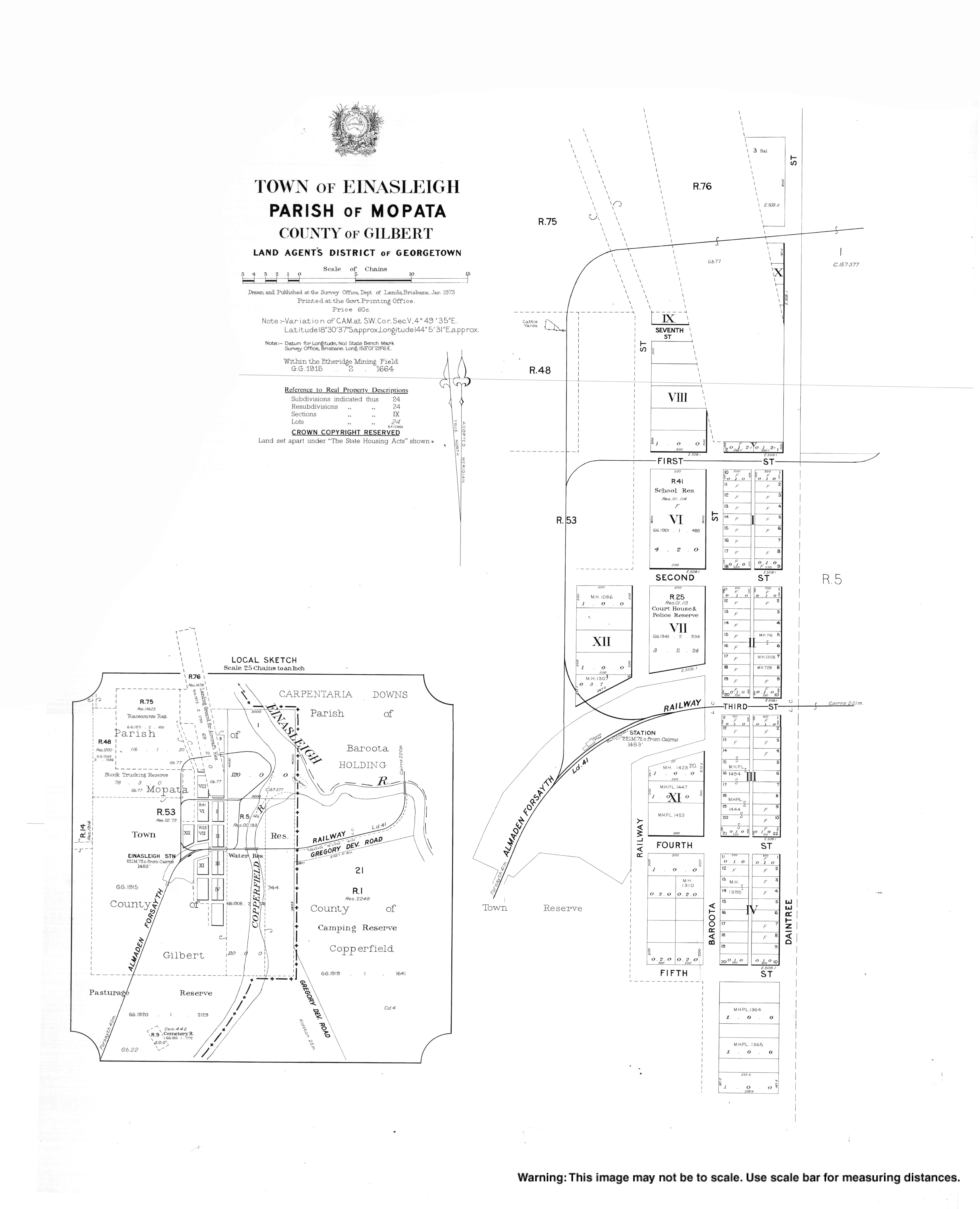
| Einasleigh State School | Einasleigh | Etheridge | 1901 | 1955 | 18°30′36″S144°05′36″E / 18.5101°S 144.0932°E | Located at 5–7 First Street. [139] |
| Ellinjaa Road State School | Ellinjaa | Tablelands | 1919 | 1949 | ||
| Emuford State School | via Petford | Mareeba | 1910 | 1921–1923 | ||
| Eubenangee State School | Eubenangee | Cassowary Coast | 1921 | 1971 | The locality of Eubenangee is predominantly in the Cairns Region but the town (the most likely location for this former school) is in Cassowary Coast Region. | |
| Euluma Creek State School | Euluma Creek (now Julatten) | Mareeba | 1930 | 1951 | ||
| Euramo State School | Euramo | Cassowary Coast | 1927 | 1974 | approx 18°00′36″S145°56′05″E / 18.0101°S 145.9346°E | The school building was relocated from the closed Japoon West State School in Japoonvale. Located in Euramo on the Bruce Highway. [140] |
| Evelyn Scrub State School | Evelyn | Tablelands | 1896 | 1946 | approx 17°30′04″S145°27′13″E / 17.50116°S 145.45370°E | Located near Mill Creek on Jonsson Road. [141] [142] |
| Evolution State School | near Ravenswood | Charters Towers | 1885 | 1921 | Opened in 1885 as Sandy Creek Provisional School. Changed name in 1886 and became a State School in 1909. | |
| Fossilbrook State School | Fossilbrook | Mareeba | 1908 | 1926 | It opened as Fossilbrook Provisional School in 1908. On 1 January 1909 it became Fossilbrook State School. There was one temporary closure.[ when? ] It permanently closed due to low attendances in 1926. [27] | |
| Gadgarra State School | Gadgarra (now within Lake Barrine) | Tablelands | 1928 | 1958 | 17°16′18″S145°39′03″E / 17.27156°S 145.65093°E | At 211 Gadgarra Road, now within the locality boundaries of neighbouring Lake Barrine. [143] [144] |
| Geraldton Road State School | Ravenshoe (now in Evelyn) | Tablelands | 1916 | 1960 | 17°30′24″S145°30′19″E / 17.50658°S 145.50540°E | Geraldton Road State School opened in 1916 via Ravenshoe. It closed in 1960. [113] It was at 45 Geraldton Road (now within the boundaries of neighbouring Evelyn). [145] [146] |
| Gilbert River State School | Gilbert River | Etheridge | 1899 | 1961 | ||
| Gilmore State School | via Chillagoe | Mareeba | 1909 [147] | 1913 [148] | The school was probably serving the families working at the Gilmore Mine via Chillagoe. It may initially have been known as Gilmore Siding Provisional School. [149] In 1915 the building was relocated to Mount Mulligan. [150] | |
| Girofla State School | Mungana, near Chillagoe | Mareeba | 1898 | 1946 | Later became known as Mungana State School. | |
| Glen Allyn State School | Glen Allyn | Tablelands | 1920 | 1965 | approx 17°23′05″S145°39′55″E / 17.38471°S 145.66526°E | Located on the western side of Glen Allyn Road. [151] [152] |
| Golden Gate State School | Golden Gate | Croydon | 1896 | 1921 | Golden Gate was a mining township near Croydon. | |
| Goode Island State School | Goods Island | Torres Strait | 1903 | 1912 | ||
| Granadilla State School | Granadilla | Cassowary Coast | 1937 | 1941 | 17°51′29″S146°01′43″E / 17.8580°S 146.0285°E | Located on the southern corner of Granadilla Road and Banfield Road [153] [154] |
| Grass Tree Provisional School | via Cooktown | Cook | 1910 | 1911 | Grass Tree Provisional School operated briefly as a half-time school in conjunction with Shipton's Flat Provisional School. No to be confused with a similarly named school near Mackay. [27] | |
| Gregory Educational Facility | Gregory | Burke | ? | 2012 | ||
| Hale's Siding State School | Irvinebank | Mareeba | 1915 | 1922 | ||
| Herberton Range State School | Herberton area | Tablelands | 1909 | 1910 | ||
| Holloways Beach State School | Holloways Beach | Cairns | 1955 | 1966 | ||
| Horse Shoe Bend State School | Ravenshoe | Tablelands | 1917 | 1952 | 17°35′56″S145°32′29″E / 17.59882°S 145.54150°E | Horse Shoe Bend State School (sometimes written as Horseshoe Bend State School) opened in 1917 under head teacher Mary Ellen Duffy. It closed in 1925 due to low student numbers. The school reopened in 1929 and closed on 1 August 1952. [113] [155] It was at 182 Glendinning Road. [156] [157] |
| Innisfail Inclusive Education Centre | Innisfail | Cassowary Coast | 1980 | 2009 | Merged into Innisfail State College | |
| Innisfail State High School | Mighell, Innisfail | Cassowary Coast | 1955 | 2009 | 17°32′12″S146°01′41″E / 17.5367°S 146.0280°E | Merged into Innisfail State College. Located at 2 Stitt Street, Mighell in Innisfail. [158] [159] [160] Innisfail State High School's website was archived. [161] |
| Iyah State School | Iyah (now Fredericksfield) | Cassowary Coast | 1920 | 1963 | ||
| Innot Hot Springs State School | Innot Hot Springs | Tablelands | 1940 | 1957 | approx 17°39′57″S145°14′19″E / 17.6659°S 145.2386°E | Located at approx 16018 Kennedy Highway. [162] [163] [121] |
| Jaggan State School | Jaggan | Tablelands | 1918 | 1965 | ||
| Jessica Point (Napranum) State School | Napranum | Napranum | 1898 | 2005 | Originally opened in 1898 as Weipa Mission School run by the Presbyterian church but was staffed by the Queensland Government not long after. It changed name to Weipa South State School in 1966 and then again to Jessica Point State School in 1976. The name changed again in 2002 to become Napranum Campus of Western Cape College. The school closed in 2005. | |
| Junction Creek State School | Bellenden Ker | Cairns | 1898 | 1902 | The present Bellenden Ker State School opened in 1922. [27] | |
| Kaban State School | Kaban | Tablelands | 1914 | 1965? | ||
| Kidston State School | Kidston | Etheridge | 1911 | 1954 | ||
| Killaloe State School | Killaloe (but now in Craigslie) | Douglas | 1928 | 1935 | approx 16°30′39″S145°26′33″E / 16.51096°S 145.44257°E | The school was on the northern corner of the Captain Cook Highway and Mcclellan Road in present-day Craiglie. [164] |
| Kingsborough State School | Kingsborough | Mareeba | 1882 | 1924 | [27] | |
| Koah State School | Koah | Mareeba | 1933 | 1938? | [165] [166] No mentions of this school in the Trove newspapers after 1938 | |
| Koombooloomba State School | Koombooloomba | Tablelands | 1953 | 1963 | ||
| Koorboora State School | Koorboora (now Petford) | Mareeba | c.1901 | c.1936 | ||
| Kulara State School | Kulara (now Barrine) | Tablelands | 1912 | 1958 | 17°14′39″S145°34′59″E / 17.24420°S 145.58306°E | The town of Kulara was inundated with the filling of Tinaroo Dam in 1959. [113] However, being on higher ground, the school building was not flooded and is now a private residence at 85 Backshall Road, Barrine. [118] [167] [168] |
| Kuranda Senior High School | Kuranda | Mareeba | 1998 | 2007 | Merged into Kuranda District State College | |
| Kuranda District State School | Kuranda | Mareeba | 1892 | 2007 | 16°49′18″S145°38′23″E / 16.8218°S 145.6396°E | Opened in 1892 as Kuranda State School, renamed in 2002 Kuranda. Located at 14–22 Arara Street. [169] In 2007, it was amalgamated with Kuranda District State High School to create Kuranda District State College. Kuranda District State School's website was archived. [170] |
| Kureen State School | Kureen | Tablelands | 1912 | 1958 | approx 17°19′56″S145°35′40″E / 17.3323°S 145.5944°E | Located on the eastern side of Peeramon Road. [171] [172] |
| Lake Barrine State School | Lake Barrine | Tablelands | 1922 | 1949 | 17°14′38″S145°38′28″E / 17.24382°S 145.64108°E | At 3426 Gillies Range Road. [144] [173] |
| Lancelot State School | in north-western Silver Valley | Tablelands | 1905 | 1926 | 17°27′06″S145°17′20″E / 17.45170°S 145.28883°E | Lancelot Provisional School opened in 1905 but closed in 1906 when insufficient students enrolled. It reopened circa 1920 and closed in 1926. [113] It was on 2-acre (0.81 ha) site on the eastern side of Silver Valley Road. [174] [128] |
| Lappa Lappa State School | Lappa Lappa, near Petford | Mareeba | 1900 | 1902 | [175] | |
| Lever Estate State School | Walter Lever Estate | Cassowary Coast | 1936 | 1967 | 17°43′49″N145°58′21″E / 17.73028°N 145.97258°E | At 410 Walter Lever Estate Road. [176] [177] |
| Limestone State School | Groganville | Mareeba | 1890 | 1905 | Groganville was formerly known as Limestone. [178] | |
| Little Mulgrave State School | Little Mulgrave | Cairns | 1926 | 1964 | ||
| Lorraine State School | Lorraine Station in Stokes | Carpentaria | 1981 | 1995 | ||
| Lower Nettles Provisional School | Innot Hot Springs | Tablelands | 1911 | 1916 | Lower Nettles opened as a provisional school in about July 1911. [179] In July 1916, it became a half time school in conjunction with Coolgarra State School. However, later in 1916, Lower Nettles was closed and Coolgarra reverted to full-time status. | |
| Maytown State School | Maytown (now in Palmer) | Cook | circa 1877 | 1925 | approx 16°02′59″S144°17′16″E / 16.0497°S 144.2878°E | Maytown State School opened circa 1877 in Maytown and closed in 1917. It reopened briefly in 1924, closing in 1925. [180] Coordinates are for the town generally. |
| McIvor River Provisional School [181] | via Hope Vale | Cook | 1960 | early 1961 | ||
| Merragallan State School | Merragallan (now Jaggan) | Tablelands | 1913 | 1935 | ||
| Middlebrook Road State School | Middlebrook | Tablelands | 1935 | 1945 | approx 17°33′47″S145°38′26″E / 17.56298°S 145.64042°E | Located on the eastern corner of Middlebrook Road and Barter Road. [182] [183] |
| Midgenoo State School | Midgenoo | Cassowary Coast | 1923 | 1933 | ||
| Minbun State School | Minbun | Tablelands | 1922 | 1974 | 17°28′43″S145°34′49″E / 17.47854°S 145.58027°E | Opened 1922 as Nash Road State School, renamed 1925 Minbun State School. Located on the north-eastern corner or Nash Road and Millaa Millaa – Malanda Road. [123] [118] |
| Montalbion State School | Montalbion (now in Irvinebank) | Tablelands | 1888 | 1906 | Montalbion is a former mining town at 17°24′02″S145°09′01″E / 17.4006°S 145.1504°E . [121] | |
| Moregatta State School | Moregatta | Tablelands | 1927 | 1948 | 17°29′04″S145°35′55″E / 17.48438°S 145.59856°E | Located at 323 Moregatta Road. [123] [118] |
| Moresby State School | Moresby | Cassowary Coast | 1915 | 2014 | 17°38′05″S146°01′42″E / 17.63466°S 146.02829°E | Located at 2–20 Moresby Road. [184] The school's website was archived. [185] |
| Mount Amos State School | Mount Amos (now Rossville) | Cook | 1918 | 1919 | ||
| Mount Aunt State School | Mount Aunt (now in Chewko) | Mareeba | 1940 | 1958 | ||
| Mount Carbine State School | Mount Carbine | Mareeba | 1908 | 1957 | approx 16°31′49″S145°07′56″E / 16.5302°S 145.1321°E | Located on the western side of Pump Road. [186] [42] |
| Mount Jackson State School | via Georgetown | Etheridge | 1918 | 1922 | ||
| Mount Mulligan State School | Mount Mulligan | Mareeba | 1915 | 1958 | The school building was relocated from the closed Gilmore State School in 1915. [150] | |
| Mowbray River State School | Mowbray | Douglas | 1925 | 1961 | 16°33′56″S145°28′03″E / 16.56561°S 145.46745°E | Located at 264 Mowbray River Road.The school building is still on the site, forming part of a house. [187] [42] |
| Muldiva State School | Muldiva, near Chillagoe | Mareeba | c.1892 | c.1894 | ||
| Mungana State School | Mungana, near Chillagoe | Mareeba | 1898 | 1946 | Originally known as Girofla State School. | |
| Northcote State School | via Dimbulah | Mareeba | 1883 | c.1910 | ||
| North East Harbour Line State School | New Harbourline | Cassowary Coast | 1936 | 1941 | approx 17°36′50″S146°03′40″E / 17.6139°S 146.0611°E | Located on the northern side of New Harbourline Road. [188] [189] |
| North Johnstone State School | North Johnstone | Tablelands | 1914 | 1971 | ||
| Nymbool State School | Mount Garnet | Tablelands | 1904 | c.1937 | ||
| O.K. State School | Ok mining settlement (now in Chillagoe) | Mareeba | 1904 | 1910 | [190] | |
| Palmerston East State School | East Palmerston | Cassowary Coast | 1938 | 2012 | 17°36′12″S145°50′48″E / 17.6033°S 145.8467°E | Sometimes known as East Palmerston State School. It was located at 2068 Palmerston Highway East. [191] The school's website was archived. [192] |
| Peeramon State School | Peeramon | Tablelands | 1911 | 1959 | 17°18′36″S145°37′26″E / 17.3099°S 145.6239°E | Opened in 1911 as Lake Eacham State School, renamed Peeramon State School in 1919. [113] It was at 107 Mckenzie Road (corner Peeramon School Road). [193] [194] |
| Percyville State School | via Kidston | Etheridge | c.1910 | 1921? | ||
| Petford State School | Petford | Mareeba | 1935 | 1995 | 17°20′27″S144°55′48″E / 17.3407°S 144.9299°E | Located at 21 Bamford Road. [195] |
| Port Douglas State School | Port Douglas | Douglas | 1879 | 1962 | ||
| Redcap State School | Redcap, near Chillagoe | Mareeba | 1905 | c.1908 | ||
| Riversdale State School | Euramo | Cassowary Coast | 1953 | 1968 | 17°59′44″S145°51′37″E / 17.9956°S 145.8602°E | Riversdale is now in Euramo. [196] Located at approx 917 Davidson Road. [197] |
| Rocky Bluffs State School | near Irvinebank | Mareeba | 1904 | 1910 | ||
| Rocky Point State School | Rocky Point | Douglas | 1939 | 1999 | 16°23′15″S145°25′03″E / 16.3874°S 145.4176°E | Located at 14 Rocky Point School Road. [198] [199] [42] In 1999, the school was replaced by the Wonga Beach State School. [200] |
| Shiptons Flat State School | via Cooktown | Cook | 1910 | 1921 | ||
| Silky Oak Creek State School | Silky Oak | Cassowary Coast | 1940 | 1974 | 17°58′54″S145°56′45″E / 17.98160°S 145.94591°E | Located at 254 Jack Evans Drive. [201] [202] |
| Smithfield State School | Smithfield | Cairns | 1899 | 1964 | ||
| Stannary Hills State School | Stannary Hills (now in the north-east of Irvinebank) | Tablelands | 1904 | circa 1931 | approx 17°19′01″S145°13′02″E / 17.3169°S 145.2173°E | The town of Stannary Hills is now abandoned. [117] |
| Strathmore State School | Strathmore | Mareeba/Etheridge | 1916 | 1932 | ||
| Stratvell State School | Japoonvale | Cassowary Coast | 1916 | 2002 | 17°43′26″S145°55′20″E / 17.7239°S 145.9221°E | Located at 34 Stratvell Road. [203] |
| Sunnymount State School | Petford | Mareeba | 1913 | 1924 | ||
| Tableland State School | 1904 | 1919 | There was a Tableland State School in Tablelands, Gladstone Region. [27] | |||
| Tabletop State School | near Croydon | Croydon | circa 1888 | 1910 | Opened as Tabletop Provisional School circa 1888, becoming Tabletop State School on 1 January 1909, then closing in 1910. [27] Is different to Table Top State School on the Darling Downs. | |
| Tarzali State School | Tarzali | Tablelands | 1914 | 1967 | ||
| Tate Tin Mines State School | near Almaden | Mareeba | 1894 | 1940 | Provisional school until 1909. Closed in 1924 then opened again in 1930 before closing permanently in 1940. | |
| Tinaroo Falls State School | Tinaroo | Tablelands | 1954 | 1959 | ||
| Thornborough State School | Thornborough | Mareeba | 1878 | 1932 | ||
| Topaz State School | Topaz | Tablelands | 1932 | 1960 | 17°25′24″S145°43′05″E / 17.42344°S 145.71793°E | At 3 Union Street. [204] [205] The school building was converted into a house and was still extant in May 2023. [205] |
| Trevethan Creek State School | via Cooktown | Cook | 1915 | 1919 | ||
| True Blue State School | near Croydon | Croydon | 1893 | 1913 | Needs further research as there is some evidence at Qld State Archives that this school was open between 1975 and 1977. | |
| Tully Falls State School | via Ravenshoe | Tablelands | 1953 | 1955 | ||
| Tumoulin State School | Tumoulin | Tablelands | 1912 | 1960 | ||
| Upper Barron State School | Upper Barron | Tablelands | 1911 | 2008 | 17°22′58″S145°30′52″E / 17.3827°S 145.5145°E | Located at 9570 Kennedy Highway. [206] [207] The school's website was archived. [208] |
| Vine Creek State School | Ravenshoe | Tablelands | 1936 | 1945 | 17°39′57″S145°30′28″E / 17.6658°S 145.50770°E | Located at 620 Tully Falls Road. [209] [121] |
| Wai-Ben State School | Thursday Island, Torres Strait | Torres | 1940 | c1963 | Originally known as Thursday Island State School for Coloured Children. Renamed in 1954. | |
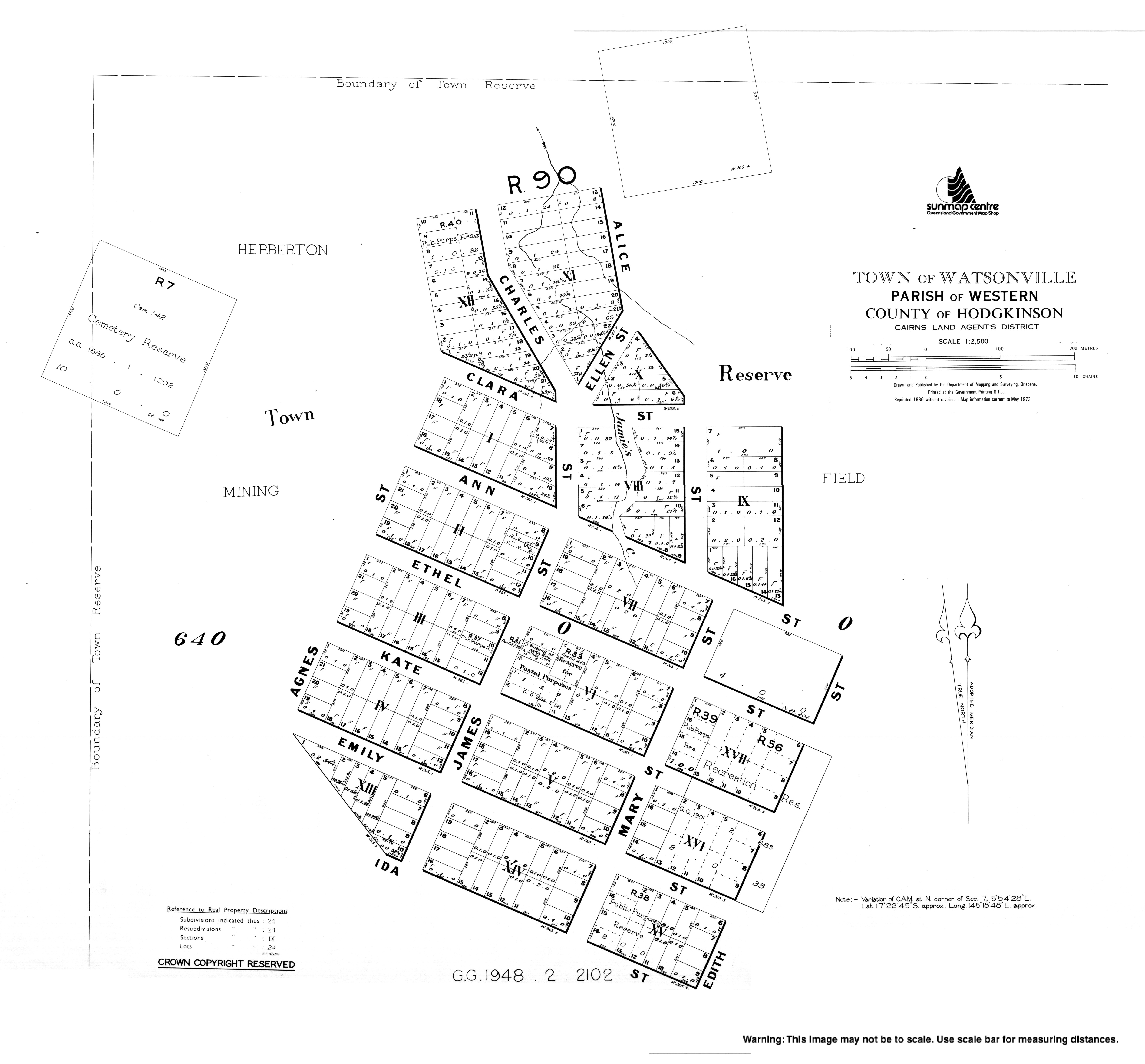
| Watsonville State School | Watsonville | Mareeba | 1882 | c.1943 | 17°22′44″S145°18′53″E / 17.3790°S 145.3148°E | Located on the block surrounded by Ann, Mary, Ethel and Edith Streets. [210] [211] [212] [121] |
| Wattleglen State School | near Craiglie | Douglas | 1874 | 1948 | This school opened and closed many times and changed name each time. It originally opened in 1874 as Goganjo State School, closed in 1878, then reopened in 1882 as Warralie State School for three years. It opened again in 1888 as Craiglie State School, closing again in 1928 before opening again under the final name in 1939. | |
| Wirra Wirra State School | Forsayth | Etheridge | 1914 | circa 1918 | 18°37′04″S143°46′00″E / 18.61770°S 143.76653°E | Located on a 3-acre (1.2 ha) land parcel on Wirra Wirra Road near the Wirra Wirra railway station. [213] |
| Wolfram State School | Wolfram, near Chillagoe | Mareeba | 1905 | 1940 | ||
| Wondecla State School | Wondecla | Tablelands | 1883 | 1958 | 17°24′52″S145°23′36″E / 17.4145°S 145.3933°E | Opened 1883 as Nigger Creek Provisional School, renamed 1922 Wondecla State School. Located on a 5-acre-8-perch (2.04 ha) site on the western side of Longlands Gap Road immediately south of Wondecla Creek. [214] [215] |
| Woodville State School | via Dimbulah, Hodgkinson River area | Mareeba | 1893 | c.1933 | There was also a Woodville State School near Yaamba, Shire of Livingstone. [27] | |
| Woopen Creek State School | Woopen Creek | Cairns | 1952 | 1967 | ||
| Wright's Creek State School | Wrights Creek | Cairns | 1894 | 1953 | ||
| Yandina Creek State School | near Croydon | Croydon | 1918 | 1964 | Originally known as Golden Valley State School, then in 1914 changed name to Valdora State School before becoming Yandina Creek in 1948. Note this is different to another school elsewhere in Queensland called Yandina Creek State School which operated between 1914 and 1920 and 1932–1941. | |
| Yarraden State School | Yarraden | Cook | Jan 1907 | Dec 1907 | ||
| Zillmanton State School | Zillmanton, near Chillagoe | Mareeba | 1909 | c.1914 |
Catholic schools in the Cairns region are administered by Catholic Education Office, Roman Catholic Diocese of Cairns, and supported by the Queensland Catholic Education Commission, which is responsible for coordinating administration, curriculum and policy across the Catholic school system. Preference for enrolment is given to Catholic students from the parish or local area, although non-Catholic students are admitted if room is available.
| Name | Suburb | LGA | M/F/Co-ed | Years | Opened | Coordinates | Notes |
|---|---|---|---|---|---|---|---|
| Good Counsel College | Innisfail | Cassowary Coast | Co-ed | 7–12 | 1975 | 17°31′15″S146°01′43″E / 17.5207°S 146.0285°E | At 66 Owen Street. [216] |
| Good Counsel Primary School | Innisfail | Cassowary Coast | Co-ed | P–6 | 1975 | 17°31′16″S146°01′44″E / 17.5212°S 146.0288°E | At 96 Rankin Street. [217] |
| Holy Cross Primary School | Trinity Park | Cairns | Co-ed | P–6 | 1987 | ||
| Holy Spirit College | Cooktown | Cook | Co-ed | 7–12 | 2015 | 15°28′57″S145°14′54″E / 15.4825°S 145.2484°E | Alternative, for disengaged young people. At 1 Burkitt Street (corner of Hope Street). [218] |
| Holy Spirit College | Manoora and Edmonton | Cairns | Co-ed | 2015 | Alternative, for disengaged young people | ||
| Mackillop Catholic College | Mount Peter | Cairns | Co-ed | P–12 | 2016 | ||
| Mother of Good Counsel School | Cairns North | Cairns | Co-ed | P–6 | 1936 | ||
| Mount St Bernard College | Herberton | Tablelands | Co-ed | 7–12 | 1921 | ||
| Newman Catholic College | Smithfield | Cairns | Co-ed | 7–12 | 2022 | ||
| Our Lady Help of Christians School | Earlville | Cairns | Co-ed | P–6 | 1964 | ||
| Our Lady of the Sacred Heart School | Thursday Island and Hammond Island | Torres | Co-ed | P–6 | 1886 | ||
| St Andrews Catholic College | Redlynch | Cairns | Co-ed | P–12 | 2001 | ||
| St Anthony's Primary School | Dimbulah | Mareeba | Co-ed | P–6 | 1966 | ||
| St Augustine's College | Parramatta Park | Cairns | M | 7–12 | 1930 | ||
| St Augustine's School | Mossman | Douglas | Co-ed | P–6 | 1934 | 16°27′42″S145°22′08″E / 16.4617°S 145.3688°E | In Grogan Street. [219] |
| St Clare's School | Tully | Cassowary Coast | Co-ed | P–6 | 1928 | 17°56′14″S145°55′14″E / 17.9371°S 145.9206°E | At 13 Mars Street. [220] |
| St Francis Xavier's School | Manunda | Cairns | Co-ed | P–6 | 1967 | ||
| St Gerard Majella School | Woree | Cairns | Co-ed | P–6 | 1988 | ||
| St John's Catholic School | Silkwood | Cassowary Coast | Co-ed | P–6 | 1948 | 17°44′14″S146°00′18″E / 17.7372°S 146.0051°E | In Harold Street. [221] |
| St Joseph's School | Atherton | Tablelands | Co-ed | P–6 | 1923 | 17°15′56″S145°28′43″E / 17.26554°S 145.47864°E | On the south-west corner of Jack & Alice Streets. [222] |
| St Joseph's School | Parramatta Park | Cairns | Co-ed | P–6 | 1927 | ||
| St Joseph's School | Weipa | Weipa | Co-ed | P–6 | 2016 | ||
| St Mary's College | Woree | Cairns | Co-ed | 7–12 | 1986 | ||
| St Michael's Catholic Primary School | Gordonvale | Cairns | Co-ed | P–6 | 1923 | 17°05′44″S145°47′14″E / 17.0955°S 145.7873°E | 58 Mill Street. [223] |
| St Monica's Catholic College | Cairns City | Cairns | F | 7–12 | 1890 | ||
| St Rita's School | Babinda | Cairns | Co-ed | P–6 | 1926 | 17°20′35″S145°55′21″E / 17.3430°S 145.9225°E | At 7–13 Church Street. [224] |
| St Rita's School | South Johnstone | Cassowary Coast | Co-ed | P–6 | 1932 | 17°35′56″S145°59′47″E / 17.5988°S 145.9963°E | At 8 Green Street. [225] |
| St Stephen's Catholic College | Mareeba | Mareeba | Co-ed | 7–12 | 2006 | 17°01′03″S145°25′11″E / 17.0176°S 145.4198°E | At 3 McIver Road. [226] |
| St Teresa's Primary School | Ravenshoe | Tablelands | Co-ed | P–6 | 1950 | 17°36′41″S145°29′13″E / 17.6113°S 145.4870°E | At 6 Moffatt Street. [227] |
| St Therese's School | Edmonton | Cairns | Co-ed | P–6 | 1929 | Opened as Edmonton Catholic School, renamed St Therese's School in 1965, relocated to Bentley Park in 1995. | |
| Bentley Park | 1995 | 17°00′23″S145°43′52″E / 17.0064°S 145.7312°E | At 135 Robert Road. [228] | ||||
| St Thomas's School | Mareeba | Mareeba | Co-ed | P–6 | 1909 | 16°59′43″S145°25′31″E / 16.9952°S 145.4254°E | At 63 Constance Street. [229] |
| Name | Suburb | LGA | M/F/Co-ed | Years | Category | Opened | Coordinates | Notes |
|---|---|---|---|---|---|---|---|---|
| Autism Queensland Education & Therapy Centre | Edmonton | Cairns | Co-ed | Independent | Special School, Operated by Autism Queensland | |||
| Cairns Adventist College | Gordonvale | Cairns | Co-ed | P–6 | Adventist | 1950 | 17°04′34″S145°47′32″E / 17.0760°S 145.7923°E | At 42 Crossland Road. [230] |
| Cairns Hinterland Steiner School | Kuranda | Mareeba | Co-ed | P–12 | Steiner | 2002 | Formerly Candlenut Steiner School, formerly Cairns Steiner School. | |
| Djarragun College | Gordonvale | Cairns | Co-ed | P–12 | Anglican | 2001 | 17°04′48″S145°46′35″E / 17.0799°S 145.7763°E | Formerly Emmanuel College, Manunda. [231] At 1 Maher Road. [232] |
| Djarragun College | Port Douglas | Douglas | Co-ed | P–12 | Anglican | 2008 | Formerly Wangetti Education Centre.[ citation needed ] | |
| Endeavour Christian College | Cooktown | Cook | Co-ed | P–12 | Christian | 2012 | 15°28′56″S145°15′18″E / 15.4822°S 145.2549°E | At 12 Charles Street. [233] |
| Freshwater Christian College | Brinsmead | Cairns | Co-ed | P–12 | Christian | 1983 | 16°53′33″S145°42′30″E / 16.8925°S 145.7082°E | At 369–401 Brinsmead Road. [234] |
| Gulf Christian College | Normanton | Carpentaria | Co-ed | P–12 | Christian | 1990 | 17°40′15″S141°04′47″E / 17.6709°S 141.0798°E | At 24–30 Brown Street. [235] |
| Jubilee Christian College | Atherton | Tablelands | Co-ed | P–12 | Christian | 1984 | 17°16′30″S145°28′46″E / 17.27494°S 145.47945°E | Formerly Tableland Christian College until 1998. Prep–12, at 52 Grau Street. [236] |
| Kluthuthu Christian College | Napranum | Napranum | Co-ed | P–7 | Christian | 2023 | ||
| Mastery Schools Australia | Cairns City | Cairns | Co-ed | 4–10 | Alternative | 2021 | ||
| Peace Lutheran College | Kamerunga | Cairns | Co-ed | P–12 | Lutheran | 1994 | ||
| Radiant Life College | East Innisfail | Cassowary Coast | Co-ed | P–10 | Christian | 1982 | 17°32′22″S146°02′05″E / 17.5395°S 146.0348°E | Prep to Year 7. At 1–5 Riley Street. Primarily targetting Indigenous students. [237] [238] |
| Silver Lining School | Mooroobool | Cairns | Co-ed | Aboriginal | ||||
| The BUSY School | Cairns City | Cairns | Co-ed | 11–12 | Alternative | |||
| The Rainforest School | Maria Creeks | Cassowary Coast | Co-ed | P–6 | Independent | 2019 | ||
| Trinity Anglican School | Kewarra Beach | Cairns | Co-ed | K–6 | Anglican | 16°47′20″S145°40′58″E / 16.7888°S 145.6829°E | At 45 Poolwood Road. [239] [240] | |
| White Rock | K–12 | 1983 | 16°58′44″S145°44′41″E / 16.9788°S 145.7448°E | At 4-54 Sheehy Road. [239] [241] |
| Name | Suburb | LGA | Category | Opened | Closed | Notes |
|---|---|---|---|---|---|---|
| Darlingia Forest School | East Innisfail | Cassowary Coast | Democratic | 2021 | 2023 | Prep-Year 4. [242] [243] |
| Emmanuel College | Manunda | Cairns | Anglican | 1986 | 2001 | Became Djarragun College [244] |
| Sacred Heart Girls School | Innisfail | Cassowary Coast | Catholic | 1903 | 1975 | Merged into Good Counsel College |
| St Barnabas' Anglican School | Ravenshoe | Tablelands | Anglican | 1953 | 1990 | Campus acquired by Ravenshoe SS |
| St Mary's School | Herberton | Tablelands | Anglican | 1918 | 1965 | |
| Wangetti Education Centre | Port Douglas | Douglas | Anglican | 1983 | 2008 | Became campus of Djarragun College |
{{cite web}}: CS1 maint: archived copy as title (link)