Talladega County, Alabama

Last updated

Talladega County
Talladega County Alabama Courthouse.JPG
Talladega County Courthouse in Talladega
Talladega County, Alabama Logo.png
Motto: 
"Something For Everyone"
Map of Alabama highlighting Talladega County.svg
Location within the U.S. state of Alabama
Alabama in United States.svg
Alabama's location within the U.S.
Coordinates: 33°23′N86°10′W / 33.38°N 86.17°W / 33.38; -86.17
CountryFlag of the United States.svg United States
StateFlag of Alabama.svg Alabama
FoundedDecember 18, 1832 [1]
Named after Creek for "Border Town"
Seat Talladega
Largest cityTalladega
Area
  Total
760 sq mi (2,000 km2)
  Land737 sq mi (1,910 km2)
  Water24 sq mi (60 km2)  3.1%
Population
 (2020)
  Total
82,149
  Estimate 
(2024)
81,375 Decrease2.svg
  Density110/sq mi (42/km2)
Time zone UTC−6 (Central)
  Summer (DST) UTC−5 (CDT)
Congressional districts 3rd, 6th
Website TalladegaCountyAL.org
  • County Number 61 on Alabama Licence Plates

Talladega County is one of the sixty-seven counties located in the east central portion of the U.S. state of Alabama. [1] As of the 2020 census, the population was 82,149. [2] Its county seat is Talladega. [1] [3]

Contents

Talladega County is included in the Talladega-Sylacauga, AL Micropolitan Statistical Area, which is also included in the Birmingham-Cullman-Talladega, AL Combined Statistical Area.

History

Prior to Euro-American settlement in this area, it was occupied by the Abihka tribe of the Creek Confederacy. [4] The United States forced the Creek to agree to treaties by which they ceded their land to the US, ultimately resulting in Indian Removal to west of the Mississippi River, to Indian Territory.

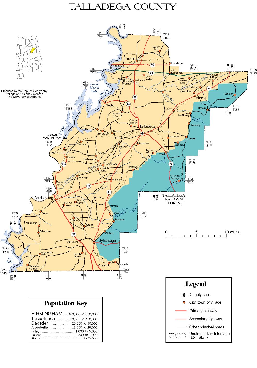
Talladega County was established on December 18, 1832, from land ceded by the Creek Indians near the state's geographic center. [1] The county seat was established at Talladega in 1834. [1]

The name Talladega is derived from a Muscogee (Creek) Native American word Tvlvtēke, from the Muscogee etvlwa , meaning "town", and vtēke, or "border" "Border Town" a town indicating its location on the boundary between the lands of the Creek tribe and those of the Cherokee and Chickasaw. [5]

Geography

According to the United States Census Bureau, the county has a total area of 760 square miles (2,000 km2), of which 737 square miles (1,910 km2) is land and 24 square miles (62 km2) (3.1%) is water. [6] It is drained by Choccolocco Creek (archaic spelling: Chockolocko) and other streams. [7] The county is located within the Coosa River Valley and the Ridge-and-Valley Appalachians, with the state's highest point, Mount Cheaha, being located on its northeastern border with Cleburne County.

Adjacent counties

National protected area

Demographics

Historical population
CensusPop.Note
1840 12,587
1850 18,62448.0%
1860 23,52026.3%
1870 18,064−23.2%
1880 23,36029.3%
1890 29,34625.6%
1900 35,77321.9%
1910 37,9216.0%
1920 41,0058.1%
1930 45,24110.3%
1940 51,83214.6%
1950 63,63922.8%
1960 65,4952.9%
1970 65,280−0.3%
1980 73,82613.1%
1990 74,1070.4%
2000 80,3218.4%
2010 82,2912.5%
2020 82,149−0.2%
2024 (est.)81,375 [8] −0.9%
U.S. Decennial Census [9]
1790–1960 [10] 1900–1990 [11]
1990–2000 [12] 2010–2020 [2]

2020 Census

Talladega County, Alabama – Racial and ethnic composition
Note: the US Census treats Hispanic/Latino as an ethnic category. This table excludes Latinos from the racial categories and assigns them to a separate category. Hispanics/Latinos may be of any race.
Race / Ethnicity (NH = Non-Hispanic)Pop. 2000 [13] Pop. 2010 [14] Pop. 2020 [15] % 2000% 2010% 2020
White alone (NH)53,39953,07950,73266.48%64.50%61.76%
Black or African American alone (NH)25,20625,95326,34031.38%31.54%32.06%
Native American or Alaska Native alone (NH)1722301840.21%0.28%0.22%
Asian alone (NH)1593293950.20%0.40%0.48%
Pacific Islander alone (NH)206270.02%0.01%0.03%
Other race alone (NH)35602060.04%0.07%0.25%
Mixed race or Multiracial (NH)5189632,4860.64%1.17%3.03%
Hispanic or Latino (any race)8121,6711,7791.01%2.03%2.17%
Total80,32180,32182,149100.00%100.00%100.00%

As of the 2020 United States census, there were 82,149 people, 30,602 households, and 20,515 families residing in the county.

2010 Census

As of the census [16] of 2010, there were 82,291 people, 31,890 households, and 22,191 families living in the county. The population density was 112 inhabitants per square mile (43 inhabitants/km2). There were 37,088 housing units at an average density of 50 units per square mile (19 units/km2). The racial makeup of the county was 65.3% White, 31.7% Black or African American, 0.3% Native American, 0.4% Asian, 0.0% Pacific Islander, 1.0% from other races, and 1.3% from two or more races. Nearly 2.0% of the population were Hispanic or Latino of any race.

There were 31,890 households, out of which 27.8% had children under the age of 18 living with them; 47.2% were married couples living together, 17.5% had a female householder with no husband present, and 30.4% were non-families. 26.7% of all households were made up of individuals, and 10.1% had someone living alone who was 65 years of age or older. The average household size was 2.48, and the average family size was 2.98.

In the county, the population was spread out, with 23.4% under the age of 18, 8.6% from 18 to 24, 25.8% from 25 to 44, 28.1% from 45 to 64, and 14.1% who were 65 years of age or older. The median age was 39.3 years. For every 100 females, there were 94.9 males. For every 100 females age 18 and over, there were 98.1 males.

The median income for a household in the county was $36,948, and the median income for a family was $44,695. Males had a median income of $38,430 versus $27,404 for females. The per capita income for the county was $18,713. About 15.3% of families and 18.4% of the population were below the poverty line, including 27.1% of those under age 18 and 15.7% of those age 65 or over.

2000 Census

As of the census [17] of 2000, there were 80,321 people, 30,674 households, and 21,901 families living in the county. The population density was 109 inhabitants per square mile (42 inhabitants/km2). There were 34,469 housing units at an average density of 47 units per square mile (18 units/km2). The racial makeup of the county was 67.02% White, 31.55% Black or African American, 0.23% Native American, 0.20% Asian, 0.02% Pacific Islander, 0.27% from other races, and 0.71% from two or more races. Nearly 1.01% of the population were Hispanic or Latino of any race.

In 2000, the largest ancestry groups in Talladega County were:

There were 30,674 households, out of which 32.10% had children under the age of 18 living with them; 52.40% were married couples living together, 15.20% had a female householder with no husband present, and 28.60% were non-families. 25.90% of all households were made up of individuals, and 10.60% had someone living alone who was 65 years of age or older. The average household size was 2.50, and the average family size was 3.00.

In the county, the population was spread out, with 25.00% under the age of 18, 9.00% from 18 to 24, 28.80% from 25 to 44, 23.90% from 45 to 64, and 13.30% who were 65 years of age or older. The median age was 37 years. For every 100 females, there were 95.70 males. For every 100 females age 18 and over, there were 93.50 males.

The median income for a household in the county was $31,628, and the median income for a family was $38,004. Males had a median income of $30,526 versus $21,040 for females. The per capita income for the county was $15,704. About 13.90% of families and 17.60% of the population were below the poverty line, including 24.70% of those under age 18 and 18.20% of those age 65 or over.

Government

United States presidential election results for Talladega County, Alabama [18] [19]
Year Republican Democratic Third party(ies)
No.%No.%No.%
2024 22,10066.47%10,89832.78%2520.76%
2020 22,23562.35%13,13836.84%2900.81%
2016 20,61461.71%12,12136.28%6722.01%
2012 19,24657.60%13,90541.61%2650.79%
2008 20,11258.80%13,77940.28%3130.92%
2004 18,33161.31%11,37438.04%1930.65%
2000 13,80754.25%11,26444.26%3801.49%
1996 10,93147.99%10,38545.59%1,4626.42%
1992 12,66148.21%10,69540.72%2,90811.07%
1988 12,97360.32%8,29138.55%2421.13%
1984 14,06761.11%8,49036.88%4632.01%
1980 9,90247.97%10,15949.22%5802.81%
1976 6,42536.49%10,57760.07%6063.44%
1972 12,76373.12%4,56726.16%1250.72%
1968 1,93510.32%3,09916.52%13,72273.16%
1964 8,94670.67%00.00%3,71229.33%
1960 4,72344.86%5,72954.41%770.73%
1956 4,19743.73%5,24354.63%1571.64%
1952 3,58841.52%5,02858.18%260.30%
1948 59316.01%00.00%3,11283.99%
1944 67517.74%3,10281.50%290.76%
1940 53411.84%3,96587.88%130.29%
1936 48911.14%3,75185.42%1513.44%
1932 61715.51%3,35484.31%70.18%
1928 1,60248.43%1,69351.18%130.39%
1924 62826.04%1,73071.72%542.24%
1920 93130.14%2,13769.18%210.68%
1916 44722.39%1,53977.10%100.50%
1912 1116.13%1,31272.49%38721.38%
1908 35125.23%1,01072.61%302.16%
1904 25216.10%1,26480.77%493.13%

The county is a Republican stronghold. However, Doug Jones, in his 2017 bid for the Senate managed to flip the county Democratic, due to sexual misconduct allegations against his opponent, Roy Moore. Donald Trump nevertheless won the county by wide margins against Hillary Clinton and Joe Biden in the 2016 and 2020 presidential elections respectively.

Education

Talladega County Schools is the local school district.

The Birmingham Supplementary School Inc. (BSS, バーミングハム日本語補習校 Bāminguhamu Nihongo Hoshūkō), a part-time Japanese school, has its office at the Honda Manufacturing of Alabama, LLC facility in unincorporated Talladega County, near Lincoln. It holds its classes at the Shelby-Hoover campus of Jefferson State Community College in Hoover. The school first opened on September 1, 2001. [20] [21] [22]

Transportation

Major highways

Rail

Communities

Cities

Towns

Census-designated places

Unincorporated communities

Ghost town

See also

References

  1. 1 2 3 4 5 "ACES Winston County Office" (links/history), Alabama Cooperative Extension System (ACES), 2007, webpage: ACES-Talladega.
  2. 1 2 "State & County QuickFacts". United States Census Bureau. Retrieved September 12, 2023.
  3. "Find a County". National Association of Counties. Retrieved June 7, 2011.
  4. Swanton, John R. The Indians of the Southeastern United States, as Smithsonian Institution Bureau of American Ethnology Bulletin 137. (Washington: United States Government Printing Office, 1946) p. 81
  5. Jack Martin and Margaret McKane Mauldin, A Dictionary of Creek/Muskogee (Lincoln: University of Nebraska Press, 2000), s.vv. "Tvlvtēke," "Talladega."
  6. "2010 Census Gazetteer Files". United States Census Bureau. August 22, 2012. Retrieved August 22, 2015.
  7. Ripley, George; Dana, Charles A., eds. (1879). "Talladega, a N. E. county of Alabama"  . The American Cyclopædia .
  8. "County Population Totals and Components of Change: 2020-2024". United States Census Bureau. Retrieved September 4, 2025.
  9. "U.S. Decennial Census". United States Census Bureau. Retrieved August 22, 2015.
  10. "Historical Census Browser". University of Virginia Library. Retrieved August 22, 2015.
  11. Forstall, Richard L., ed. (March 24, 1995). "Population of Counties by Decennial Census: 1900 to 1990". United States Census Bureau. Retrieved August 22, 2015.
  12. "Census 2000 PHC-T-4. Ranking Tables for Counties: 1990 and 2000" (PDF). United States Census Bureau. April 2, 2001. Retrieved August 22, 2015.
  13. "P004 Hispanic or Latino, and Not Hispanic or Latino by Race – 2000: DEC Summary File 1 – Talladega County, Alabama". United States Census Bureau .
  14. "P2 Hispanic or Latino, and Not Hispanic or Latino by Race – 2010: DEC Redistricting Data (PL 94-171) – Talladega County, Alabama". United States Census Bureau .
  15. "P2 Hispanic or Latino, and Not Hispanic or Latino by Race – 2020: DEC Redistricting Data (PL 94-171) – Talladega County, Alabama". United States Census Bureau .
  16. "U.S. Census website". United States Census Bureau . Retrieved August 10, 2015.
  17. "U.S. Census website". United States Census Bureau . Retrieved May 14, 2011.
  18. "Dave Leip's Atlas of U.S. Presidential Elections" . Retrieved November 21, 2016.
  19. "Our Campaigns" . Retrieved June 22, 2025.
  20. "About Birmingham Supplementary School" (Archived May 12, 2014, at the Wayback Machine ). Birmingham Supplementary School. Retrieved on May 11, 2014. "Mailing Address 1800 Honda Drive Lincoln, AL 35096 c/o Honda Manufacturing of Alabama, LLC" and "Facility Jefferson State Community College, Shelby Campus 4600 Valleydale Road Birmingham, AL 35242 " Japanese page: "学校の概要" (Archive).
  21. "2010 CENSUS - CENSUS BLOCK MAP: Hoover city, AL." (Archived May 12, 2014, at the Wayback Machine ). United States Census Bureau. Retrieved on May 11, 2014.
  22. "Shelby-Hoover Campus." Jefferson State University. Retrieved on May 11, 2014. Use the Google Maps function to see the buildings and where they are in relation to the city limits.

33°23′N86°10′W / 33.383°N 86.167°W / 33.383; -86.167