Altura, Colorado | |
|---|---|
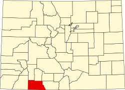
 Altura Location of Altura, Colorado.  Altura Altura (Colorado) | |
| Coordinates: 37°11′00″N107°11′28″W / 37.18333°N 107.1912°W [1] | |
| Country | United States |
| State | Colorado |
| County | Archuleta [2] |
| Tribe | Southern Ute Indian Tribe |
| Government | |
| • Type | unincorporated community |
| • Body | Archuleta County [2] |
| Elevation | 7,159 ft (2,182 m) |
| Time zone | UTC−07:00 (MST) |
| • Summer (DST) | UTC−06:00 (MDT) |
| GNIS pop ID | 184567 |
Altura is an unincorporated community on the Southern Ute Indian Reservation in Archuleta County, Colorado, United States. [1]