Chromo, Colorado | |
|---|---|
 Entering Chromo from the south on U.S. Route 84. | |
 Chromo Location of Chromo, Colorado.  Chromo Chromo (Colorado) | |
| Coordinates: 37°02′11″N106°50′36″W / 37.0364°N 106.8434°W [1] | |
| Country | United States |
| State | Colorado |
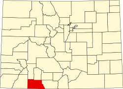
| County | Archuleta [2] |
| Government | |
| • Type | unincorporated community |
| • Body | Archuleta County [2] |
| Elevation | 7,284 ft (2,220 m) |
| Time zone | UTC−07:00 (MST) |
| • Summer (DST) | UTC−06:00 (MDT) |
| ZIP code [3] | 81128 |
| Area code | 719 |
| GNIS place ID | 191038 |
Chromo is an unincorporated community and U.S. Post Office in Archuleta County, Colorado, United States. The Chromo Post Office has the ZIP Code 81128. [3]
Contents
The community takes its name from nearby Chromo Mountain. [4]