Amorita, Oklahoma

Last updated

Amorita, Oklahoma
OKMap-doton-Amorita.PNG
Location of Amorita, Oklahoma
Coordinates: 36°55′26″N98°17′37″W / 36.92389°N 98.29361°W / 36.92389; -98.29361
Country United States
State Oklahoma
County Alfalfa
Area
[1]
  Total0.25 sq mi (0.65 km2)
  Land0.25 sq mi (0.65 km2)
  Water0.00 sq mi (0.00 km2)
Elevation
[2]
1,207 ft (368 m)
Population
 (2020)
  Total38
  Density150.20/sq mi (58.07/km2)
Time zone UTC-6 (Central (CST))
  Summer (DST) UTC-5 (CDT)
ZIP code
73719
Area code 580
FIPS code 40-02000 [3]
GNIS feature ID2412362 [2]

Amorita is a town in Alfalfa County, Oklahoma, United States. The population was 38 at the time of the 2020 Census. [4]

Contents

History

Amorita was founded in September 1901. It is speculated that Amorita was likely named after the wife of railroad owner, Charles E. Ingersoll. At the time of its founding, the area was part of the much larger Woods county. It did not become part of present-day Alfalfa county until the time of statehood in 1907. [5]

The town was established in Byron township in 1901 approximately two miles north of the existing town of Byron, by what was then known as the Choctaw Northern Railroad, later owned by the Chicago, Rock Island and Pacific. [5] In that year, the railroad became the county's first, connecting Amorita to the other Alfalfa county towns of Aline, Augusta, Ingersoll, Lambert, Driftwood, and on into Kansas. [6] City lots were sold when the railroad completed its rail line through the county in November 1901. [5]

Although the initial sale of lots in November was small, within a month a butcher shop and a coal and grain business were established, and by February of the following year, two grain elevators were also opened. Farming was the predominant economic activity in the area at the time. [5] The town was temporarily given a competitive advantage as a transportation hub because nearby Byron did not acquire its own competing railroad access (the Kansas City, Mexico and Orient Railway) until October 1902. [7]

Residents voted to incorporate their town in May 1912. In 1919 a fifty-thousand-dollar bond was approved to construct a new school building for the consolidated schools of Amorita and two other districts. In 1921, voters of both Byron and Amorita jointly approved the construction of power lines extending from Kansas to supply electricity to both their towns. [5]

The railroad abandoned its line through the town in 1936. In the 1960s, the Amorita school was consolidated into a single entity along with the nearby districts of Burlington, Byron, and Driftwood, which was located in Burlington. [5]

Geography

Amorita lies along State Highway 58, [8] between Byron to the south and the Kansas border to the north. [9]

The town has a total area of 0.26 square miles (0.67 km2), all land, with a population density of 153 people per square mile.

Demographics

Historical population
CensusPop.Note
1920 196
1930 194−1.0%
1940 2087.2%
1950 125−39.9%
1960 74−40.8%
1970 63−14.9%
1980 664.8%
1990 56−15.2%
2000 44−21.4%
2010 37−15.9%
2020 382.7%
U.S. Decennial Census [10]

2010 census

As of the census of 2010, there were 37 people living in the town. [11] The population density was 172.4 inhabitants per square mile (66.6/km2). There were 19 housing units in the town. [11] The racial makeup of the town was 84.09% White, 6.82% African American, 4.55% Native American, and 4.55% from two or more races. Hispanic or Latino of any race were 2.27% of the population.

There were 14 households in the town, [11] out of which 22.7% had children under the age of 18 living with them, 45.5% were married couples living together, 13.6% had a female householder with no husband present, and 36.4% were non-families. 36.4% of all households were made up of individuals, and 27.3% had someone living alone who was 65 years of age or older. The average household size was 2.00 and the average family size was 2.57.

In the town, the population was spread out, with 22.7% under the age of 18, 6.8% from 18 to 24, 18.2% from 25 to 44, 22.7% from 45 to 64, and 29.5% who were 65 years of age or older. The median age was 46 years. For every 100 females, there were 57.1 males. For every 100 females aged 18 and over, there were 70.0 males.

The median income for a household in the town was $27,500, and the median income for a family was $38,125. Males had a median income of $21,875 versus $30,625 for females. The per capita income for the town was $12,137. There were 15.4% of families and 7.8% of the population living below the poverty line, including no one under the age of eighteen and none of those over 64.

Related Research Articles

<span class="mw-page-title-main">Garfield County, Oklahoma</span> County in Oklahoma, United States

Garfield County is a county located in the U.S. state of Oklahoma. As of the 2020 census, the population was 62,846. Enid is the county seat and largest city within Garfield County. The county is named after President James A. Garfield.

<span class="mw-page-title-main">Alfalfa County, Oklahoma</span> County in Oklahoma, United States

Alfalfa County is a county located in the U.S. state of Oklahoma. As of the 2020 census, the population was 5,699. The county seat is Cherokee.

<span class="mw-page-title-main">Aline, Oklahoma</span> Town in Oklahoma, United States

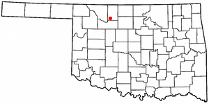
Aline is a town in Alfalfa County, Oklahoma, United States. The population was 168 at the time of the 2020 Census.

<span class="mw-page-title-main">Burlington, Oklahoma</span> Town in Oklahoma, United States

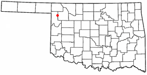
Burlington is a town in northwestern Alfalfa County, Oklahoma, United States. The population was 152 at the 2010 census.

<span class="mw-page-title-main">Byron, Oklahoma</span> Town in Oklahoma, United States

Byron is a town in Alfalfa County, Oklahoma, United States. The population was 35 at the time of the 2010 census.

<span class="mw-page-title-main">Cherokee, Oklahoma</span> City in Oklahoma, United States

Cherokee is the largest city within, and county seat of, Alfalfa County, Oklahoma, United States. The population was 1,476 at the 2020 census, a decline of 1.5 percent from 2010.

<span class="mw-page-title-main">Goltry, Oklahoma</span> Town in Oklahoma, United States

Goltry is an incorporated rural small town in Alfalfa County, Oklahoma, United States. The population was 249 at the 2010 census. Located there are a town hall, a post office, a farmer's co-op with gas service, a fire department, and a bank, with several blocks of homes.

<span class="mw-page-title-main">Helena, Oklahoma</span> Town in Oklahoma, United States

Helena is a town in southeastern Alfalfa County, Oklahoma, United States. Residents pronounce the town's name with a long E: "Heh-LEE'-nuh." The population was 1,403 at the 2010 census.

<span class="mw-page-title-main">Jet, Oklahoma</span> Town in Oklahoma, United States

Jet is a town in southeast Alfalfa County, Oklahoma, United States. The population was 197 at the time of the 2020 Census.

<span class="mw-page-title-main">Lambert, Oklahoma</span> Town in Oklahoma, United States

Lambert is a town in Alfalfa County, Oklahoma, United States. The population was 5 at the time of the 2020 Census.

<span class="mw-page-title-main">Fargo, Oklahoma</span> Town in Oklahoma, United States

Fargo is a town in Ellis County, Oklahoma, United States. The population was 312 at the time of the 2020 census. Fargo, like many towns in the region, has never fully recovered from the Dust Bowl years.

<span class="mw-page-title-main">Shattuck, Oklahoma</span> Town in Oklahoma, United States

Shattuck is a town in Ellis County, Oklahoma, United States. The population was 1,249 at the time of the 2020 census, a change from the 1,356 reported in the 2010 census.

<span class="mw-page-title-main">Breckinridge, Oklahoma</span> Town in Oklahoma, United States

Breckinridge, sometimes spelled Breckenridge, is a town in Garfield County, Oklahoma, United States. The population was 199 as of the 2020 Census.

<span class="mw-page-title-main">Covington, Oklahoma</span> Town in Oklahoma, United States

Covington is a town in Garfield County, Oklahoma, United States. The population was 477 at the 2020 census.

<span class="mw-page-title-main">Drummond, Oklahoma</span> Town in Oklahoma, United States

Drummond is a town in Garfield County, Oklahoma, United States. The population was 455 at the 2010 census, up from 405 in 2000.

<span class="mw-page-title-main">Fairmont, Oklahoma</span> Town in Oklahoma, United States

Fairmont is a town in Garfield County, Oklahoma, United States. The population was 134 at the 2010 census, a decrease from 147 at the 2000 census.

<span class="mw-page-title-main">Hunter, Oklahoma</span> Town in Oklahoma, United States

Hunter is a town in Garfield County, Oklahoma, United States. The population was 165 at the 2010 census, a 4.6 percent decline from the figure of 173 in 2000.

<span class="mw-page-title-main">Lahoma, Oklahoma</span> Town in Oklahoma, United States

Lahoma is a town in Garfield County, Oklahoma, United States. The population was 611 at the 2010 census, a 5.9 percent gain over the figure of 577 in 2000. Its name was formed from the last three syllables of Oklahoma. Until the 1960s, Lahoma was a farm town. Later, it became primarily a bedroom community for people who commuted to work in Enid.

Ingersoll is a small unincorporated community in Alfalfa County, Oklahoma, United States.

Driftwood is a small unincorporated community in northern Alfalfa County, Oklahoma, United States. A formerly prosperous small rural community, at one time it had two churches, a grocery store, barber shop, gas station with repair shop, grain elevator, two-story school, a telephone office, bank, and post office. Currently, it is made up of less than a dozen residences - along with a church and cemetery - grouped along both sides of Oklahoma State Highway 8/State Highway 58.

References

  1. "ArcGIS REST Services Directory". United States Census Bureau. Retrieved September 20, 2022.
  2. 1 2 U.S. Geological Survey Geographic Names Information System: Amorita, Oklahoma
  3. "U.S. Census website". United States Census Bureau . Retrieved January 31, 2008.
  4. "Amorita (town), Oklahoma". United States Census Bureau. Retrieved April 20, 2024.
  5. 1 2 3 4 5 6 Everett, Dianna. "Encyclopedia of Oklahoma History and Culture - Amorita". Encyclopedia of Oklahoma History and Culture. Oklahoma Historical Society. Retrieved June 13, 2016.
  6. Everett, Dianna. "Encyclopedia of Oklahoma History and Culture - Alfalfa County". Encyclopedia of Oklahoma History and Culture. Oklahoma History Center. Retrieved July 7, 2016.
  7. Everett, Dianna. "Encyclopedia of Oklahoma History and Culture - Byron". Encyclopedia of Oklahoma History and Culture. Oklahoma Historical Society. Retrieved June 13, 2016.
  8. Oklahoma 2009-2010 Official State Map (PDF) (Map) (2009-2010 ed.). Oklahoma Department of Transportation. Retrieved August 31, 2016.
  9. "Amorita, Oklahoma". Google Maps. Retrieved July 5, 2020.
  10. "Census of Population and Housing". Census.gov. Retrieved June 4, 2015.
  11. 1 2 3 "2010 City Population and Housing Occupancy Status". U.S. Census Bureau. Retrieved October 18, 2013.[ dead link ]