East Loch Tarbert, Argyll

Last updated

East Loch Tarbert
Tarbert.JPG
East Loch Tarbert, looking towards Loch Fyne
Scotland relief location map.jpg
Red pog.svg
East Loch Tarbert
Location Loch Fyne, Firth of Clyde
Coordinates 55°52′3″N5°23′55″W / 55.86750°N 5.39861°W / 55.86750; -5.39861
Type Sea Loch
FrozenNo

East Loch Tarbert, Argyll is a small sea loch on the eastern side of the Kintyre Peninsula, in Argyll and Bute, west of Scotland. It is a part of the much larger Loch Fyne. The village of Tarbert is distributed along the shores of the loch. [1] East Loch Tarbert is separated from West Loch Tarbert by an isthmus, that is only 1.5 kilometres (0.93 mi) long. [2]

Contents

Full-scale replica of a Viking longship Moragsoorm.jpg
Full-scale replica of a Viking longship
Blaeu's 1654 Atlas with the Tarbert isthmus at right. The map is oriented with west at the top. Blaeu - Atlas of Scotland 1654 - CANTYRA - Kintyre.jpg
Blaeu's 1654 Atlas with the Tarbert isthmus at right. The map is oriented with west at the top.

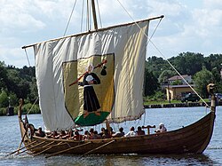
According to Snorri Sturluson's Heimskringla , Magnus Barefoot, King of Norway, had his longship dragged across this isthmus as part of a campaign to increase his possessions in the Hebrides. He made an arrangement with King Malcolm III of Scotland that he could take possession of land on the west coast around which a ship could sail. Magnus declared that Kintyre had "better land than the best of the Hebrides", and by taking command of his ship's tiller and "sailing" across the isthmus he was able to claim the entire peninsula, which remained under Norse rule for more than a dozen years as a result. [3] [4] [5]

More than two centuries later Robert the Bruce completed a similar feat during the Scottish Wars of Independence in order to impress the clan chieftains of Argyll. He used tree trunks as rollers. [6]

In the 18th century Thomas Pennant recorded that sea-going vessels of up to 10 tonnes (9.8 long tons) were being hauled over the isthmus in order to avoid the dangers of storms and tidal races in the seas surrounding the Mull of Kintyre. James Watt surveyed the area and decided that it was feasible to construct a canal between the two lochs. Some 60 years later it was estimated that the cost for a cut without locks would be £90,000 but delays in implementation and the construction of the Crinan canal in 1801 rendered the plan redundant. [6]

In the modern era the Tarbert (Loch Fyne) Harbour Commissioners control the loch, an area defined as "from the point of Garvell on the North, to the Oakenhead or Rudha Loigste point on the South". There are various quays and slipways in the inner harbour and 80 pontoon berths for yachts and other leisure craft. [7]

Related Research Articles

<span class="mw-page-title-main">Islands of the Clyde</span> Scottish island group

The Islands of the Firth of Clyde are the fifth largest of the major Scottish island groups after the Inner and Outer Hebrides, Orkney and Shetland. They are situated in the Firth of Clyde between Argyll and Bute in the west and Inverclyde, North Ayrshire and South Ayrshire in the east. There are about forty islands and skerries. Only four are inhabited, and only nine are larger than 40 hectares. The largest and most populous are Arran and Bute. They are served by dedicated ferry routes, as are Great Cumbrae and Holy Island. Unlike the isles in the four larger Scottish archipelagos, none of the isles in this group are connected to one another or to the mainland by bridges.

<span class="mw-page-title-main">Argyll and Bute</span> Council area of Scotland

Argyll and Bute is one of 32 unitary council areas in Scotland and a lieutenancy area. The current lord-lieutenant for Argyll and Bute is Jane Margaret MacLeod. The administrative centre for the council area is in Lochgilphead at Kilmory Castle, a 19th-century Gothic Revival building and estate. The current council leader is Councillor Jim Lynch.

<span class="mw-page-title-main">Kingdom of the Isles</span> 9th – 13th century kingdom in British Isles

The Kingdom of the Isles was a Norse-Gaelic kingdom comprising the Isle of Man, the Hebrides and the islands of the Clyde from the 9th to the 13th centuries AD. The islands were known to the Norsemen as the Suðreyjar, or "Southern Isles" as distinct from the Norðreyjar or Northern Isles of Orkney and Shetland. In Scottish Gaelic, the kingdom is known as Rìoghachd nan Eilean. The territory is sometimes called the Kingdom of Mann and the Isles, although only some of the later rulers claimed that title. The historical record is incomplete, and the kingdom was not a continuous entity throughout the entire period. At times the rulers were independent of external control, although for much of the period they had overlords in Norway, Ireland, England, Scotland or Orkney. At times there also appear to have been competing claims for all or parts of the territory. The islands have a total land area of over 8,300 square kilometres (3,205 sq mi) and extend for more than 500 kilometres (310 mi) from north to south.

<span class="mw-page-title-main">Argyll</span> Historic county in Scotland

Argyll, sometimes called Argyllshire, is a historic county and registration county of western Scotland.

<span class="mw-page-title-main">Kintyre</span> Peninsula in Argyll and Bute, Scotland, UK

Kintyre is a peninsula in western Scotland, in the southwest of Argyll and Bute. The peninsula stretches about 30 miles, from the Mull of Kintyre in the south to East and West Loch Tarbert in the north. The region immediately north of Kintyre is known as Knapdale.

<span class="mw-page-title-main">Gigha</span> Island in Scotland

Gigha or the Isle of Gigha is an island off the west coast of Kintyre in Scotland. The island forms part of Argyll and Bute and has a population of 163 people. The climate is mild with higher than average sunshine hours and the soils are fertile. The main settlement is Ardminish.

<span class="mw-page-title-main">Lord of the Isles</span> Title of Scottish nobility

Lord of the Isles or King of the Isles (Scottish Gaelic: Triath nan Eilean or Rìgh Innse Gall; Latin: Dominus Insularum) is a title of Scottish nobility with historical roots that go back beyond the Kingdom of Scotland. It began with Somerled in the 12th century and thereafter the title was held by a series of his descendants, the Norse-Gaelic rulers of the Isle of Man and Argyll and the islands of Scotland in the Middle Ages. They wielded sea-power with fleets of galleys (birlinns). Although they were, at times, nominal vassals of the kings of Norway, Ireland, or Scotland, the island chiefs remained functionally independent for many centuries. Their territory included much of Argyll, the Isles of Arran, Bute, Islay, the Isle of Man, Hebrides, Knoydart, Ardnamurchan, and the Kintyre peninsula. At their height they were the greatest landowners and most powerful lords after the kings of England and Scotland.

<span class="mw-page-title-main">Knapdale</span> Parishes and area in Scotland

Knapdale forms a rural district of Argyll and Bute in the Scottish Highlands, adjoining Kintyre to the south, and divided from the rest of Argyll to the north by the Crinan Canal. It includes two parishes, North Knapdale and South Knapdale. The area is bounded by sea to the east and west, whilst the sea loch of West Loch Tarbert almost completely cuts off the area from Kintyre to the south. The name is derived from two Gaelic elements: Cnap meaning hill and Dall meaning field.

<span class="mw-page-title-main">Cowal</span> Peninsula in Argyll and Bute, Scotland

Cowal is a rugged peninsula in Argyll and Bute, on the west coast of Scotland. It is connected to the mainland to the north, and is bounded by Loch Fyne to the west, by Loch Long and the Firth of Clyde to the east, and by the Kyles of Bute to the south.

<span class="mw-page-title-main">Loch Fyne</span> Sea inlet on west coast of Scotland

Loch Fyne, is a sea loch off the Firth of Clyde and forms part of the coast of the Cowal Peninsula. Located on the west coast of Argyll and Bute, west of Scotland. It extends 65 kilometres (40 mi) inland from the Sound of Bute, making it the longest of the sea lochs in Scotland. It is connected to the Sound of Jura by the Crinan Canal. Although there is no evidence that grapes have grown there, the title is probably honorific, indicating that the river, Abhainn Fìne, was a well-respected river.

<span class="mw-page-title-main">Leverburgh</span> Human settlement in Scotland

Leverburgh is the second largest village, after Tarbert, in Harris in the Outer Hebrides of Scotland. Leverburgh is within the parish of Harris. In 1971 it had a population of 223.

<span class="mw-page-title-main">Tarbert, Kintyre</span> Village in Argyll and Bute, Scotland

Tarbert is a village in the west of Scotland, in the Argyll and Bute council area. It is built around East Loch Tarbert, an inlet of Loch Fyne, and extends over the isthmus which links the peninsula of Kintyre to Knapdale and West Loch Tarbert. Tarbert had a recorded population of 1,338 in the 2001 Census.

Tarbert is a place name in Scotland and Ireland. Places named Tarbert are characterised by a narrow strip of land, or isthmus. This can be where two lochs nearly meet, or a causeway out to an island.

<span class="mw-page-title-main">Portavadie</span> Human settlement in Scotland

Portavadie is a village on the shores of Loch Fyne on the coast of the Cowal Peninsula, in Argyll and Bute, West of Scotland.

Tarbert a place name in Scotland and Ireland.

National Cycle Route 75 runs from Edinburgh to Tarbert on the Kintyre peninsula, via Glasgow. It is often known as the Clyde to Forth cycle route.

<span class="mw-page-title-main">East Loch Tarbert</span>

East Loch Tarbert is a sea loch that lies to the east of Harris in the Outer Hebrides of Scotland. The loch contains several small islands including Sgeotasaigh, Stiughiag, Stiughiag na Leum and Rosaigh and the larger bridged island of Scalpay. The Caledonian MacBrayne ferry from the Isle of Skye to Harris reaches Tarbert via this loch.

<span class="mw-page-title-main">West Loch Tarbert, Argyll</span> West Loch Tarbert, Argyll, Scotland

West Loch Tarbert is a long, narrow sea loch on the western side of the Kintyre Peninsula, in Argyll and Bute, west of Scotland.

Tarbertshire, or the sheriffdom of Tarbert, was a shire of Scotland until 1633, when it was annexed to Argyllshire. It comprised the mainland peninsula formed by Knapdale and Kintyre, together with the southern Inner Hebrides to the west.

References

Footnotes

  1. "East Loch Tarbert" Gazetteer for Scotland. Retrieved 13 September 2008.
  2. "West Loch Tarbert" Gazetteer for Scotland. Retrieved 13 September 2008.
  3. Magnus's saga, chapter 10 in Hollander (1964), pp. 676677.
  4. Murray (1977) p. 100. has the date as 1093.
  5. "Tarbert History" Archived 2008-12-20 at the Wayback Machine Tarbert.info. Retrieved 13 September 2008.
  6. 1 2 Murray (1977) pp. 10001.
  7. "Tarbert (Loch Fyne)" Ports and Harbours of the UK. Retrieved 15 September 2008.