| Hirakata 枚方市 | |||
|---|---|---|---|
| Core City | |||
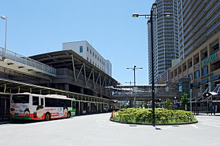
 Hirakata Park | |||
| |||
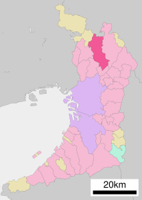
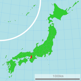
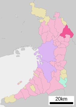 Location of Hirakata in Osaka Prefecture | |||
 Hirakata Location in Japan | |||
| Coordinates: 34°49′N135°39′E / 34.817°N 135.650°E Coordinates: 34°49′N135°39′E / 34.817°N 135.650°E | |||
| Country | Japan | ||
| Region | Kansai | ||
| Prefecture | Osaka Prefecture | ||
| Government | |||
| • Mayor | Hiroshi Nakatsuka | ||
| Area | |||
| • Total | 65.08 km2 (25.13 sq mi) | ||
| Population (October 1, 2016) | |||
| • Total | 402,927 | ||
| • Density | 6,200/km2 (16,000/sq mi) | ||
| Symbols | |||
| • Tree | Willow | ||
| • Flower | Chrysanthemum | ||
| • Bird | Common kingfisher | ||
| Time zone | Japan Standard Time (UTC+9) | ||
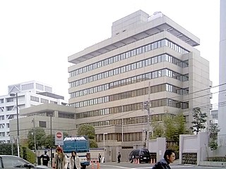
| City hall address | 2-1-20 Ogaito-chō, Hirakata-shi, Osaka-fu 573-8666 | ||
| Website | Official website | ||


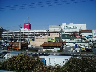
Hirakata(枚方市Hirakata-shi) is a city in northeastern Osaka Prefecture, Japan. [1] It is known for Hirakata Park, an amusement park which includes roller coasters made of wood. [2]

A city is a local administrative unit in Japan. Cities are ranked on the same level as towns and villages, with the difference that they are not a component of districts. Like other contemporary administrative units, they are defined by the Local Autonomy Law of 1947.
Osaka Prefecture is a prefecture located in the Kansai region on Honshu, the main island of Japan. The capital is the city of Osaka. It is the center of Osaka-Kobe-Kyoto area. Osaka is one of the two "urban prefectures" of Japan, Kyoto being the other.
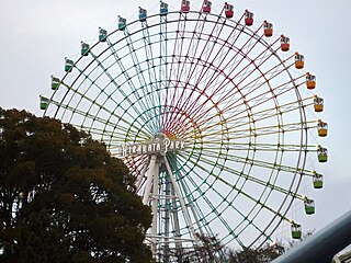
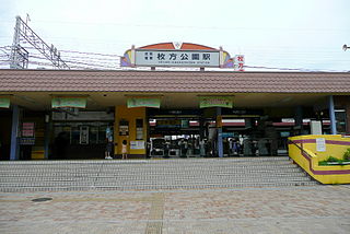
Hirakata Park is an amusement park in Hirakata, Osaka, Japan, nicknamed "Hirapah". The park is managed by Keihan Leisure Service and is located on the Keihan line at Hirakata-kōen Station (枚方公園駅). It takes advantage of its hilly landscape to site 43 attractions on 160,000 square meters.
Contents
- History
- Mayors
- Demographics
- Ethnic Koreans
- Burakumin
- Education
- Transportation
- Rail
- Roads
- Companies with offices in Hirakata
- Sister and friendship cities
- References
- External links
As of October 1, 2016, the city has an estimated population of 402,927, and a population density of 6,200 persons per km2. The total area of the city is 65.07 km2.

In biology, a population is all the organisms of the same group or species, which live in a particular geographical area, and have the capability of interbreeding. The area of a sexual population is the area where inter-breeding is potentially possible between any pair within the area, and where the probability of interbreeding is greater than the probability of cross-breeding with individuals from other areas.

Population density is a measurement of population per unit area or unit volume; it is a quantity of type number density. It is frequently applied to living organisms, and most of the time to humans. It is a key geographical term. In simple terms population density refers to the number of people living in an area per kilometer square.
Eriko Aoki, author of "Korean children, textbooks, and educational practices in Japanese primary schools," stated that the city's location in proximity to both Osaka City and Kyoto contributed to its population growth of ten times its previous size from around 1973 to 2013. [3]

Kyoto, officially Kyoto City, is the capital city of Kyoto Prefecture, located in the Kansai region of Japan. It is best known in Japanese history for being the former Imperial capital of Japan for more than one thousand years, as well as a major part of the Kyoto-Osaka-Kobe metropolitan area.