Huttonsville, West Virginia | |
---|---|
Coordinates: 38°42′48″N79°58′38″W / 38.71333°N 79.97722°W | |
Country | United States |
State | West Virginia |
County | Randolph |
Area | |
• Total | 0.30 sq mi (0.78 km2) |
• Land | 0.30 sq mi (0.78 km2) |
• Water | 0.00 sq mi (0.00 km2) |
Elevation | 2,037 ft (621 m) |
Population | |
• Total | 163 |
• Estimate (2021) [3] | 162 |
• Density | 693.07/sq mi (267.58/km2) |
Time zone | UTC-5 (Eastern (EST)) |
• Summer (DST) | UTC-4 (EDT) |
ZIP code | 26273 |
Area code | 304 |
FIPS code | 54-39628 [4] |
GNIS feature ID | 1551537 [2] |
Website | https://townofhuttonsville.com/ |
Huttonsville is a town in Randolph County, West Virginia, United States, along the Tygart Valley River. The population was 163 at the 2020 census. [3]
Huttonsville was named for Jonathan Hutton, a pioneer settler. [5] [6]
Located at Huttonsville are the E. E. Hutton House and Tygarts Valley Church, listed on the National Register of Historic Places. [7] Located near Huttonsville are the site of Cheat Summit Fort and Fort Marrow, also listed on the Register. [7]
Huttonsville Correctional Center of the West Virginia Division of Corrections and Rehabilitation is located in the area.
Huttonsville is located at 38°42′48″N79°58′38″W / 38.71333°N 79.97722°W (38.713266, -79.977329). [8]
According to the United States Census Bureau, the town has a total area of 0.30 square miles (0.78 km2), all land. [9]
The climate in this area has mild differences between highs and lows, and there is adequate rainfall year-round. According to the Köppen Climate Classification system, Huttonsville has a marine west coast climate, abbreviated "Cfb" on climate maps. [10]
Census | Pop. | Note | %± |
---|---|---|---|
1910 | 251 | — | |
1920 | 265 | 5.6% | |
1930 | 303 | 14.3% | |
1940 | 308 | 1.7% | |
1950 | 227 | −26.3% | |
1960 | 242 | 6.6% | |
1970 | 167 | −31.0% | |
1980 | 242 | 44.9% | |
1990 | 211 | −12.8% | |
2000 | 217 | 2.8% | |
2010 | 221 | 1.8% | |
2020 | 163 | −26.2% | |
2021 (est.) | 162 | [3] | −0.6% |
U.S. Decennial Census [11] |
At the 2010 census there were 221 people, 87 households, and 56 families living in the town. The population density was 736.7 inhabitants per square mile (284.4/km2). There were 105 housing units at an average density of 350.0 per square mile (135.1/km2). The racial makeup of the town was 99.5% White and 0.5% from two or more races. Hispanic or Latino of any race were 2.3%. [12]
Of the 87 households 33.3% had children under the age of 18 living with them, 40.2% were married couples living together, 13.8% had a female householder with no husband present, 10.3% had a male householder with no wife present, and 35.6% were non-families. 31.0% of households were one person and 18.3% were one person aged 65 or older. The average household size was 2.54 and the average family size was 3.11.
The median age in the town was 32.4 years. 28.1% of residents were under the age of 18; 12.6% were between the ages of 18 and 24; 21.7% were from 25 to 44; 23% were from 45 to 64; and 14.5% were 65 or older. The gender makeup of the town was 48.0% male and 52.0% female.
At the 2000 census there were 217 people, 83 households, and 62 families living in the town. The population density was 707.3 inhabitants per square mile (270.3/km2). There were 96 housing units at an average density of 312.9 per square mile (119.6/km2). The racial makeup of the town was 99.08% White and 0.92% Asian. [4] Of the 83 households 36.1% had children under the age of 18 living with them, 63.9% were married couples living together, 8.4% had a female householder with no husband present, and 24.1% were non-families. 22.9% of households were one person and 13.3% were one person aged 65 or older. The average household size was 2.61 and the average family size was 3.06.
The age distribution was 25.8% under the age of 18, 10.1% from 18 to 24, 30.9% from 25 to 44, 21.7% from 45 to 64, and 11.5% 65 or older. The median age was 35 years. For every 100 females, there were 88.7 males. For every 100 females age 18 and over, there were 91.7 males.
The median household income was $22,321 and the median family income was $24,821. Males had a median income of $24,107 versus $12,321 for females. The per capita income for the town was $11,827. About 14.5% of families and 16.6% of the population were below the poverty line, including 28.4% of those under the age of eighteen and 7.1% of those sixty five or over.
Taylor County is a county in the U.S. state of West Virginia. As of the 2020 census, the population was 16,705. Its county seat is Grafton. The county was formed in 1844 and named for Senator John Taylor of Caroline.
Randolph County is a county located in the U.S. state of West Virginia. As of the 2020 census, the population was 27,932. Its county seat is Elkins. The county was founded in 1787 and is named for Edmund Jennings Randolph.
Belington is a town in Barbour County, West Virginia, United States, situated along the Tygart Valley River. The population was 1,804 as of the 2020 census.
Junior is a town in Barbour County, West Virginia, United States, situated along the Tygart Valley River. The population was 384 at the 2020 census.
Burnsville is a town in Braxton County, West Virginia, United States, at the confluence of the Little Kanawha River and Saltlick Creek. The population was 401 at the 2020 census. Burnsville was incorporated in 1902 by the Circuit Court and named for Captain John Burns who operated the first sawmill in that section of the state and who established the town shortly after the close of the American Civil War. It was named "All West Virginia City" in 1976.
Jane Lew is a town in Lewis County, West Virginia, United States. The population was 409 at the time of the 2020 census.
Man is a town in Logan County, West Virginia, United States. The population was 772 at the 2020 census. The town is located along the Guyandotte River at the mouth of Buffalo Creek, which was the site of the 1972 Buffalo Creek Flood following a dam collapse. The name of the town reportedly derives from the last syllable of the surname of Ulysses Hinchman, who was a member of the House of Delegates from Logan County between 1866 and 1869.
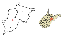
Henderson is an unincorporated community and former town in Mason County, West Virginia, United States, at the confluence of the Ohio and Kanawha Rivers. The population was 231 at the 2020 census. It is part of the Point Pleasant, WV–OH Micropolitan Statistical Area. The town was incorporated in 1893 and named for Samuel Bruce Henderson, who owned the townsite at the time. The town was unincorporated following a public hearing on August 11, 2022.
Matoaka is a census-designated place in Mercer County, West Virginia, United States. The population was 173 at the 2020 census. It is part of the Bluefield, WV-VA micropolitan area which has a population of 100,093. This town is named for Chief Powhatan's daughter Matoaka who was better known by her nickname "Pocahontas". Matoaka became an unincorporated town when it voted to dissolve its charter in May 2018.
Granville is a town in Monongalia County, West Virginia, United States. The population was 1,355 at the 2020 census. It is included in the Morgantown metropolitan area.
Albright is a town in central Preston County, West Virginia, United States, along the Cheat River. The population was 260 at the 2020 census. A former coal town, it is part of the Morgantown metropolitan area.
Eleanor is a town in Putnam County, West Virginia, United States, along the Kanawha River. Its population was 1,548 at the 2020 census. It is part of the Huntington–Ashland metropolitan area. The town, named for Eleanor Roosevelt, was established as a New Deal project in the 1930s like other Franklin D. Roosevelt towns around the nation.
Beverly is a town in Randolph County, West Virginia, United States. Founded in 1787, it is the oldest settlement in the Tygart River Valley. It had a population of 628 at the 2020 census. Beverly was the county seat of Randolph County for over a century—from 1790 until 1899—after which the nearby settlement of Elkins assumed that role following an intense local political "war".
Elkins is a city in and the county seat of Randolph County, West Virginia, United States, along the Tygart Valley River. The community was incorporated in 1890 and named in honor of Stephen Benton Elkins, a U.S. Senator from West Virginia. The population was 6,950 at the 2020 census and estimated at 6,895 in 2021. Elkins is home to Davis and Elkins College and the Mountain State Forest Festival, held in early October every year.
Mill Creek is a town in Randolph County, West Virginia, United States, along the Tygart Valley River. The population was 563 at the 2020 census.
Cairo is a town in Ritchie County, West Virginia, United States, along West Virginia Route 31, the North Fork of the Hughes River, and the North Bend Rail Trail. The population was 174 at the 2020 census.
Hambleton is a town in Tucker County, West Virginia, United States. The population was 216 at the 2020 census. Hambleton was established in 1889, but not incorporated until 1905. It was named by then United States Senator Stephen B. Elkins in honor of a stockholder by this name in the West Virginia Central Railroad Company. The town was previously known as Hulings.
Middlebourne is a town in Tyler County, West Virginia, United States. The population was 715 at the 2020 census. It serves as the county seat of Tyler County.
North Hills is a town in Wood County, West Virginia, United States. It is a suburb of Parkersburg. The population was 837 at the 2020 census. North Hills was incorporated on February 15, 1979.
Machias is a census-designated place (CDP) corresponding to the central village area within the town of Machias in Washington County, Maine, United States. The population of the CDP was 1,274 at the 2010 census.