Naval Base Kwajalein Naval Base Kwajalein in the Marshall Islands  Naval Base Kwajalein Naval Base Kwajalein (Pacific Ocean) | |
| Geography | |
|---|---|
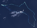
| Location | North Pacific Ocean |
| Coordinates | 8°43′55″N167°44′02″E / 8.732°N 167.734°E |
| Additional information | |
| Time zone |
|


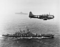
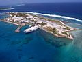
Naval Base Kwajalein was a United States Navy base built on Kwajalein Atoll, in the Marshall Islands to support the World War II efforts in the Pacific War. The base was built after the Battle of Kwajalein ended 3 February 1944. The US Navy built airfields, a seaport and a craft repair depot on the captured islands. The base was part of the vast Naval Base Marshall Islands. [1] [2] [3]