Temelec | |
---|---|
Coordinates: 38°16′0″N122°29′34″W / 38.26667°N 122.49278°W | |
Country | United States |
State | California |
County | Sonoma |
Area | |
• Total | 1.588 sq mi (4.113 km2) |
• Land | 1.588 sq mi (4.113 km2) |
• Water | 0 sq mi (0 km2) 0% |
Elevation | 98 ft (30 m) |
Population (2010) | |
• Total | 1,441 |
• Density | 910/sq mi (350/km2) |
Time zone | UTC-8 (PST) |
• Summer (DST) | UTC-7 (PDT) |
ZIP code | 95476 |
Area code | 707 |
FIPS code | 06-78126 |
GNIS feature ID | 1799782 |
Reference no. | 237 |
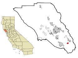
Temelec (Miwok: Tamuleko) [3] [4] is a census-designated place (CDP) in Sonoma County, California, United States. The population was 1,441 at the 2010 census.
Temelec is the site of Temelec Hall, built in 1858 by Captain Granville P. Swift, a member of the Bear Flag Party. The hall was owned by journalist Edmond Coblentz in the mid-1900s. [5] The hall is currently part of the Temelec Adult Community Center. Located at 220 Temelec Circle, it was designated California Historical Landmark #237. It is additionally a Sonoma County Historic Landmark.
According to the United States Census Bureau, the CDP has a total area of 1.6 square miles (4.1 km2), all land.
The 2010 United States Census [6] reported that Temelec had a population of 1,441. The population density was 907.4 inhabitants per square mile (350.3/km2). The racial makeup of Temelec was 1,376 (95.5%) White, 4 (0.3%) African American, 4 (0.3%) Native American, 31 (2.2%) Asian, 5 (0.3%) Pacific Islander, 5 (0.3%) from other races, and 16 (1.1%) from two or more races. Hispanic or Latino of any race were 68 persons (4.7%).
The Census reported that 100% of the population lived in households.
There were 960 households, out of which 8 (0.8%) had children under the age of 18 living in them, 318 (33.1%) were opposite-sex married couples living together, 45 (4.7%) had a female householder with no husband present, 12 (1.3%) had a male householder with no wife present. There were 30 (3.1%) unmarried opposite-sex partnerships, and 22 (2.3%) same-sex married couples or partnerships. 513 households (53.4%) were made up of individuals, and 398 (41.5%) had someone living alone who was 65 years of age or older. The average household size was 1.50. There were 375 families (39.1% of all households); the average family size was 2.07.
The population was spread out, with 11 people (0.8%) under the age of 18, 4 people (0.3%) aged 18 to 24, 23 people (1.6%) aged 25 to 44, 411 people (28.5%) aged 45 to 64, and 992 people (68.8%) who were 65 years of age or older. The median age was 71.5 years. For every 100 females, there were 63.9 males. For every 100 females age 18 and over, there were 63.6 males.
There were 1,051 housing units at an average density of 661.8 per square mile (255.5/km2), of which 86.7% were owner-occupied and 13.3% were occupied by renters. The homeowner vacancy rate was 3.9%; the rental vacancy rate was 6.5%. 87.2% of the population lived in owner-occupied housing units and 12.8% lived in rental housing units.
As of the census [7] of 2000, there were 1,556 people, 989 households, and 452 families residing in the CDP. The population density was 919.0 inhabitants per square mile (354.8/km2). There were 1,045 housing units at an average density of 617.2 per square mile (238.3/km2). The racial makeup of the CDP was 96.53% White, 0.06% African American, 0.39% Native American, 1.74% Asian, 0.13% Pacific Islander, 0.13% from other races, and 1.03% from two or more races. Hispanic or Latino of any race were 2.63% of the population.
There were 989 households, out of which 0.1% had children under the age of 18 living with them, 41.8% were married couples living together, 3.7% had a female householder with no husband present, and 54.2% were non-families. 47.1% of all households were made up of individuals, and 37.3% had someone living alone who was 65 years of age or older. The average household size was 1.56 and the average family size was 2.07.
In the CDP, the population was spread out, with 0.2% under the age of 18, 0.4% from 18 to 24, 2.6% from 25 to 44, 22.6% from 45 to 64, and 74.3% who were 65 years of age or older. The median age was 73 years. For every 100 females, there were 66.8 males. For every 100 females age 18 and over, there were 66.6 males.
The median income for a household in the CDP was $36,964, and the median income for a family was $49,766. Males had a median income of $45,781 versus $38,889 for females. The per capita income for the CDP was $33,678. About 1.8% of families and 3.5% of the population were below the poverty line, including none of those under age 18 and 2.1% of those age 65 or over.
In the state legislature, Temelec is located in the 3rd Senate District, and in the 12th Assembly District.
Federally, Temelec is in California's 4th congressional district , represented by Democrat Mike Thompson. [8]
The school district is Sonoma Valley Unified School District. [9]
Mesa is a census-designated place (CDP) in Inyo County, California, United States. The population was 251 at the 2010 census, up from 214 at the 2000 census.
West Bishop is a census-designated place (CDP) in Inyo County, California, United States. The population was 2,607 at the 2010 census, down from 2,807 at the 2000 census.
Weldon is a census-designated place (CDP) in Kern County, California, United States. It sits at the southeast tip of Lake Isabella. Weldon is located 9 miles (14 km) east-southeast of Wofford Heights, at an elevation of 2,654 feet (809 m). The population was 2,642 at the 2010 census, up from 2,387 at the 2000 census.
Tamalpais-Homestead Valley is a census-designated place (CDP) in Marin County, California, United States. The population was 11,492 at the 2020 census.
North Tustin is an unincorporated community and census designated place (CDP) in Orange County, California. The population was 25,718 at the 2020 census, up from 24,917 in 2010. For statistical purposes, the United States Census Bureau has defined North Tustin as a census-designated place (CDP). It is both the largest CDP and largest unincorporated community in Orange County. The CDP's name was changed from Tustin Foothills in 2005. Located outside the city limits of Tustin, North Tustin has 92705 and 92780 ZIP Codes.
El Verano is a census-designated place (CDP) in Sonoma Valley, Sonoma County, California, United States. The population was 4,123 at the 2010 census, falling to 3,867 at the 2020 census.
Eldridge is a census-designated place (CDP) in Sonoma County, California, United States. The population was 1,233 at the 2010 census. It is notably the home to the Sonoma Developmental Center, the largest facility serving the needs of persons with developmental disabilities in the state.
Glen Ellen is a census-designated place (CDP) in Sonoma Valley, Sonoma County, California, United States. The population was 784 at the 2010 census, down from 992 at the 2000 census. Glen Ellen is the location of Jack London State Historic Park, Sonoma Valley Regional Park, and a former home of Hunter S. Thompson.
Graton is an unincorporated town and census-designated place (CDP) in west Sonoma County, California, United States. The population was 1,707 at the 2010 census. Graton's ZIP code is 95444. The town also has a culinary reputation attributed to two restaurants in the area.
Monte Rio is a census-designated place (CDP) in Sonoma County, California along the Russian River near the Pacific Ocean. The town of Guerneville lies northeast of Monte Rio, and Jenner is to the west. The population was 1,152 at the 2010 census, up from 1,104 at the 2000 census. Bohemian Grove is located in Monte Rio.
Occidental is a census-designated place (CDP) in Sonoma County, California, United States. The population was 1,132 at the 2020 census, up from 1,115 at the 2010 census.
Roseland is a neighborhood in Santa Rosa, California. As of the 2010 census, the population was 6,325. Roseland was an unincorporated enclave within the City of Santa Rosa until the area was annexed by Santa Rosa on November 1, 2017.
Terra Bella is a census-designated place (CDP) in Tulare County, California, United States. The population was 2,910 at the 2020 census, down from 3,310 at the 2010 census.
Park View is a census-designated place (CDP) in Scott County, Iowa, United States. The population was 2,709 at the time of the 2020 census; up from 2,389 at the 2010 census.
Larkfield-Wikiup is a census-designated place unincorporated area in Sonoma County, California, United States. The population was 8,884 at the 2010 census, up from 7,479 at the 2000 census. It comprises the Mark West area between Santa Rosa, Windsor (north), Calistoga (east), and Fulton (west). There are at least four schools within the limits of the CDP, including Cardinal Newman High School, John B. Riebli Elementary School, Mark West Elementary, and San Miguel Elementary schools.
Oakville is an unincorporated community and census-designated place (CDP) in south St. Louis County, Missouri, United States. The population was 36,301 at the 2020 census. Oakville is 18 miles south of the city of St. Louis and borders the Mississippi and Meramec rivers; the area is part of "South County".
Lincolndale is a hamlet and census-designated place (CDP) located in the town of Somers in Westchester County, New York, United States. The population was 1,521 at the 2010 census.
Northridge is an unincorporated community in Harrison Township in Montgomery County, Ohio, United States. It was delineated as a census-designated place (CDP) for the 2000 census, at which time its population was 8,487. It is located directly north of the city of Dayton and is part of the Dayton Metropolitan Statistical Area.
Brittany Farms-The Highlands is a census-designated place (CDP) in Bucks County, Pennsylvania, United States. The population was 3,695 at the 2010 census. At the 2000 census, it was listed as "Brittany Farms-Highlands" CDP.
Marshallton is a census-designated place (CDP), located in Coal Township, in Northumberland County, Pennsylvania, United States. The population was 1,441 at the 2010 census.