Related Research Articles
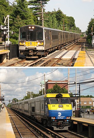
The Long Island Rail Road, often abbreviated as the LIRR, is a commuter rail system in the southeastern part of the U.S. state of New York, stretching from Manhattan to the eastern tip of Suffolk County on Long Island. With an average weekday ridership of 354,800 passengers in 2016, it is the busiest commuter railroad in North America. It is also one of the world's few commuter systems that runs 24/7 year-round. It is publicly owned by the Metropolitan Transportation Authority, which refers to it as MTA Long Island Rail Road. In 2022, the system had a ridership of 70,342,700, or about 253,800 per weekday as of the second quarter of 2023.

Hampton Bays is a hamlet and census-designated place (CDP) in the Town of Southampton in Suffolk County, on Long Island, in New York. It is considered as part of the region of Long Island known as The Hamptons. The population was 13,603 at the 2010 census.

Montauk is a hamlet and census-designated place (CDP) in the Town of East Hampton in Suffolk County, New York, on the eastern end of the South Shore of Long Island. As of the 2020 United States census, the CDP's population was 4,318.
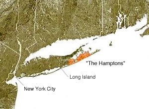
The South Fork of Suffolk County, New York is a peninsula in the southeastern section of the county on the South Shore of Long Island. The South Fork includes most of the Hamptons. The shorter, more northerly peninsula is known as the North Fork.

Mastic–Shirley is a station on the Long Island Rail Road's Montauk Branch in Shirley, New York. This station is reached via William Floyd Parkway. The station has two ticket machines.

The Shinnecock Canal is a canal that cuts across the South Fork at Hampton Bays, New York. At 4,700 feet (1,400 m) long, it connects Great Peconic Bay and the north fork of Long Island with Shinnecock Bay and the Atlantic Ocean. The canal opened to traffic in 1892.

The Montauk Branch is a rail line owned and operated by the Long Island Rail Road in the U.S. state of New York. The line runs the length of Long Island, 115 miles (185 km) from Long Island City to Montauk. However, in LIRR maps and schedules for public use, the term Montauk Branch refers to the line east of Babylon; service from Jamaica to Babylon is covered by separate Babylon Branch schedules, while the line west of Jamaica is currently unused for passenger service. A select number of Montauk Branch trains operate via the Main Line during peak hours.
The West Hempstead Branch is an electrified rail line owned and operated by the Long Island Rail Road (LIRR) in the U.S. state of New York. It runs between Valley Stream, New York, and West Hempstead, New York.
The Main Line is a rail line owned and operated by the Long Island Rail Road in the U.S. state of New York. It begins as a two-track line at Long Island City station in Long Island City, Queens, and runs along the middle of Long Island about 95 miles (153 km) to Greenport station in Greenport, Suffolk County. At Harold Interlocking approximately one mile east of Long Island City, the tracks from the East River Tunnels and 63rd Street Tunnel into Manhattan intersect with the Main Line, which most trains use rather than continuing to Long Island City station.
The Long Island Rail Road is a railroad owned by the Metropolitan Transportation Authority in the U.S. state of New York. It is the oldest United States railroad still operating under its original name and charter. It consolidated several other companies in the late 19th century. The Pennsylvania Railroad owned the Long Island Rail Road for the majority of the 20th century and sold it to the State in 1966.
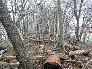
Brooklyn Manor was a station on the Long Island Rail Road's Rockaway Beach Branch located on the south side of Jamaica Avenue at 100th Street, straddling the border between Richmond Hill and Woodhaven in Queens, New York City. The station name referred to the nearby Brooklyn Manor section of Woodhaven, originally a 603-lot development bounded by Woodhaven Boulevard to the west, 96th/98th Streets to the east, Forest Park to the north, and Jamaica Avenue to the south. The station opened in January 1911, and was constructed as a replacement for the Brooklyn Hills station, which was located 3,000 feet (910 m) to the north. This station closed along with the rest of the Rockaway Beach Branch in 1962, and was subsequently demolished.
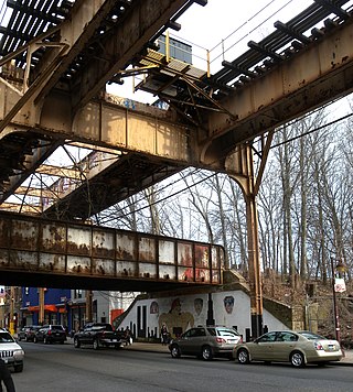
Parkside is a former elevated Long Island Rail Road (LIRR) station on the north side of Metropolitan Avenue on the border of the Rego Park, Forest Hills, and Glendale neighborhoods in Queens, New York City. Opened in 1927, the wooden station was part of the Rockaway Beach Branch and was the northernmost station on the branch before the junction with the Main Line at Rego Park Station and the terminus of the line at Grand Street station in Elmhurst. It also had a connecting spur to the Montauk Branch east towards Richmond Hill station. The station was closed in 1962, twelve years after the LIRR had abandoned the Rockaway portions of the line.
Bayport was a station stop along the Montauk Branch of the Long Island Rail Road. It was located on Railroad Street between Oakwood and Snedecor Avenues in Bayport, New York, and was the easternmost station along the Montauk Branch in the Town of Islip.

Hagerman was a rail station stop in Hagerman, New York along the Montauk Branch. It first opened around October 1890, and though little more than a small shack, it was the site of a former experimental electric-powered monorail line. It was later razed and discontinued as a station stop in 1929. It was located between the Patchogue and Bellport stations.

Peconic was a station stop along the Greenport Branch of the Long Island Rail Road in Peconic, New York. The station was originally built as Hermitage station on May 1, 1848 but was renamed Peconic on the June 1876 timetable. In August 1876 a second Peconic Station replaced the former one, which was built on the south side of the tracks and on the west side of Peconic Lane. This building also served as the post office. That station was razed in April 1942 and replaced with a shelter along the platform. The post office moved to the grocery store next door where it remains to this day. When Cutchogue station was closed in June 1962, the two nearest replacements were Mattituck station, which still exists today, and Peconic station, which was discontinued in 1970.

South Farmingdale was a station along the Central Branch of the Long Island Rail Road in South Farmingdale, New York, United States.
Suffolk Downs was a seasonal flag stop along the Montauk Branch of the Long Island Rail Road and was first built in 1907. The depot was purchased by an LIRR employee and was moved to Peconic Bay at an undisclosed location on February 6, 1923 and the station stop itself closed around 1927. The station stop was located between Canoe Place and Shinnecock Hills Stations.

Water Mill is a former Long Island Rail Road station on the Montauk Branch of the Long Island Rail Road. It was located at the end of a dead-end street off Montauk Highway in Water Mill, New York.
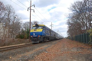
The Cannonball is a seasonal named train operated by the Long Island Rail Road between Penn Station and Montauk. The train operates from May through October, running Fridays to Montauk and Sundays to New York.
References
- 1 2 3 Morrison, David D. (2021). Long Island Rail Road: Montauk Branch. Charleston, SC: Arcadia Publishing. p. 83. ISBN 9781467106900.
- ↑ "Montauk". Letter to the Editor. The New York Times. November 5, 1989. p. A26. Retrieved December 2, 2022.
- ↑ "Fishing and the LIRR". trainsarefun.com. Retrieved December 2, 2022.
- ↑ Meyer, Robert Jr. (June 12, 1949). "Fisherman's Special to Montauk". The New York Times. p. X19. Retrieved November 30, 2022.
- ↑ Weigold, Marilyn E. (2015). Peconic Bay: Four Centuries of History on Long Island's North and South Forks. Syracuse, NY: Syracuse University Press. p. 147. ISBN 9780815653097.
- ↑ "LONG ISLAND STATION HISTORY". trainsarefun.com. Archived from the original on 2010-04-08. Retrieved 2010-01-06.
| | This New York train station–related article is a stub. You can help Wikipedia by expanding it. |