
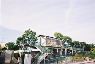
Far Rockaway is the terminus of the Long Island Rail Road's Far Rockaway Branch in the Far Rockaway neighborhood of Queens in New York City. The station is located at Nameoke Avenue and Redfern Avenue.
Medford is a station in the hamlet of Medford, New York on the Main Line of the Long Island Rail Road. Medford is located on New York State Route 112 between Peconic Avenue and Long Island Avenue. Access to the station is available from a narrow curving roadway leading off Route 112. This roadway used to connected with the Ohio Avenue intersection until Ohio Avenue was closed north of Peconic Avenue in 2007. It is also accessible from the north end of Oregon Avenue, although the Medford Fire Department periodically closes the Oregon Avenue access road for drills or other exercises.
The Sag Harbor Branch was a branch of the Long Island Rail Road that was the eastern terminal on the south shore line of Long Island from 1869 to 1895 and then was a spur from Bridgehampton to Sag Harbor, New York from 1895 to 1939.

St. James is a station and historic landmark on the Port Jefferson Branch of the Long Island Rail Road. The station is located on Lake Avenue and Railroad Avenue, just south of New York State Route 25A in St. James, Suffolk County, New York.

Central Islip is a station on the Main Line of the Long Island Rail Road. It is at the southwest corner of Suffolk County Road 100 and Lowell Avenue in Central Islip, New York. Short-term parking is also available on Suffolk CR 100 across from the intersections between Pineville and Hawthorne Avenues.

The Long Beach station is an intermodal center and the terminus of the Long Beach Branch of the Long Island Rail Road. It is located at Park Place and Park Avenue in the City of Long Beach, New York, serving as the city's major transportation hub.

Deer Park is a station along the Main Line of the Long Island Rail Road. It is officially located at Pineaire Drive, Executive Avenue, and Long Island Avenue in Baywood, New York.

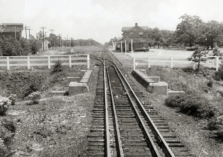
Bellport is a station along the Montauk Branch of the Long Island Rail Road, at Bellport Station Road and Montauk Highway in North Bellport, New York.
Westhampton is a station along the Montauk Branch of the Long Island Rail Road. It is on Station Road and Depot Road in Westhampton, New York, just west of Old Riverhead Road and south of the Francis S. Gabreski Airport.

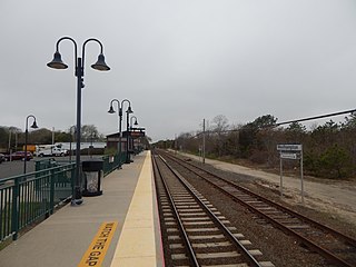
Speonk is an unmanned railroad station on the Montauk Branch of the Long Island Rail Road. It is located on Phillips Avenue at Depot Road in Speonk, New York, just north of Montauk Highway. The station has two parking lots, one operated by the Long Island Rail Road, and the other operated by the Town of Southampton, both of which are free. It also lies adjacent to one of the largest railroad yards on Long Island's East End. This yard is mostly used to hold passenger consists, as a handful of trains terminate at Speonk rather than continue all the way to Montauk.

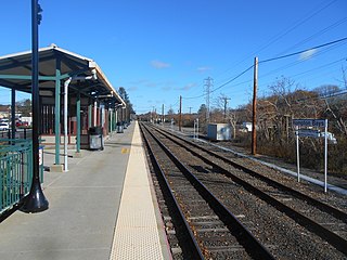
The Rockville Centre station is a station along the Babylon Branch of the Long Island Rail Road. It is officially at North Village Avenue and Front Street north of Sunrise Highway in Rockville Centre, New York, but the station property spreads west to North Center Avenue and east to North Park Avenue. Parking is available throughout the Village of Rockville Centre, near the station for those with residential and non-residential permits. The station is east of the former Rockville Centre Bus Depot. The station is 21.1 miles (34.0 km) from Penn Station.
Hampton Bays is a railroad station along the Montauk Branch of the Long Island Rail Road. It is on Good Ground Road between Springville Road and Suffolk CR 32 in Hampton Bays, New York.

The Rosa Parks Hempstead Transit Center is an intermodal center and transportation hub in Hempstead, New York. It contains the Nassau Inter-County Express bus system's indoor customer facility between Jackson and West Columbia Streets – as well as the terminus for the Hempstead Branch of the Long Island Rail Road, located right across West Columbia Street from the bus terminal.

Glendale was a Long Island Rail Road station along the Lower Montauk Branch, located in Glendale, Queens at Edsall Avenue and 73rd Street, near Central Avenue, at the All Faiths Monuments factory for the All Faiths Cemetery. This station had a sign indicating its location, and two tracks.

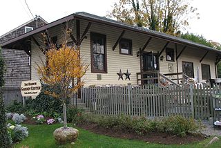
Mill Neck is a former rail station along the Oyster Bay Branch of the Long Island Rail Road. It is located between Oyster Bay and Locust Valley stations. As of 2023, the historic former station depot is home to Mill Neck's village hall, post office, and police substation.

Calverton was a station stop along the Greenport Branch of the Long Island Rail Road in Calverton, New York. The station was built in 1880 and closed in 1981.

Setauket was a station stop along the Port Jefferson Branch of the Long Island Rail Road. The station was located on the north side of the tracks just east of the bridge where Gnarled Hollow Road passes under the tracks in East Setauket. Access to the station was through a driveway which emptied onto Gnarled Hollow Road just north of the bridge on the east side of the road. The station opened in July 1873, and closed on June 27, 1980.
Higbie Avenue was a railroad station along the Atlantic Branch of the Long Island Rail Road, in Queens, New York City. The station was located on 140th Avenue and Edgewood Avenue in the Springfield section of Queens, New York City between Locust Manor and Laurelton stations.

The Quogue Historic District is an area of historic residences in Quogue on the East End of Long Island, New York. The historic houses include structures that date from the 18th, 19th and early 20th centuries and retain their architectural and historic integrity. The district was listed in the National Register of Historic Places as a historic district in 2016.
