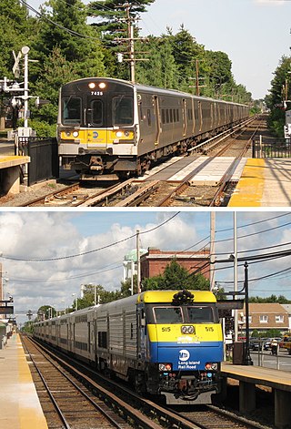
The Long Island Rail Road, or LIRR, is a railroad in the southeastern part of the U.S. state of New York, stretching from Manhattan to the eastern tip of Suffolk County on Long Island. The railroad currently operates a public commuter rail service, with its freight operations contracted to the New York and Atlantic Railway. With an average weekday ridership of 354,800 passengers in 2016, it is the busiest commuter railroad in North America. It is also one of the world's few commuter systems that runs 24/7 year-round. It is publicly owned by the Metropolitan Transportation Authority, which refers to it as MTA Long Island Rail Road. In 2023, the system had a ridership of 75,186,900, or about 276,800 per weekday as of the third quarter of 2024.

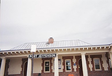
Port Jefferson, also known as Port Jeff, is an incorporated village in the town of Brookhaven in Suffolk County, New York, on the North Shore of Long Island. Officially known as the Incorporated Village of Port Jefferson, the population was 7,962 as of the 2020 United States census.

Pennsylvania Station is the main intercity railroad station in New York City and the busiest transportation facility in the Western Hemisphere, serving more than 600,000 passengers per weekday as of 2019. The station is located beneath Madison Square Garden in the block bounded by Seventh and Eighth Avenues and 31st and 33rd Streets and in the James A. Farley Building, with additional exits to nearby streets, in Midtown Manhattan. It is close to several popular Manhattan locations, including Herald Square, the Empire State Building, Koreatown, and Macy's Herald Square.

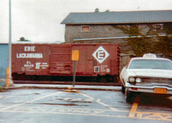
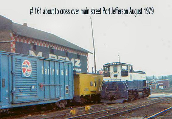
The Port Jefferson Branch is a rail line and service owned and operated by the Long Island Rail Road in the U.S. state of New York. The branch splits from the Main Line just east of Hicksville and runs northeast and east to Port Jefferson. Several stations on the Main Line west of Hicksville are served primarily by trains bound to/from the Port Jefferson branch, so LIRR maps and schedules for the public include that part of the Main Line in the "Port Jefferson Branch" service.

The Long Island City station is a rail terminal of the Long Island Rail Road in the Hunters Point and Long Island City neighborhoods of Queens, New York City. Located within the City Terminal Zone at Borden Avenue and Second Street, it is the westernmost LIRR station in Queens and the end of both the Main Line and Montauk Branch. The station consists of one high-level passenger platform located at ground level and is wheelchair accessible.

The Mineola Intermodal Center is an intermodal center and transportation hub in the village of Mineola, Nassau County, New York, U.S. It contains the Mineola Long Island Rail Road station – one of the railroad's busiest stations – in addition to one of the Nassau Inter-County Express bus system's main hubs, located adjacent to the southern train platform.
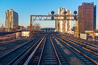
The Main Line is a rail line owned and operated by the Long Island Rail Road in the U.S. state of New York. It begins as a two-track line at Long Island City station in Long Island City, Queens, and runs along the middle of Long Island about 95 miles (153 km) to Greenport station in Greenport, Suffolk County. At Harold Interlocking approximately one mile east of Long Island City, the tracks from the East River Tunnels and 63rd Street Tunnel into Manhattan intersect with the Main Line, which most trains use rather than using the Long Island City station.

Patchogue is a station of the Montauk Branch of the Long Island Rail Road in the Village of Patchogue, Suffolk County, New York. It is on Division Street between West Avenue and South Ocean Avenue. The station is the eastern terminus for some trains on the branch.

Stony Brook is a station on the Port Jefferson Branch of the Long Island Rail Road. It is located in Stony Brook, New York, adjacent to the campus of Stony Brook University, on the southeast side of New York State Route 25A, across the street from the intersection with Cedar Street. There is also a gated at-grade pedestrian crossing between the station and a parking lot at the University – one of only a few stations on the Long Island Rail Road to feature such crossings.

St. James is a station and historic landmark on the Port Jefferson Branch of the Long Island Rail Road. The station is located on Lake Avenue and Railroad Avenue, just south of New York State Route 25A in St. James, Suffolk County, New York.
The Long Island Rail Road is a railroad owned by the Metropolitan Transportation Authority in the U.S. state of New York. It is the oldest United States railroad still operating under its original name and charter. It consolidated several other companies in the late 19th century. The Pennsylvania Railroad owned the Long Island Rail Road for the majority of the 20th century and sold it to the State in 1966.

Greenport is the terminus of the Main Line of the Long Island Rail Road. It is officially located at Wiggins Street and Fourth Street in the Village of Greenport, New York, although the property spans as far east as 3rd Street and the Shelter Island North Ferry terminal.
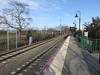
Oyster Bay is the terminus on the Oyster Bay Branch of the Long Island Rail Road. The station is located off Shore Avenue between Maxwell and Larabee Avenues. It is a sheltered concrete elevated platform that stands in the shadows of the original station, which was accessible from the ends of Maxwell, Audrey, and Hamilton Avenues. Both stations exist along the south side of Roosevelt Park.

Syosset station is a commuter rail station on the Long Island Rail Road's Port Jefferson Branch in Syosset, New York. It is located at Jackson Avenue and Underhill Boulevard, south of New York State Route 25A, but north of Jericho Turnpike and the Long Island Expressway. Syosset's downtown was built around the station. There are no public transportation connections at the station, but taxi service is available.

Roslyn is a station on the Long Island Rail Road's Oyster Bay Branch. It is located at Lincoln Avenue and Railroad Avenue, west of Roslyn Road and south of Warner Avenue, in Roslyn Heights, Nassau County, New York.

Hampton Jitney is a commuter bus company based in Southampton, New York. It operates three primary routes from the east end of Long Island to New York City. Hampton Jitney also operates charter and tour services, along with local transit bus service in eastern Suffolk County under contract with Suffolk County Transit.

The Rosa Parks Hempstead Transit Center is an intermodal center and transportation hub in Hempstead, New York. It contains the Nassau Inter-County Express bus system's indoor customer facility between Jackson and West Columbia Streets – as well as the terminus for the Hempstead Branch of the Long Island Rail Road, located right across West Columbia Street from the bus terminal.
The Manhattan and Queens Traction Company, also known as the Manhattan and Queens Transit Company, was a streetcar company operating in Manhattan and Queens County, New York between 1913 and 1937.
Miller Place was a station on the Wading River Extension on the Port Jefferson Branch of the Long Island Rail Road. The station was just east of Sylvan Avenue just north of New York State Route 25A, along what is now access for Long Island Power Authority power lines.


