Amityville station

Last updated

Amityville
Amityville LIRR.JPG
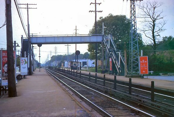
The southern side of the island platform at the Amityville LIRR station.
General information
LocationJohn Street between Sterling Place & Oak Street
Amityville, New York
Coordinates 40°40′49″N73°25′14″W / 40.680263°N 73.420472°W / 40.680263; -73.420472
Owned by Long Island Rail Road
Line(s) Montauk Branch
Platforms1 island platform
Tracks2
ConnectionsAiga bus trans.svg Suffolk County Transit : 1, 2, 4, 10 Aiga bus trans.svg Nassau Inter-County Express : n54, n55, n71 (n71 weekends only)
Construction
ParkingYes
Bicycle facilitiesYes
AccessibleNo; accessibility planned
Other information
Fare zone9
History
Opened1868 (SSRRLI)
Rebuilt1889, 1964, 19681973
ElectrifiedMay 20, 1925
750 V (DC) third rail
Passengers
201220142,607 [1]
Rank42 of 125
Services
Preceding station MTA NYC logo.svg Long Island Rail Road Following station
Massapequa Park Babylon Branch Copiague
toward Babylon
      Montauk Branch does not stop here
Former services
Preceding station Long Island
Rail Road
Following station
Massapequa Park Montauk Division Copiague
toward Montauk

Amityville is the westernmost station on the Babylon Branch of the Long Island Rail Road in Suffolk County. It is located on John Street in Amityville, New York, but the official description of its location is not as precise. The MTA describes the station as being located on John Street between Sunrise Highway (NY 27) and NY 27A west of NY 110. John Street is located between Sterling Place and West Oak Street (Old Sunrise Highway, NY 900D).

Contents

History

Amityville station is typical of the elevated Babylon Branch stations that were rebuilt during the mid-to-late 20th century. It was originally built in 1868 by the South Side Railroad of Long Island, then replaced by a brick station in 1889. [2] From 1890 to 1919, it was a stop for the Huntington Railroad cross-island trolley line, which included a bridge over the tracks on the west side of the station. It was also the terminus of the Amityville Line for of the Babylon Railroad trolley line from 1910 to 1920. When the trolleys were abandoned the cross-island trolley bridge over the tracks became a pedestrian crossover. [3] The station building was completely demolished in 1964 and on October 25, 1968, a temporary station building was opened with high-level side platforms to accommodate the new M1 cars and facilitate the construction of the new grade separated Babylon Branch. The new elevated structure was opened on August 7, 1973. The 1868 station remains standing as a private residence. Amityville is also the site of the first interlocking after the Central Branch splits from the Babylon Branch.

Platform and tracks

The station has one 10-car-long high-level island platform between the two tracks. Twelve-car trains will not open doors of the last two cars westbound or first two cars eastbound. Starting in late 2023, along with Lindenhurst, Copiague, and Massapequa Park, work will begin to add an elevator and make other improvements to make the station ADA-compliant.

Related Research Articles

<span class="mw-page-title-main">Atlantic Branch</span> Long Island Rail Road branch

The Atlantic Branch is an electrified rail line owned and operated by the Long Island Rail Road in the U.S. state of New York. It is the only LIRR line with revenue passenger service in the borough of Brooklyn.

<span class="mw-page-title-main">Babylon Branch</span> Long Island Rail Road branch

The Babylon Branch is a rail service operated by the Long Island Rail Road in the U.S. state of New York. The term refers to the trains serving Montauk Branch stations from Valley Stream east to Babylon; in other words, the Babylon Branch is a rail service rather than an actual track. The electrification of the Montauk Branch ends east of the Babylon station, so the Babylon Branch is mostly served by electric trains.

<span class="mw-page-title-main">Montauk Branch</span> Long Island Rail Road branch

The Montauk Branch is a rail line owned and operated by the Long Island Rail Road in the U.S. state of New York. The line runs the length of Long Island, 115 miles (185 km) from Long Island City to Montauk. However, in LIRR maps and schedules for public use, the term Montauk Branch refers to the line east of Babylon; service from Jamaica to Babylon is covered by separate Babylon Branch schedules, while the line west of Jamaica is currently unused for passenger service. A select number of Montauk Branch trains operate via the Main Line during peak hours.

<span class="mw-page-title-main">Lynbrook station</span> Long Island Rail Road station in Nassau County, New York

Lynbrook is a Long Island Rail Road commuter train station in Lynbrook, New York. The station is located at the intersection of Sunrise Highway and Peninsula Boulevard and is located on the railroad's Montauk Branch and Long Beach Branch lines and is served by Long Beach Branch trains and select weekday Babylon Branch trains. The station is elevated and is wheelchair accessible through elevator access.

<span class="mw-page-title-main">Babylon station</span> Long Island Rail Road station in Suffolk County, New York

Babylon is a station on the Long Island Rail Road in the village of Babylon, New York at Railroad Avenue west of Deer Park Avenue. It is on the Montauk Branch and is the eastern terminus of the Babylon Branch service. To the west is the junction with the Central Branch, which heads northwest to join the Main Line at Bethpage Interlocking southeast of the Bethpage station. Babylon station is elevated with two island platforms and is wheelchair accessible through elevator access. The electrified portion of the Montauk Branch ends east of the station.

<span class="mw-page-title-main">Main Line (Long Island Rail Road)</span> Long Island Rail Road branch

The Main Line is a rail line owned and operated by the Long Island Rail Road in the U.S. state of New York. It begins as a two-track line at Long Island City station in Long Island City, Queens, and runs along the middle of Long Island about 95 miles (153 km) to Greenport station in Greenport, Suffolk County. At Harold Interlocking approximately one mile east of Long Island City, the tracks from the East River Tunnels and 63rd Street Tunnel into Manhattan intersect with the Main Line, which most trains use rather than continuing to Long Island City station.

<span class="mw-page-title-main">Huntington station (LIRR)</span> Long Island Rail Road station in Suffolk County, New York

Huntington is a station on the Port Jefferson Branch of the Long Island Rail Road. It is located near New York Avenue, connecting it to Melville, the Long Island Expressway and Huntington and Broadway in Huntington Station, New York.

The Long Island Rail Road is a railroad owned by the Metropolitan Transportation Authority in the U.S. state of New York. It is the oldest United States railroad still operating under its original name and charter. It consolidated several other companies in the late 19th century. The Pennsylvania Railroad owned the Long Island Rail Road for the majority of the 20th century and sold it to the State in 1966.

<span class="mw-page-title-main">Queens Village station</span> Long Island Rail Road station in Queens, New York

Queens Village is a station on the Long Island Rail Road's Main Line, located between 218th Street and Springfield Boulevard, in the Queens Village neighborhood of Queens, New York City. It has two side platforms along the four-track line, and is served by Hempstead Branch trains. Just east of the station is Queens Interlocking, a universal interlocking that splits the four-track line into two parallel two-track lines—the Main Line and Hempstead Branch—and controls the junction with the spur to Belmont Park. The station is elevated and the tracks leading in and out are on raised ground and only above the road at intersections.

<span class="mw-page-title-main">Freeport station (LIRR)</span> Long Island Rail Road station in Nassau County, New York

The Freeport station is a station on the Babylon Branch of the Long Island Rail Road. It is located in Freeport Plaza between Henry Street and Benson Place, just north of NY 27 in Freeport, New York.

<span class="mw-page-title-main">Northport station</span> Long Island Rail Road station in Suffolk County, New York

Northport is a station on the Port Jefferson Branch of the Long Island Rail Road. It is located at the corner of Larkfield Road and Bellerose Avenue, north of Suffolk CR 11 in East Northport, Suffolk County, New York.

<span class="mw-page-title-main">Bellmore station</span> Long Island Rail Road station in Nassau County, New York

Bellmore is a station on the Babylon Branch of the Long Island Rail Road. It is located on the north side of Sunrise Highway between Bedford and Centre Avenues in Bellmore, New York, however the actual land area occupied by the station's several parking lots begins west of Centre Avenue and continues east of Bellmore Avenue.

<span class="mw-page-title-main">Rockville Centre station</span> Long Island Rail Road station in Nassau County, New York

The Rockville Centre station is a station along the Babylon Branch of the Long Island Rail Road. It is officially at North Village Avenue and Front Street north of Sunrise Highway in Rockville Centre, New York, but the station property spreads west to North Center Avenue and east to North Park Avenue. Parking is available throughout the Village of Rockville Centre, near the station for those with residential and non-residential permits. The station is east of the former Rockville Centre Bus Depot. The station is 21.1 miles (34.0 km) from Penn Station.

<span class="mw-page-title-main">Baldwin station</span> Long Island Rail Road station in Nassau County, New York

Baldwin is a station on the Babylon Branch of the Long Island Rail Road. It is officially located on Sunrise Highway and Grand Avenue in Baldwin, New York, although it also includes Milburn and Brooklyn Avenues.

<span class="mw-page-title-main">Merrick station</span> Long Island Rail Road station in Nassau County, New York

Merrick is a station on the Babylon Branch of the Long Island Rail Road. It is officially located on Sunrise Highway, between Hewlett Avenue and Merrick Avenue, in Merrick, New York. However, the parking areas for the station expand well beyond the given location.

<span class="mw-page-title-main">Massapequa station</span> Long Island Rail Road station in Nassau County, New York

Massapequa is a station along the Long Island Rail Road's Montauk Branch in Massapequa, New York, serving Babylon Branch trains. It is officially located on Sunrise Highway east of Broadway and NY 107 and parking lots are located far beyond its given location.

Central Railroad of Long Island was built on Long Island, New York, by Alexander Turney Stewart, who was also the founder of Garden City. The railroad was established in 1871, then merged with the Flushing and North Side Railroad in 1874 to form the Flushing, North Shore and Central Railroad. It was finally acquired by the Long Island Rail Road in 1876 and divided into separate branches. Despite its short existence, the CRRLI had a major impact on railroading and development on Long Island.

The Huntington Railroad was established on July 19, 1890 with a trolley line between Huntington Village and Halesite on Long Island, New York. It was eventually extended to Huntington Railroad Station, then along what is today mostly NY 110 through Melville, Farmingdale, and as far south as the docks of Amityville. Huntington Railroad had only one line throughout its history, although the length varied through the years.

References

  1. "2012-2014 LIRR Origin and Destination Report : Volume I: Travel Behavior Among All LIRR Passengers" (PDF). Metropolitan Transportation Authority. August 23, 2016. PDF pp. 15, 198. Archived (PDF) from the original on July 17, 2019. Retrieved March 29, 2020. Data collection took place after the pretest determinations, starting in September 2012 and concluding in May 2014. .... 2012-2014 LIRR O[rigin and ]D[estination] COUNTS: WEEKDAY East/West Total By Station in Numerical Order
  2. Morrison, David D.; Pakaluk, Valerie (2003). Long Island Rail Road Stations. Images of Rail. Chicago: Arcadia Publishing. p. 89. ISBN   0-7385-1180-3 . Retrieved November 25, 2011.
  3. Close-up picture of former Amityville Trolley Bridge in 1964, by Bradford G. Phillips (TrainsAreFun.com)