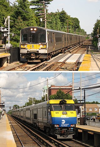
The Long Island Rail Road, or LIRR, is a railroad in the southeastern part of the U.S. state of New York, stretching from Manhattan to the eastern tip of Suffolk County on Long Island. The railroad currently operates a public commuter rail service, with its freight operations contracted to the New York and Atlantic Railway. With an average weekday ridership of 354,800 passengers in 2016, it is the busiest commuter railroad in North America. It is also one of the world's few commuter systems that runs 24/7 year-round. It is publicly owned by the Metropolitan Transportation Authority, which refers to it as MTA Long Island Rail Road. In 2023, the system had a ridership of 75,186,900, or about 276,800 per weekday as of the third quarter of 2024.

Jamaica is a major train station of the Long Island Rail Road located in Jamaica, Queens, New York City. With weekday ridership exceeding 200,000 passengers, it is the largest transit hub on Long Island, the fourth-busiest rail station in North America, and the second-busiest station that exclusively serves commuter traffic. It is the third-busiest rail hub in the New York area, behind Penn Station and Grand Central Terminal. Over 1,000 trains pass through each day, the fourth-most in the New York area behind Penn Station, Grand Central Terminal, and Secaucus Junction.

Port Washington is the terminus of the Long Island Rail Road's Port Washington Branch in Port Washington, New York. The station is located on Main Street, between Haven Avenue and South Bayles Avenue, just west of Port Washington Boulevard, and is 19.9 miles (32 km) from Pennsylvania Station in Midtown Manhattan. A pedestrian bridge exists between the platforms, and is in line with Franklin Avenue, ending at Haven Avenue.

The Port Jefferson Branch is a rail line and service owned and operated by the Long Island Rail Road in the U.S. state of New York. The branch splits from the Main Line just east of Hicksville and runs northeast and east to Port Jefferson. Several stations on the Main Line west of Hicksville are served primarily by trains bound to/from the Port Jefferson branch, so LIRR maps and schedules for the public include that part of the Main Line in the "Port Jefferson Branch" service.

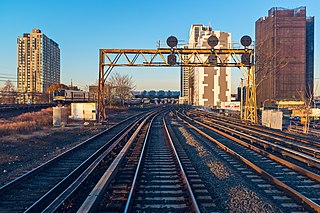
The Long Island City station is a rail terminal of the Long Island Rail Road in the Hunters Point and Long Island City neighborhoods of Queens, New York City. Located within the City Terminal Zone at Borden Avenue and Second Street, it is the westernmost LIRR station in Queens and the end of both the Main Line and Montauk Branch. The station consists of one high-level passenger platform located at ground level and is wheelchair accessible.

Floral Park is a Long Island Rail Road train station in Floral Park, New York, at Tulip and Atlantic Avenues, on the Main Line and Hempstead Branch just west of their split. Most service is provided by trains on the Hempstead Branch and the Port Jefferson Branch.

The Main Line is a rail line owned and operated by the Long Island Rail Road in the U.S. state of New York. It begins as a two-track line at Long Island City station in Long Island City, Queens, and runs along the middle of Long Island about 95 miles (153 km) to Greenport station in Greenport, Suffolk County. At Harold Interlocking approximately one mile east of Long Island City, the tracks from the East River Tunnels and 63rd Street Tunnel into Manhattan intersect with the Main Line, which most trains use rather than using the Long Island City station.

Port Jefferson is the terminus for the Port Jefferson Branch of the Long Island Rail Road in Port Jefferson Station, New York. The station is located on New York State Route 25A, on the north side of the tracks, but is also accessible from Oakland Avenue, as well as Railroad Avenue and Union Street on the south side of the tracks. All service is diesel-only, and most off-peak trains are shuttles requiring a transfer to an electric train at Huntington.

Stony Brook is a station on the Port Jefferson Branch of the Long Island Rail Road. It is located in Stony Brook, New York, adjacent to the campus of Stony Brook University, on the southeast side of New York State Route 25A, across the street from the intersection with Cedar Street. There is also a gated at-grade pedestrian crossing between the station and a parking lot at the University – one of only a few stations on the Long Island Rail Road to feature such crossings.

Smithtown is a station on the Port Jefferson Branch of the Long Island Rail Road. The station is located off a low bridge over NY 25 / 25A along Redwood Lane between NY 25 / 25A and Landing Avenue in Smithtown, New York.

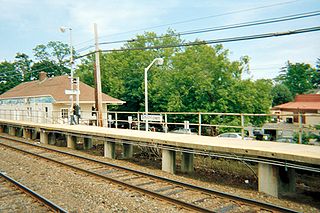
St. James is a station and historic landmark on the Port Jefferson Branch of the Long Island Rail Road. The station is located on Lake Avenue and Railroad Avenue, just south of New York State Route 25A in St. James, Suffolk County, New York.
The Long Island Rail Road is a railroad owned by the Metropolitan Transportation Authority in the U.S. state of New York. It is the oldest United States railroad still operating under its original name and charter. It consolidated several other companies in the late 19th century. The Pennsylvania Railroad owned the Long Island Rail Road for the majority of the 20th century and sold it to the State in 1966.

Syosset station is a commuter rail station on the Long Island Rail Road's Port Jefferson Branch in Syosset, New York. It is located at Jackson Avenue and Underhill Boulevard, south of New York State Route 25A, but north of Jericho Turnpike and the Long Island Expressway. Syosset's downtown was built around the station. The station is also served by Nassau Inter-County Express's NICE Mini On-Demand Syosset Zone, Weekdays from 6 AM to 6 PM. Taxi Service is also available.

Northport is a station on the Port Jefferson Branch of the Long Island Rail Road. It is located at the corner of Larkfield Road and Bellerose Avenue, north of Suffolk CR 11 in East Northport, Suffolk County, New York.

Cold Spring Harbor is a station on the Long Island Rail Road's Port Jefferson Branch. It is located at West Pulaski Road and East Gate Drive, just south of Woodbury Road in West Hills, Suffolk County, New York.

Setauket was a station stop along the Port Jefferson Branch of the Long Island Rail Road. The station was located on the north side of the tracks just east of the bridge where Gnarled Hollow Road passes under the tracks in East Setauket. Access to the station was through a driveway which emptied onto Gnarled Hollow Road just north of the bridge on the east side of the road. The station opened in July 1873, and closed on June 27, 1980.

Wading River was the terminus of the abandoned Wading River Extension on the Port Jefferson Branch of the Long Island Rail Road. This is an abandoned station just outside south of downtown Wading River, and was located on Wading River-Manor Road north of New York State Route 25A.

Rocky Point was a station on the Wading River Extension on the Port Jefferson Branch of the Long Island Rail Road. This abandoned station was just east of Broadway between King Road & Prince Road, along what is now access for Long Island Power Authority power lines.

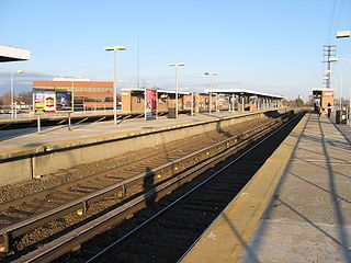
Elmont–UBS Arena is a Long Island Rail Road (LIRR) station in Elmont and Bellerose Terrace, New York, just east of the Nassau County border with the New York City borough of Queens. It serves the LIRR Main Line and was built as part of the redevelopment of Belmont Park, which included the construction of the UBS Arena for the NHL's New York Islanders hockey team. The station opened for eastbound service in November 2021 and westbound service in October 2022.


