| CDP [3] | County | Location
of County | Population
(2020) | Population
(2010) | Population
(2000) [4] | Population
(1990) [5] | Population
(1980) [6] | Notes [7] [8] [9] |
|---|
| Antioch | Harris |  | 613 | x | x | x | x | |
| Appling | Columbia |  | 658 | x | x | x | x | |
| Axson | Atkinson |  | 360 | x | x | x | x | |
| Belvedere Park | DeKalb |  | 15,113 | 15,152 | 18,945 | 18,089 | 17,766 | |
| Bemiss | Lowndes |  | 8,999 | x | x | x | x | |
| Berry College | Floyd |  | 1,565 | x | x | x | x | |
| Bolingbroke | Monroe |  | 497 | x | x | x | x | |
| Bonanza | Clayton |  | 4,406 | 3,135 | 2,904 | x | x | |
| Box Springs | Talbot |  | 303 | x | x | x | x | |
| Boykin | Miller |  | 151 | 143 | x | x | x | |
| Bristol | Pierce |  | 122 | x | x | x | x | |
| Buckhead | Bryan |  | 4,441 | x | x | x | x | |
| Calvary | Grady |  | 129 | 161 | x | x | x | |
| Candler-McAfee | DeKalb | | 22,468 | 23,025 | 28,294 | 29,491 | 27,306 | |
| Canoochee | Emanuel |  | 70 | 71 | x | x | x | |
| Cataula | Harris | | 1,433 | x | x | x | x | |
| Cedar Springs | Early |  | 75 | 74 | x | x | x | |
| Chattanooga Valley | Walker |  | 3,962 | 3,846 | 4,065 | 4,088 | x | |
| Cherry Log | Gilmer |  | 99 | 119 | x | x | x | |
| Clyattville | Lowndes | | 552 | x | x | x | x | |
| Cogdell | Clinch |  | 23 | x | x | x | x | |
| Coleman | Randolph |  | 116 | 127 | 149 | 137 | 164 | Dissolved as a town in 2007 although still listed as a CDP in 2000. Listed as a town prior to 2000. |
| Conley | Clayton | | 6,680 | 6,228 | 6,188 | 5,528 | 6,033 | |
| Country Club Estates | Glynn |  | 8,373 | 8,545 | 7,594 | 5,192 | x | |
| Crescent | McIntosh |  | 838 | x | x | x | x | |
| Crooked Creek | Putnam |  | 685 | 639 | x | x | x | |
| Deenwood | Ware |  | 2,207 | 2,146 | 1,836 | 2,055 | 3,580 | Listed as the unincorporated place of Hebardville in the 1950 U.S. census (pop. 1,113) and 1960 U.S. census. Named change to Deenwood in the 1970 U.S. census with a population of 3,015 |
| Dewy Rose | Elbert |  | 161 | 154 | x | x | x | |
| Dixie | Brooks |  | 121 | x | x | x | x | |
| Dixie Union | Ware | | 184 | x | x | x | x | |
| Dock Junction | Glynn | | 8,266 | 7,721 | 6,951 | 7,094 | 6,189 | Previously listed as an unincorporated place in 1970 (pop 6,009), 1960 (pop 5,417), and 1950 (pop 4,160) |
| Druid Hills | DeKalb | | 9,429 | 14,568 | 12,741 | 12,174 | 12,700 | |
| Dutch Island | Chatham |  | 1,238 | 1,247 | x | x | x | |
| Eagle Grove | Hart |  | 139 | 164 | x | x | x | |
| East Griffin | Spalding |  | 1,561 | 1,451 | 1,635 | 1,569 | 1,570 | East Griffin was listed as an unincorporated place in the 1950 U.S. census (pop 1,539), the 1960 U.S. census (pop 1,715), and the 1970 U.S. census (pop 1,479) |
| East Newnan | Coweta |  | 1,022 | 1,321 | 1,305 | 1,173 | 1,495 | In 1970, East Newnan was listed as an unincorporated place with a population of 1,634 |
| Ellerslie | Harris | | 1,053 | x | x | x | x | |
| Empire | Bleckley
Dodge | 
 | 319 | 393 | x | x | x | Listed as an incorporated place in the 1920, 1930, 1940, and 1950 U.S. Censuses |
| Epworth | Fannin |  | 668 | 480 | x | x | x | Epworth was listed as a town in the 1910, 1920, and 1930 censuses |
| Eulonia | McIntosh | | 351 | x | x | x | x | |
| Evans | Columbia | | 34,536 | 29,011 | 17,727 | 12,220 | x | |
| Everett | Glynn | | 158 | x | x | x | x | |
| Experiment | Spalding | | 3,328 | 2,894 | 3,233 | 3,762 | 3,731 | Previously listed as an unincorporated place in 1970 (pop 2,256), 1960 (pop 2,497), and 1950 (pop 4,265) |
| Faceville | Decatur |  | 136 | x | x | x | x | |
| Fair Oaks | Cobb |  | 9,028 | 8,225 | 8,443 | 6,996 | 8,486 | Fair Oaks was listed as an unincorporated place in the 1950 U.S. census (pop 3,181) and the 1960 U.S. census (pop 7,543) but was not listed in the 1970 U.S. census |
| Fairfield Plantation | Carroll |  | 4,898 | x | x | x | x | |
| Fairplay | Douglas |  | 1,267 | x | x | x | x | |
| Fairview | Walker | | 6,409 | 6,769 | 6,601 | 6,444 | 6,558 | |
| Fort Stewart | Liberty |  | 8,821 | 4,924 | 11,205 | 13,774 | 15,031 | In 1970, Fort Stewart was listed as an unincorporated place with a population of 4,467 |
| Gardi | Wayne |  | 91 | x | x | x | x | |
| Georgetown | Chatham | | 11,916 | 11,823 | 10,599 | 5,554 | 2,785 | |
| Glenn | Heard |  | 101 | x | x | x | x | |
| Godfrey | Morgan |  | 108 | x | x | x | x | Listed as a village in the 1910 through 1960 U.S. Censuses. |
| Gough | Burke |  | 137 | x | x | x | x | |
| Gresham Park | DeKalb | | 7,700 | 7,432 | 9,215 | 9,000 | 6,232 | |
| Gumlog | Franklin |  | 2,358 | 2,146 | 2,025 | 1,436 | x | |
| Hannahs Mill | Upson | 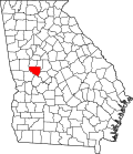 | 3,121 | 3,298 | 3,267 | x | 2,616 | Did not appear in the 1990 Census after being partially annexed to Thomaston. |
| Hardwick | Baldwin | 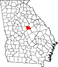 | 3,513 | 3,930 | 5,135 | 4,910 | 8,977 | Listed as an unincorporated place in 1970 (pop 14,047), in 1960 (pop 16,909 ), and 1950 (pop 14,774). |
| Henderson | Chatham | | 2,178 | 1,647 | x | x | x | |
| Heron Bay | Henry
Spalding | 
| 4,673 | 3,384 | x | x | x | |
| Hickox | Brantley |  | 234 | x | x | x | x | |
| Hilltop | Pike |  | 245 | 262 | 401 | x | x | |
| Hortense | Brantley | | 252 | x | x | x | x | |
| Howard | Taylor |  | 50 | 110 | x | x | x | |
| Indian Springs | Catoosa |  | 2,336 | 2,241 | 1,982 | 1,273 | x | |
| Irondale | Clayton | | 8,740 | 7,446 | 7,727 | 3,352 | x | |
| Isle of Hope | Chatham | | 2,357 | 2,402 | 2,605 | 2,637 | x | |
| Jekyll Island | Glynn | | 866 | x | x | x | x | |
| Juliette | Monroe | | 290 | x | x | x | x | |
| Kennesaw State University | Cobb | | 382 | x | x | x | x |
| Kings Bay Base | Camden |  | 2,329 | 1,777 | 2,599 | 3,463 | x | |
| Knoxville | Crawford |  | 65 | 69 | x | x | x | Appeared as a village in the 1890 through 1910 censuses |
| Lakeview | Catoosa
Walker |
| 4,777 | 4,839 | 4,820 | 5,184 | 5,403 | |
| Lakeview Estates | Rockdale |  | 2,660 | 2,695 | 2,637 | 1,344 | 1,576 | |
| Lincoln Park | Upson | | 817 | 833 | 1122 | x | 1,755 | Did not appear in the 1990 Census after being partially annexed to Thomaston.
Appeared as an unincorporated place 1970 (pop 1,852), 1960 (pop 1,840), and 1950 (pop 1,575). |
| Lindale | Floyd | | 4,283 | 4,191 | 4,088 | 4,187 | 2,958 | Listed as an unincorporated place with a population of 2,768 in the 1970 U.S. census |
| Lithia Springs | Douglas | | 16,644 | 15,491 | 2,072 | 11,403 | 9,145 | Listed as a town in the 2000 U.S. census and then redesignated a CDP in the 2010 U.S. census |
| Manor | Ware | | 94 | x | x | x | x | |
| Martinez | Columbia | | 34,535 | 35,795 | 27,749 | 29,877 | 16,472 | |
| Matthews | Jefferson |  | 146 | 150 | x | x | x | |
| Mendes | Tattnall |  | 124 | 122 | x | x | x | |
| Mershon | Pierce | | 44 | x | x | x | x | |
| Millwood | Ware | | 72 | x | x | x | x | |
| Milstead | Rockdale | | 628 | x | x | x | x | |
| Mineral Bluff | Fannin | | 223 | 150 | x | 163 | 130 | Appeared as a town in the 1890 through 1990 censuses |
| Montgomery | Chatham | | 4,443 | 4,523 | 4,134 | 4,327 | x | |
| Moody AFB | Lowndes | | 1,307 | 886 | 993 | 1,288 | 1,297 | In 1970, Moody Air Force Base was listed as an unincorporated place with a population of 1,424 |
| Mountain Park | Gwinnett | 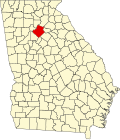 | 13,089 | 11,554 | 11,753 | 11,025 | 9,425 | |
| Musella | Crawford | | 104 | x | x | x | x | |
| Naylor | Lowndes | | 139 | x | x | x | x | |
| New England | Dade |  | 546 | x | x | x | x | |
| Norristown | Emanuel | | 54 | 50 | x | x | x | |
| North Decatur | DeKalb | | 18,511 | 16,698 | 15,270 | 12,830 | 11,830 | |
| North Druid Hills | DeKalb | | 20,385 | 18,947 | 18,852 | 14,170 | 12,438 | |
| Ohoopee | Toombs |  | 29 | x | x | x | x | |
| Panthersville | DeKalb | | 11,237 | 9,749 | 11,791 | 9,874 | 11,366 | |
| Perkins | Jenkins |  | 93 | 91 | x | x | x | |
| Phillipsburg | Tift |  | 640 | 707 | 887 | 1,044 | 2,450 | Previously listed as an unincorporated place in 1970 (pop 2,335) and 1960 (pop 2,037) |
| Piney Grove | Harris | | 434 | x | x | x | x | |
| Putney | Dougherty |  | 2,869 | 2,898 | 2,998 | 3,108 | x | |
| Raoul | Habersham |  | 2,803 | 2,558 | 1,816 | 1,674 | x | |
| Redan | DeKalb | | 31,749 | 33,015 | 33,841 | 24,376 | x | |
| Reed Creek | Hart | | 2,724 | 2,604 | 2,148 | 1,796 | x | |
| Robins AFB | Houston |  | 1,061 | 1,170 | 3,949 | 3,092 | 3,571 | |
| Rock Spring | Walker | | 891 | x | x | x | x | |
| Rockingham | Bacon | 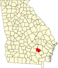 | 230 | 248 | x | x | x | |
| Russell | Barrow |  | 1,322 | 1,203 | x | x | x | |
| Salem | Upson | | 307 | 310 | 339 | x | x | |
| Satilla | Jeff Davis |  | 487 | 421 | x | x | x | |
| Sautee Nacoochee | White |  | 332 | 363 | x | x | x | |
| Scottdale | DeKalb | | 10,698 | 10,631 | 9,803 | 8,636 | 8,770 | |
| Seville | Wilcox |  | 197 | 202 | x | x | x | |
| Shannon | Floyd | | 1,919 | 1,862 | 1,682 | 1,514 | 2,040 | Listed as an unincorporated community in the 1950 U.S. census (pop 1,563) and the 1960 U.S. census (pop 1,629). |
| Skidaway Island | Chatham | | 9,310 | 8,341 | 6,914 | 4,495 | 1,264 | |
| Smarr | Monroe | | 218 | x | x | x | x | |
| St. Simons | Glynn | | 14,982 | 12,743 | 13,381 | 12,026 | 6,566 | Previously listed as an unincorporated place in 1970 (pop 5,346), 1960 (pop 3,199), and 1950 (pop 1,706) |
| Sterling | Glynn | | 2,534 | x | x | x | x | |
| Stockton | Lanier |  | 135 | x | x | x | x | |
| Sunny Side | Spalding | | 203 | x | x | x | x | |
| Sunnyside | Ware | | 1,472 | 1,303 | 1,385 | 1,506 | 1,658 | |
| Sunset Village | Upson | | 921 | 846 | 871 | x | x | |
| Talahi Island | Chatham | | 1,247 | 1,248 | x | x | x | |
| Tate City | Towns |  | 27 | 16 | x | x | x | |
| Tazewell | Marion |  | 93 | x | x | x | x | |
| The Rock | Upson | | 179 | 160 | x | 88 | 78 | Former town dissolved in 1995 |
| Unionville | Tift | | 1,688 | 1,845 | 2,074 | 2,710 | 1,942 | Previously listed as an unincorporated place in 1970 (pop 1,646) and 1960 (pop 1,607) |
| Vinings | Cobb | | 12,581 | 9,734 | 9,677 | 7,417 | x | |
| Waresboro | Ware | | 375 | x | x | x | x | |
| Warthen | Washington |  | 132 | x | x | x | x | |
| Waverly | Camden | | 281 | x | x | x | x | |
| Waynesville | Brantley | | 331 | x | x | x | x | |
| Wenona | Crisp |  | 231 | x | x | x | x | |
| West Brow | Dade | | 887 | x | x | x | x | |
| Whitemarsh Island | Chatham | | 6,983 | 6,792 | 5,824 | 2,554 | x | |
| Wildwood | Dade | | 382 | x | x | x | x |
| Wilmington Island | Chatham | | 15,129 | 15,138 | 14,213 | 11,230 | 7,546 | |
| Yonah | White | | 657 | 507 | x | x | x | |


