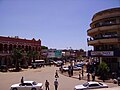
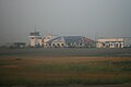
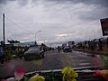
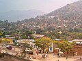
This is a list of places, mostly cities and towns, in the Democratic Republic of the Congo without regard to their official status.
This is a list of places, mostly cities and towns, in the Democratic Republic of the Congo without regard to their official status.
Human settlements can be one of the following subdivisions of the DR Congo: cities, communes, groupings (fr. groupements) and villages; or may not be an administrative division at all.
This section's factual accuracy may be compromised due to out-of-date information. The reason given is: uses pre-2015 provinces.(March 2022) |

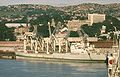
Kongo Central, formerly Bas-Congo, is one of the 26 provinces of the Democratic Republic of the Congo. Its capital is Matadi.

Bandundu is one of eleven former provinces of the Democratic Republic of the Congo. It bordered the provinces of Kinshasa and Bas-Congo to the west, Équateur to the north, and Kasai-Occidental to the east. The provincial capital is also called Bandundu.

Équateur was a province in the northwest of the Belgian Congo and the successor Republic of the Congo, now known as Democratic Republic of the Congo. It had its origins in the Équateur District of the Congo Free State, the private property of King Leopold II of Belgium. It was upgraded to the status of a province in 1917. Between 1933 and 1947 it was named Coquilhatville. In 1962 it was divided into three smaller provinces, but there were recombined in 1966. Équateur was one of the eleven provinces of the Democratic Republic of the Congo until 2015, when it was split into the new, smaller Équateur province, as well as the Tshuapa, Mongala, Nord-Ubangi and Sud-Ubangi provinces.
Orientale Province is one of the former provinces of the Democratic Republic of the Congo and its predecessors the Congo Free State and the Belgian Congo. It went through a series of boundary changes between 1898 and 2015, when it was divided into smaller units.

The Sangha River, a tributary of the Congo River, is located in Central Africa.

The Alima River is a tributary of the Congo River. It is formed by the confluence of two streams, the Lékéti and the Dziélé.
The 8th parallel south is a circle of latitude that is 8 degrees south of the Earth's equatorial plane. It crosses the Atlantic Ocean, Africa, the Indian Ocean, Southeast Asia, Australasia, the Pacific Ocean and South America.
The meridian 22° east of Greenwich is a line of longitude that extends from the North Pole across the Arctic Ocean, the Atlantic Ocean, Europe, Africa, the Indian Ocean, the Southern Ocean, and Antarctica to the South Pole.
The meridian 23° east of Greenwich is a line of longitude that extends from the North Pole across the Arctic Ocean, the Atlantic Ocean, Europe, Africa, the Indian Ocean, the Southern Ocean, and Antarctica to the South Pole.
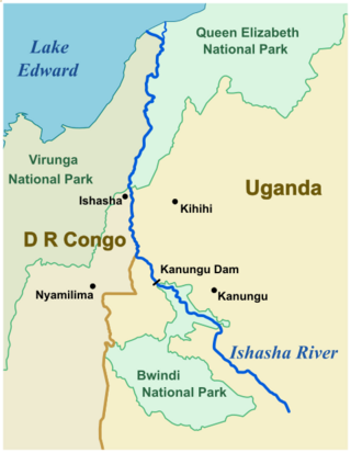
The Ishasha is a river in southwest Uganda, forming part of the border with the Democratic Republic of the Congo. It runs from its source north of Kabale to its mouth at Lake Edward. Its length is very roughly 100 kilometres (62 mi) ignoring the many small meanders.
The 2019 FIBA AfroCan was the inaugural edition of the AfroCan, a men's basketball continental competition of Africa. Only players who play for Africa-based basketball clubs are eligible to participate. The tournament was hosted by Mali, from 19 to 28 July 2019.
![]() Media related to Cities in the Democratic Republic of the Congo at Wikimedia Commons
Media related to Cities in the Democratic Republic of the Congo at Wikimedia Commons