Vermont Route 12 (VT 12) is a 101.627-mile-long (163.553 km) north-south state highway in Vermont that runs from Weathersfield to Morrisville.

State Route 627 is a 4.76-mile (7.66 km) east–west state highway in Stark County, Ohio. SR 627's western terminus is at a diamond interchange with the US 30/US 62 freeway in southeast Massillon. Its eastern terminus is a diamond interchange with Interstate 77 at I-77 Exit 101 in southern Canton.
Highway 367 is a provincial highway in the Canadian province of Saskatchewan. It runs from Highway 42 near Eyebrow to Highway 19 near Bridgeford. It is about 24 kilometres (15 mi) long.
Interstate 80 (I-80) is a transcontinental Interstate Highway in the United States, stretching from San Francisco, California, to Teaneck, New Jersey. In Indiana, it consists entirely of the following two highways:
Alberta Provincial Highway No. 627, commonly referred to as Highway 627, is a highway in the province of Alberta, Canada. It runs west to east through rural parts of Parkland County, beginning at Highway 759 about 12 km (7.5 mi) south of Seba Beach and heads due east. It takes name Maskêkosihk Trail passes 215 Street/Winterburn Road, before terminating at 184th Street, and continuing along 184th Street to the Anthony Henday Drive in Edmonton. Portions of 23 Avenue NW and 184 Street NW between Winterburn Road and Anthony Henday Drive were renamed Maskêkosihk Trail in February 2016 to honour Cree heritage.

Maryland Route 627 is a state highway in the U.S. state of Maryland. Known as Oriole Road, the state highway runs 2.48 miles (3.99 km) from the intersection of Oriole Back Road and Crab Island Road in Oriole east to MD 363 near Venton. MD 627 was constructed and assigned in the mid-1930s.
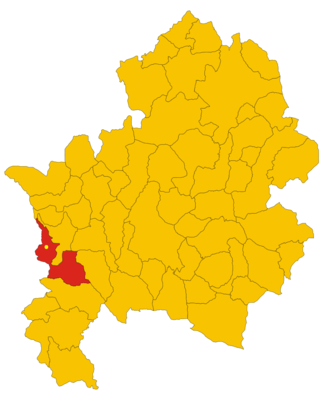
Tugaske is a village in the Canadian province of Saskatchewan within the Rural Municipality of Huron No. 223 and Census Division No. 7. It is nicknamed Gateway to Lake Diefenbaker. It is near Eyebrow Lake, a prairie lake in the Qu'Appelle Valley. It was named after an eyebrow-shaped hill also in the Qu'Appelle Valley above Eyebrow Lake. The lake, which is 9 km long and 1 km wide, is a bird sanctuary and is near Highway 627.
King's Highway 109, or Highway 109, is a former provincial highway in Ontario. It was used on two separate, unrelated routes during the 1950s and 1960s:
Ontario Highway 5A (1937–1953), as a former Connecting Link in the Ontario Provincial Highway Network, bypassed portions of Ontario Highway 5 within what is now Toronto. There were two discontinuous segments:
Cerasuolo is an Italian village, the most populated hamlet (frazione) of Filignano, a municipality in the province of Isernia, Molise. As of 2009 its population was of 151.
Secondary Highway 500, commonly referred to as Highway 500, was a secondary highway in the Canadian province of Ontario which was first designated in 1956. Its route was renumbered in 1964, becoming:
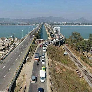
National Highway 27, an East - West National highway in India that starts in Porbandar and ends in Silchar, the highway passes through the states of Gujarat, Rajasthan, Madhya Pradesh, Uttar Pradesh, Bihar, West Bengal, Assam. NH-27 was laid and is maintained by Ministry of Road Transport and Highways (MoRTH). It is the second longest National Highway in India and is a part of NS-EW Corridor of NHAI.

Kentucky Route 418 (KY 418) is a 11.736-mile-long (18.887 km) state highway in the U.S. state of Kentucky. The highway connects mostly rural areas of Clark County with Lexington.

Kentucky Route 627 is a 30.367-mile-long (48.871 km) north–south state highway in east-central Kentucky, United States. It traverses portions of northern Madison, Clark, and southern Bourbon counties.
Corinne is an unincorporated community in Bratt's Lake Rural Municipality No. 129, Saskatchewan, Canada. The community is located at the intersections of Highway 6, Highway 39 and Highway 334 about 11 km (7 mi) northwest of Milestone.
National Highway 627, commonly referred to as NH 627 is a national highway in India. It is a spur road of National Highway 27. NH-627 traverses the state of Assam in India.
Secondary Highway 514, commonly referred to as Highway 514, was a secondary highway in the Canadian province of Ontario. It was used on two separate routes from the 1950s to the 1990s:
This page is based on this
Wikipedia article Text is available under the
CC BY-SA 4.0 license; additional terms may apply.
Images, videos and audio are available under their respective licenses.