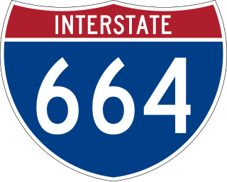
Interstate 664 (I-664) is an auxiliary Interstate Highway in the US state of Virginia. The Interstate runs 20.79 miles (33.46 km) from I-64 and I-264 in Chesapeake north to I-64 in Hampton. I-664 forms the west side of the Hampton Roads Beltway, a circumferential highway serving the Hampton Roads metropolitan area. The Interstate crosses Hampton Roads via the Monitor–Merrimac Memorial Bridge–Tunnel (MMMBT) between Suffolk and Newport News. I-664 is connected to the other major cities of the metropolitan area—Portsmouth, Norfolk, and Virginia Beach—by I-264. The Interstate also has a connection to Portsmouth through State Route 164 (SR 164) and to Suffolk via U.S. Route 13 (US 13), US 58, and US 460.
The Hampton Roads Beltway is a loop of Interstate 64 and Interstate 664, which links the communities of the Virginia Peninsula and South Hampton Roads which surround the body of water known as Hampton Roads and comprise much of the region of the same name in the southeastern portion of Virginia in the United States. It crosses the harbor of Hampton Roads at two locations on large four-laned bridge-tunnel facilities: the eastern half carries Interstate 64 and uses the Hampton Roads Bridge-Tunnel and the western half carries Interstate 664 and uses the Monitor-Merrimac Memorial Bridge-Tunnel. The beltway has the clockwise direction signed as the Inner Loop, and the counter-clockwise direction signed as the Outer Loop. The entire beltway, including the bridge-tunnels, is owned and operated by the Virginia Department of Transportation.
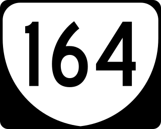
State Route 164 is a 7.27-mile-long (11.70 km) primary state highway in the U.S. state of Virginia that connects the northern parts of Suffolk and Portsmouth with Newport News and Hampton via Interstate 664 (I-664) with Downtown Portsmouth and Norfolk through either the Downtown or Midtown Tunnels.
Alberta Provincial Highway No. 55, commonly referred to as Highway 55, is a 263-kilometre (163 mi) long east–west highway in northeast Alberta, Canada. It extends from the Saskatchewan border in the east through the Cold Lake, Lac La Biche, and Athabasca where it ends at Highway 2. In Saskatchewan, it continues as Saskatchewan Highway 55.
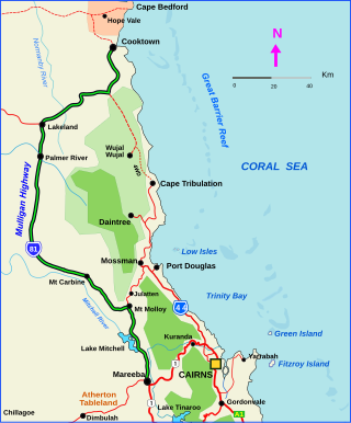
The Mulligan Highway is a state highway in Queensland, Australia. It runs for approximately 266 km between Mareeba and Cooktown, on the east coast of Cape York Peninsula where it terminates. It is signed as State Route 81 from Mareeba to Lakeland and State Route 40 from Lakeland to Cooktown. It is a state-controlled regional road.

State Route 135 is a primary state highway in the U.S. state of Virginia. Known as College Drive, the state highway runs 2.20 miles (3.54 km) from U.S. Route 17 north to the entrance of Tidewater Community College, where the highway continues as SR 367, within the independent city of Suffolk. In addition to providing access to the community college's Suffolk location, SR 135 connects US 17 with SR 164 and Interstate 664 (I-664).

State Route 191 is a primary state highway in the U.S. state of Virginia. Known as Jolliff Road, the state highway runs 3.13 miles (5.04 km) from U.S. Route 13, US 58, US 460, and US 460 Alternate north to SR 337 within the independent city of Chesapeake.

Interstate 64 (I-64) in the US state of Virginia runs east–west through the middle of the state from West Virginia to the Hampton Roads region, for a total of 299 miles (481 km). From the West Virginia state line to Chesapeake, it passes through the major cities of Lexington, Staunton, Charlottesville, the state capital of Richmond, Newport News, Hampton, and Norfolk. It is notable for crossing the mouth of the harbor of Hampton Roads on the Hampton Roads Bridge–Tunnel (HRBT), the first bridge–tunnel to incorporate artificial islands, concurrent with U.S. Route 60 (US 60). Also noteworthy is a section through Rockfish Gap, a wind gap in the Blue Ridge Mountains, which was equipped with an innovative system of airport-style runway lighting embedded into the pavement to aid motorists during periods of poor visibility due to fog or other conditions.

KTLT is a commercial radio station licensed to Anson, Texas, broadcasting to the Abilene, Texas area. KTLT airs an active rock format branded as "98.1 The Phantom". Studios are located along U.S. Highway 84 in southwest Abilene, and the transmitter site is in between Anson and Hawley, Texas along U.S. Highway 277 in Jones County.
King's Highway 72, commonly referred to as Highway 72, is a provincially maintained highway in the northern half of the Canadian province of Ontario. The highway connects Highway 17 in Dinorwic with the town of Sioux Lookout, where there are connections with Highway 516 towards Savant Lake and Highway 642 towards Silver Dollar.
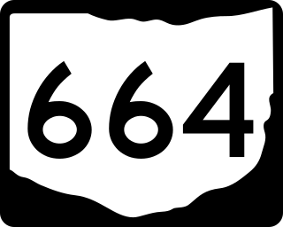
State Route 664 is a north–south state highway in the southern portion of the U.S. state of Ohio. The highway has its southern terminus at a T-intersection with SR 56 in the unincorporated community of South Bloomingville. The northern terminus of SR 664 is also at a T-intersection, this time with SR 256 on the Fairfield–Perry county line approximately 4.75 miles (7.64 km) north of the village of Rushville.

Pennsylvania Route 664 is a 17.59-mile-long (28.31 km) state highway located in Clinton and Lycoming counties in Pennsylvania. The southern terminus is at PA 120 in Lock Haven, while the northern terminus is at PA 44 on the Clinton-Lycoming county line in the community of Haneyville. The route passes through small communities, but does not intersect with any other legislated highways in the area.
King's Highway 109, or Highway 109, is a former provincial highway in Ontario. It was used on two separate, unrelated routes during the 1950s and 1960s:
Ontario Highway 5A (1937–1953), as a former Connecting Link in the Ontario Provincial Highway Network, bypassed portions of Ontario Highway 5 within what is now Toronto. There were two discontinuous segments:

State Highway 69 (SH 69) is an 82.664-mile-long (133.035 km) state highway in the US state of Colorado. SH 69's northern terminus is at U.S. Route 50 (US 50) in Texas Creek, and the southern terminus is at Interstate 25 Business north of Walsenburg.

South Carolina Highway 177 (SC 177) is a 7.820-mile (12.585 km) primary state highway in the U.S. state of South Carolina. It connects the community of Wallace with Hamlet, North Carolina.
Secondary Highway 500, commonly referred to as Highway 500, was a secondary highway in the Canadian province of Ontario which was first designated in 1956. Its route was renumbered in 1964, becoming:
Secondary Highway 514, commonly referred to as Highway 514, was a secondary highway in the Canadian province of Ontario. It was used on two separate routes from the 1950s to the 1990s:
This page is based on this
Wikipedia article Text is available under the
CC BY-SA 4.0 license; additional terms may apply.
Images, videos and audio are available under their respective licenses.