The following highways are numbered 703:
| Preceded by 702 | Lists of highways 703 | Succeeded by 704 |
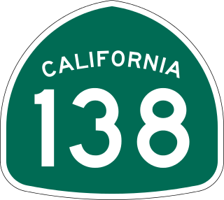
State Route 138 is an east–west state highway in the U.S. state of California that generally follows the northern foothills of the San Gabriel Mountains and the western Mojave Desert. The scenic highway begins in the west at its junction with Interstate 5 located south of Gorman in the Sierra Pelona Mountains, continues eastward through the Antelope Valley and Cajon Pass, to its junction with State Route 18 in the east, located in the San Bernardino Mountains south of Crestline.

State Route 175 (SR 175) is a primary state highway in the U.S. state of Virginia. Known as Chincoteague Road, the state highway runs 10.49 miles (16.88 km) from U.S. Route 13 (US 13) at Nash Corner east to Main Street in Chincoteague. SR 175 passes through the northeastern corner of Accomack County, providing the primary access to NASA's Wallops Flight Facility and both Chincoteague Island and the Virginia portion of Assateague Island. The route travels between the mainland and Chincoteague Island along the John B. Whealton Memorial Causeway.

State Route 364 (SR 364) is a north–south state route in Ohio. It starts from SR 705 near Yorkshire. The route moves north across several counties, then northeast against the side of the Grand Lake. SR 364 then travels west along a concurrency with SR 703, and ends at SR 29 near St. Marys. The route was designated in 1934, from SR 219 to SR 29. It was extended southwards to SR 705 in 1936 and completely paved by 1940. SR 364 was also extended in 1973 to the new alignment of SR 29.

State Route 6 (SR 6) is a state highway that is unsigned. It travels through the central part of the U.S. state of Tennessee from Lawrence County to Sumner County. The highway is related to the following U.S. Highways:

State Route 703 (SR 703) is a state highway in western Ohio. Its western terminus is in Montezuma at SR 219, and its eastern terminus is in St. Marys at an intersection with SR 29, SR 66, and the southern terminus of SR 116 in St. Marys. The route is mainly an east–west highway along the shores of Grand Lake St. Marys, although the section between Celina and Montezuma travels in a more north-south fashion.

State Route 197 (SR 197) is 25.28-mile (40.68 km) east–west state highway in the western part of the U.S. state of Ohio. The western terminus of SR 197 is at a signalized intersection in downtown Celina that marks the junction of U.S. Route 127 (US 127), SR 29 and SR 703. SR 197 has its eastern terminus at SR 198 nearly 2 miles (3.2 km) southeast of the village of Buckland.

South Carolina Highway 703 (SC 703) is a 10.930-mile (17.590 km) state highway in the U.S. state of South Carolina. The highway connects Mount Pleasant and Isle of Palms, via Sullivan's Island.

State Route 106 is a north–south state highway in Middle Tennessee. The highway is a secret, or hidden, designation for the following highways: