Constantine III may refer to:

U.S. Route 641 (US 641) is a U.S. Route in Tennessee and Kentucky. It runs for 165.45 miles (266.27 km) from US 64 south of Clifton, Tennessee to an intersection with US 60 in Marion, Kentucky. While it is considered a spur route of U.S. Route 41, the two routes no longer connect.

Highway 118 is a divided highway connecting Dartmouth with Highway 102 at Fall River, 14 kilometres (8.7 mi) to the north in the Canadian province of Nova Scotia.

The Rural Municipality of Lumsden No. 189 is a rural municipality (RM) in the Canadian province of Saskatchewan within Census Division No. 6 and SARM Division No. 2. It is located in the south-east portion of the province.

European route E 641 is a secondary E-road in Austria and Germany.
Highway 99 is a provincial highway in the Canadian province of Saskatchewan. It runs from Highway 20 near Craven to Highway 6 near Fairy Hill. The highway follows the course of the Qu'Appelle River, starting at Highways 20 and 641 in Craven, passing Craven Dam at the west end and ending up at Highway 6 on the east end. It is about 21 kilometres (13 mi) long and unpaved for its entire length.

Pennsylvania Route 641 is a state route that is located in Central Pennsylvania in the United States. The route is 57.9 miles (93.2 km) long and runs from U.S. Route 522 near Shade Gap east to US 11/US 15 in Camp Hill.

State Route 69 is a state highway in West and Middle Tennessee that runs parallel to the Tennessee River for the majority of its length. SR 69 carries both primary and secondary highway designations and is routed through rural areas. Due to the amount of deaths on this highway, It's nickname is "Bloody 69"

Pennsylvania Route 433 is a 9.1-mile-long (14.6 km) state highway located in Franklin County, Pennsylvania. The southern terminus is at U.S. Route 11 near Red Bridge. The northern terminus is at PA 997 in Lurgan Township. PA 433 is a two-lane undivided road that passes through farmland in northern Franklin County. The route passes to the east of the Letterkenny Army Depot before it crosses PA 997. The route heads northeast and north before curving northwest and crossing PA 533 in Orrstown. PA 433 continues northwest to its end at PA 997.

The Onion Lake Cree Nation is a Plains Cree First Nations band government in Canada, straddling the Alberta/Saskatchewan provincial border approximately 50 km (31 mi) north of the City of Lloydminster.

Highway 641 is a 600-series municipal highway in the Canadian province of Saskatchewan. It runs from Highway 39 near Rouleau north to Highway 15 at Semans. It is about 153.3 kilometres (95.3 mi) long. The highway intersects the Trans-Canada Highway south of Pense and east of Belle Plaine, Highway 20 at Lumsden, and Highway 22 at Earl Grey. Local Improvement Districts were the precursors of rural municipalities which initially established and maintained roads in their area. Early settlers helped to construct and maintain the route and would get paid road improvement wages from the local rural municipality. The 8 kilometres (5.0 mi) concurrency between Highway 20 and Highway 641 was constructed in 1927 following the removal of the Canadian National Railway line between Lumsden and Craven. The remainder of the road followed Dominion land survey township and range lines.
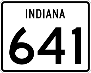
State Road 641 (SR 641) in the U.S. state of Indiana is a state road in Vigo County that bypasses the city of Terre Haute. The highway connects U.S. Route 41 (US 41) in the south and Interstate 70 (I-70) in the north.
King's Highway 109, or Highway 109, is a former provincial highway in Ontario. It was used on two separate, unrelated routes during the 1950s and 1960s:
Ontario Highway 5A (1937–1953), as a former Connecting Link in the Ontario Provincial Highway Network, bypassed portions of Ontario Highway 5 within what is now Toronto. There were two discontinuous segments:
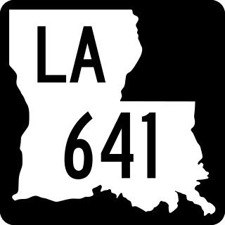
Louisiana Highway 641 (LA 641) is a state highway in Louisiana that serves St. James Parish. It travels 6.9 miles (11.1 km) in the shape of a capital J, starting northwest, veering northeast, and then turning north, serving the communities of Lutcher and Gramercy and providing a connection to Interstate 10 (I-10) for those towns.

South Carolina Highway 641 (SC 641) is a 21.560-mile (34.697 km) primary state highway in the U.S. state of South Carolina. It provides the city of Allendale with a direct route toward Charleston, via SC 64 and U.S. Route 17 (US 17). It also serves access to Rivers Bridge State Park.
Secondary Highway 500, commonly referred to as Highway 500, was a secondary highway in the Canadian province of Ontario which was first designated in 1956. Its route was renumbered in 1964, becoming:
Old Bridge Road is the name of multiple highways in the United States:
Secondary Highway 514, commonly referred to as Highway 514, was a secondary highway in the Canadian province of Ontario. It was used on two separate routes from the 1950s to the 1990s:
This page is based on this
Wikipedia article Text is available under the
CC BY-SA 4.0 license; additional terms may apply.
Images, videos and audio are available under their respective licenses.