USS Dolphin may refer to:

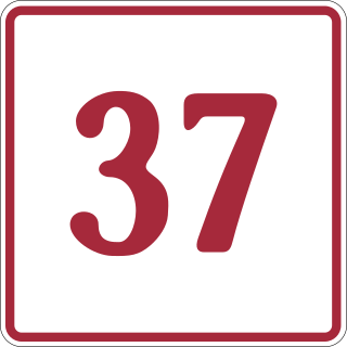
The Stewart–Cassiar Highway, also known as the Dease Lake Highway and the Stikine Highway as well as the Thornhill –Kitimat Highway from Kitimat to Thornhill, is the northwesternmost highway in the Canadian province of British Columbia. A scenic route through some of the province's most isolated areas, the highway first gained designation as British Columbia Highway 37 in the year 1975. At that time, its southern terminus was at the community of New Hazelton on the BC Highway 16. In 1975, with the completion of a new bridge over the Kitimat River, the highway's Yellowhead junction was relocated to a point on Highway 16 just south of the site of Kitwanga. Highway 37 was then extended south to Kitimat in 1986 superseding what was then designated Highway 25. At the north end, the highway briefly stretches into the Yukon, becoming Yukon Highway 37.
State Road 874 (SR 874), named the South Miami Dade Don Shula Expressway for its length, is a controlled-access toll road in southern Miami-Dade County, Florida. It extends 7 miles (11 km) northeast from the Homestead Extension of Florida's Turnpike (HEFT) in southwestern Kendall to SR 826 in Glenvar Heights, allowing traffic from the far south of Miami-Dade County and the Florida Keys to move to more central regions of metropolitan Miami and vice versa, bypassing communities along US 1, while also permitting local access to the Kendall district. The road, named in honor of the long-serving coach of the Miami Dolphins NFL team, is maintained and tolled by the Miami-Dade Expressway Authority (MDX). Contrary to the numbering plan of Florida State Roads, SR 874 is signed north–south.
State Road 878 (SR 878), named the Snapper Creek Expressway, is a 2.7-mile (4.3 km) east–west controlled-access toll road south of Miami, Florida. The expressway is named for the nearby Snapper Creek which runs parallel to SR 878. It acts as a spur route of SR 874, providing access to U.S. Route 1 (US 1) near South Miami and local access to the eastern Kendall area while bypassing the Dadeland district. The road is maintained and tolled by the Miami-Dade Expressway Authority (MDX).

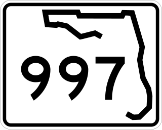
State Road 997, also known as Krome Avenue and West 177th Avenue is a 36.7-mile-long (59.1 km) north–south state highway in western Miami-Dade County, Florida. It runs from State Road 998 in Homestead north across U.S. Route 41 to U.S. Route 27 near Countyline Dragway, just south of the Broward County line. Its main use is as a bypass around the western side of Miami, linking the routes that run southwest, west and northwest from that city. The road passes through newer suburbs in the southern third of its length, while the northern two thirds of the highway traverse the eastern edge of the Everglades.

State Road 990 is the 2.97-mile-long (4.78 km) central section of the approximately 11.6-mile-long (18.7 km) Killian Drive, also known as Killian Parkway, Southwest 104th Street and Southwest 112th Street and historically South Kendall Drive, located in southern Miami-Dade County, Florida. Running from east to west, it serves to connect the community of The Hammocks with the village of Pinecrest via the community of Kendall, with State Road 990 connecting Southwest 107th Avenue and the Don Shula Expressway to the South Dixie Highway. Recognising the role the road played in southern Miami-Dade County's history and development, the section of State Road 990 between the Expressway and US 1 was designated the Killian Drive State Historic Highway by the Florida Senate in 1995.
Interstate 80 (I-80) is a transcontinental Interstate Highway in the United States, stretching from San Francisco, California, to Teaneck, New Jersey. In Indiana, it consists entirely of the following two highways:
USS LST-874 was an LST-542-class tank landing ship in the United States Navy. Like many of her class, she was not named and is properly referred to by her hull designation.
Sultan-ul-Arifeen is an Arabic word/title which literally means "the king among those who have Knowledge " and may refer to:
King's Highway 109, or Highway 109, is a former provincial highway in Ontario. It was used on two separate, unrelated routes during the 1950s and 1960s:
Ontario Highway 5A (1937–1953), as a former Connecting Link in the Ontario Provincial Highway Network, bypassed portions of Ontario Highway 5 within what is now Toronto. There were two discontinuous segments:
Secondary Highway 500, commonly referred to as Highway 500, was a secondary highway in the Canadian province of Ontario which was first designated in 1956. Its route was renumbered in 1964, becoming:

Kentucky Route 1447 is a 9.242-mile-long (14.874 km) state highway in the U.S. State of Kentucky. Its western terminus is at KY 1932 in Louisville and its eastern terminus is at KY 146.
Caesium oxide, or cesium oxide, describes inorganic compounds composed of caesium and oxygen. Several binary oxides of caesium are known.
Secondary Highway 514, commonly referred to as Highway 514, was a secondary highway in the Canadian province of Ontario. It was used on two separate routes from the 1950s to the 1990s:
This page is based on this
Wikipedia article Text is available under the
CC BY-SA 4.0 license; additional terms may apply.
Images, videos and audio are available under their respective licenses.


