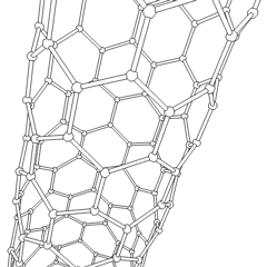
A nanotube is a nanometer-scale hollow tube-like structure.

Thunchan Parambu is a village in Tirur, Kerala, South India. It is 2 km south west of Tirur railway station and 28 km west of the District Headquarters city. It is a residential area.

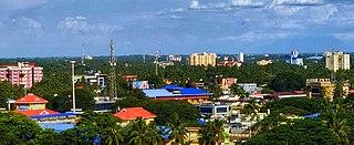
Maradu is a municipality in the Ernakulam district of Kerala, India. Maradu is located 6.1 km (3.8 mi) east of the Kochi city centre, and is a part of the Kochi metropolitan area. Maradu is an inner suburb of Kochi, located immediately south of Vyttila and connected to Thevara in the west by the Kundanoor bypass. National highways NH 85, NH 966 B and NH 66 passes through Maradu and has played a vital role in the development of the area.
Armed conflicts between Greece and Kievan Rus' include:
Highway 966 is a provincial highway in the Canadian province of Saskatchewan. It runs from Highway 905 near Stony Rapids until a dead end near Riou Lake. It is about 30 kilometres (19 mi) long.
This is a discussion of telephone numbers in the nation of Saudi Arabia. The country's calling code is +966. In addition to a numbering plan, there are also dedicated numbers or number formats for Internet services, toll-free numbers, and public or emergency services.

Keezhattur is a village in Malappuram district in the state of Kerala, India. Poonthanam illam, the birthplace of "bhakthakavi" Poonthanam namboothiri, famous ancient Malayalam poet, is located here. The poonthanam illam is now a popular cultural centre. Keezhattur is a moderately large panchayat.The major place in keezhattur panchayat is kizhattur.'kizhattur pooram' is the major festival in keezhattur. Its administrative offices are located in Akkaparambu, which is about 12 km away from Perinthalmanna, the largest city of Malappuram district.

Pallikkal is a T-shaped town, village and gram panchayat in Kondotty Taluk, Malappuram district in the state of Kerala, India.
Puthuppariyaram is a suburb of Palakkad city, Kerala,India. Puthuppariyaram lies on National Highway 966 and is located about 5 km from district headquarters and 124 km from Kozhikode. Puthuppariyaram Panchayat is one among the Panchayat which is supposed to be part of proposed Palakkad Municipal Corporation.

National Highway 966 is a highway which connects Palakkad, Malappuram and Kozhikode district headquarters in Kerala. It was previously known as NH 213. It covers a distance of 125 km. At Ramanattukara, near Kozhikode, it joins NH 66. At Palakkad it joins NH 544, which connects Coimbatore and Cochin through Palakkad. The Palakkad–Kozhikode Greenfield Highway has been proposed in order to decongest the traffic on NH 966 and reduce travelling time between Kozhikode and Palakkad.
Angadippuram is a census town and major suburb of Perinthalmanna town, in the Malappuram District of Kerala. It was the capital of the powerful medieval kingdom of Valluvanad. Angadippuram is also known for Angadippuram Laterite, a notified geo-heritage monument. Angadippuram is famous for its two temples, the Thirumandhamkunnu Temple and the Tali Mahadeva Temple. Kozhikode - Palakkad National Highway 966 passes through the town and Angadipuram Railway Station is one of the major railway stations on the Nilambur - Shornur Line of Palakkad Division, Southern Railways. It is connected to the major cities Kochi and Thiruvananthapuram by this line.

The Rural Municipality of Preeceville No. 334 is a rural municipality (RM) in the Canadian province of Saskatchewan within Census Division No. 9 and SARM Division No. 4.
King's Highway 109, or Highway 109, is a former provincial highway in Ontario. It was used on two separate, unrelated routes during the 1950s and 1960s:
Ontario Highway 5A (1937–1953), as a former Connecting Link in the Ontario Provincial Highway Network, bypassed portions of Ontario Highway 5 within what is now Toronto. There were two discontinuous segments:
Cherukavu is a census town in Malappuram district in the state of Kerala, India.

Perinthalmanna is a major town and municipality in Malappuram district, Kerala, India. It serves as the administrative centre for the Perinthalmanna taluk, as well as a revenue division, a community development block, and a police sub-division bearing the same name. It was formerly the headquarters of Valluvanad Taluk, which was one of the two Taluks in the Malappuram Revenue Division of the erstwhile Malabar District during the British Raj. The city is located 23 kilometres (14 mi) southwest to the city of Malappuram at the centre of the Kozhikode–Malappuram–Perinthalmanna–Palakkad National Highway 966.
Mundur is a town and gram panchayat in the Palakkad district, state of Kerala, India. Mundur is an important junction which connects National Highway 966 and State Highway 53. It is located about 11 km from Palakkad city and is one of the growing suburbs.
Secondary Highway 500, commonly referred to as Highway 500, was a secondary highway in the Canadian province of Ontario which was first designated in 1956. Its route was renumbered in 1964, becoming:
Secondary Highway 514, commonly referred to as Highway 514, was a secondary highway in the Canadian province of Ontario. It was used on two separate routes from the 1950s to the 1990s:
This page is based on this
Wikipedia article Text is available under the
CC BY-SA 4.0 license; additional terms may apply.
Images, videos and audio are available under their respective licenses.