The following highways are numbered 917:
The following highways are numbered 917:
| Preceded by 916 | Lists of highways 917 | Succeeded by 918 |

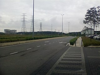
Telok Panglima Garang is a mukim in Kuala Langat District, Selangor, Malaysia. The Telok Panglima Garang Free Trade Zone (FTZ) is located here. The town is administered by the Zone 4, 5 and 8 of the Kuala Langat Municipal Council.
Highway 917 is a provincial highway in the north-west region of the Canadian province of Saskatchewan. It runs from Highway 916 to a dead end near Doré Lake. It is about 25 kilometres (16 mi) long.
Pursat municipality is a municipality in Pursat province, Cambodia. The provincial capital Pursat is located within the municipality. The municipality was formerly known as Sampov Meas district.

Pennsylvania Route 917 (PA 917) is a 11.15-mile-long (17.94 km) state highway located in Washington County, Pennsylvania. The southern terminus is at U.S. Route 40 in North Bethlehem Township. The northern terminus is at PA 136 in Fallowfield Township.

Càng Long is a rural district (huyện) of Trà Vinh province in the Mekong Delta region of Vietnam. As of 2019 the district had a population of 287.955. The district covers an area of 284 km². The district capital lies at Càng Long. In Sino-Vietnamese script, used until 1945, the city's name is given as 冈隆.

South Carolina Highway 917 (SC 917) is a 39.690-mile (63.875 km) state highway in the northeastern part of the U.S. state of South Carolina. It travels from the SC 410/SC 9 Business intersection between Green Sea and Loris in Horry County to the SC 38 intersection outside Latta in Dillon County.

Highway 215 is a designation for three north–south state highways in northwest Arkansas. A southern route of 8.80 miles (14.16 km) runs north from Franklin County Road 31 and Franklin County Road 221 (CR 31/CR 221) at Dahoma to Highway 96 near the Arkansas River. A second route of 15.94 miles (25.65 km) begins at US Route 64/Highway 917 (US 64/AR 917) in Mulberry and runs north to CR 77/CR 102 in the Ozark National Forest. A third segment of 16.44 miles (26.46 km) begins at Highway 23 at Cass and runs north to Johnson CR 36 at Oark.
King's Highway 109, or Highway 109, is a former provincial highway in Ontario. It was used on two separate, unrelated routes during the 1950s and 1960s:

Farm to Market Road 157 is a Farm to Market Road in the US state of Texas, traveling from an exit on Texas State Highway 121 south, through Euless, Bedford, Fort Worth, and Arlington in Tarrant County, then enters Johnson County, and passes through Mansfield, and Venus, before entering Ellis County, and terminating at an intersection with Farm to Market Road 66 in Maypearl. While located in Euless and Bedford, FM 157 is known as Industrial Boulevard, while in Fort Worth, it is known as Collins Street. In Arlington, the route continues on North Collins, Division, and South Cooper Streets. In Mansfield, the road is known as Main Street and Lone Star Road; in Venus as Main, 8th & 7th Streets; and in Maypearl as Highway 157. The highway passes directly through the center of Euless and Bedford, passing large neighborhoods and businesses. The route passes a large wetland before passing directly through downtown Arlington, passing major attractions such as AT&T Stadium and Globe Life Field. The route passes through the center of the University of Texas at Arlington, and continues through downtown and southern Arlington, before entering Mansfield. The route continues through central Mansfield, and south to Maypearl. The Texas Department of Transportation (TxDOT) designated the route in 1945, and redesignated the portion traveling from SH 121 to US Bus. 287 as Urban Road 157 from 1995 until 2018.

There are currently nine business routes of U.S. Highway 287 in Texas that are designated and maintained by the Texas Department of Transportation (TxDOT). The business routes in the US state of Texas are traditionally short spurs or loops that connect the main route, in this case, U.S. Highway 287 (US 287), to the center or commercial district of a city. The routes commonly follow the course of a decommissioned state highway, or the old course of the main route. Business routes are signed with the traditional US 287 highway shield, and with a small "business plate" placed above the marker. TxDOT regards business routes as official highways, and is responsible for the maintenance of the route.
Secondary Highway 500, commonly referred to as Highway 500, was a secondary highway in the Canadian province of Ontario which was first designated in 1956. Its route was renumbered in 1964, becoming:
The Philippine highway network is a network of national roads owned and maintained by the Department of Public Works and Highways (DPWH) and organized into three classifications according to their function or purpose: national primary, secondary, and tertiary roads. The national roads connecting major cities are numbered from N1 to N83. They are mostly single and dual carriageways linking two or more cities.
Secondary Highway 514, commonly referred to as Highway 514, was a secondary highway in the Canadian province of Ontario. It was used on two separate routes from the 1950s to the 1990s: