The following highways are numbered 986:
| Preceded by 985 | Lists of highways 986 | Succeeded by 987 |

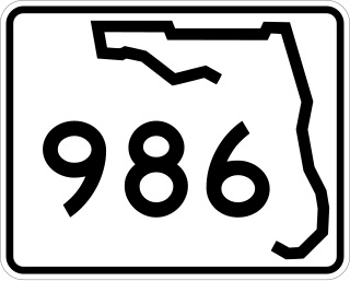
Sunset Drive, also known as Southwest 72nd Street is a 12.5-mile-long (20.1 km) east–west arterial road traversing the southwestern suburbs of Miami, Florida, from the northwestern portions of the Kendall area to Coral Gables. A central portion of Sunset Drive is maintained by the Florida Department of Transportation as State Road 986, which runs from the Homestead Extension (HEFT) underpass to Southwest 69th Avenue and is signed through South Miami to US 1.
Dano-Swedish War may refer to one of multiple wars which took place between the Kingdom of Sweden and the Kingdom of Denmark up to 1814:

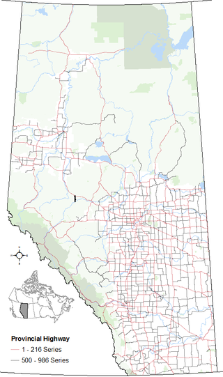
Alberta Provincial Highway No. 31, commonly referred to as Highway 31, is a short north–south highway in central Alberta, Canada. Highway 31 begins at Highway 16, 3.3 km (2.1 mi) east of Gainford, and ends 3.9 km (2.4 mi) to the south in Seba Beach, where it continues south as Highway 759.
USS LST-986 was an LST-542-class tank landing ship in the United States Navy. Like many of her class, she was not named and is properly referred to by her hull designation.

Alberta Provincial Highway No. 947, commonly referred to as Highway 947, is a designated north-south highway in northern Alberta, Canada that is partially constructed. Upon completion, the entire highway will span approximately 89 km (55 mi) from Highway 16 to Highway 43. The constructed portion of the highway consists of the final 20 km (12 mi) of the route from the Athabasca River to Highway 43.
BulyeaBUUL-yay is a village in the Canadian province of Saskatchewan within the Rural Municipality of McKillop No. 220 and Census Division No. 6.
Lintlaw is a village in the Canadian province of Saskatchewan within the Rural Municipality of Hazel Dell No. 335 and Census Division No. 9. The village is located at the intersection of Highway 49 and Highway 617, 142 km northwest of the City of Yorkton.

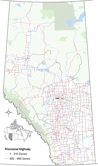
Alberta Provincial Highway No. 628, commonly referred to as Highway 628, is a highway in the province of Alberta, Canada, that runs west to east through the Edmonton Capital Region in two sections. The western 19-kilometre-long (12 mi) section runs from the town of Stony Plain to the Edmonton city limits at 231 Street. The eastern 6-kilometre-long (4 mi) section, also known as a Whitemud Extension, runs from Anthony Henday Drive to Highway 21 and it is just at the south of Sherwood Park.

Alberta Provincial Highway No. 814, commonly referred to as Highway 814, is a highway in the province of Alberta, Canada. It runs south–north from Highway 13 in Wetaskiwin to Beaumont town limits at Highway 625. This highway used to extend to Edmonton limits, until the Beaumont government took control of the road. This extension is the most direct link between Edmonton and the suburb of Beaumont. This route is also known as 47 Street in Wetaskiwin, and 50 Street in Beaumont and Edmonton.
Alberta Provincial Highway No. 686, also known as Highway 686, is an east–west highway in northern Alberta, Canada. It has two sections; the main section is a gravel highway that spans approximately 90 kilometres (56 mi) from Highway 88 near Red Earth Creek to Trout Lake, and a two-kilometre-long (1.2 mi) developing freeway section in Fort McMurray which connects Highway 63 with the new neighbourhood of Parsons Creek known as Parsons Access Road.

Symons Valley Road is a major arterial road and rural highway that links Calgary from Stoney Trail to Madden in Alberta, Canada. It is preceded by Beddington Trail, a major expressway along West Nose Creek linking Deerfoot Trail to Stoney Trail within Calgary, and is succeeded by Range Road 30. The portion of Symons Valley Road within Rocky View County from the Calgary city limit to Highway 574 south of Madden is designated as Alberta Provincial Highway No. 772.
Alberta Provincial Highway No. 921 is a designated future north-south highway in central Alberta, Canada. Consisting of two future segments, the highway will be approximately 16 km (9.9 mi) in length, not including a future 12 km (7.5 mi) concurrency along Highway 11, once constructed.

Alberta Provincial Highway No. 986, commonly referred to as Highway 986, is an east-west highway in Northern Alberta. It spans approximately 158 km (98 mi) from Highway 35 to Highway 88.
King's Highway 109, or Highway 109, is a former provincial highway in Ontario. It was used on two separate, unrelated routes during the 1950s and 1960s:
Ontario Highway 5A (1937–1953), as a former Connecting Link in the Ontario Provincial Highway Network, bypassed portions of Ontario Highway 5 within what is now Toronto. There were two discontinuous segments:
Mór is an Irish language feminine given name.
"So Alive" is a song by singer-songwriter Ryan Adams from his 2003 album Rock n Roll. The song was co-written with Johnny T. Yerington and was released as a single in 2004.
Secondary Highway 500, commonly referred to as Highway 500, was a secondary highway in the Canadian province of Ontario which was first designated in 1956. Its route was renumbered in 1964, becoming:
Secondary Highway 514, commonly referred to as Highway 514, was a secondary highway in the Canadian province of Ontario. It was used on two separate routes from the 1950s to the 1990s: