State Road 860 (SR 860), locally known as Miami Gardens Drive or North 183rd Street, is a 13-mile-long (21 km) east–west street serving bedroom communities in northern Miami-Dade County, Florida. Its western terminus is a diamond interchange with Interstate 75 in the Palm Springs North area near Miami Lakes, passing through Carol City, Miami Gardens, and North Miami Beach before ending at an intersection with Biscayne Boulevard in Aventura.

State Route 423 (SR 423) is a 17.07-mile (27.47 km) long north–south state highway in the central portion of the U.S. state of Ohio. The southern terminus of SR 423 is in Waldo at a T-intersection that also serves as the eastern terminus of SR 47, as well as the southern terminus of SR 98. The signed northern terminus of SR 423 is at its junction with SR 231 nearly 3 miles (4.8 km) east of Morral. However, SR 423 is defined to continue northeast from this point along SR 231 for about 0.25 miles (0.40 km) before coming to an end at the U.S. Route 23 (US 23) expressway.

Florida State Road 823 (SR 823) is a 20.6-mile (33.2 km) long state highway in the U.S. state of Florida. The road runs from U.S. Route 27 in Hialeah to Interstate 595 and SR 84 in Davie. The section in Miami-Dade County, through Hialeah and Miami Lakes, is known as Red Road. In Broward County, the road turns northwest and merges into Flamingo Road, until its terminus in Davie, though the road continues without designation into Sunrise.

A major east–west commercial artery in northern Miami-Dade County, State Road 932 is a 9.7-mile-long (15.6 km) four-lane highway connecting U.S. Route 27 in Hialeah Gardens and SR 915 in Miami Shores, just south of the campus of Barry University. Locally, SR 932 is also known as North 103rd Street in greater Miami, and as 49th Street or Palm Springs Mile in Hialeah.

State Road 934 runs for 13.1 miles (21.1 km) from State Road 826 in Medley to SR A1A in Miami Beach. It is a major east–west highway in the Miami metropolitan area.

County Road 854, locally known as Ives Dairy Road, Dan Marino Boulevard, and Honey Hill Drive, is the unsigned designation for an east–west commuter road spanning 8.7 miles (14.0 km) across northern Miami-Dade County, which encompasses sections of North 199th Street, North 202nd Street, North 203rd Street, and North 205th Terrace. Its western terminus is an intersection with Red Road/Northwest 57th Avenue near Miami Lakes and Carol City, the eastern terminus is an intersection with Biscayne Boulevard in Aventura, a half block east of an overpass over West Dixie Highway that once served as part of the Dixie Highway and US 1.

Griffin Road is a boulevard extending 18.2 miles (29.3 km) in Broward County, mostly designated State Road 818 (SR 818). It begins at Orange Drive in Southwest Ranches and continues east to Federal Highway (US 1) in Dania Beach. The westernmost 7.5 miles (12.1 km) of Griffin Road are designated as County Road 818 (CR 818).

Red Road, also known as West 57th Avenue, is a 20.6-mile (33.2 km) main north-south street running west of downtown Miami in Miami-Dade County, Florida and into Broward County. Red Road is signed as State Road 959 from U.S. 1 to the south end of the Miami International Airport, and State Road 823 from U.S. 27 to the Broward County line.

State Route 823 (SR 823), officially known as the Southern Ohio Veterans Memorial Highway and colloquially as the Portsmouth Bypass, is a north–south four-lane divided controlled-access highway in Scioto County, Ohio. The highway, which runs from Sciotodale to Lucasville, reroutes through traffic around the cities of Portsmouth and New Boston to the east. The bypass provides better mobility within the local area for residents and has the potential to increase the economic development of the local area. In September 2013, the Ohio Department of Transportation (ODOT) recommended a public–private partnership (P3) to fund and build the highway. Construction began in June 2015. The highway was dedicated on December 13, 2018 with vehicle traffic beginning the next day.

State Route 823 (SR 823) is a state highway in Yakima County, Washington, United States. It runs for 5.6 miles (9.0 km) from an interchange with U.S. Route 12 (US 12) and through the city of Selah to a junction with SR 821. A portion of the highway runs in the median of Interstate 82 (I-82), its parent route, as it crosses the Naches River.

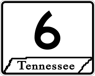
State Route 6 (SR 6) is a state highway that is unsigned. It travels through the central part of the U.S. state of Tennessee from Lawrence County to Sumner County. The highway is related to the following U.S. Highways:
This page is based on this
Wikipedia article Text is available under the
CC BY-SA 4.0 license; additional terms may apply.
Images, videos and audio are available under their respective licenses.


