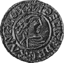
Æthelred or Ethelred is an Old English personal name and may refer to:

China National Highway 211 (G211) runs from Yinchuan in Ningxia to Xi'an in Shaanxi. It is 645 kilometres in length and runs southwest from Wuning in Ningxia and then turns southeast on a virtual straight line to Xi'an via primarily rural areas.

State Route 645 in Fairfax County, Virginia is a secondary state highway. There are six portions, three of them being major, named Wall Road, Lees Corner Road, Stringfellow Road, Clifton Road, Main Street and Burke Lake Road. There are also numerous overlaps : some include SR 657 / Centreville Road, U.S. Route 50, SR 652, SR 612, and SR 641. A concurrency used to exist at US 29 near Centreville until the 1990s.
Interstate 80 (I-80) is a transcontinental Interstate Highway in the United States, stretching from San Francisco, California, to Teaneck, New Jersey. In Indiana, it consists entirely of the following two highways:

Pennsylvania Route 645 is a state highway in the U.S. state of Pennsylvania. The route runs from U.S. Route 422 in Myerstown, Lebanon County north to PA 443 in Pine Grove Township, Schuylkill County. PA 645 heads north from Myerstown into agricultural areas and enters Berks County, where it passes through Frystown and comes to an interchange with Interstate 78 (I-78)/US 22. Past here, the route heads across forested Blue Mountain and continues into Schuylkill County, where it reaches its northern terminus. PA 645 is a two-lane undivided road its entire length. The road was paved for a short distance north of Myerstown by 1928. The paved portion was extended to Frystown in the 1930s and north of there by 1953. PA 645 was designated onto its current alignment in 1962.

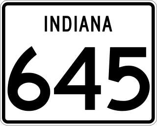
State Road 645 is a state road in the southern section of the U.S. state of Indiana. Running for about 2 miles (3.2 km) in a general east–west direction, connecting Naval Surface Warfare Center Crane Division to U.S. Route 231. SR 645 was originally introduced as small part of a much longer SR 58 in 1931. During the early 1940s SR 58 and SR 45 were rerouted around Crane Naval Ammunition Depot. SR 645 was commissioned in the early 1950s.

Secondary Highway 529, commonly referred to as Highway 529, is a provincially maintained secondary highway in the Canadian province of Ontario. Located within Parry Sound District, the highway follows a 25.7-kilometre (16.0 mi) route, from its southern terminus at Highway 69 near Pointe au Baril to its northern terminus at the Highway 69 crossing of the Magnetawan River near Byng Inlet. Two spur routes, Highway 529A and Highway 645, branch off the highway to serve the communities of Bayfield Inlet and Byng Inlet, respectively. The route was established along the present alignment of Highway 529A in 1956. It was relocated in 1961 along the former routing of Highway 69 when a bypass opened through the area, with the former alignment being renumbered as Highway 529A.
King's Highway 109, or Highway 109, is a former provincial highway in Ontario. It was used on two separate, unrelated routes during the 1950s and 1960s:
Ontario Highway 5A (1937–1953), as a former Connecting Link in the Ontario Provincial Highway Network, bypassed portions of Ontario Highway 5 within what is now Toronto. There were two discontinuous segments:
Secondary Highway 500, commonly referred to as Highway 500, was a secondary highway in the Canadian province of Ontario which was first designated in 1956. Its route was renumbered in 1964, becoming:

Kentucky Route 645 (KY 645) is a 14.692-mile-long (23.644 km) state highway in eastern Kentucky that runs from U.S. Route 23 (US 23) northeast of Ulysses to, temporarily, a dead end east of KY 40 southeast of Inez.

The Battle of Tam Kỳ took place during the Vietnam War from 3–6 March 1968. After a night-time rocket attack on their base camp by the People’s Army of Vietnam (PAVN) 3rd Regiment, 3rd Division. The 1st Squadron, 1st Cavalry Regiment and Company A, 3rd Battalion, 23rd Infantry Regiment engaged the PAVN killing 436.
Secondary Highway 514, commonly referred to as Highway 514, was a secondary highway in the Canadian province of Ontario. It was used on two separate routes from the 1950s to the 1990s:
This page is based on this
Wikipedia article Text is available under the
CC BY-SA 4.0 license; additional terms may apply.
Images, videos and audio are available under their respective licenses.


