The following highways are numbered 983:
| Preceded by 982 | Lists of highways 983 | Succeeded by 984 |
Sovetsk is the name of several urban localities in Russia.
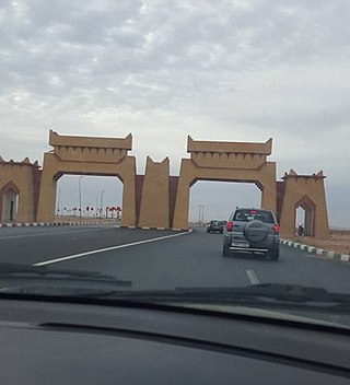
Guelmim is a city in southern Morocco, often called Gateway to the Desert. It is the capital of the Guelmim-Assif Noun region which includes southern Morocco and the northeastern corner of Western Sahara. The population of the city was 187,808 as of the 2014 Moroccan census, making it the largest city in the region. The N1 and N12 highways cross at Guelmim and link it to the nearby region of Souss-Massa.
The Federal Route 2 is a major east–west oriented federal highway in Malaysia. The 276.9 kilometres (172 mi) road connects Port Klang in Selangor to Kuantan Port in Pahang. The Federal Route 2 became the backbone of the road system linking the east and west coasts of Peninsula Malaysia before being surpassed by the East Coast Expressway E8.
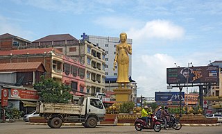
Serei Saophoan is the capital and largest city of the Banteay Meanchey Province and the fourth most populous city in Cambodia. The city separates Cambodia's National Highway 5 and National Highway 6. Its administrative name is "Serei Sophon" as used by the government. The more commonly used name Sisophon is derived from the Thai pronunciation Si Sophon when it was under the Thai rule. Another nickname "Svay" is used mainly by truck drivers, train drivers and workers transporting goods. The origin of the word "Svay" is unknown. Its population is 61,482 in the 1998 census, changing little to 61,631 in the 2008 census having been overtaken by Poipet in size.
The Federal Route 8, also known as the Kuala Lumpur–Kota Bharu Highway, is a 402.7-km federal highway in Malaysia. It connects Bentong in the south to Kota Bharu in the north. The highway had two parts - Kota Bharu–Kuala Krai Road and Bentong–Kuala Lipis Road until the completion of the missing link from Kuala Krai to Kuala Lipis, causing the entire FT8 highway to take 99 years to be completed.
Highway 984 is a provincial highway in the east central region of the Canadian province of Saskatchewan. It runs from Highway 23 near Somme to a dead end past the Piwei River Recreation Site. The highway connects with Highway 983 and is about 18 kilometres (11 mi) long.
Highway 983 is a provincial highway in the east-central region of the Canadian province of Saskatchewan.
Highway 982, also known as Little Swan Road, is a provincial highway in the east central region of the Canadian province of Saskatchewan. It runs from Highway 8 to Highway 9 and is about 57 kilometres (35 mi) long.

Maxcanú is a large town in the western part of the Mexican state of Yucatán; it also functions as the seat for the Maxcanú Municipality. It is located on Federal Highway 180, approximately 62 km (39 mi) south of Mérida.
Pandulf may refer to:

Serei Saophoan is a municipality (krong) in the centre of Banteay Meanchey province, in north-western Cambodia. Serei Saophoan is the urban district of Banteay Meanchey province and the district capital is also the provincial capital Sisophon town. The town is located 359 kilometres north of Phnom Penh and 48 kilometres from the border with Thailand at Poipet. Serei Saophoan municipality is the central municipality of Banteay Meanchey and is surrounded by other Banteay Meanchey districts. Cambodia's main railway line from Phnom Penh to Poipet enters the municipality from the south and exits to the west.
National Highway 140 is a National Highway in the Indian state of Andhra Pradesh. It starts near Chittoor and terminates near Tirupati. This is one of the best laid National Highways in South India. There are 6 main carriageways, plus 2+2 lanes of service road. The tarmac is simply superb and ultra smooth with no potholes or undulations, and better than the Mysore-Bangalore expressway. The road has very few disturbances in the form of crossings or entry/exit points. Very safe to drive at permissible high speeds. If you love driving, this is a stretch of road you should not miss. It has a total length of 61.128 km (37.983 mi).
The Goorudee Rivulet, a perennial river of the Murrumbidgee catchment of the Murray–Darling basin, is located in the Snowy Mountains region of New South Wales, Australia.
The Maclaughlin River, a perennial river of the Snowy River catchment, is located in the Monaro region of New South Wales, Australia.
King's Highway 109, or Highway 109, is a former provincial highway in Ontario. It was used on two separate, unrelated routes during the 1950s and 1960s:
Ontario Highway 5A (1937–1953), as a former Connecting Link in the Ontario Provincial Highway Network, bypassed portions of Ontario Highway 5 within what is now Toronto. There were two discontinuous segments:

Maryland Route 983 was the unsigned designation for a pair of state highways in the U.S. state of Maryland. The highways formed parts of the old alignment of MD 216 on either side of Interstate 95 (I-95) in North Laurel in southeastern Howard County. MD 983 had a length of 1.02 miles (1.64 km) and ran on the east side of I-95. MD 983A spanned 0.71 miles (1.14 km) on the west side of I-95. MD 216 through North Laurel was built in the early 1920s. The segments of MD 983 were designated when MD 216 was relocated east of I-95 in the early 1960s and west of I-95 in the late 1970s. In 2017, both MD 983 and MD 983A were removed from the state highway system and transferred to county maintenance.
Secondary Highway 500, commonly referred to as Highway 500, was a secondary highway in the Canadian province of Ontario which was first designated in 1956. Its route was renumbered in 1964, becoming:
Secondary Highway 514, commonly referred to as Highway 514, was a secondary highway in the Canadian province of Ontario. It was used on two separate routes from the 1950s to the 1990s: