The following highways are numbered 710:
| Preceded by 709 | Lists of highways 710 | Succeeded by 711 |

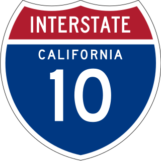
Route 710, consisting of the non-contiguous segments of State Route 710 (SR 710) and Interstate 710 (I-710), is a major north–south state highway and auxiliary Interstate Highway in the Los Angeles metropolitan area of the U.S. state of California. Also called the Los Angeles River Freeway prior to November 18, 1954, the highway was initially planned to connect Long Beach and Pasadena, but a gap in the route exists from Alhambra to Pasadena through South Pasadena due to community opposition to its construction.

The Ventura Freeway is a freeway in southern California, United States, that runs from the Santa Barbara/Ventura county line to Pasadena in Los Angeles County. It is the principal east–west route through Ventura County and in the southern San Fernando Valley in Los Angeles County. From the Santa Barbara County line to its intersection with the Hollywood Freeway in the southeastern San Fernando Valley in Los Angeles, it is signed as U.S. Route 101 (US 101), which was built in the late 1950s and opened on April 5, 1960. The segments from the Santa Barbara County line to Sea Cliff, and from Solimar Beach to Oxnard, are also concurrent with State Route 1 (SR 1), although no signs mention SR 1 there. East of the Hollywood Freeway intersection, the Ventura Freeway is signed as State Route 134 (SR 134), which was built by 1971.

Interstate 105 (I-105) is an east–west auxiliary Interstate Highway in the Greater Los Angeles urban area of Southern California. It runs from State Route 1 (SR 1) near El Segundo and Los Angeles International Airport (LAX) to I-605 in the City of Norwalk. It is commonly known as the Century Freeway after Century Boulevard which it parallels, and also officially known as the Glenn Anderson Freeway after the late congressman Glenn M. Anderson who advocated for its construction.

State Route 60 (SR 60) is an east–west state highway in the U.S. state of California. It serves the cities and communities on the eastern side of the Los Angeles metropolitan area and runs along the south side of the San Gabriel Valley. It functions as a bypass route of Interstate 10 (I-10) through the area between the East Los Angeles Interchange in Los Angeles and Beaumont. SR 60 provides a route across several spurs of the Peninsular Ranges, linking the Los Angeles Basin with the Pomona Valley and San Gabriel Valley. The highway also runs concurrently with SR 57 and I-215. Portions of SR 60 are designated as either the Pomona Freeway or the Moreno Valley Freeway.

The Southern California freeways are a vast network of interconnected freeways in the megaregion of Southern California, serving a population of 23 million people. The Master Plan of Metropolitan Los Angeles Freeways was adopted by the Regional Planning Commission in 1947 and construction began in the early 1950s. The plan hit opposition and funding limitations in the 1970s, and by 2004, only some 61% of the original planned network had been completed.

The Foothill Freeway is a freeway in the Los Angeles metropolitan area, California, United States, running from the Sylmar district of Los Angeles east to Redlands. The western segment is signed as Interstate 210 (I-210) from its western end at I-5 to SR 57 in Glendora, while the eastern segment is signed as State Route 210 (SR 210) to its eastern terminus at I-10. Under the California Streets and Highways Code, the entire Foothill Freeway is legally referred to as Route 210.

Maryland Route 10 is a state highway in the U.S. state of Maryland. Known as the Arundel Expressway, the highway runs 7.17 miles (11.54 km) from MD 2 in Pasadena north to Interstate 695 (I-695) near Glen Burnie. MD 10 is a four- to six-lane freeway that serves as a bypass of MD 2 through Pasadena and Glen Burnie in northeastern Anne Arundel County. The Arundel Expressway was planned as a Baltimore–Annapolis freeway to provide relief to MD 2 between the cities as early as the 1950s. However, the portion of MD 10 south of Pasadena was removed from state plans when the I-97 corridor was chosen for the intercity freeway in the 1970s. MD 10 was constructed from I-695 to MD 710 in the early 1970s and continued south to MD 648 in the late 1970s. The freeway was extended south to MD 100 and completed to MD 2 in the late 1980s and early 1990s, respectively.

State Route 47 is a state highway in the U.S. state of California, connecting Terminal Island to the mainland in the Los Angeles area. From its south end at I-110 in San Pedro, it heads east across the Vincent Thomas Bridge to the island and the end of state maintenance. The state highway begins again at the junction with I-710 on Terminal Island, crossing the Schuyler Heim Bridge north to the mainland and the second terminus, where SR 103 begins. Signage continues along a locally maintained route, mainly Alameda Street, to the Gardena Freeway in Compton, and an unconstructed alignment follows the same corridor to the Santa Monica Freeway (I-10) near downtown Los Angeles.

State Route 103 is a state highway in the U.S. state of California that forms part of the Terminal Island Freeway in Los Angeles and Long Beach. It runs from State Route 47 near Terminal Island north to State Route 1 in Long Beach. At the south end of SR 103, the Terminal Island Freeway runs south with SR 47 over the Commodore Schuyler F. Heim Bridge to its end at Ocean Boulevard on Terminal Island, at the former Long Beach Naval Shipyard. SR 47 then turns west there to its end at Interstate 110.

State Road 710 is a 57-mile (92 km) northwest-southeast route connecting SR 70 near Okeechobee, three miles (5 km) from the northern tip of Lake Okeechobee in south central Florida, to Old Dixie Highway in Riviera Beach. Most of the route is also known as Bee-Line Highway and Dr. Martin Luther King Jr. Boulevard, as it parallels the railroad tracks maintained by CSX Transportation and used by Amtrak; and doesn’t have a turn or curve in the 48 miles (77 km) southeast of Sherman, except for a small bend northwest of North Palm Beach County General Aviation Airport. Near the middle of the highway, where Indiantown is located, the route is also known as Warfield Boulevard, named after S. Davies Warfield, the president of the Seaboard Air Line Railroad who originally built the adjacent railroad tracks.
Interstate 10 (I-10) is a transcontinental Interstate Highway in the United States, stretching from Santa Monica, California, to Jacksonville, Florida. The segment of I-10 in California, also known as the Pearl Harbor Memorial Highway, runs east from Santa Monica through Los Angeles, San Bernardino, and Palm Springs before crossing into the state of Arizona. In the Greater Los Angeles area, it is known as the Santa Monica and San Bernardino freeways, linked by a short concurrency on I-5 at the East Los Angeles Interchange. I-10 also has parts designated as the Rosa Parks and Sonny Bono Memorial freeways. Some parts were also formerly designated as the Christopher Columbus Transcontinental Highway. However, the California State Legislature removed this designation following the passage of a bill on August 31, 2022. I-10 is also known colloquially as "the 10" to Southern California residents .

The California Freeway and Expressway System is a system of existing or planned freeways and expressways in the U.S. state of California. It encompasses both State highways and federal highways in California. It was defined by Article 2 of Chapter 2 of Division 1 of the Streets and Highways Code. which was originally added by Chapter 1062 of 1959.
Interstate 80 (I-80) is a transcontinental Interstate Highway in the United States, stretching from San Francisco, California, to Teaneck, New Jersey. In Indiana, it consists entirely of the following two highways:
Below is a list and summary of the unconstructed state highways in the U.S. state of Arizona. Some are currently proposed while the others have since been cancelled prior to being constructed.

State Route 710 is a 4.06-mile-long (6.53 km) state highway in the central portion of the U.S. state of Ohio. Existing entirely within the northern portion of the city of Columbus, SR 710 begins at an intersection with SR 161, less than one-quarter mile (0.40 km) west of exit 117 off Interstate 71 (I-71). The highway ends at a seven-ramp partial cloverleaf interchange with I-270 at its exit 27.
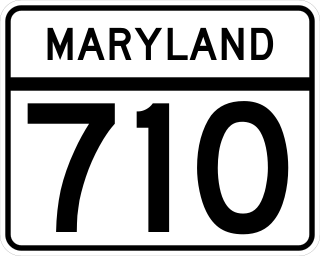
Maryland Route 710 is a state highway in the U.S. state of Maryland. Known as Ordnance Road, the state highway runs 2.16 miles (3.48 km) from MD 2 in Glen Burnie east to MD 173 in Brooklyn Park at the city limits of Baltimore. MD 710 provides access to the Defense Logistics Agency Curtis Bay Depot, a unit of the General Services Administration. The state highway is named for the federal site's prior use as a U.S. Army Depot. MD 710 was constructed in the early 1940s and relocated for most of its length concurrent with the construction of MD 10 in the early 1970s.
Beeline Highway may refer to:

North Carolina Highway 710 (NC 710) is a primary state highway in the U.S. state of North Carolina. It connects the town of Pembroke to Interstate 74 (I-74) and U.S. Route 74 and the nearby towns of Red Springs and Rowland.