Romanization of Greek is the transliteration (letter-mapping) or transcription (sound-mapping) of text from the Greek alphabet into the Latin alphabet.
Annual average daily traffic, abbreviated AADT, is a measure used primarily in transportation planning, transportation engineering and retail location selection. Traditionally, it is the total volume of vehicle traffic of a highway or road for a year divided by 365 days. AADT is a simple, but useful, measurement of how busy the road is.
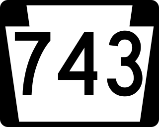
Pennsylvania Route 743 is a north–south state route located in central Pennsylvania. The southern terminus is at PA 441 in Marietta. The northern terminus is at U.S. Route 22 near the East Hanover Township hamlet of Grantville though some signage has it continue north past Interstate 81 (I-81) to PA 443. The route runs north through Lancaster County, passing through Maytown before reaching Elizabethtown. Here, the route has concurrencies with PA 230 and PA 241 and comes to an interchange with the PA 283 freeway. PA 743 continues into Dauphin County and crosses PA 341 before reaching Hershey. In Hershey, the route follows Cocoa Avenue between US 322 and US 422, the latter which is known as Chocolate Avenue. PA 743 follows Park Avenue north past Hersheypark and Hersheypark Drive east before heading north on Laudermilch Road from Hershey to Grantville.
Interstate 80 (I-80) is a transcontinental Interstate Highway in the United States, stretching from San Francisco, California, to Teaneck, New Jersey. In Indiana, it consists entirely of the following two highways:

Pennsylvania Route 241 is a 23.6-mile-long (38.0 km) state highway in the U.S. state of Pennsylvania. The route runs from PA 441 in Conoy Township, Lancaster County, northeast to PA 72 in the city of Lebanon in Lebanon County. The route heads east from PA 441 to Elizabethtown, where it runs concurrent with both PA 230 and PA 743. PA 241 continues into Lebanon County and intersects PA 341 and PA 117 in Colebrook. The route heads northeast and forms a concurrency with U.S. Route 322 before continuing to Lebanon.
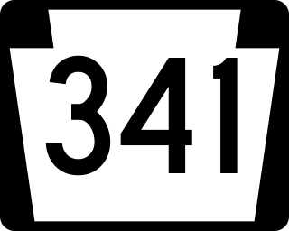
Pennsylvania Route 341 is a state highway in the U.S. state of Pennsylvania. The route runs 10.7 miles (17.2 km) from PA 230 in Londonderry Township in Dauphin County east to PA 241 in South Londonderry Township in Lebanon County. The route is a two-lane undivided road known as Colebrook Road for its entire length, passing through rural areas. Along the way, PA 341 crosses PA 743 near Deodate and passes through Upper Lawn. An eastbound truck route, PA 341 Truck, bypasses the route between PA 230 and PA 743. PA 341 was first designated onto its current alignment by 1930, running between U.S. Route 230 and PA 241. The route was fully paved in the 1930s. Between the 1930s and 1940s, PA 341 headed southeast along Lawn Road to end at PA 241 in Lawn.
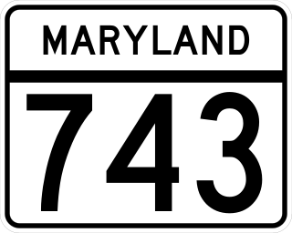
Maryland Route 743 (MD 743) is a state highway in the U.S. state of Maryland. The state highway runs 1.00 mile (1.61 km) from MD 36 in Frostburg east to U.S. Route 40 Alternate (US 40 Alternate) in Eckhart Mines. MD 743 is the original alignment of US 40 through Eckhart Mines. The state highway was designated when US 40 bypassed Eckhart Mines around 1950.
Theodemir, Theodemar, Theudemer or Theudimer was a Germanic name common among the various Germanic peoples of early medieval Europe. According to Smaragdus of Saint-Mihiel, the form Theudemar is Frankish and Theudemir is Gothic.

Horse Lakes 152B is an Indian reserve of the Horse Lake First Nation in Alberta. It is 60 km (37 mi) northwest of Grande Prairie at an elevation of 774 m (2,539 ft).

State Route 743 is a short east–west state highway in southwestern Ohio, a U.S. state. The highway's western terminus is in the village of Moscow at the intersection of Wells Street and 5th Street, a mere two blocks off of U.S. Route 52 (US 52). Traversing Clermont County's Moscow and Washington Township, SR 743 ultimately arrives at its eastern terminus at SR 222 approximately four and a half miles (7.2 km) northwest of Felicity.

The Rural Municipality of Emerald No. 277 is a rural municipality (RM) in the Canadian province of Saskatchewan within Census Division No. 10 and SARM Division No. 4.
King's Highway 109, or Highway 109, is a former provincial highway in Ontario. It was used on two separate, unrelated routes during the 1950s and 1960s:
Ontario Highway 5A (1937–1953), as a former Connecting Link in the Ontario Provincial Highway Network, bypassed portions of Ontario Highway 5 within what is now Toronto. There were two discontinuous segments:
Artavasdes is the Hellenized form of the Iranian name *R̥tavazdāʰ. Variant renderings in Greek include Artabazos (Ἀρτάβαζος), Artabazes (Ἀρταβάζης), and Artabasdos (Ἀρτάβασδος); in Armenian Artavazd (Արտավազդ); and in Latin Ardabastus or Artabasdus.
Secondary Highway 500, commonly referred to as Highway 500, was a secondary highway in the Canadian province of Ontario which was first designated in 1956. Its route was renumbered in 1964, becoming:

The Quail Fire was a wildfire that burned during the 2020 California wildfire season southwest of Winters and north of Vacaville in Solano County, California in the United States. Igniting on Saturday, June 6, within the rural confines of Quail Canyon, the fire ballooned to an estimated 1,837 acres (743 ha) and destroyed three structures including one residential property. The fire was fully contained on Wednesday, June 10, 2020, and the cause remains under investigation.
Secondary Highway 514, commonly referred to as Highway 514, was a secondary highway in the Canadian province of Ontario. It was used on two separate routes from the 1950s to the 1990s:
This page is based on this
Wikipedia article Text is available under the
CC BY-SA 4.0 license; additional terms may apply.
Images, videos and audio are available under their respective licenses.