
Interstate 880 (I-880) is a north–south auxiliary Interstate Highway in the San Francisco Bay Area of Northern California. It runs from I-280 and State Route 17 (SR 17) in San Jose to I-80 and I-580 in Oakland, running parallel to the eastern shore of San Francisco Bay. For most of its route, I-880 is officially known as the Nimitz Freeway, after World War II fleet admiral Chester W. Nimitz, who retired to the Bay Area. The northernmost five miles (8.0 km) is also commonly referred to as the Cypress Freeway, after the former alignment of the freeway and its subsequent replacement.
Interstate 580 (I-580) is an approximately 76-mile-long (122 km) east–west auxiliary Interstate Highway in Northern California. The heavily traveled spur route of I-80 runs from US Route 101 (US 101) in San Rafael in the San Francisco Bay Area to I-5 at a point outside the southern city limits of Tracy in the Central Valley. I-580 forms a concurrency with I-80 between Albany and Oakland, the latter of which is the location of the MacArthur Maze interchange immediately east of the San Francisco–Oakland Bay Bridge. I-580 provides a connection from the Bay Area to the southern San Joaquin Valley and Southern California via I-5, as I-5 bypasses the Bay Area to the east.

Interstate 980 (I-980) is a short 2.03-mile (3.27 km) auxiliary Interstate Highway entirely within Oakland in Northern California, connecting I-580 and State Route 24 (SR 24) to I-880 near Downtown Oakland. I-980 passes the Oakland Convention Center and near the famous Jack London Square. I-980 is commonly considered the dividing line between Downtown Oakland and West Oakland. The freeway was planned as the eastern approach to the Southern Crossing. It is officially known as the John B. Williams Freeway, after the former director of the city of Oakland's Office of Community Development.

Interstate 280 (I-280) is a 57.22-mile-long (92.09 km) major north–south auxiliary Interstate Highway in the San Francisco Bay Area of Northern California. It runs from I-680 and US Route 101 (US 101) in San Jose to King and 5th streets in San Francisco, running just to the west of the larger cities of San Francisco Peninsula for most of its route.
Route 238, consisting of State Route 238 (SR 238) and Interstate 238 (I-238), is a mostly north–south state and auxiliary Interstate highway in the San Francisco Bay Area of California. The southern segment is signed as SR 238 and is a divided multilane surface highway that runs parallel to the Hayward hills between I-680 in Fremont and I-580 in Castro Valley. The northern segment is signed as I-238 and is a six-lane freeway that runs more east–west between I-580 and I-880 in San Leandro.

State Route 92 is a state highway in the U.S. state of California, serving as a major east-west corridor in the San Francisco Bay Area. From its west end at State Route 1 in Half Moon Bay near the coast, it heads east across the San Francisco Peninsula and the San Mateo–Hayward Bridge to downtown Hayward in the East Bay at its junction with State Route 238 and State Route 185. It has interchanges with three freeways: Interstate 280, U.S. Route 101 in or near San Mateo, and Interstate 880 in Hayward. It also connects indirectly to Interstates 238 and 580 by way of Hayward's Foothill Boulevard, which carries Route 238 and flows directly into Route 92.

State Route 87, known as the Guadalupe Freeway or referred to by the locals as Highway 87, is a north–south state highway in San Jose, California, United States. Before being upgraded to a freeway, it was Guadalupe Parkway.
State Route 237 is a state highway in the U.S. state of California that runs from El Camino Real in Mountain View to Interstate 680 in Milpitas. Known as the Southbay Freeway for most of its length, SR 237 runs south of the San Francisco Bay, connecting the East Bay to the Peninsula.
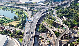
Spaghetti junction is a nickname sometimes given to a complex or massively intertwined road traffic interchange that is said to resemble a plate of spaghetti. Such interchanges may incorporate a variety of interchange design elements in order to maximize connectivity.

State Route 82 is a state highway in the U.S. state of California that runs from Interstate 880 (I-880) in San Jose to I-280 in San Francisco following the San Francisco Peninsula. It is the spinal arterial road of the peninsula and runs parallel to the nearby Caltrain line along much of the route. For much of its length, the highway is named El Camino Real and formed part of the historic El Camino Real mission trail. It passes through and near the historic downtowns of many Peninsula cities, including Burlingame, San Mateo, Redwood City, Menlo Park, Palo Alto, Mountain View, and Sunnyvale, and through some of the most walkable and transit-oriented neighborhoods in the region.

State Route 84 is a state highway in the U.S. state of California that consists of two unconnected segments, one in the San Francisco Bay Area and the other primarily in the Sacramento–San Joaquin River Delta area.

State Route 61 is a state highway in the U.S. state of California, running along the eastern edge of Oakland International Airport and through Alameda. Two additional "hidden" state highways, State Route 112 and State Route 260, are also signed as part of SR 61, despite having legal descriptions separate from Route 61.

The MacArthur Maze is a large freeway interchange in Oakland, California. It splits traffic coming off the east end of the San Francisco–Oakland Bay Bridge into three freeways: the Eastshore (I-80/I-580), MacArthur (I-580) and Nimitz (I-880).

State Route 262 (SR 262) is a state highway entirely within the Warm Springs District of Fremont, California. It runs along the 1.07-mile (1.72 km) segment of Mission Boulevard between I-880 to the west and I-680 to the east. The route is heavily trafficked, going through a commercial district and containing at least two stop lights.

State Route 185 is a state highway in the San Francisco Bay Area of the U.S. state of California. It runs along sections of Mission Boulevard in Hayward, East 14th Street in San Leandro and International Boulevard in Oakland. At its south end, SR 185 connects with State Routes 92 and 238 in Hayward. At the north end of SR 185 at International Boulevard and 42nd Avenue, the short State Route 77 heads southwest to Interstate 880.
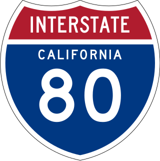
Interstate 80 (I-80) is a transcontinental Interstate Highway in the United States, stretching from San Francisco, California, to Teaneck, New Jersey. The segment of I-80 in California runs east from San Francisco across the San Francisco–Oakland Bay Bridge to Oakland, where it turns north and crosses the Carquinez Bridge before turning back northeast through the Sacramento Valley. I-80 then traverses the Sierra Nevada, cresting at Donner Summit, before crossing into the state of Nevada within the Truckee River Canyon. The speed limit is at most 65 mph (105 km/h) along the entire route instead of the state's maximum of 70 mph (110 km/h) as most of the route is in either urban areas or mountainous terrain. I-80 has portions designated as the Eastshore Freeway and Alan S. Hart Freeway.
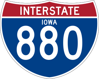
Interstate 880 (I-880) is an auxiliary Interstate Highway in Iowa. Its route was created in 2019 from a section of I-680 in order to facilitate the movement of I-29 traffic around Council Bluffs in the event of Missouri River flooding. It follows the same routing as Interstate 80N (I-80N), which originally connected I-29 and I-80 from 1966 to 1973.
Interstate 880 may refer to: