Contents
The following highways are numbered 522:
The following highways are numbered 522:
| Preceded by 521 | Lists of highways 522 | Succeeded by 523 |
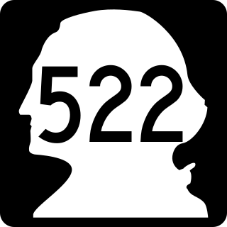
State Route 522 (SR 522) is a state highway in the U.S. state of Washington that serves the Seattle metropolitan area. Approximately 25 miles (40 km) long, it connects the city of Seattle to the northeastern suburbs of Kenmore, Bothell, Woodinville, and Monroe. Its western half is primarily an arterial street, named Lake City Way and Bothell Way, that follows the northern shore of Lake Washington; the eastern half is a grade-separated freeway that runs between Woodinville and Monroe. SR 522 connects several of the metropolitan area's major highways, including Interstate 5 (I-5), I-405, SR 9, and U.S. Route 2 (US 2).

State Route 523 is a short Washington state highway located on the city limits of Seattle, Shoreline, and Lake Forest Park in King County. The road itself runs 2.45 miles (3.94 km) east from SR 99 past Interstate 5 (I-5) and ends at SR 522; the highway was first established in 1991, but the roadway from I-5 to 5th Avenue Northeast was once the northern section of Secondary State Highway 1J from 1937 until 1964 and later SR 513 from 1964 until 1991.

U.S. Route 211 is a spur of US 11 in the U.S. state of Virginia. Known for most of its length as Lee Highway, the U.S. Highway runs 59.09 miles (95.10 km) from Interstate 81 (I-81) and Virginia State Route 211 in New Market east to US 15 Business, US 29 Business, and US 211 Business in Warrenton. US 211 connects the Shenandoah Valley with the Piedmont town of Warrenton via Luray and Sperryville, where the highway runs concurrently with US 340 and US 522, respectively.

U.S. Route 522 is a spur route of US 22 in the states of Virginia, West Virginia, Maryland, and Pennsylvania. The U.S. Highway travels in a north-south direction, and runs 308.59 miles (496.63 km) from US 60 near Powhatan, Virginia, to its northern terminus at US 11 and US 15 near Selinsgrove, Pennsylvania. US 522 serves many small cities and towns in the Piedmont, Blue Ridge Mountains, and northern Shenandoah Valley of Virginia. The highway serves the Virginia communities of Goochland, Mineral, Culpeper, the town of Washington, and Front Royal and the independent city of Winchester. US 522 then follows the Ridge-and-Valley Appalachians north and then east through the Eastern Panhandle of West Virginia, a 2-mile-wide (3.2 km) stretch of Western Maryland, and South Central Pennsylvania to its terminus in the Susquehanna Valley. The highway serves Berkeley Springs, West Virginia; Hancock, Maryland; and the Pennsylvania communities of McConnellsburg, Mount Union, Lewistown, and Middleburg.

State Route 127 is a primary state highway in the U.S. state of Virginia. The state highway begins at the West Virginia state line at Good, West Virginia, where the highway continues west as West Virginia Route 127. SR 127 heads east 3.55 miles (5.71 km) to U.S. Route 522 near Cross Junction in northwestern Frederick County. SR 127 is the easternmost portion of Bloomery Pike, a turnpike that connected Winchester with the namesake iron smelting center.
Virginia State Route 3 is a primary state highway in the U.S. state of Virginia that extends from the town of Culpeper south and eastwardly to Gloucester in Virginia's Middle Peninsula region. For many years, a portion was named "Historyland Highway".

State Route 6 is a primary state highway in the U.S. state of Virginia. Known for most of its length as River Road, the state highway runs 102.26 miles (164.57 km) from U.S. Route 250 in Afton east to SR 161 in Richmond. SR 6 is one of the main highways of mountainous Nelson County, where the highway runs north–south from its beginning to US 29. From Scottsville to Richmond, the state highway parallels the James River. SR 6 is a major suburban highway through southwestern Henrico County and the main street of Richmond's West End.

State Route 9 (SR 9) is a 98.17-mile (157.99 km) long state highway traversing three counties, Snohomish, Skagit, and Whatcom, in the U.S. state of Washington. The highway extends north from an interchange with SR 522 in the vicinity of Woodinville north through Snohomish, Lake Stevens, Arlington, Sedro-Woolley, and Nooksack to become British Columbia Highway 11 (BC 11) at the Canada–US border in Sumas. Three other roadways are briefly concurrent with the route: SR 530 in Arlington, SR 20 in Sedro-Woolley, and SR 542 near Deming. A spur route in Sumas serves trucks traveling into British Columbia.

State Route 202 (SR 202) is a state highway in the U.S. state of Washington, serving part of the Seattle metropolitan area. It runs southeasterly for 31 miles (50 km) in the Eastside region of King County, connecting Woodinville, Redmond, Fall City, and North Bend. The highway begins at SR 522 in Woodinville, intersects SR 520 in Redmond and SR 203 in Fall City, and terminates at Interstate 90 (I-90) in North Bend. The entire highway is designated as the Cascade Valleys Scenic Byway, a state scenic and recreational highway.
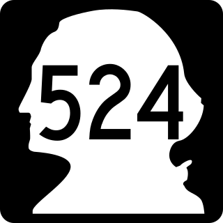
State Route 524 (SR 524) is a suburban state highway in the U.S. state of Washington, located entirely within Snohomish County. It begins at SR 104 in Edmonds and travels east past SR 99, Interstate 5 (I-5), under I-405, past SR 527 and SR 9 to end at SR 522 in Maltby. The road also has two spur routes, one connecting to SR 104 in Edmonds and another connecting to I-5 in Lynnwood.

State Route 55 is a primary state highway in the U.S. state of Virginia. Known for most of its length as John Marshall Highway, the state highway runs 64.71 miles (104.14 km) from the West Virginia state line, where the highway continues as West Virginia Route 55, east to U.S. Route 29 in Gainesville. West of its interchange with Interstate 81 (I-81) in Strasburg, SR 55 runs concurrently with the easternmost portion of US 48 as part of Corridor H. East of Front Royal, the state highway serves as the local complement of I-66 as it passes through the towns of Marshall, The Plains, and Haymarket.

State Route 22 is a primary state highway in the U.S. state of Virginia. The state highway runs 29.81 miles (47.97 km) from U.S. Route 250 in Shadwell east to US 522 and SR 208 in Mineral. SR 22 is one of two primary east–west highways in Louisa County, connecting the county seat of Louisa with Charlottesville and Mineral. The state highway runs concurrently with US 33 through Louisa and with SR 208 between Louisa and Mineral.
State Route 37 is a primary state highway in the U.S. state of Virginia. Known as Winchester Bypass, it forms a western bypass of Winchester, connecting to Interstate 81 (I-81) at both ends. Although the road is a freeway, neither I-81 connection is freeway standard; the south end is a diamond interchange with two traffic signals, while, at the north end, drivers must use a short piece of U.S. Route 11 (US 11) to connect with I-81 at exit 317. In addition to local access, the highway connects to US 50 and US 522, two major highways that lead west and northwest into West Virginia and north to I-70 at Hancock, Maryland. An eastern bypass, known locally as "Route 37 East" has been proposed in statewide and local plans to complete the loop.
State Route 208 is a primary state highway in the U.S. state of Virginia. The state highway runs 47.35 miles (76.20 km) from U.S. Route 250 at Ferncliff east to US 1 and US 1 Business at Four Mile Fork. SR 208 is a major southwest–northeast highway through Louisa and Spotsylvania counties. The state highway connects the counties' respective seats of Louisa and Spotsylvania Courthouse, where the old route of the highway is SR 208 Business, with each other and with Fredericksburg near the highway's eastern terminus. SR 208 also has a direct connection with Interstate 64 (I-64) at Ferncliff and an indirect connection to I-95 near Fredericksburg.
State Route 231 is a primary state highway in the U.S. state of Virginia. The state highway runs 49.82 miles (80.18 km) from SR 22 in Cismont north to U.S. Route 522 near Sperryville. SR 231 forms part of the connection between Charlottesville and Gordonsville, where the highway meets US 15 and US 33. The state highway also serves as the main north–south highway of Madison County, connecting the county seat of Madison, where the highway intersects US 29, with Gordonsville to the south and passing through the foothills of the Blue Ridge Mountains to the north.

State Route 277 is a primary state highway in the U.S. state of Virginia. Known also as Fairfax Pike and Fairfax Street, the state highway runs 4.72 miles (7.60 km) from U.S. Route 11 and SR 631 in Stephens City in southern Frederick County east to US 522 and US 340 at Double Tollgate in the southwestern corner of Clarke County.
State Route 6 (SR 6) is a state highway that is unsigned. It travels through the central part of the U.S. state of Tennessee from Lawrence County to Sumner County. The highway is related to the following U.S. Highways: