The following highways are numbered 41A:
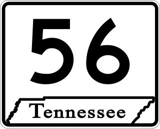
State Route 56 is a 160.6-mile-long (258.5 km) state highway that runs south to north in Middle Tennessee, from the Alabama state line near Sherwood to the Kentucky state line near Red Boiling Springs.

New York State Route 359 (NY 359) is a state highway located entirely within the town of Skaneateles in Onondaga County, New York in the United States. At 1.71 miles (2.75 km) in length, it is one of the shortest signed state highways in all of New York. The route begins at NY 38A a half-mile (0.8 km) north of the Onondaga-Cayuga County county line and ends at NY 41A in the hamlet of Mandana. It lies between Skaneateles Lake and Owasco Lake. Excluding its termini, there are only two junctions with other roadways along the entire route. NY 359 was assigned in the early 1940s and was part of the original NY 26 from 1924 to 1930.

New York State Route 41 (NY 41) is a north–south state highway in Central New York in the United States. The southern terminus of the route is at an interchange with NY 17 in the town of Sanford in Broome County, New York. Its northern terminus is at an intersection with U.S. Route 20 (US 20) in the village of Skaneateles. The route is almost 100 miles (161 km) long and passes through Broome, Chenango, Cortland, and Onondaga counties. NY 41 was assigned as part of the 1930 renumbering of state highways in New York, replacing New York State Route 70 from Homer to Skaneateles. The route initially extended as far north as Jordan; however, NY 41 was cut back to its current northern terminus c. 1933.

U.S. Route 60 (US 60) is a major U.S. Highway in the American state of Kentucky. In the early days of the U.S. Highway System, US 60 was originally to be numbered as US 62. Following extensive lobbying and complaints filed by Kentucky governor William J. Fields to the American Association of State Highway Officials, the route was re-designated as US 60 before the system was finalized. In Kentucky, US 60 parallels the Ohio River. US 60 enters Kentucky from Cairo, Illinois, traveling northeast to Louisville, then takes a direct eastward route to rejoin the Ohio River in downtown Ashland, Kentucky. Both US 60 and US 23 run concurrently from Ashland to Catlettsburg where US 60 turns east and enters Kenova, West Virginia. US 60 is the longest route in Kentucky, running 495 miles (797 km) across the width of the state, passing through 22 of Kentucky's counties and through the cities of Paducah, Henderson, Owensboro, Louisville, the state capital of Frankfort, and Lexington.

New York State Route 41A (NY 41A) is a north–south state highway in Central New York in the United States. It extends for 25.49 miles (41.02 km) from an intersection with NY 41 in the Cortland County town of Homer to a junction with U.S. Route 20 (US 20) in the Onondaga County village of Skaneateles. The southern half of NY 41A serves mostly rural areas, while the route's northern half runs along the western edge of Skaneateles Lake. NY 41A was assigned as part of the 1930 renumbering of state highways in New York to several previously unnumbered state roads and a section of pre-1930 NY 26.

New York State Route 38A (NY 38A) is a north–south state highway located within Onondaga and Cayuga counties in central New York in the United States. The southern terminus of the route is at an intersection with NY 38 in the village of Moravia. Its northern terminus is at a junction with U.S. Route 20 (US 20) and NY 5 in downtown Auburn. Much of NY 38A runs through rural, undeveloped areas situated between Owasco Lake and Skaneateles Lake.
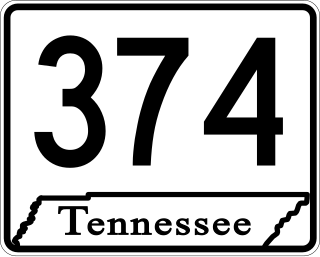
State Route 374 is an east west state highway in Montgomery County, Tennessee, that acts as a cross-town arterial road for motorists in Clarksville. The route serves as a northern bypass around downtown Clarksville, and also provides access to Fort Campbell, a United States Army installation that is the headquarters for the 101st Airborne Division and the 160th Special Operations Aviation Regiment (Airborne). It currently runs from U.S. Route 79 to US 41 Alternate. The route is planned to be extended southward to SR 149 from its western terminus, replacing a short section of that route to SR 13.

State Route 12 is a highway from Davidson County, Tennessee to Montgomery County, Tennessee.

State Route 76 (SR 76) is a state highway in Tennessee, traversing the state in a northeast-southwest axis from east of Memphis to north of Nashville. SR 76 is unique in that it actually changes its cardinal directions in Clarksville at the junction with US 41A and US 41A Bypass.

U.S. Route 31A is a 76.94-mile-long (123.82 km) alternate route of U.S. Route 31 that exists between Nashville and Pulaski, Tennessee. It is located entirely in Middle Tennessee and except for the Lewisburg bypass, where it is concurrent with SR 106, it is entirely concurrent with unsigned State Route 11.

Several special routes of U.S. Route 41 exist, including three in Wisconsin. In order from south to north they are as follows.

State Route 55 is an east–west highway in Middle Tennessee. The road begins at SR 50 in Lynchburg and ends at U.S. Route 70S and SR 380 in McMinnville. The current length is 49.3 mi (79.3 km). SR 55 heads northeast from Lynchburg to Tullahoma as a two-lane road. In Tullahoma, the route runs concurrent with US 41A. From here, SR 55 heads northeast as a multilane highway to Manchester, where it intersects US 41 and Interstate 24 (I-24). The route continues northeast, serving Summitville and Morrison before it reaches McMinnville.

State Route 16 is a state highway in the U.S. state of Tennessee. Its southern terminus is at the Alabama state line, where it continues as State Route 79 in Alabama. From there, it continues to Winchester, where it becomes unsigned in a concurrency with U.S. Route 41A. This concurrency lasts until its northern terminus in Williamson County, at a junction with U.S. Route 31A.

State Route 48 (SR 48) is a long north–south state highway in Middle Tennessee. It traverses six counties, and it is 103.86 miles (167.15 km) long.

James Robertson Parkway is a four-lane major thoroughfare in Nashville, Tennessee. It is a bypass route within the downtown Nashville area that includes portions of the alignments of three U.S. Highways, two of them with unsigned Tennessee state highway designations. Since all parts of the street includes alignments of U.S. and state routes, the road is maintained by the Tennessee Department of Transportation (TDOT).

U.S. Route 41 Alternate, also signed U.S. Route 41A in Tennessee (US 41A), connects the town of Monteagle, Tennessee, with Hopkinsville, Kentucky, 10 miles (16 km) north of the Tennessee line. It serves the city of Clarksville, Tennessee, on its way to Nashville, where it briefly runs concurrently with US 41. It then separates again to serve Shelbyville, Winchester, and Tullahoma before rejoining the main route atop Monteagle Mountain. US 41A runs west of US 41 for its entire length, aside from one mile in downtown Nashville where they are concurrent. US 41A is also concurrent with U.S. Route 31A from Nashville to Triune, Tennessee, for a distance of approximately 25 miles (40 km).

State Route 256 is a north–south secondary state highway located in northern Middle Tennessee. Except for its southern terminus on US 41A, the route is located almost entirely In western Robertson County.

State Route 276, also known as Thompson Creek Road, is a short 3.2-mile-long (5.1 km) north–south state highway in eastern Bedford County, Tennessee, United States. It connects the community of Raus, and SR 130, with U.S. Route 41A. It is a two-lane highway for its entire length and traverses rural and flat farmland for the majority of its course.

Kentucky Route 788 (KY 788) is a 1.101-mile-long (1.772 km) state highway in southern Christian County in the U.S. state of Kentucky. It begins at U.S. Route 41A (US 41A) and heads west along Gate 7 Road. The highway reaches the end of state maintenance at the Fort Campbell.