The following highways are numbered 31A:

Route 64 is a 0.32-mile-long (0.51 km) state highway in the U.S. state of New Jersey. It is a state-maintained bridge over Amtrak's Northeast Corridor line in West Windsor. Route 64 begins at an intersection with County Route 526 and County Route 571 in West Windsor. It heads along the bridge to an intersection with County Route 615, where Route 64 ends. County Routes 526 and 571, which are concurrent with Route 64, continues to Hightstown.

Route 133 is a 4.42-mile-long (7.11 km) freeway located entirely in East Windsor Township, Mercer County, New Jersey in the United States. The route runs as a four-lane bypass of Hightstown from County Route 571 (CR 571) at Windsor Center Drive to the New Jersey Turnpike / Interstate 95 (I-95) at exit 8. Originally, Route 133 did not have any direct connections to any other freeways until a new Turnpike interchange opened in January 2013.
Highway 31 is a minor north–south highway through the Selkirk Mountains in British Columbia, Canada. The highway first gained its number in 1973, and it is one of the few numbered highways in the province that is not fully paved. Highway 31 has a total distance of 175 km (109 mi) — 37 km (23 mi) along Kootenay Lake between Balfour and Kaslo, 106 km (66 mi) north along Kootenay Lake north of Kaslo, then the Duncan and Lardeau Rivers and the north shore of Trout Lake, and 32 km (20 mi) between the northwest end of Trout Lake and Galena Bay, where it ends at Highway 23.

U.S. Route 31 or U.S. Highway 31 (US 31) is a major north–south U.S. highway connecting southern Alabama to northern Michigan. Its southern terminus is at an intersection with US 90/US 98 in Spanish Fort, Alabama. Its northern terminus is at an interchange with Interstate 75 (I-75) south of Mackinaw City, Michigan.

New York State Route 429 (NY 429) is a north–south state highway located entirely within Niagara County, New York, in the United States. It extends for 12.16 miles (19.57 km) from an intersection with NY 265 and NY 384 in North Tonawanda to a junction with NY 104 on the border between the towns of Cambria and Lewiston. Although it is relatively minor in length, the route is regionally important nonetheless as it connects North Tonawanda to some of the county's interior regions. About midway between North Tonawanda and Ridge Road, NY 429 serves the hamlet of Sanborn, where it briefly overlaps with NY 31. At Pekin, a community situated between Sanborn and NY 104, NY 429 descends the Niagara Escarpment.

New York State Route 31 (NY 31) is a state highway that extends for 208.74 miles (335.93 km) across western and central New York in the United States. The western terminus of the route is at an intersection with NY 104 in the city of Niagara Falls. Its eastern terminus is at a traffic circle with NY 26 in Vernon Center, a hamlet within the town of Vernon. Over its routing, NY 31 spans 10 counties and indirectly connects three major urban areas in Upstate New York: Buffalo–Niagara Falls, Rochester, and Syracuse. The route is one of the longest routes in New York State, paralleling two similarly lengthy routes, NY 104 to the north and NY 5 to the south, as well as the Erie Canal, as it proceeds east.

New York State Route 31A (NY 31A) is an east–west state highway located in the western part of New York in the United States. It serves as a southerly alternate route of NY 31 from the western part of Orleans County to the far western part of Monroe County. It diverges from NY 31 south of the village of Medina and parallels NY 31 eastward until it reconnects to its parent route southwest of the village of Brockport. While NY 31 passes through the villages of Medina, Albion, and Holley, NY 31A bypasses all three, serving sparsely populated areas to their south instead. The route intersects NY 98 south of Albion and NY 237 in Clarendon.
Several special routes of U.S. Route 31 exist. In order from south to north they are as follows.
New York State Route 31A is an east–west state highway in Orleans and Monroe Counties in New York, United States, that was established in the mid-1930s.

State Route 11 is a mostly unsigned south–north highway that goes from the Alabama border in Giles County, Tennessee to the Kentucky border in Montgomery County.

U.S. Route 31A is a 76.94-mile-long (123.82 km) alternate route of U.S. Route 31 that exists between Nashville and Pulaski, Tennessee. It is located entirely in Middle Tennessee and except for the Lewisburg bypass, where it is concurrent with SR 106, it is entirely concurrent with unsigned State Route 11.
There have been seven business routes of US Highway 31 in the state of Michigan. All of the business routes are former sections of US Highway 31 (US 31). They connect the freeway mainline of US 31 to the various downtowns of cities bypassed by US 31. Two of the current business routes, for Hart and Ludington, are business spurs, connecting to US 31 on only one end, while the remainder for Muskegon, Whitehall–Montague and Pentwater, are business loops. The two former routes, for Niles and Holland were a business spur and loop, respectively.

State Route 16 is a state highway in the U.S. state of Tennessee. Its southern terminus is at the Alabama state line, where it continues as State Route 79 in Alabama. From there, it continues to Winchester, where it becomes unsigned in a concurrency with U.S. Route 41A. This concurrency lasts until its northern terminus in Williamson County, at a junction with U.S. Route 31A.
National Highway 10 is a national highway in North East India that connects Indo/Bangladesh border via Siliguri to Gangtok. It passes through the Indian states of West Bengal and Sikkim.The highway is being maintained by the National Highways and Infrastructure Development Corporation Limited (NHIDCL) from Rangpo to Ranipool in the state of Sikkim.
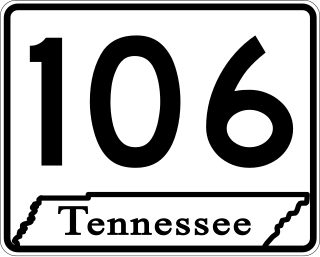
State Route 106 is a north–south state highway in Middle Tennessee. The highway is a secret, or hidden, designation for the following highways:
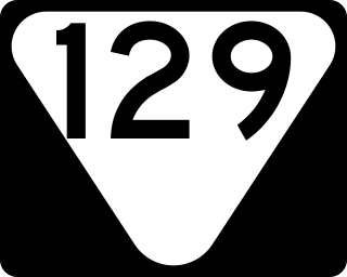
State Route 129 is a 49.22-mile-long (79.21 km) east–west state highway in the hills of southern Middle Tennessee.

State Route 272 is a 22.4-mile-long (36.0 km) north–south state highway located entirely within Marshall County in Middle Tennessee.